
One more wave of rain before the Labor Day weekend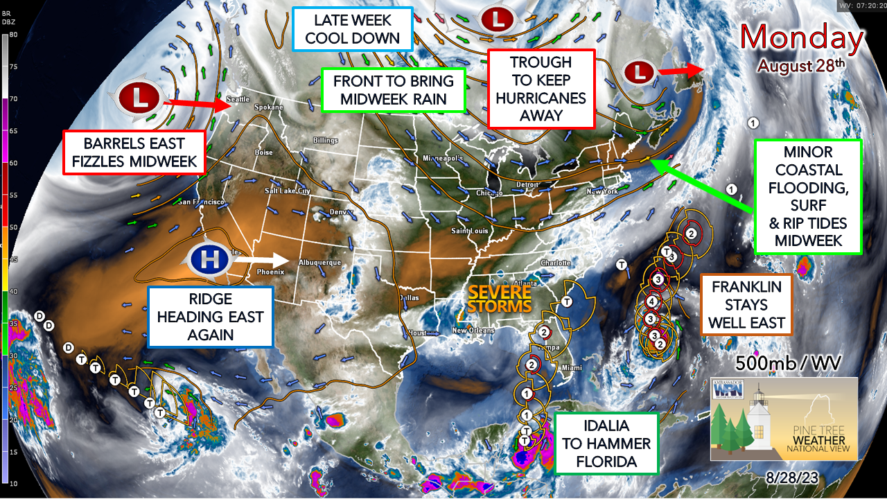 The good news is the hurricanes to the south will stay away. There will be some outflow effects from Franklin from long range swells and rip current potential. With the blue moon on the way, that will elevate tides and bring potential for minor coastal flooding and splash-over. How much rain the region receives out of this is uncertain as this is a complicated set up. A "predecessor rain event" is expected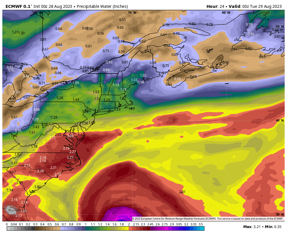 Monday 8 PM to Thursday 8 AM - A cold front approaches from the west as Franklin heads north just west of Bermuda. Outflow moisture head of the hurricane gets caught up in the southwesterly wind ahead of the front, which causes entrainment. Using the precipitable water loop here shows the dynamics well. The outflow from tropical systems is known here as a predecessor rain event. The impacts of it could yield heavy rainfall and potential for thunderstorms. Timing of the frontal boundary and Franklin's progression will dictate how much rain is to come, where it falls, and how humid the air will get. 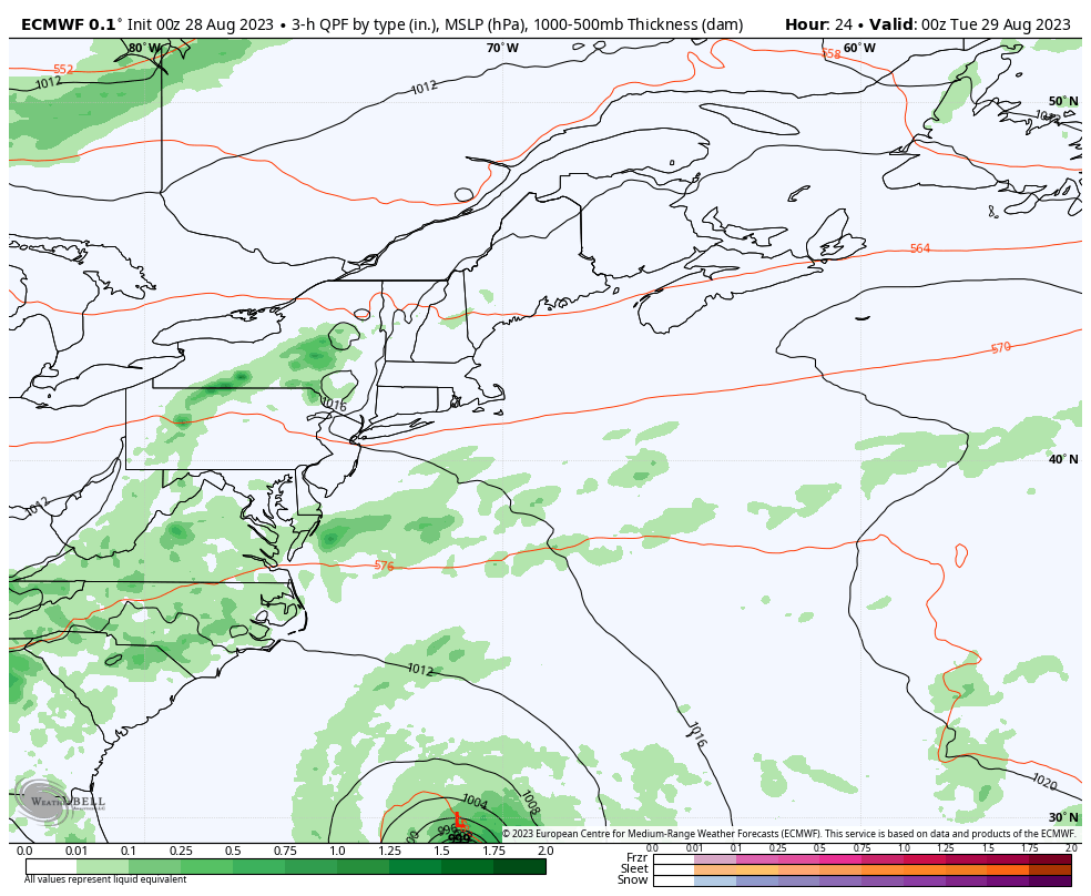 Monday 8 PM to Thursday 8 AM - A look at the forecast surface map shows outflow from the frontal boundary bringing a few showers over the mountains and north on Tuesday. The influence of Franklin becomes apparent heading into Wednesday. With the track just west of Bermuda, that cuts down the risk of heavy rain to a certain degree. If the track was closer to the Carolina's, the region could get dumped on. Maine is on the fringe here. A look at the last couple of images in the loop shows the predecessor rain event in full force impacting Nova Scotia and Newfoundland. The bottom line here is if Franklin jogs west, more rain is possible, a jog east closer to Bermuda, the less risk of rainfall. 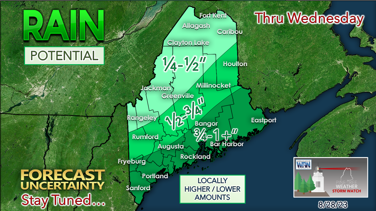 A rough idea on rainfall amounts given the fact there is time for adjustment. Eastern Maine has the best chance of higher end rainfall amounts. With the tropical influence and potential for thunderstorms, the potential for localized flash flooding is there along the coastal plain. This idea will be updated. Shoreline concerns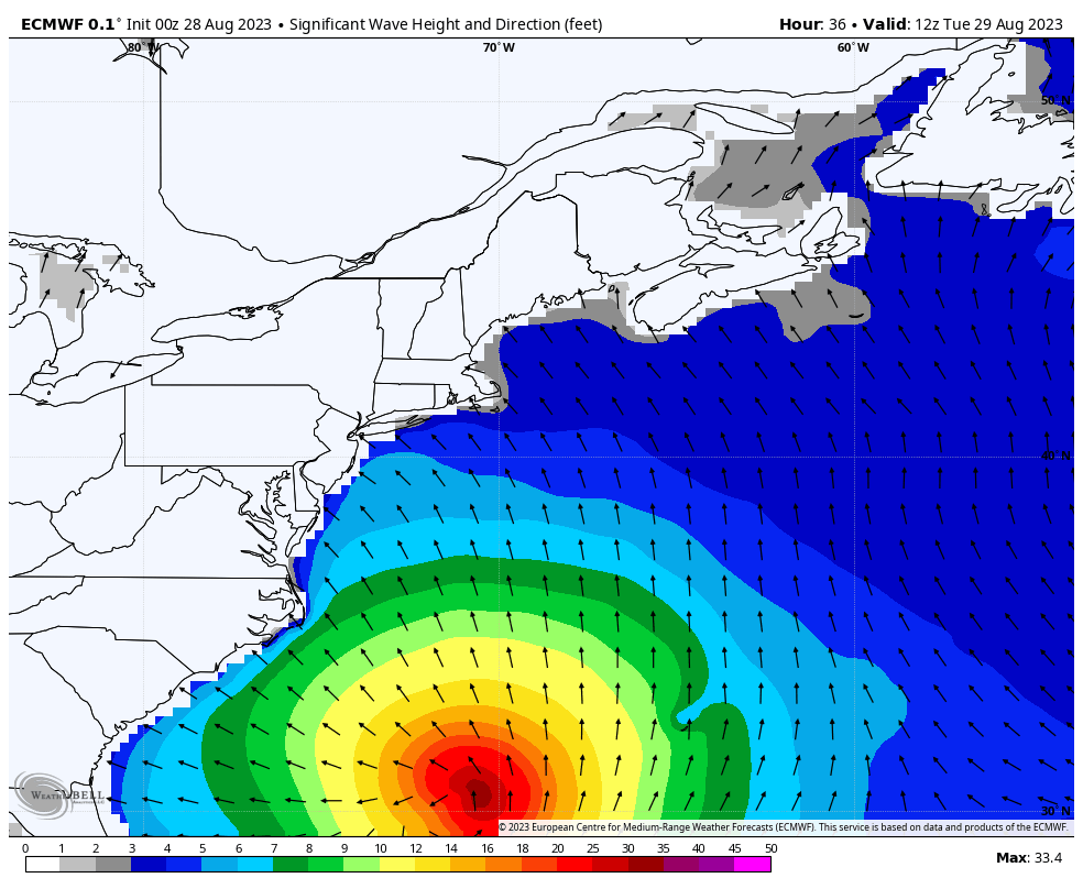 Tuesday 8 AM to Friday 8 AM - Given the track of Franklin, the main concern for surf will be for southern New England and DownEast areas, with Cape Cod protecting Portland and areas to the west. We've seen larger waves with Nor'easters. Given the blue moon on the way midweek, the surf arrives at the time of astronomically high tides, which will be high enough to cause some minor coastal flooding and splash-over in the susceptible areas. The concern for late season beachgoers will be rip currents.  The threat for rip currents appears higher on Wednesday with some impacts lingering into Thursday. Important to note here given the late season timing of this, oceanside beaches may be short staffed with the college students returning to campus. It won't exactly be beach weather as temperatures are expected to drop a few degrees behind the front on Thursday with low 70s prevalent over much of the region. However, for those who are ocean curious, it would be wise of the threat, along with higher than forecast waves that could drag careless viewers into the ocean. Respect the ocean and watch from a safe distance. Pine Tree Weather is funded from followers like you. I would appreciate your financial support. Click here for how you can contribute. You may not like the weather, but I hope you like what I do, and support my efforts. Thank you! Stay updated, stay on alert, and stay safe! - Mike NOTE: The forecast information depicted on this platform is for general information purposes only for the public and is not designed or intended for commercial use. For those seeking pinpoint weather information for business operations, you should use a private sector source. For information about where to find commercial forecasters to assist your business, please message me and I will be happy to help you |

Mike Haggett
|


