
Dew point temperatures on the rise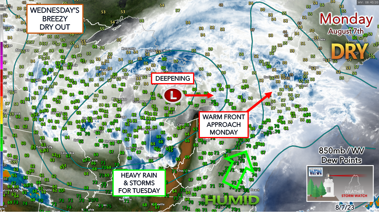 A bit of a different perspective here with the observation map to focus on the 850mb (~5,000 ft) level of the atmosphere as that is the important part of the forecast. While the region starts off with comfortable dew point temperatures in the 50s, it won't stay that way. As the upper low over the Great Lakes deepens and strengthens a surface low associated with it, the humidity pump turns on and brings sultry conditions to Maine as it moves eastward Monday night into Tuesday. Low level jet to bring in the moisture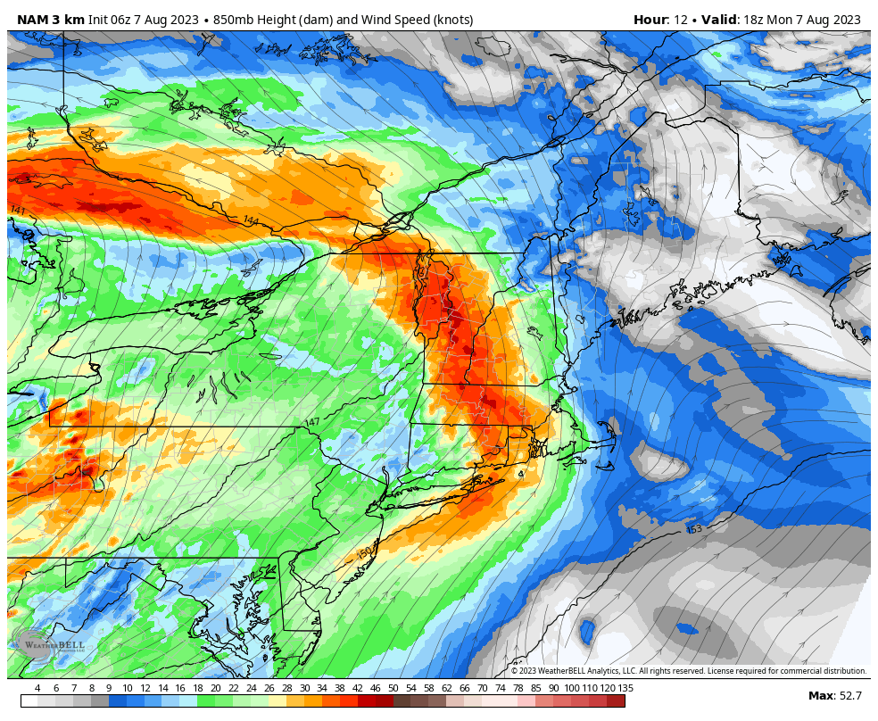 Monday 2 PM to Wednesday 2 AM - This is the NAM3km model idea of forecast wind speeds at the 850mb level. This is what will draw the moisture in from the south and bring heavy rain with the risk of storms to the region Monday night into Tuesday morning. There are a couple of takeaways from this. For one, this scenario will throw a lot of moisture over the mountains and foothills especially due to orographic lifting. This also sets up a considerable amount of spin in the atmosphere due to the high wind speeds. This is where the damaging wind threat comes in. The combination of tropical moisture and a strong low-level jet brings potential for downdraft wind in torrential rainfall. IMPORTANT TO NOTE that this does not mean widespread power outages. There is certainly potential for isolated power outages due to the downdraft wind gust potential from any strong thunderstorms that could develop. I do expect wind gusts in the 30-40 mph range for the shorelines and higher elevations, and 20-30 mph over much of the rest of the state. Flash flooding is the main concern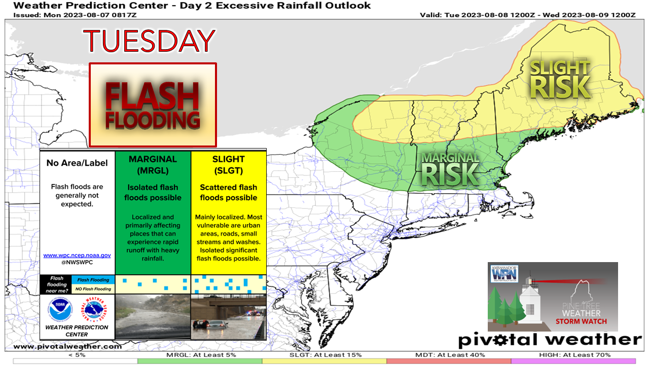 It's like a bad song on repeat. We are all too familiar with this threat, and because of the number of times the region has gone through it, one could become numb to it. That is the mistake that cannot be made here. The National Weather Service has not yet committed to a flood watch or advisory as of the time of this update Monday morning, and that could change. 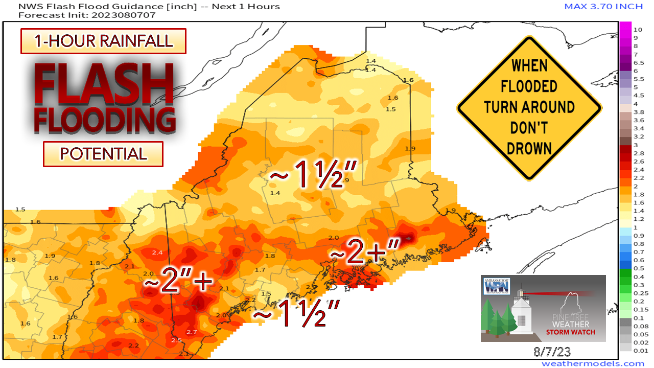 Like that bad song on repeat, I've stated numerous times and will continue to preach that the region is under a perpetual state of flood watch whether it is official or not. In this situation where tropical downpours are a strong possibility. Localized flash flooding is a virtual lock as much of the state remains in the 1½" per hour range and with the dynamics here, that threshold can be easily reached. Timing Monday Noon to Tuesday 6 AM - A look at the HRRR forecast idea of 1-hour precipitation rates shows some light shower activity in the afternoon as the warm front moves in, with heavier rain and potential for storms heading into the overnight and into early Tuesday. Notice the streaking of the darker greens and blues. There is potential for training of heavier rain showers and storms, and this is where the threat of flash flooding comes into play. 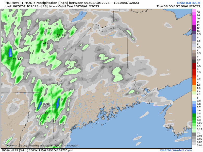 Tuesday 6 AM to Wednesday 2 AM - The risk for torrential downpours and storms continues through the day and tapers off from southwest to northeast Tuesday night, ending over northern and eastern areas Wednesday morning.  The greatest threat for flash flooding is over the south and east facing slopes of the higher elevations, but there is no area exempt from this threat as it could happen anywhere. The over/under for the state continues to be 1"+. Given some ideas that are floating around, some areas could see upwards of 6-7". Please make sure you have multiple ways to receive alerts 24/7 and take appropriate action when necessary. Pine Tree Weather is funded from followers like you. I would appreciate your financial support. Click here for how you can contribute. You may not like the weather, but I hope you like what I do, and support my efforts. Thank you! Stay updated, stay on alert, and stay safe! - Mike NOTE: The forecast information depicted on this platform is for general information purposes only for the public and is not designed or intended for commercial use. For those seeking pinpoint weather information for business operations, you should use a private sector source. For information about where to find commercial forecasters to assist your business, please message me and I will be happy to help you. |

Mike Haggett
|


