
The fine line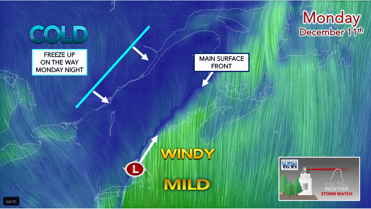 Games like football, baseball and golf can boil down to inches. In the weather world, it comes down to miles. The cold front set up just offshore of the southwest coast up through Bangor to Houlton. To the east of it comes the wind. To the west of it, not much of it. The low-level jet hangs out over the Gulf of Maine, sparing most of the region of the strongest gusts. As low pressure tracks up along the front, it will bring heavy rain over central and eastern areas, and heavy snow along the Quebec border on up into the Allagash. A reinforcing cold front passes through the region later in the day and freezes this mess up overnight into Tuesday morning. What to expect the rest of the way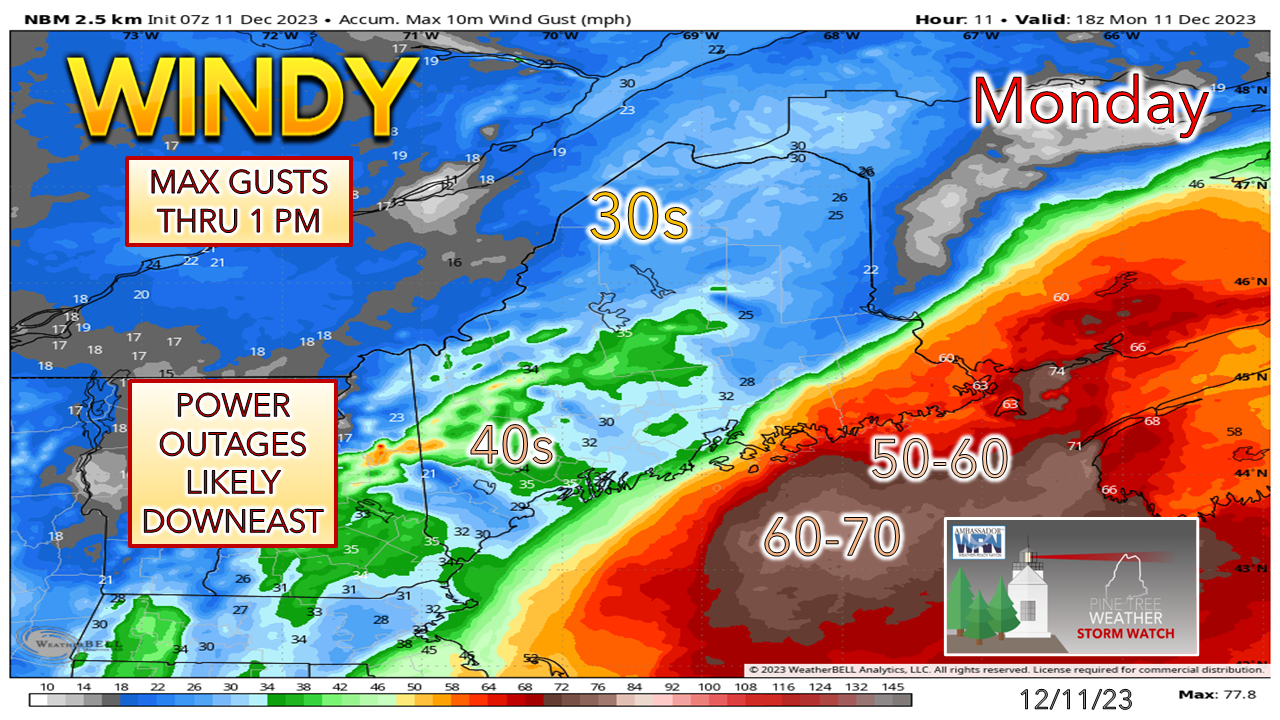 The wind advisory over the southwest coast has been dropped. This isn't to say there could be a few potent gusts in the 30-40 mph range, but not sustained enough to be overly concerned about it. The bust potential I mentioned in Sunday's post was realized. The Bar Harbor region on over into Washington County get the highest speeds, and that has been in the cards all along. Eastport could reach 60-65. The worst of the wind is over by 1 PM. There will be power outages, but fortunately not as many had the front set up 30 miles more to the west. 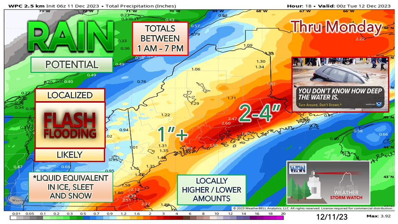 Rain / liquid equivalent totals are still on track for 2-4" across the region. Concerns are there for flooding, Eastern areas where the ground has froze could see the worst of it. Rainfall rates 1-2" per hour are possible. That water has to go somewhere. Highways, urban streets, secondary roads brooks, streams, small rivers, and basements are the likely destinations. Potential for a couple road washouts. Rain ends from west to east in the afternoon, and the faucet thankfully shuts off over eastern areas by tonight.  Winter storm warning area was expanded over northern Aroostook. Border crossings in Coburn Gore and Jackman are on track to get pasted. The Allagash is good for a foot of snow. Power outages in these areas are likely. 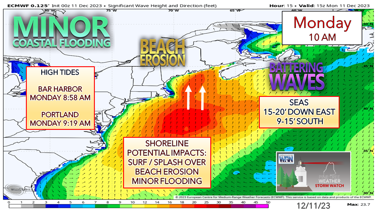 Coastal flood statement is posted for DownEast shorelines where the higher waves could bring splash-over. I can't rule out that potential in exposed areas to the south. No flood concerns for Portland and areas protected by the islands. With the low passing through in the afternoon around the time of low tide, that helps minimize the shoreline abuse. 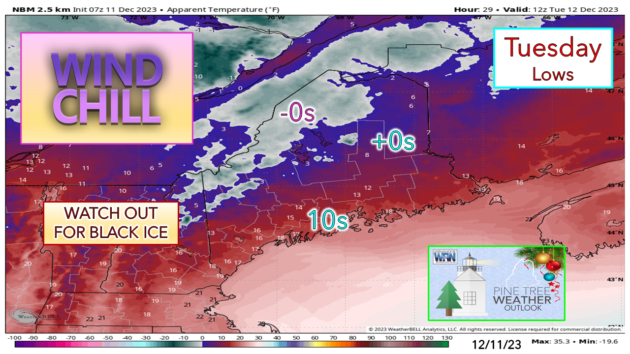 Just a reminder that this will all freeze up Monday night. Snow on trees will turn to cement. A northwest breeze bringing the cold in brings some concern for continuing the power outage threat until it diminishes on Wednesday. It may be Friday before temperatures rise above freezing over the mountains and north to help loosen up the snow and clean up the trees a bit, but it will only be in the mid-30s. Travel safe over the next couple of days and allow for plenty of extra time. Designed for you, supported by you Thank you to Allspeed Cyclery & Snow in Portland, Downeast Aerial Photography in Rockland, Dutch Elm Golf Club in Arundel, and Sunrise Property Services in Bridgton, for partnering with Pine Tree Weather. Special thanks to all the individuals who financially contribute. I sincerely appreciate your support. Stay updated, stay on alert, and stay safe! - Mike PRINT MEDIA: Feel free to quote and cite my work here for your stories. Please give me the professional courtesy of knowing that you are referencing my material so I can read your final product and acknowledge it on my media and link it on the Who I Am page here on the website. Feel free to send me a message via the Facebook page or Twitter (X) to get my phone number if necessary. Thank you! NOTE: The forecast information depicted on this platform is for general information purposes only for the public and is not designed or intended for commercial use. For those seeking pinpoint weather information for business operations, you should use a private sector source. For information about where to find commercial forecasters to assist your business, please message me and I will be happy to help you. |

Mike Haggett
|


