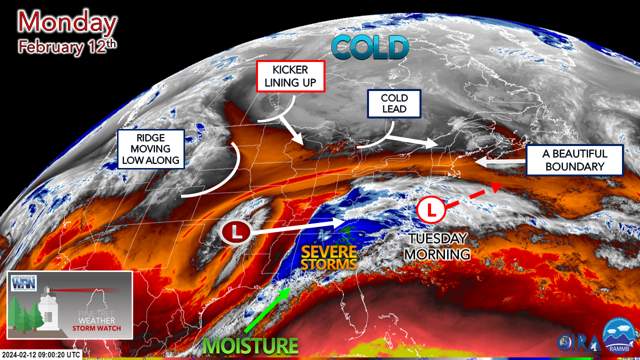
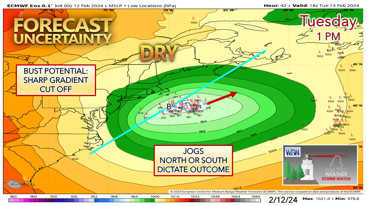
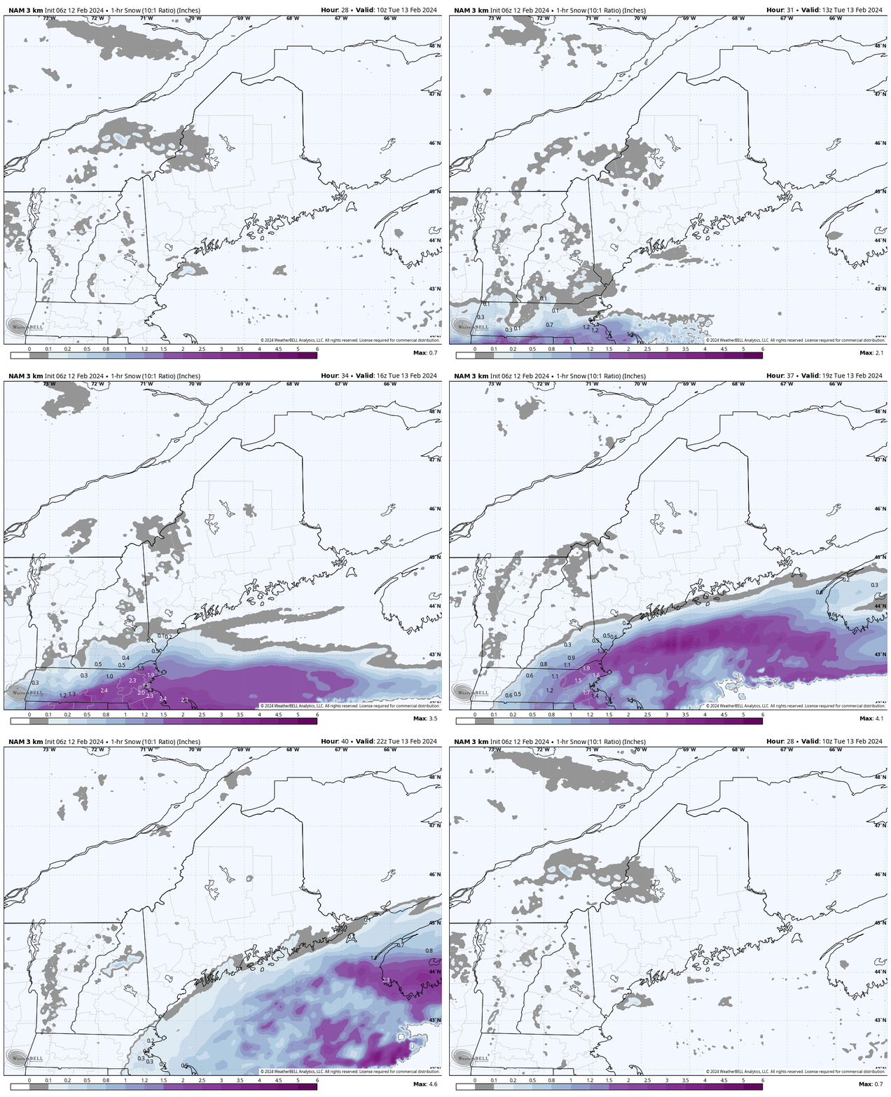
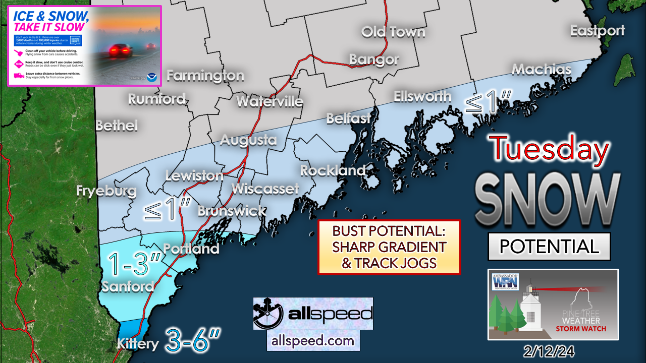
Bust potential on the low end looms largeNow that all of the players are in range and guidance is lining up, a better idea on the forecast is coming into line. I didn't like this set up from the onset, and mentioned that last week on Facebook. I tried to avoid the bait of the European model as long as I could, and I am shaping up to get bit bad by that, as Sunday's snowfall idea is likely to go down in flames. I am not happy with myself as a result of it as patience is everything in the weather forecasting business. I should have trusted my judgment all along here that this was likely going to be a miss, based on what was noted with a Facebook post on Saturday: the northern piece had the path of least resistance to reach the region first and play spoiler here. So here we are. The cold lead work through the region on Monday, and brings areas of snow showers and flurries to the mountains and north as it passes through. Meanwhile to the south, the upper low over Oklahoma heads to the east while dragging up moisture from the Gulf of Mexico. The low level water vapor image here shows the boundary set up between the trough moving in from the north and the ridge nosing up from the south. The battle line is clearly drawn. Monday 1 AM (06z) to Tuesday 7 PM (00z Wednesday) - Putting all of that into motion here, you can see the cold lead passing through which holds the trough in place, the kicker digging in behind the approaching system, and in turn shoves everything to the east. The trough holds serve and keeps the storm to the south. At this point in the ballgame with less than 24 hours before the first flakes fly, I don't see where this idea is going to change much. The ideas that I pay attention to closely in comparison with each other are all on board with a low impact event for Maine. A little wobble to the north isn't out of the question, but that may only amount to an inch or two of difference in accumulation for the south. Timing / amountsTuesday 6 AM (10z) to 7 PM (00z Wednesday) - A look at hourly snowfall rates shows the heavy banding hammering southern New England and staying offshore of Maine. A jog 30 miles north at this point may change the outcome a bit as I mentioned previously, but it may only add an inch or two of accumulation. I think the trough is going to hold up in this case. Thus a dramatic drop off in the snowfall amounts. Talk about taking the pie in the face here. I knew better. I own it. I will monitor and may post an update on Facebook later today. Thank you to Allspeed Cyclery & Snow in Portland, Downeast Aerial Photography in Rockland, Dutch Elm Golf Club in Arundel, and Sunrise Property Services in Bridgton, for partnering with Pine Tree Weather. Special thanks to all the individuals and businesses who financially contribute. I sincerely appreciate your support. Always have MULTIPLE ways to receive weather alerts. Stay updated, stay on alert, and stay safe! - Mike PRINT MEDIA: Feel free to quote and cite my work here for your stories. Please give me the professional courtesy of knowing that you are referencing my material so I can read your final product and acknowledge it on my media and link it on the PTW IN MEDIA page here on the website. Feel free to send me a message via the Facebook page or Twitter (X) to get my phone number if necessary. Thank you! NOTE: The forecast information depicted on this platform is for general information purposes only for the public and is not designed or intended for commercial use. For those seeking pinpoint weather information for business operations, you should use a private sector source. For information about where to find commercial forecasters to assist your business, please message me and I will be happy to help you. |
Mike Haggett
|


