
Elevated risk for flash flooding through Tuesday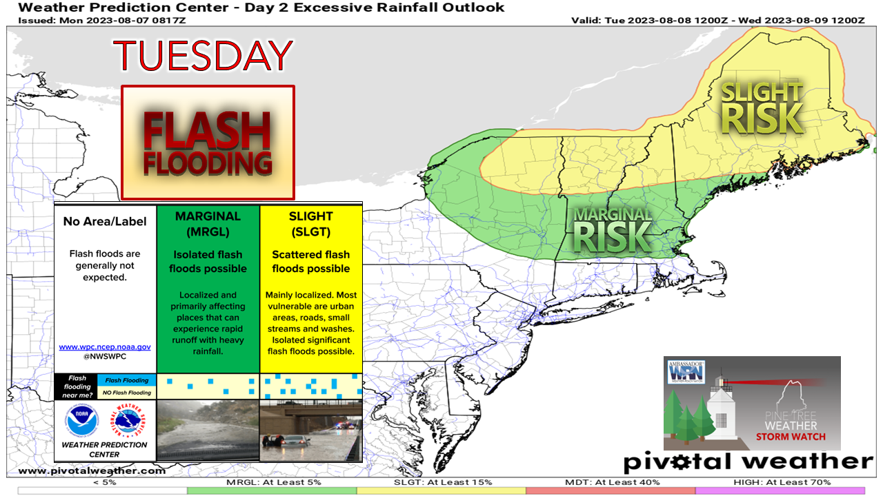 It's not very often that New England sees this kind of flood risk, and when it does, it is usually something with tropical characteristics after a period of rain, which is what is going on here. This is a bad situation for Vermont, not good for western New Hampshire, most of Massachusetts, northern Connecticut, and eastern New York. Maine is likely to see some impacts in the way of road washouts, urban street flooding, river rises and standing water on roadways. 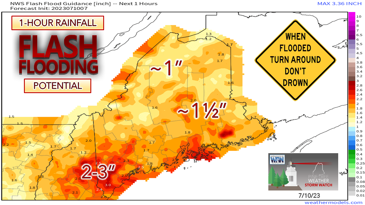 The past few days have allowed for some drying over the region, but not much. Most of the state is in the 1-1½" per hour range of accumulation that could cause localized flash flooding. This morning as I was preparing this update, I received a heavy shower here in Kennebunk that brought a high rainfall rate of 2.5" / hour. I expect that hourly rainfall rate to be at a low end by the time I review the data by the time this ends on Tuesday. Expect numerous bulletins to be issued for flood related statements and warnings through Monday night. Be sure you have multiple ways to receive alerts by phone and NOAA Weather Radio. Training and back building of convective showers and storms are the concern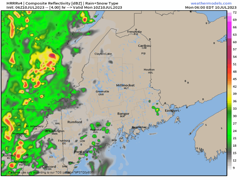 Monday 6 AM to 8 PM - I am using the 15-minute interval forecast loop from the 06z HRRR to illustrate how the model is anticipating the training and back building of rainfall from convective showers and storms. Here you can see where Vermont is going to get hammered, something that area has not seen since Hurricane Irene in August 2011. Western and southern Maine gets into some of that activity heading into Monday night. The power wash comes Monday night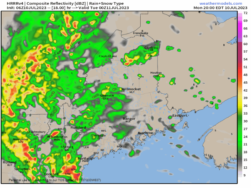 Monday 8 PM to Tuesday 6 AM - The surface low moves northward Monday night and pinwheels the heavy rain through much of the state. With the cyclone becoming mature, a dry slot works in which shuts down the widespread heavy rainfall and turns it into scattered showers heading into Tuesday. Expect some overnight rumbles of thunder. I don't expect anything too crazy other than torrential rain that may bring some gusty wind along with it. The overall severe threat is very low, thankfully. Front kicks through on Tuesday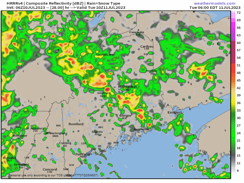 Tuesday 6 AM to Wednesday Midnight - Showers and storms are on track to taper off from southwest to northeast through the day, with a few scattered dumpers with rumble potential over the Quebec border region as a parting gift Tuesday afternoon into the evening. Potential rainfall amounts adjusted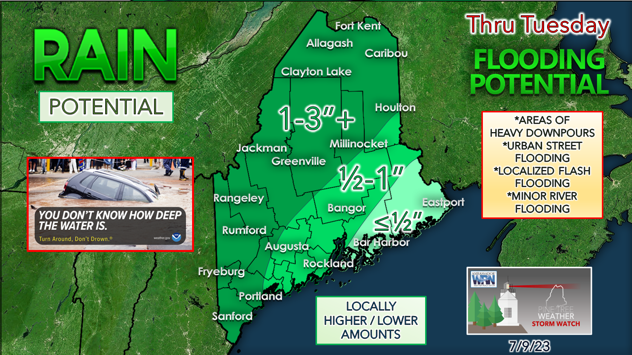 A slight adjustment to the forecast rainfall amounts to include southern areas in the 1"+ level. As I mentioned here yesterday, a few miles may be the difference between receiving half the forecast amount, or double, even triple the amount given the dynamics here. These storms with tropical characteristics can bring the element of surprise either way. Be on alert while travelling for rapidly changing driving conditions. Rain could fall in sheets. Urban streets could turn into rivers. Visibility could be zero. Then there is fog, also. Remember to never cross a flooded roadway... ever. Click here for the old school Weather Channel Local ForecastScroll to the bottom and click on Hazardous Weather, scroll back up, enter your town, then click go! Pine Tree Weather is funded from followers like you. I would appreciate your financial support. Click here for how you can contribute. You may not like the weather, but I hope you like what I do, and support my efforts. Thank you! Stay updated, stay on alert, and stay safe! - Mike NOTE: The forecast information depicted on this platform is for general information purposes only for the public and is not designed or intended for commercial use. For those seeking pinpoint weather information for business operations, you should use a private sector source. For information about where to find commercial forecasters to assist your business, please message me and I will be happy to help you. |

Mike Haggett
|


