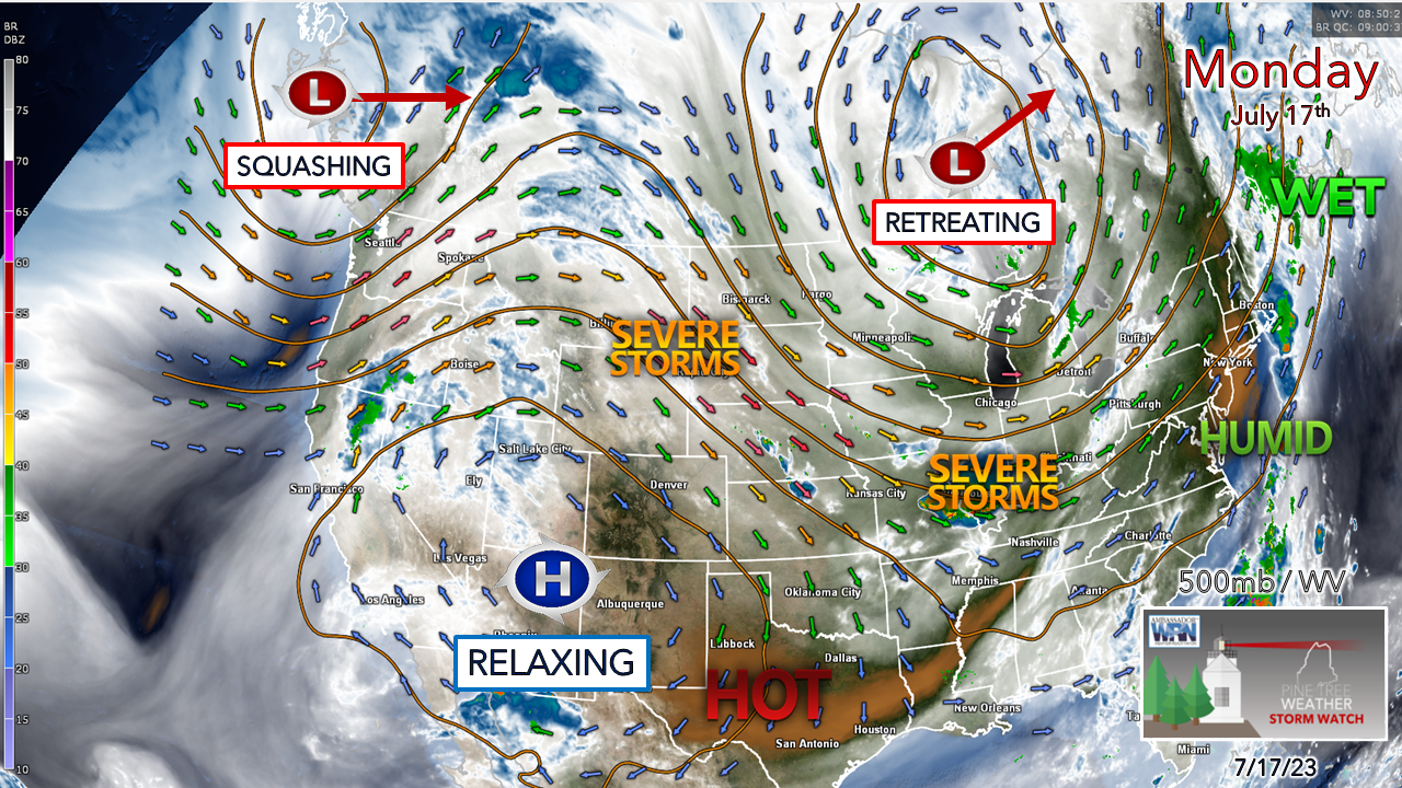
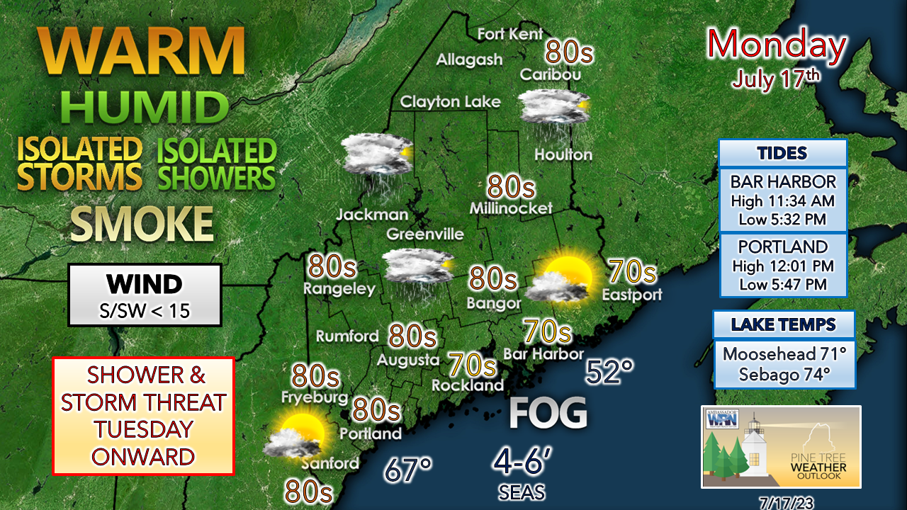
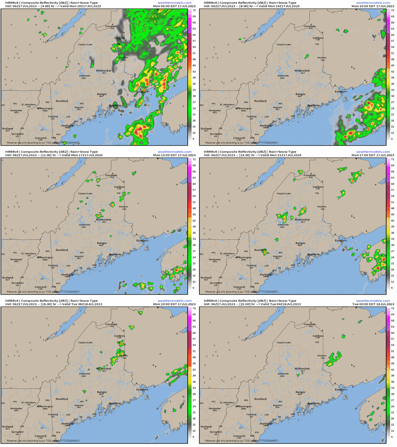
Pattern shifting a bitA look here at the 500mb (altimeter ~18,000 ft) level of the atmosphere with water vapor imagery shows the beginning of some change in the pattern. The upper-low over central Quebec is in the process of weakening moving out. The strong death ridge over the southwest is also weakening as an upper-low over the Pacific northwest barrels in to squash it. While the region will still deal with a troffy, unsettled pattern overall, the idea is for it to be more east to west zonal flow in nature, which will help move disturbances along a bit quicker. The timing of these disturbances isn't great as it appears we may have yet another showery / stormy weekend ahead, but we'll see how the week unfolds to get a better scope on that. Humid is the rule for most of the region as dew points generally stay in the 60s overall as the southwest flow continues. A lazy, hazy day of summerThe day will be a warm one, if not hot especially for the south as the heat index climbs into the 90s there. The Maine Department of Environmental Protection has issued a moderate ozone forecast for the southwest coast and moderate particle pollution over much of the state as wildfire smoke creeps back in for a brief visit. For those seeking relief and want to find a fresh water or saltwater beach, please check on water quality in those locations as the recent heavy rains have stirred up sewage before running into it. Fog may ruin what would be a decent day for MidCoast and DownEast shorelines. Monday 6 AM to Tuesday Midnight - There is an isolated chance for a shower or storm over the interior through the day. The dynamics aren't great, so whatever forms may be a pop-up dumper with a risk of thunder that will likely be short lived as there is little going on to sustain it. Another round of heavy rain and severe potential TuesdayInterior areas are on track to get hammered with heavy rain and strong to severe storms as a frontal boundary passes through the region for Tuesday. Tuesday 8 AM to Wednesday 2 AM - After a mainly dry morning, activity is expected to ramp up in the afternoon. The best chance for strong to severe storms appears over the west and north, but southern areas may have potential for some action later in the day. It's definitely a "head on swivel" afternoon, so be aware and stay alert. The risk of isolated showers and storms continues through the rest of the week. Pine Tree Weather is funded from followers like you. I would appreciate your financial support. Click here for how you can contribute. You may not like the weather, but I hope you like what I do, and support my efforts. Thank you! Stay updated, stay on alert, and stay safe! - Mike NOTE: The forecast information depicted on this platform is for general information purposes only for the public and is not designed or intended for commercial use. For those seeking pinpoint weather information for business operations, you should use a private sector source. For information about where to find commercial forecasters to assist your business, please message me and I will be happy to help you. |
Mike Haggett
|


