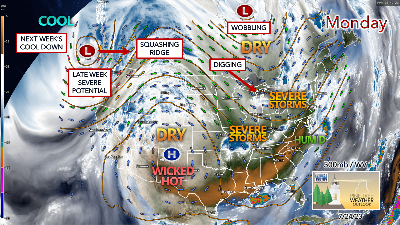
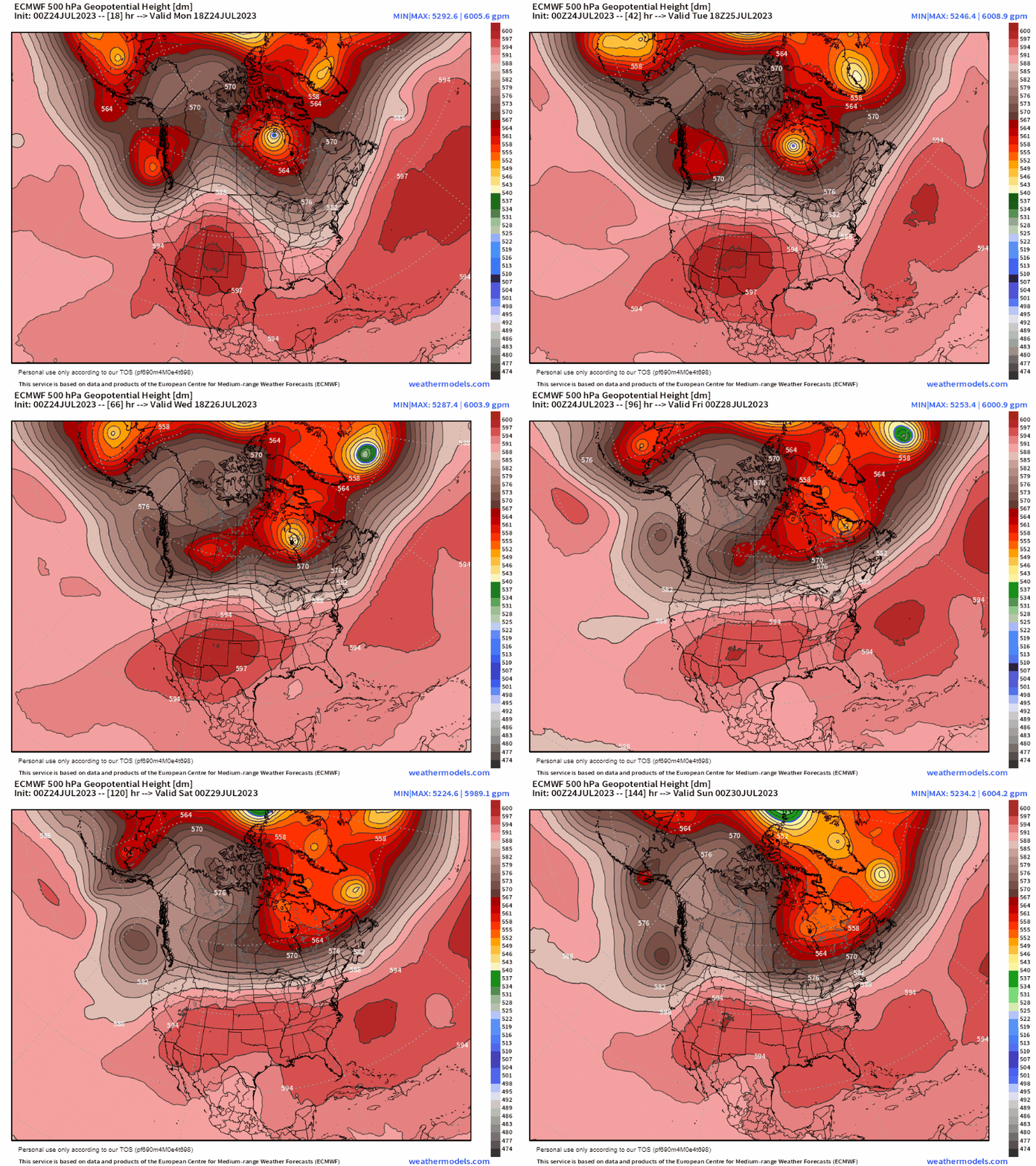
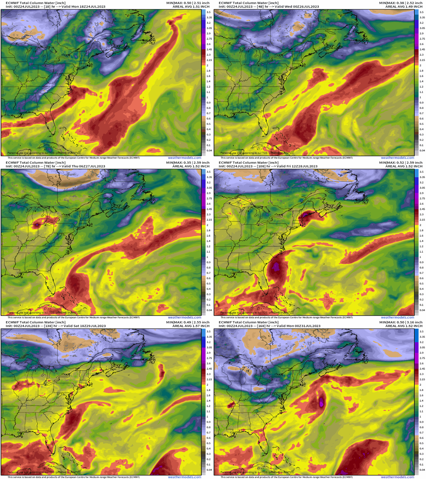
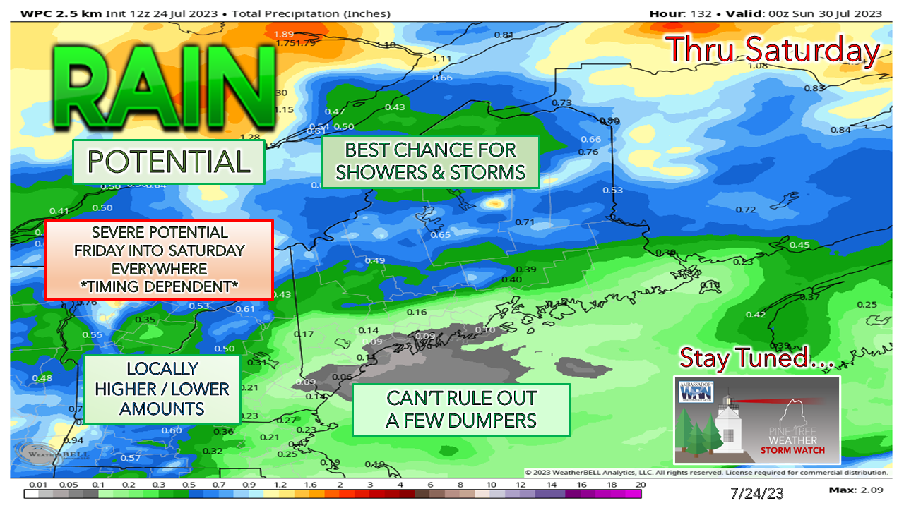
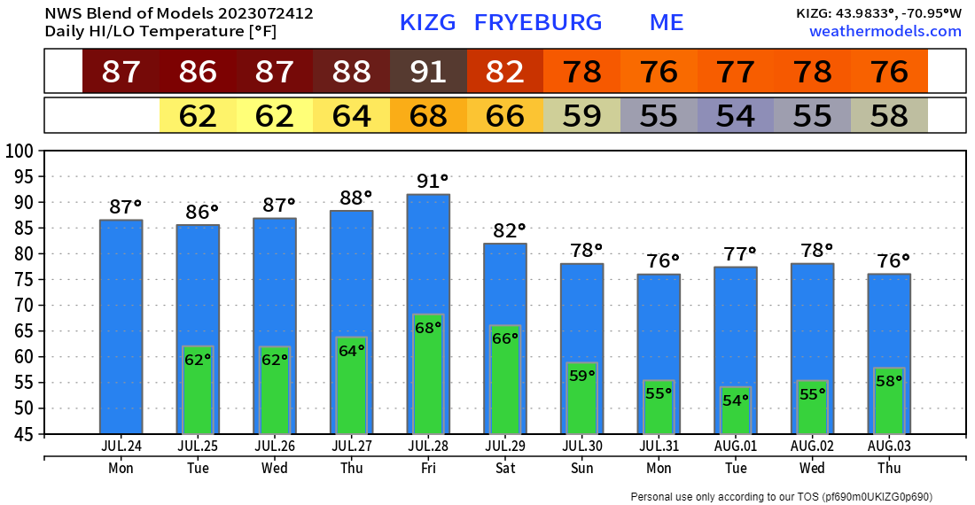
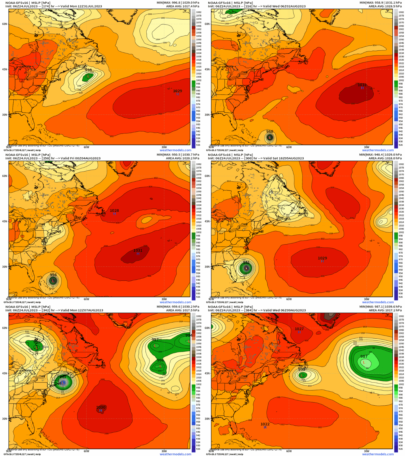
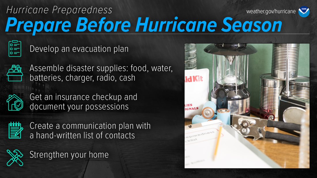
A look at the steering levelNow that the region has finally taken a break from the waves of heavy rain, a more typical summer-like pattern is taking shape through the rest of the week. The upper-level high (aka death ridge) over the south has been dictating out pattern, with an assist to another over the Atlantic. Upper lows over the north keep chipping away at the competing highs, and the one entering the Pacific northwest is expected to flatten out the pattern into a more west-to-east, progressive pattern as we head into next week. Monday 2 PM to Saturday 8 PM - The forecast idea put into motion shows that upper low over the Pacific northwest squashing the death ridge and will bring rains to the wildfires over western Canada. The upper-low that has been parked over Hudson Bay in what seems like forever continues to hold serve with its battle with the strong ridge to the south. Energy from the upper-low crosses central Canada and sets up a strong cold front that is on the way Friday into Saturday. Monday 2 PM to Sunday 8 PM - Using precipitable water values here for humidity purposes shows the increase in dew points as the week progresses, climbing into the upper-60s to the mid-70s by Friday into Saturday, before a cool down comes Sunday and into next week. Rainfall and temperaturesNorthern and western areas have the best chance for rainfall at times through the period, but not all areas are exempt. Given the strong nature of the frontal boundary passing through late week, all areas are on notice for storm potential, but for now it is wait and see how the dynamics shape up. Using Fryeburg and this model blend of temperature ideas shows the roasting that the region is expected to experience later in the week. Heat indices are likely to jump into the 90s along the coastal plain and on up into the western and eastern interior. There may be air quality concerns due to low level ozone. The timing of tides are favorable for capacity crowds at the oceanside beaches with low tides during the noon hour Thursday and 1 PM hour on Friday. A "typical Maine summer" is on the way heading into next week with comfortable temperatures and humidity levels. Enjoy it. The outlook is for the death ridge to strengthen again heading into the following week, with potential for increased humidity, heat, and severe weather potential. NOT A FORECAST, but...First off, a quick explainer here. This is the GFS model, which is notorious for spinning up some outrageous ideas in the long term for hurricane potential. I don't have enough hair left on my body as to the number of these long-term doomsday scenarios I've seen over the years did not happen. These often get spread around on social media to invoke fear, and meteorologists and forecasters like me see message boxes filling up wondering about it. This model also has a history of changing its mind with model runs. What looks like disaster at 00z looks like nothing at 12z. This happens with ideas of big snow in winter as well. Those of us in the forecasting world joke about these things, calling them "GFSicanes." It's science fiction most of the time, but to give the GFS credit where credit is due, that model is geared to sniff out tropical trouble well ahead of time by design and scores better than any other model when it comes to warm core storms. We are in hurricane season. Sure, it's been since August of 1991 since the region experienced Hurricane Bob, and we've had many remnants that have passed through since. While the adage can be passed around "we're due for one", and I can understand that thinking, many things have to go right for New England to get hit with one. The sea surface temperatures continue to be a focal point as tropical systems feed off the heat of the water and will continue to get warmer. Given the troughy pattern that has been persistent over the region all summer and strong blocking over the Atlantic, the total of ingredients indicates this idea may not be outrageous, and perhaps it may be viewed as distinct possibility. I am not one to be so brazen to suggest that this is going to happen or be so bold to say it would happen in the second week of August. Hurricane Bob did come in mid-August, so it's not crazy to think it won't happen again. My message here is that the tropics need to be monitored closely. The time to prepare for these is well ahead of time, not when the National Hurricane Center has the region in the 5-day window and people rush to prepare. The best time to prepare for hurricanes is BEFORE hurricane season begins. Avoid having to rush through potentially life-saving preparations by waiting until it’s too late. Get your disaster supplies while the shelves are still stocked, and get that insurance checkup early, as flood insurance requires a 30-day waiting period. noaa.gov/prepare-before-hurricane-season Pine Tree Weather is funded from followers like you. I would appreciate your financial support. Click here for how you can contribute. You may not like the weather, but I hope you like what I do, and support my efforts. Thank you! Stay updated, stay on alert, and stay safe! - Mike NOTE: The forecast information depicted on this platform is for general information purposes only for the public and is not designed or intended for commercial use. For those seeking pinpoint weather information for business operations, you should use a private sector source. For information about where to find commercial forecasters to assist your business, please message me and I will be happy to help you. |
Mike Haggett
|

