
The big picture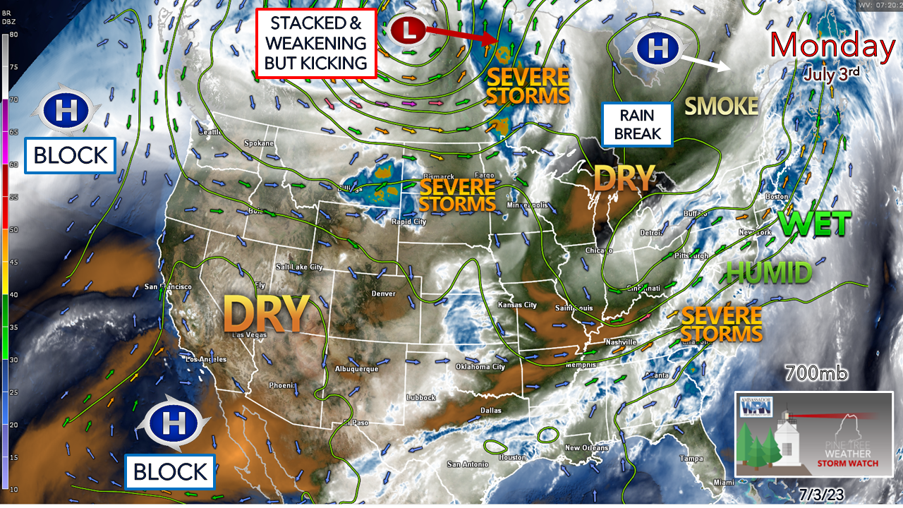 As I was preparing this update in the 3-6 AM time period Monday morning, it was to the sound of heavy rain at my home in Kennebunk. Rain total since Sunday here had eclipsed 2¾" as I sat down with my second cup of coffee to type. Using Portland data, the average monthly total for July is 3.43", and that total could be left in the Mousam River by the time the sun sets either by the end of the day or by Tuesday. The is a look at the 700mb (~10,000 ft) moisture level atmospheric heights along with the water vapor from about 3:30 AM Monday morning. The long wave hose of moisture from the south is well observed. A dry slot from the weak ridge to the northwest is getting kicked east by a strong upper-low over northern Alberta and Saskatchewan. A strong blocking ridge over the northeastern Pacific along with the heat dome southwest of California is controlling the pattern and will for a while. Not seen is a strong ridge to the east over the Atlantic which is directing the moisture flow into the northeast. The dry slot works into the region slowly and arrives by Wednesday. Given the fact the moisture flow from the southwest stays stubborn, this will keep the humidity up, pump heat in, and keep the threat for showers and storms in the forecast through the rest of the week. 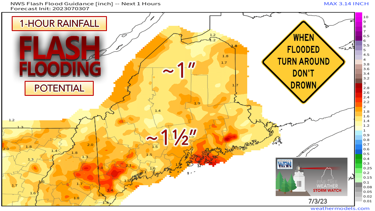 The flash flooding threat is here to stay for the time being. The mindset at this point should be where downpours occur, flash flooding, flood advisories, and flood warnings are all possible, depending on the situation. Monday is a day to dry out... somewhat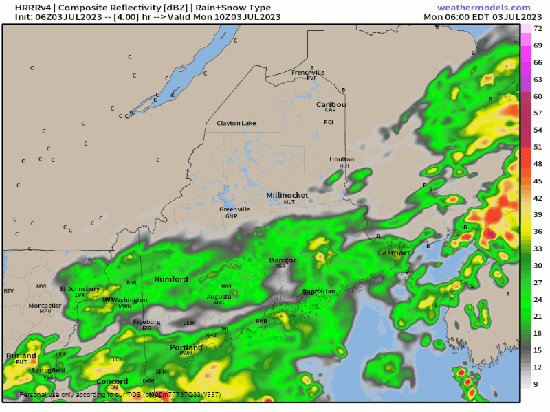 Monday 6 AM to Tuesday 6 AM - After steady and locally heavy rain passes through the region to start the day, showers taper off around midday. The main question heading into the afternoon is IF and/or WHEN the sun pokes out, what happens from there. The rule of thumb continues to be that if the sun comes out, the thunder guns could come out, and that is what is going on here. The best chance for sun will be over southwestern areas. While the main thunder threat appears in New Hampshire, that could spill over the western border of Maine pending on cloud cover. A weak wave passes through overnight and could bring some showers to start the day on the Fourth. There is hope for some fireworks to go off Tuesday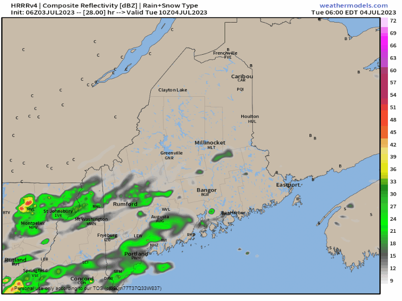 Tuesday 6 AM to Wednesday 2 AM - Showers are expected to start off the day over the southern half of the state. Clouds appear to break up heading into the afternoon which may touch off afternoon and early evening thunderstorms. As the sun sets and the atmosphere cools off, showers and storms taper off. In areas that get rainfall, those locations could see some locally dense fog break out which would reduce visibility. Outlook for Wednesday onwardIMPORTANT NOTE: This forecast model loop idea is for convective available potential energy (CAPE) which is fuel for thunderstorm activity. This is NOT meant to be viewed as a precipitation forecast. 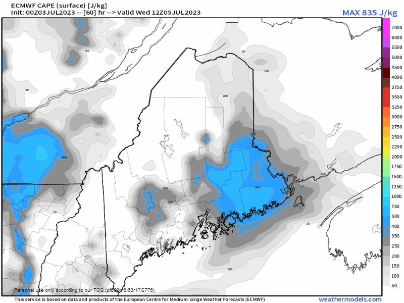 Wednesday through Friday - The humidity is around, the heat is expected to turn up, so the shift here is to afternoon and early evening showers and thunderstorms through the rest of the week. Coastal areas may get spared as the sea breeze is expected to occur all three days which brings in stable air but may get hit with a decaying storm. As the CAPE idea indicates here, interior areas will have plenty of energy to work with for showers and storms to fire, especially along the sea breeze boundary from interior York County on up into the western foothills and eastern areas. With this kind of heat, humidity, and energy, there is the threat of isolated severe storms. It will be important to stay updated on the weather forecast and to have multiple ways to receive alerts when storms develop. Widespread rain from a long wave frontal boundary is expected for the upcoming weekend. Expect showers for now both days and stay tuned for details and changes. 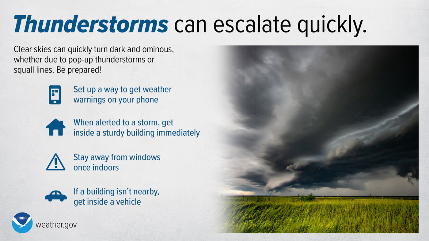 Thunderstorms and squall lines can quickly turn clear skies dark. Stay Weather-Ready by having a way to get weather alerts on your phone and stay safe by immediately going inside when the skies turn threatening. weather.gov/safety/thunderstorm Click here for the old school Weather Channel Local ForecastScroll to the bottom and click on Hazardous Weather, scroll back up, enter your town, then click go! Pine Tree Weather is funded from followers like you. I would appreciate your financial support. Click here for how you can contribute. You may not like the weather, but I hope you like what I do, and support my efforts. Thank you! Stay updated, stay on alert, and stay safe! - Mike NOTE: The forecast information depicted on this platform is for general information purposes only for the public and is not designed or intended for commercial use. For those seeking pinpoint weather information for business operations, you should use a private sector source. For information about where to find commercial forecasters to assist your business, please message me and I will be happy to help you. |

Mike Haggett
|


