
Winter Storm Warnings across the whole state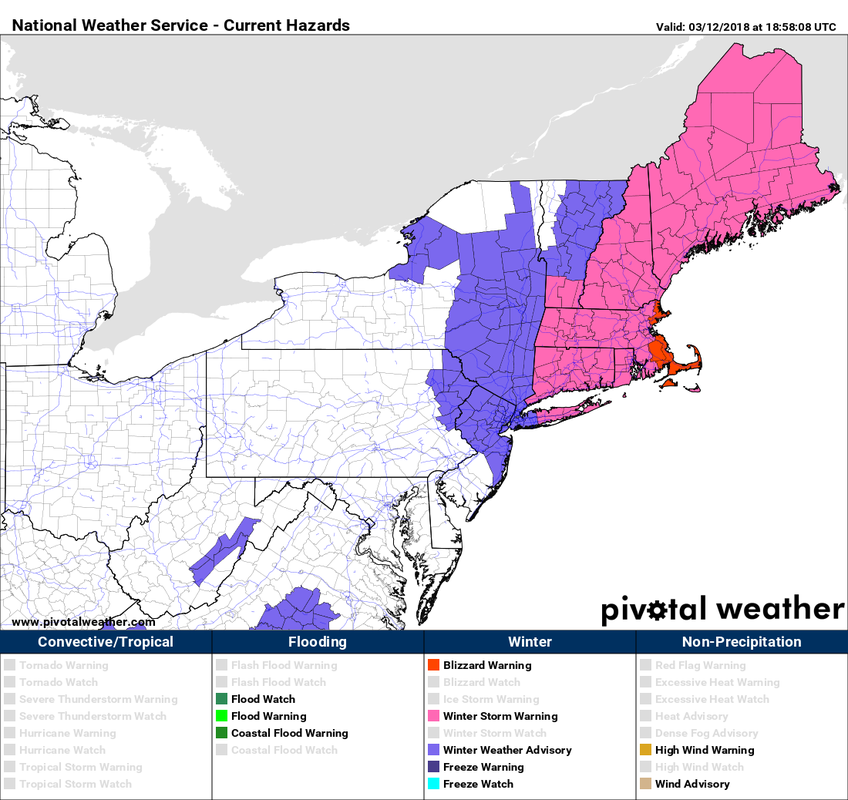 With the exception of the upper two-thirds of Vermont, the New England region is under winter storm warning. Coastal Massachusetts is under blizzard warning. High wind warnings and wind advisories are also posted for the shorelines of the Bay State. This is going to a mess across most of the six state region. Expect cancellations, roads shut down, and disruption to ground and air travel, along with freight, mail and parcel delivery. Expect power outages to be likely. If you absolutely have to travel, make sure you are well prepared in case you end up stranded. It could be a while before you can be reached. Road crews are going to be challenged at times keeping up. Best thing to do is shelter as close as you can to where you need to be. Go to a friend or family members home. Get a hotel room. This isn't anything that cannot be dealt with in Maine. For areas to the south, this is a crippling event. Updated snowfall idea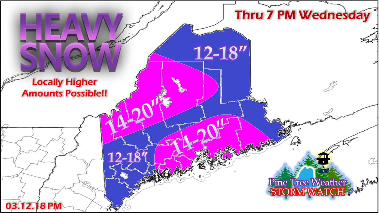 With the possible exception of way Down East areas, this is an all snow event. It will be cold enough for copious accumulations. I expect a higher ratio snow in the mountains, which will be easier to move and a joy to the ski hills. The snow will blow around. This will cause drifting. It will also continue well into Wednesday, and beyond for the mountains and north. Simulated radar outlook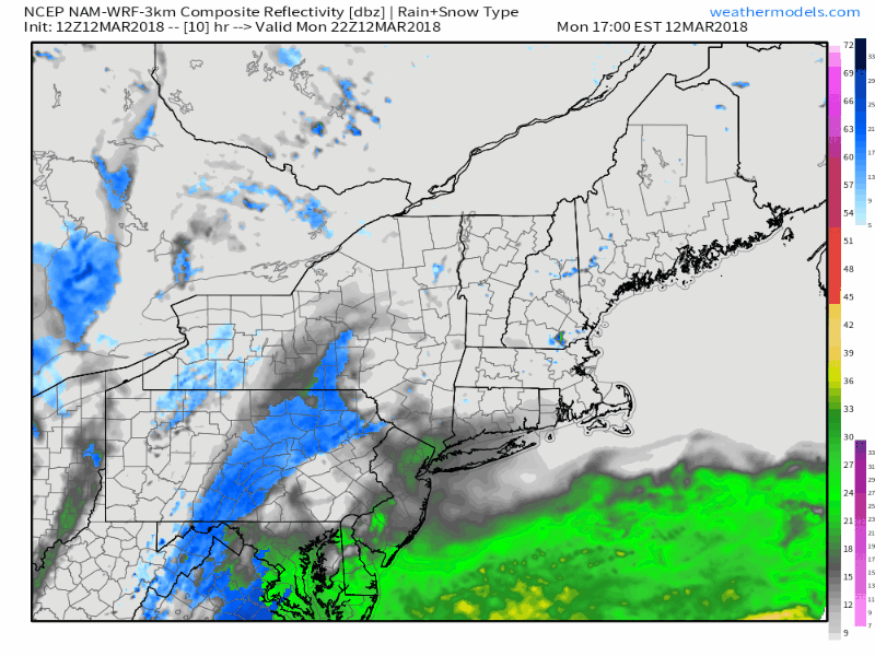 While the heavier snow will fall over the region Tuesday and Tuesday night, wrap around snow showers are likely to persist well into Wednesday as the storm tracks into the Gulf of St. Lawrence. If you wake up Wednesday morning and think my snow fall call was a little short, you can expect to add another 2-6" on top of that, pending on region, by the time this is all said and done. Mesoscale banding will tell the tale on this one. It's always hard to figure out just where they set up. Models are floating the idea of the potential of snowfall rates in the 2-3" range per hour in areas. This is likely to skew snow totals a bit in areas. And the snow will blow around... This is only one model idea, and this is used here for discussion purposes only. I do think this is a bit over done, but the potential is there. NWS Taunton has issued blizzard warnings for the south shore and Cape Cod. I am concerned that the MidCoast east of Wiscasset on up through the DownEast coast are likely to see blizzard conditions, if not an all out blizzard with this event. Add to it the heavy snowfall, little to no visibility, this is where traffic could come to crawl or a complete standstill.
Again, if you do not have to drive, don't. Stay off the roads. For the latest bulletins and forecast changes, please stay in touch with NWS Caribou for northern and eastern Maine, NWS Gray for New Hampshire western and southern Maine, and NWS Taunton for most of southern New England. Feel free to follow on Twitter @WesternMEwx for quick hits of information. For those following on the Pine Tree Weather Facebook page, click on the Following tab on the page, then click on See First to get the latest information. - Mike |

Mike Haggett
|


