 The shovels appear to get a decent workout in the days ahead here. The pattern of inside runners appears to have broken. This sets up ocean storm tracks, which increases snow potential for interior areas. While December was a kick in the groin for ski country, January appears to be more kind. 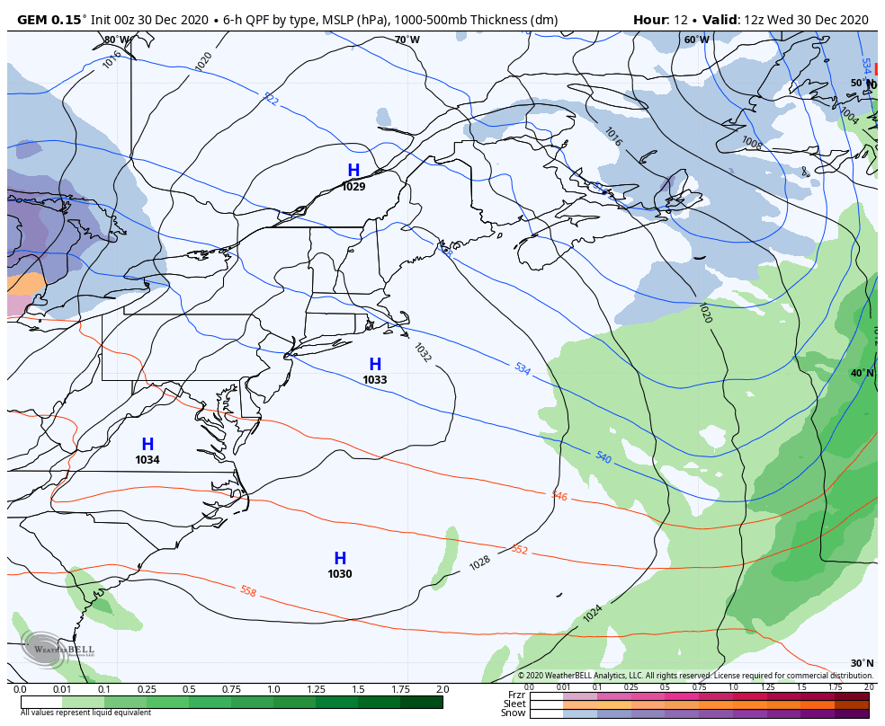 Speed loop here from Wednesday to Tuesday to set the table. Potential for three storms in this time span... overnight Wednesday into Thursday, Saturday, and Monday. It may not stop there. I will get into that later in the post. Light snow overnight for interior areas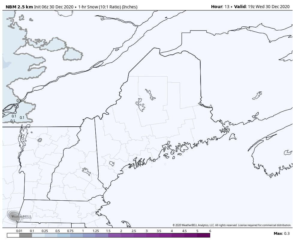 Wednesday stays mainly void of snow until later in the day. There is some dry air to contend with, which may eat at any development early on. Snow overspreads the region overnight, and is over for most areas by daylight Thursday morning. 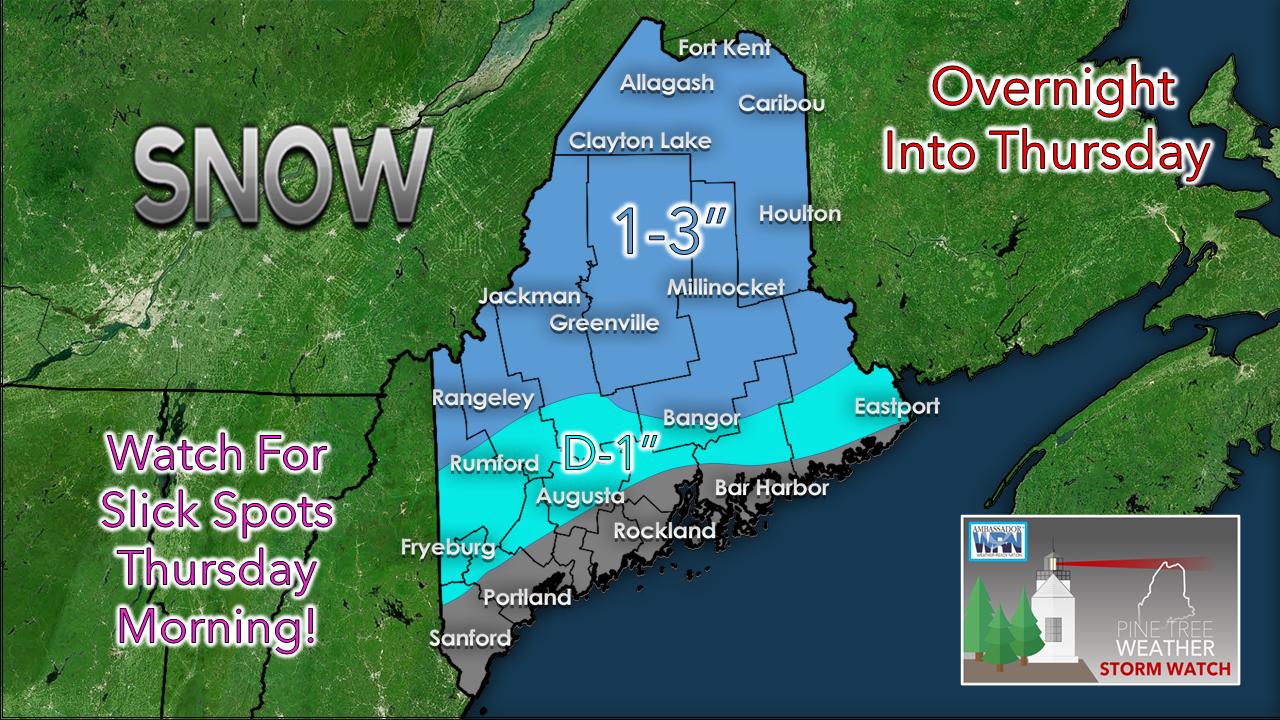 A general 1-3" is expected for the western mountains and the north, along with far eastern interior areas. The higher peaks may see upwards of 5". For most. this is fluff. I can't rule out some flakes along the coast, but I don't see any accumulation to cause issue. Slick spots are likely for the night owls and early birds Thursday morning. Onto Saturday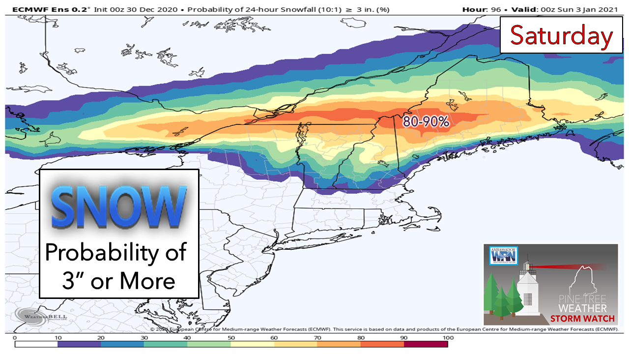 What was looking like an icy affair has trended cooler. For now, the ice concern has shifted into southern New Hampshire. Southwestern Maine may see a bit of sleet and ice. For most of the region, this has turned into a mainly snow event. For ski country, an 80-90% chance for 3" or more of snow as the European ensemble idea presents here is much improved over yesterday. The bases on the slopes and snowmobile trails will start to build. By this time next week, it could look much different than it does at this point. Fine tuning on timing and amounts will come Thursday. Storm potential to start next week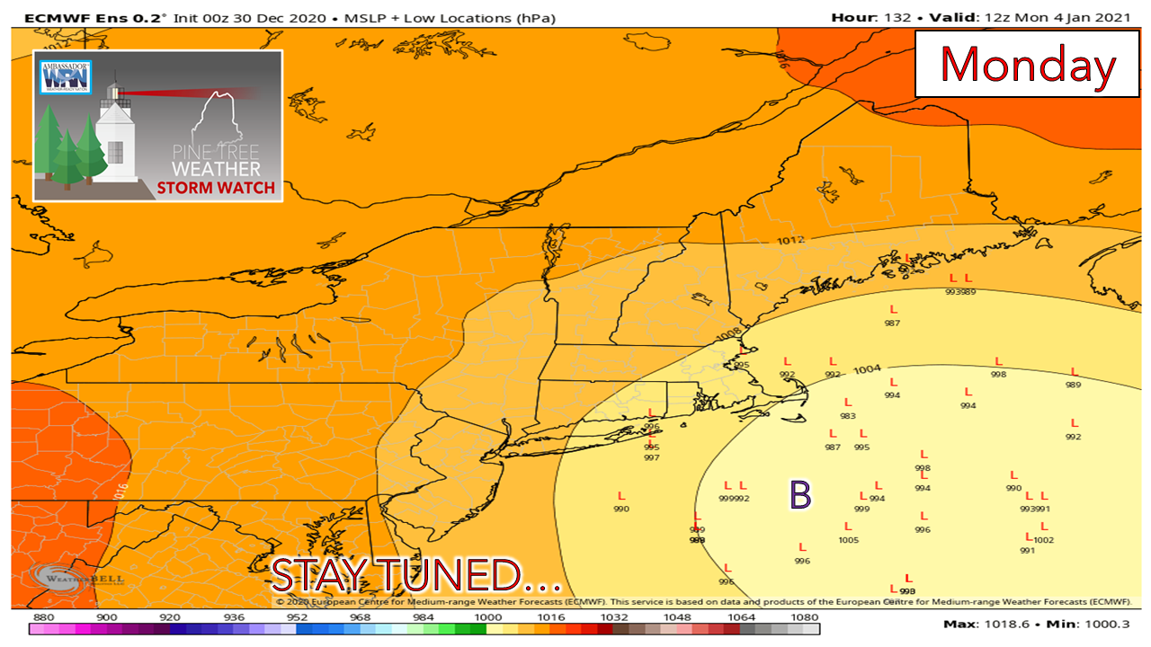 There is a fair amount of ensemble spread, so there is definitely some wiggle room on this. The "B" indicates the benchmark 40° N / 70° W point which is an indicator for coastal snow. There is potential here. Updates on this will come.  Pattern appears to be active into next week.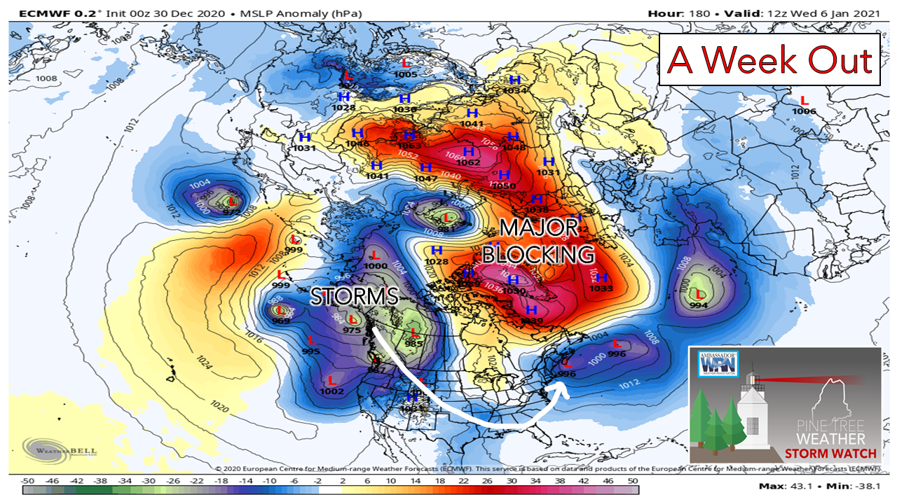 Reports out of Mongolia on Tuesday indicated a potential new world record report of high pressure at 1094.1mb (32.31"). Since the atmosphere is a one big balancing act, a pressure that high means there is offsetting low pressure to offset it. The northern Pacific will get rocked. This kind of amplification indicates potential for stronger storms. Major blocking over the north Atlantic stretching over to north central Asia means middle and upper latitude storms have no other place to go but over North America. With the Greenland block on, that cuts off the inside runners. With a ridge over the Pacific and the block to the east, the storm track falls south, then northeast. The question at this point is the cold, and as a result, increased snow potential for the coast. While there are ideas out there of above normal temperatures, it certainly won't be 70° and flip-flop weather. Expect a stormy pattern, and stay tuned. Winter road trip safety If you’re going to be driving this winter, know how to stay safe. Winterize your vehicle and pack an emergency supply kit. Share your travel plans with friends and family. Before leaving, check road conditions and the weather forecast so you know what to expect. weather.gov/safety/winter Temperature outlook through TuesdayThe normal high/low for Frenchville is 20°/ 4°. For Augusta, 29° / 14°. The period is definitely warmer than normal, but still cool enough for snow potential at times. 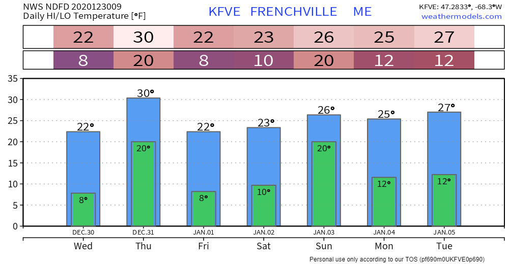 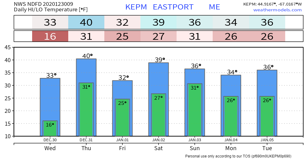 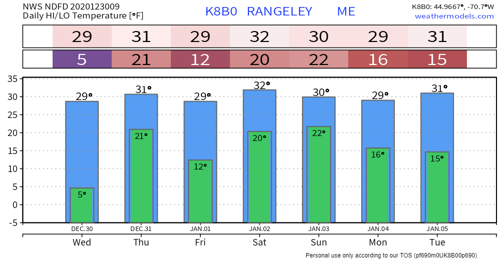 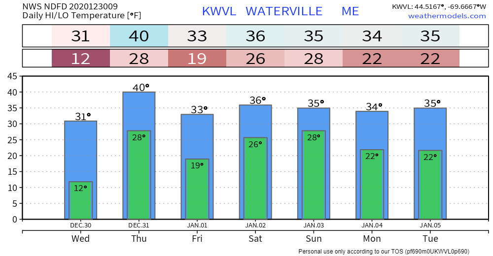 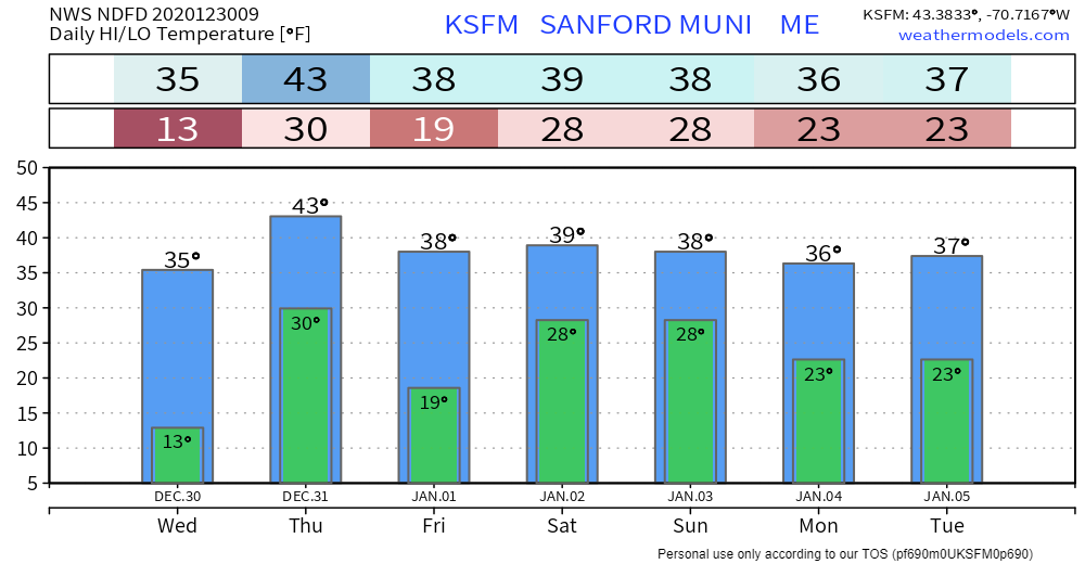 Be prepared to receive alerts and stay updated!
For more information, please follow Pine Tree Weather on Facebook and Twitter.
** FUNDING NEEDED FOR 2021 ** Thank you for supporting this community based weather information source that is funded by your financial contributions. Stay updated, stay on alert, and stay safe! - Mike |

Mike Haggett
|