Rainier conditions this afternoon and evening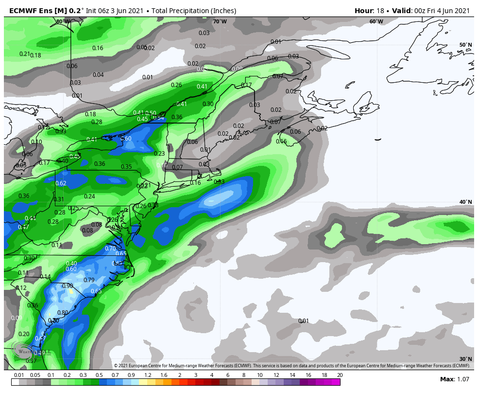 The warm front from earlier this Thursday will move to the north throughout the day and in doing so cause lifting which will cause cloud formation ahead of this front. This will later produce precipitation for Aroostook and the western mountain region of Maine as this area will experience the most convergence and upward lifting. Therefore, we will see the most total precipitation in this area by later tonight. The presence of precipitation in the northern part of the state will inhibit temperatures from climbing significantly. The high temperatures for Thursday should remain within the seasonally normal range at about 65 to 70 degrees Fahrenheit. Rainy conditions clear out by Thursday evening as the warm front passes by. Areas of fog possible overnight in the northern and northwestern areas after rainfall during the afternoon. 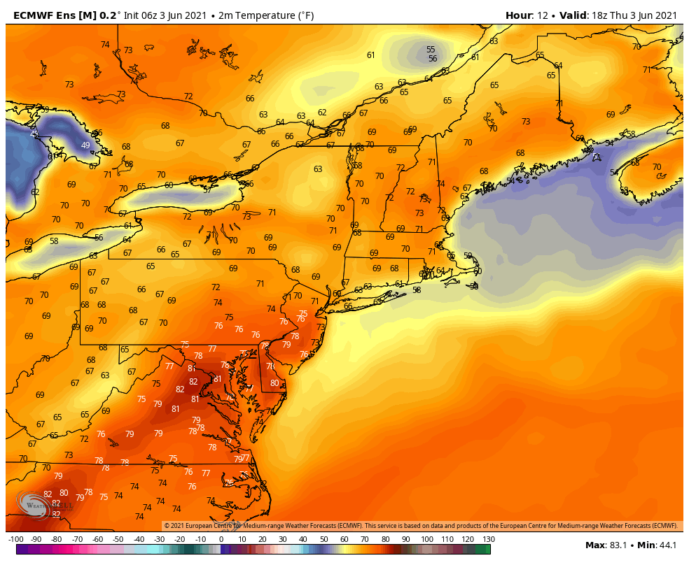 Temperatures for Thursday afternoon at around 2 p.m. reach a high in the mid 60s to low 70s. The afternoon rain pattern continues for Friday and Saturday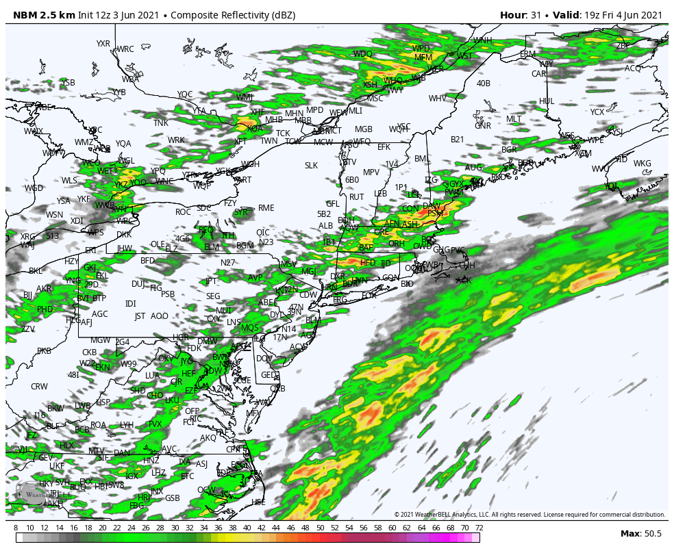 On Friday, a low-pressure system passes slightly to the north of Maine and the associated boundary from this weather feature dips down into the very northern regions of the state. Conditions are less conducive to rainfall than on Thursday afternoon however, there is still potential for scattered showers in the area for Friday. Another low-pressure system makes its way in from the west and through NH Thursday night bringing with it a new storm system that will brush by Maine to the south making for scattered rain in southern regions and along the coast Friday afternoon. Slight chance of thunder is associated with this system as well. 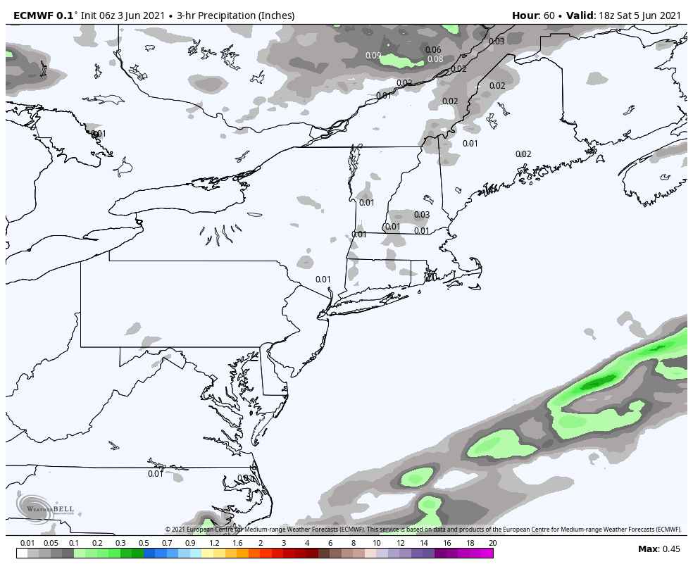 Saturday has predictions for much less precipitation across Maine with a slight chance to in the north and northwest once again in the afternoon. Early Saturday morning a low-pressure system will set up to the northwest of Maine. The chance for showers and thunderstorms in the northwest increase late morning and into the early afternoon as a warm front comes through the area along with the impinging low-pressure system. Plenty of moisture and shear will be available to aid in the formation of the predicted rainy weather and possible storms Saturday. Wetter conditions should taper of by midnight on Saturday and be almost completely gone by Sunday morning. Humidity ramps up for the end of the week Friday morning has dew points starting out in the upper 50s and lower 60s. Throughout the day these dew point temperatures are likely to rise and reach into the lower 60s in the south of Maine by the afternoon. This will leave the area feeling quite humid for most of the morning and afternoon until a cold front moves through the region late in the afternoon bringing temperatures back down a bit. Once this cold front passes through dew points will pop right back up on Saturday due to southwesterly wind blowing hot and moist air in from the south. This humid air mass is predicted to last most of the weekend from Saturday into late afternoon on Sunday. Let's talk about Drought
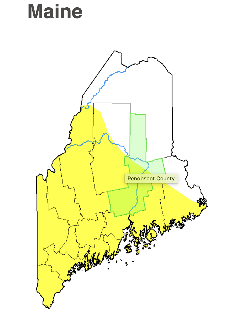
This week's drought report shows that there is no level of drought for most of the northern region of Maine and a low level for the rest of the state. This makes sense for the region given that over this past week most of the experienced rain events have taken place to the north. This pattern will likely continue for the end of this week. The chance of rain for the south and along the coast of Maine may provide some temporary relief on Saturday afternoon. The intensity classification D0 that has currently been assigned to the central and southern areas has had historical impacts such as planting delay, elevated fire danger, browning lawns and a decline in surface water levels. So please remember to stay alert and updated as best you can. Become an WRN Ambassador! We are always looking for more information as a part of the weather community in order to better our forecasts and keep others safe. If you're looking to get involved WRN abassasdors could be the perfect way. WRN Ambassadors serve as leaders in their community. They inspire others to be better informed and prepared, thus helping to minimize, mitigate, or avoid the impacts of natural disasters. WRN Ambassadors can encourage these changes in their community in many ways. If you are interested in weather and in becoming a community leader for your community this is the perfect opportunity to do so! Click the link here to sign up. Become an Ambassador! Be prepared to receive alerts and stay updatedBE PREPARED WITH A NOAA Weather Radio. For $20-$40, it could provide vital information to you when you need it. The weather bands are standard on most public safety scanners, and newer scanner models. Weather radios can be programmed for auto alert. Click here for more information.  ► ► For the latest official forecasts, bulletins, and advisories, please check in with the National Weather Service in Gray for western and southern areas, or Caribou for northern and eastern parts of Maine. 
|

Mike Haggett
|