A chance for isolated showers in the north on Wednesday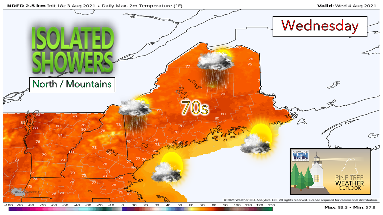 On Tuesday night, a weak cold front currently to the north in Canada will begin moving into the state, entering Aroostook county overnight and moving southeast. Breaks in otherwise mostly cloudy skies should allow for some instability to build along the front allowing for a few isolated showers and to form across northern Maine during the afternoon. The southern part of the state should stay dry with temperatures in the mid and upper 70’s although a strong sea breeze should keep the coast cooler, especially farther north where temperatures may not get above 70. Farther north, temperatures are likely to be just a bit cooler, reaching the lower 70’s. Potential for rain along and just inland of the coast on Thursday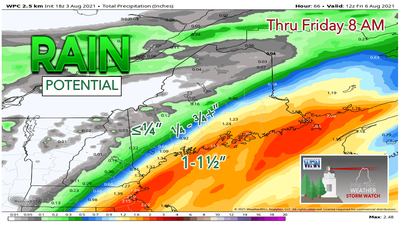 Beginning Wednesday evening, a low pressure system just off the mid-Atlantic coast will be moving north towards the New England coast. Beginning early Thursday morning, a warm front extending from the system will be moving onshore. Rain from this warm front will spread inland with some of the heaviest rain along and just inland of the coast. Otherwise, expect cloudy skies with some clearing towards the west later in the day. Temperatures should be in the 70’s farther west while staying in the 60’s farther east. Rain begins early Thursday night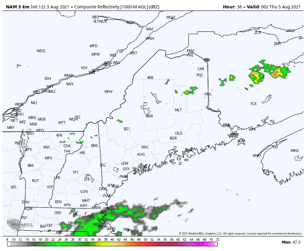 As the system moves north, the rain should begin around nightfall towards the southernmost areas and spread north and west throughout the night. Rain should begin to taper off towards the south during the early morning and should leave the state by early evening. Showers should penetrate into central Maine while most of the west and north stay dry. This system may provide some minor drought relief although the heaviest rain is likely to stay east of the driest regions. However, there is still some uncertainty in regards to the exact track of the storm with the GEM model trending farther east than the Euro and American models. Dry and warm on Friday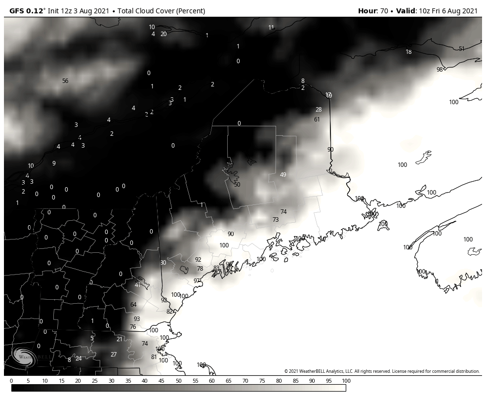 Upper level ridging is expected to build into the region on Friday behind the retreating low pressure. Clouds will continue to move towards the east allowing for some sun during the day. Warmer temperatures are also expected, reaching the upper 70’s and low and mid-80’s. A sea breeze should keep the coast on the cooler side, however. Dewpoints on the rise Friday into the weekend to bring sticky conditions into next week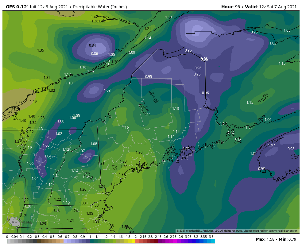 On Saturday, a cold front is forecast to pass through the state and modest instability in conjunction with a substantially moist atmosphere should allow thunderstorms to develop during the afternoon. Saturday will also be another warm day with temperatures reaching the upper 70’s and lower 80’s. Combined with the high moisture content, the air may feel a bit uncomfortable. On Sunday, the humid trend continues with some dewpoints even reaching 70. Temperatures should be in 70's and lower 80's. There is also the chance for some more showers and thunderstorms. The humidity should stick around until early next week. CoCoRaHS Observers Wanted Ever wanted to take rain or snow measurements? Join CoCoRaHS or Community Collaborative Rain, Hail, and Snow Network. This volunteer network of observers measures precipitation from their backyards. Any age can volunteer. Data is used by NWS meteorologists to help with forecasts. Click here for the CoCoRaHS Maine website for more information. Warmer trend aheadTemperatures are expected to rise over the next several days, peaking around Friday and Saturday, before cooling slightly for the end of the weekend and into next week. 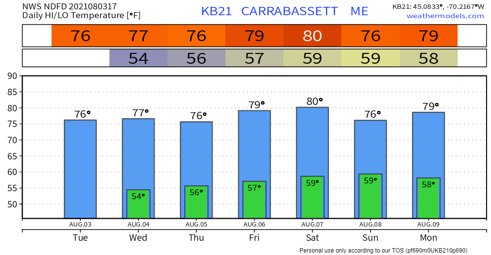 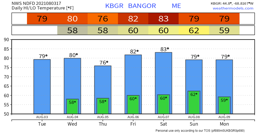 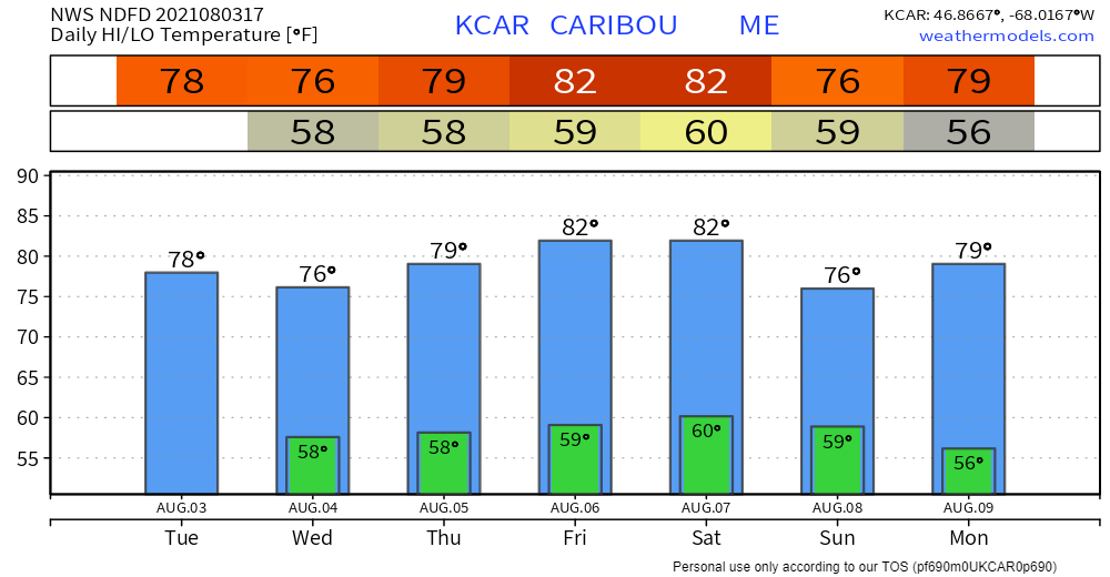 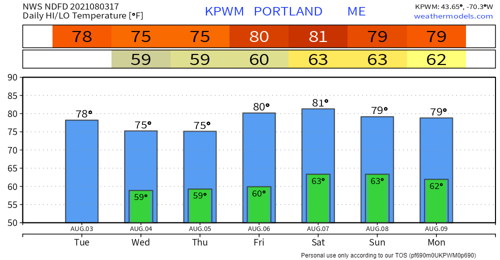 Be prepared to receive alerts and stay updated!
For more information in between posts, please follow Pine Tree Weather on Facebook and Twitter.
Thank you for supporting this community-based weather information source which operates by reader supported financial contributions. Stay updated, stay on alert, and stay safe! |

Mike Haggett
|