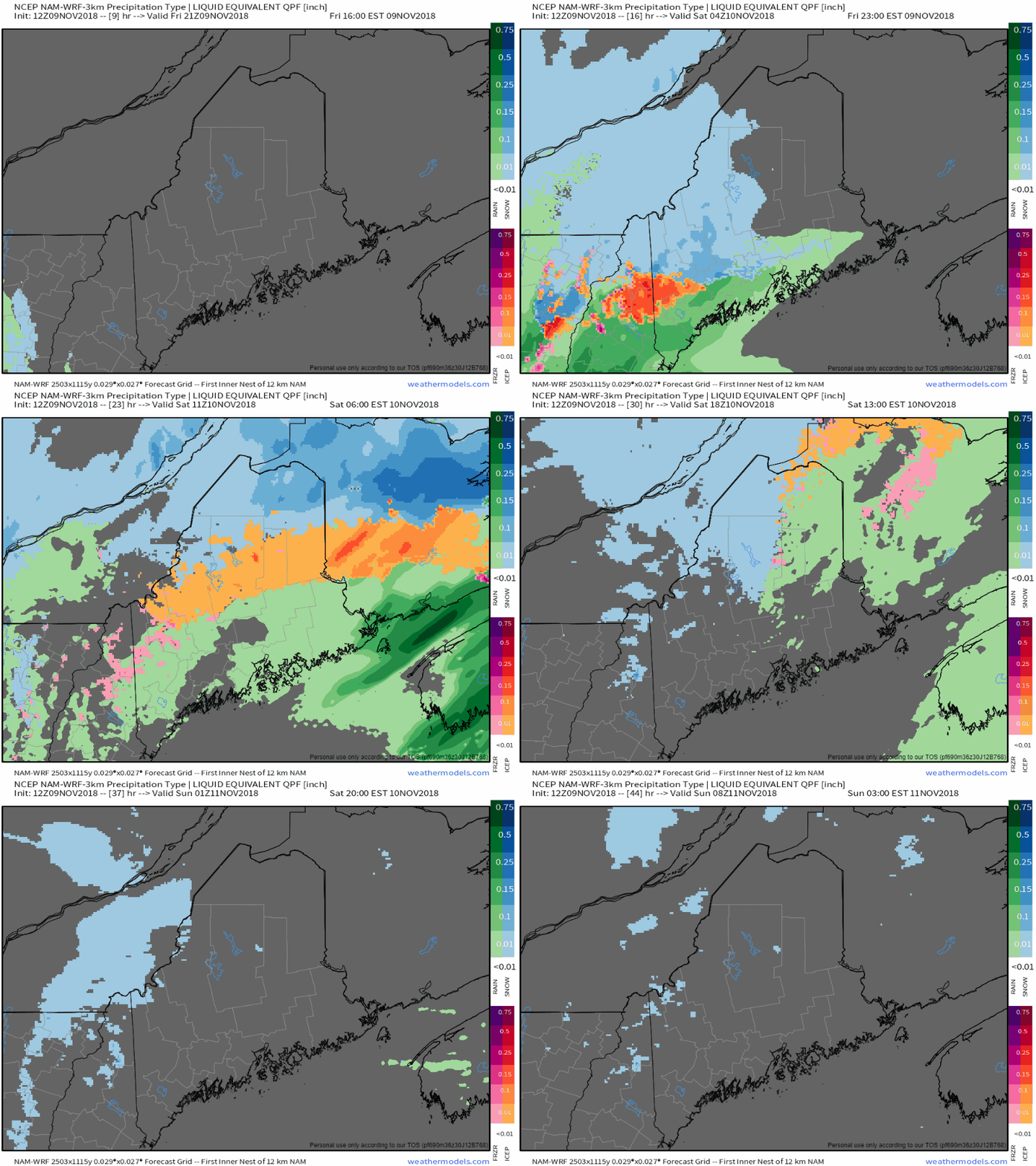
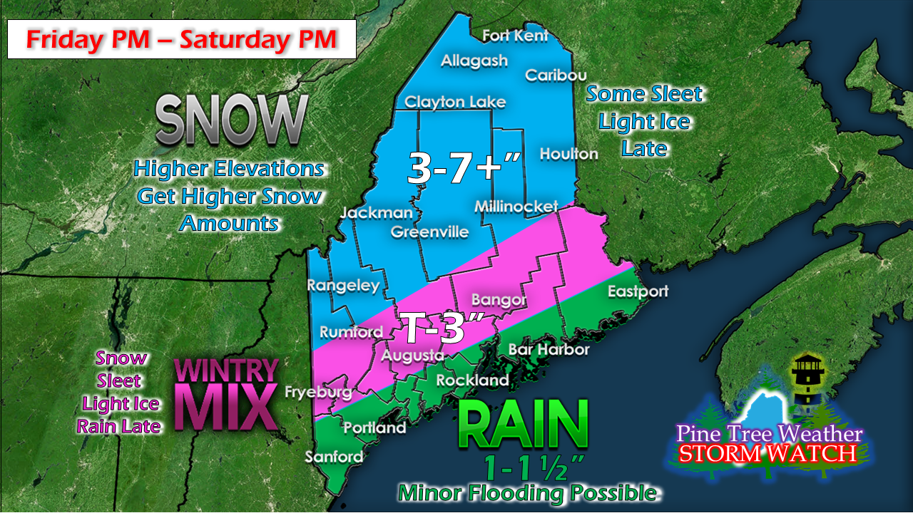
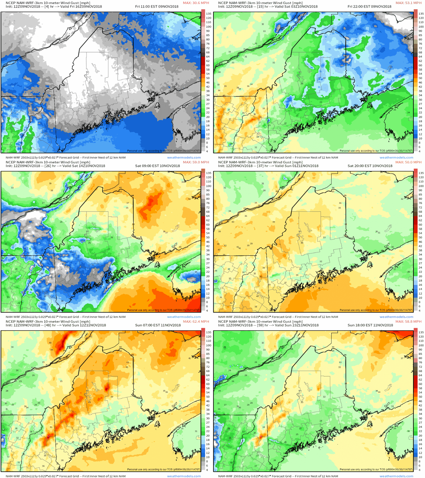
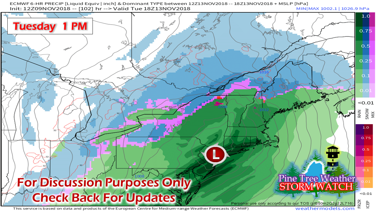
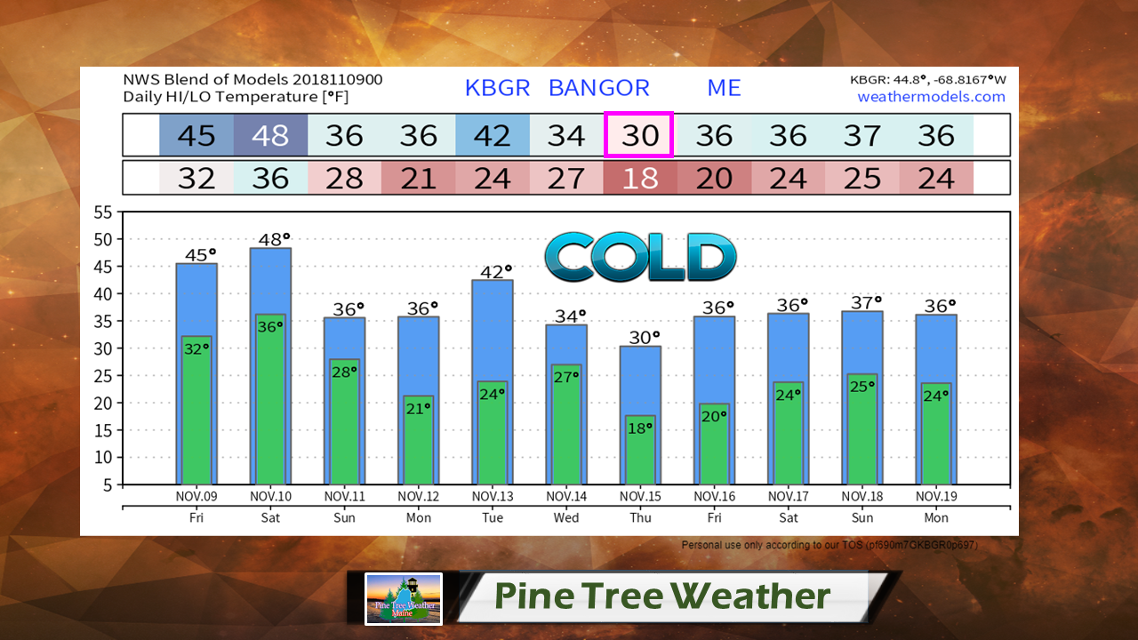
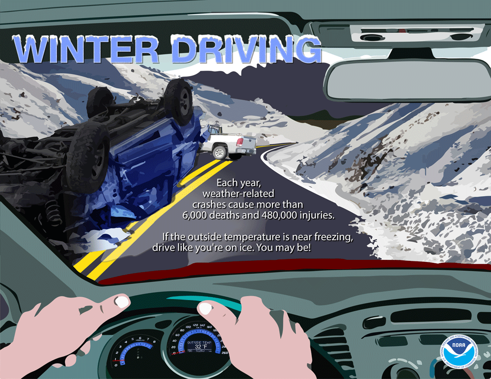
Precipitation type depends on locationAs I have said in previous updates, it's a good thing this a quick moving event. Anytime there is high end moisture and snow / mixed precipitation involved, it's not a good scenario. While I am sure winter weather enthusiasts would love to see a snow base develop, any time it is of the heavy wet variety is not good when you depend on electricity. For the mountains and north, this will primarily be a snow event with some mixing as precipitation ends Saturday. Over the foothills into interior Washington County, this is a mix to rain event. The coast is still on track for mainly rain. Steady precipitation ends from west to east Saturday morning / early afternoon. The higher terrain could see snow showers into Sunday morning. Folks travelling overnight Friday into Saturday should use caution on the roads over the interior. Allow for extra time to get to your destination. Travel conditions improve as precipitation ends as the day progresses. Some subtle tweaking to the map posted previously. Pink shaded areas will see a sloppy gooey mess. The mountains could see higher snow amounts, with 10" possible on the peaks. Coastal areas will get another decent dose of rain out this, which may cause some minor flooding of rivers and streams. Backside wind remains concerning for interior areasThe wind ideas haven't changed a whole lot from the past couple of days. Coastal areas get their strongest gusts overnight Friday into the wee hours of Saturday. Once a cold front tracks through Saturday afternoon, the northwest breeze begins to crank where gusts could reach 35-40+ mph and could be problematic in areas where the snow sticks to trees and power lines. The wind slowly begins to subside Sunday afternoon into Monday morning. We'll play this game again on TuesdayStill a few days out, but a similar set up is on the way for Tuesday. Models are disagreeing on details and timing, but the idea is firmly on the table. I suspect this may trend colder into a similar set up for precipitation type by region as the Friday / Saturday event in front of us. This model idea above is NOT the final answer. Stay tuned. Are you ready for January Cold?I've mentioned this idea in a previous update, and as the time approaches, just how cold it could get is beginning to come into focus. After the Tuesday storm, the coldest air of the season thus far gets dragged down behind it. Daily highs could be between 15-20° below normal through the remainder of the week. The Bangor temperature forecast shown above could set an new high maximum for Thursday. For those who are living in other areas of the state, it's cooler to the north and only a scant handful of digits higher to the south. Don not trust your vehicle thermometerRule of thumb when your vehicle thermometer reads 37° or less, be aware that the pavement could be 32° or less. How do I know this? My main job is in the automotive field. Car thermometers are NEVER to be trusted due to their locations on the vehicle. They give you an idea, sure, but 1-2 feet above ground going at speeds between 25-70 mph will not show you ground truth. Remember in summer when they would read 105° on hot pavement after parking in direct sun while the actual temperature was 90°. I rest my case. One should always be skeptical of what the car thermometer says versus what is actual ground truth. Stay Updated!For the latest official forecasts, bulletins and advisories, please check in with the National Weather Service in Gray for western and southern areas, or Caribou for northern and eastern parts of Maine.
For more information from me, please follow the Pine Tree Weather Facebook page and my Twitter feed. Please consider making a donation to keep Pine Tree Weather going through the year ahead. My data cost expense is increasing. The operation is 70% funded and needs your help to get through the winter. You can set up a monthly pledge on my Patreon page or send me a message from the Facebook page or direct message on Twitter to get my address to mail a check or set up bill pay. Always stay weather aware, and thank you for your support! - Mike |
Mike Haggett
|

