A good soaker for most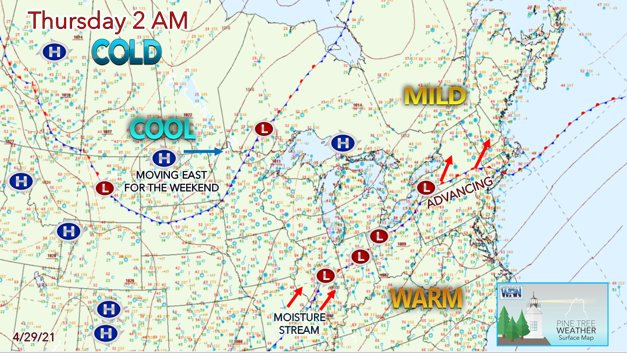 Weak high pressure keeps the north country warmer and sunnier for Thursday. Southern areas deal with cooler temperatures and showery conditions. Low pressure advances to the northeast Thursday night into Friday, giving all areas some needed rainfall. High pressure moves in to start the weekend. 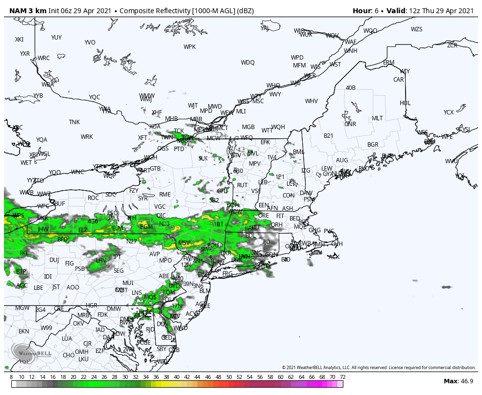 From 8 AM to 8 PM Thursday showers begin to overspread the region, reaching eastern areas by early evening. 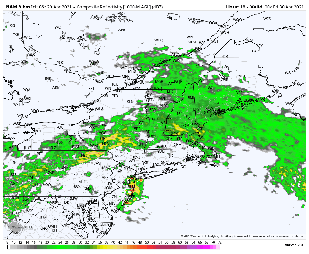 From 8 PM Thursday to 8 AM Friday, the first round of moisture exits to the east. Far southern areas may see some heavier showers, with perhaps a chance for a rumble of thunder before midnight. Most areas south of the northern crown are soggy for the Friday morning commute. 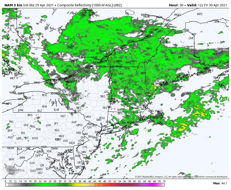 From 8 AM to 8 PM Friday, the southern stream merges with the northern stream, and a rapidly intensifying storm begins to take shape over the Gulf of Maine. 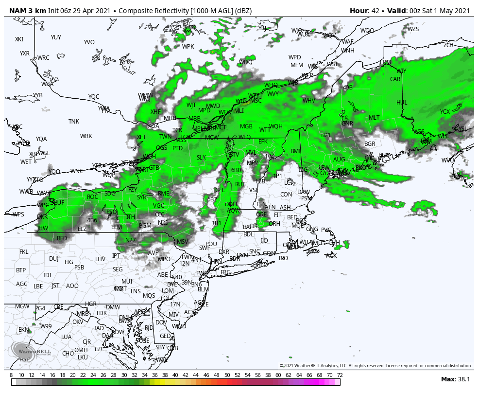 From 8 PM Friday to 8 AM Saturday, the storm exits to the east/northeast, ending shower activity by early morning. 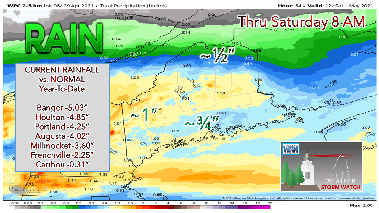 For most areas, ¾ - 1¼" of much needed rainfall is expected through Saturday morning. The higher elevations could pick up an inch or two of wet snow as a parting gift, and the summits could see more, pending on the time of the phase. Wind picks up on Friday, chilly start for Saturday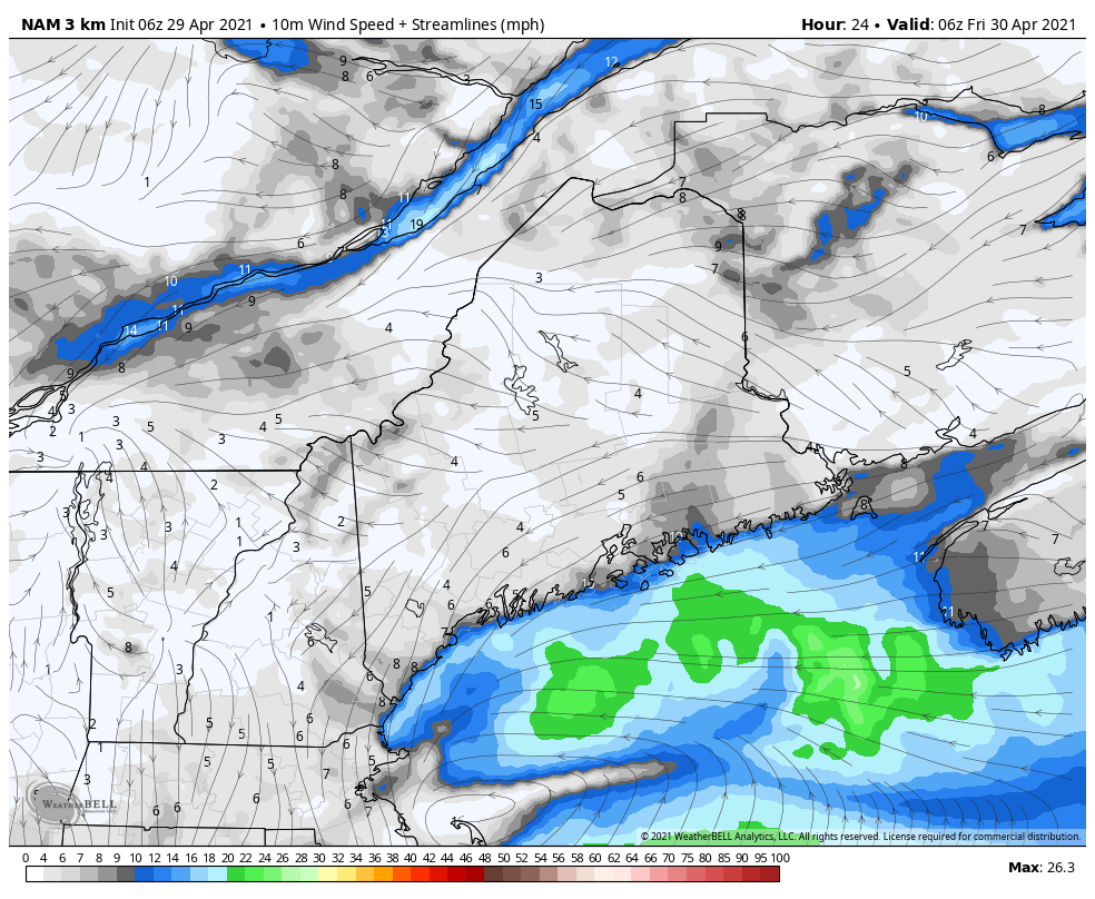 As the storm comes together and intensifies, the wind picks up along with it. Expect gusts Friday night into Saturday in the 25-35 mph range out of the northwest, with higher elevations reaching 40 mph. 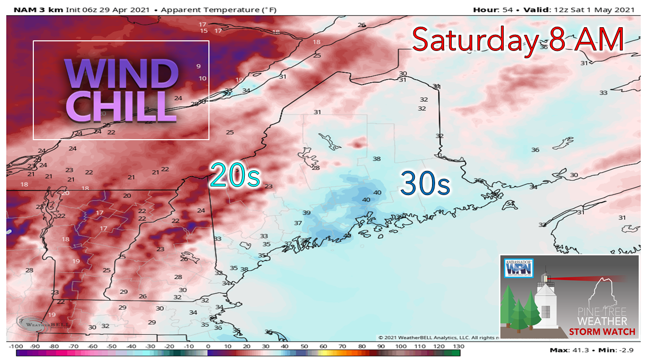 For the first of May, it will feel more like the first of March with wind chill values in the 20s and 30s to start off. The breeze drops by Saturday evening, only to see it pick back up again on Sunday as a moisture starved cold front passes through the region. Next week appears to be unsettled with chances for rain possible every day through Thursday at least. Join the weather community as a storm spotter! Here's a wonderful way to become active in the weather community and help the US National Weather Service Gray ME , broadcast media and forecasters like myself with storm reports. This information is vital during and after an event for forecasting and alerting purposes. I can't tell you how many times I have seen the importance of these reports in the past 9+ years I have been involved. Pine Tree Weather followers have stepped up in the past and participated, and with the readership base continuing to grow, I know there are more out there. This is the spring/summer session which discusses severe weather, what to look for, and how to report it. These sessions run for about 90 minutes. They are fact filled, educational and interesting. You can get the whole family involved from the comfort and safety of home. Once completed, you will get your spotter ID, and will be ready for the season ahead. For those who trained for the winter session, this will complete your full year training. It's important to have both sessions done. The link to register is here ► https://www.weather.gov/gyx/skywarn#fragment-2a If you need more information, please contact Donald Dumont, the Warning Coordinating Meteorologist at NWS Gray via email [email protected] or message me directly. Ten-day temperature outlook through May 9thI'm tempted to give the green light for planting over southern areas, but I am concerned that the region may get one more shot of chilly air next weekend. Climatology speaking, May 1st is the final average day for 32° or less for the Portland area. The shoreline areas are likely clear of frost at this point. My confidence for interior areas a few miles inland is a different story. It would be best to wait until next weekend clears just in case. For northern areas, the caution light stays on for the next two weeks for now. 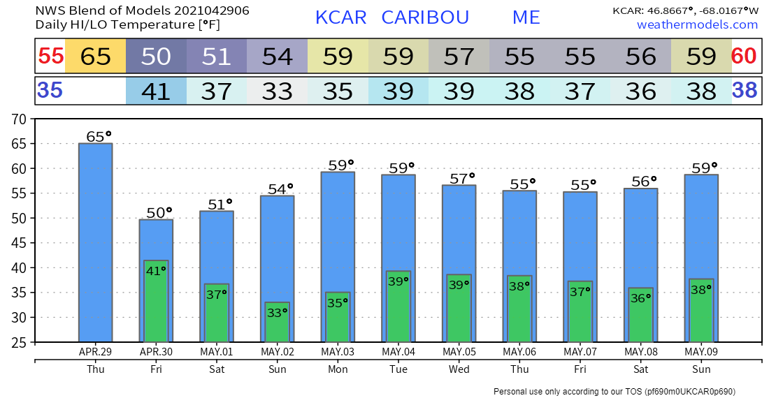 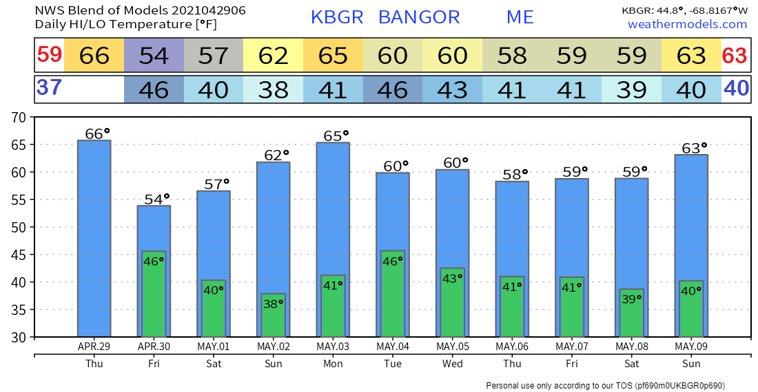 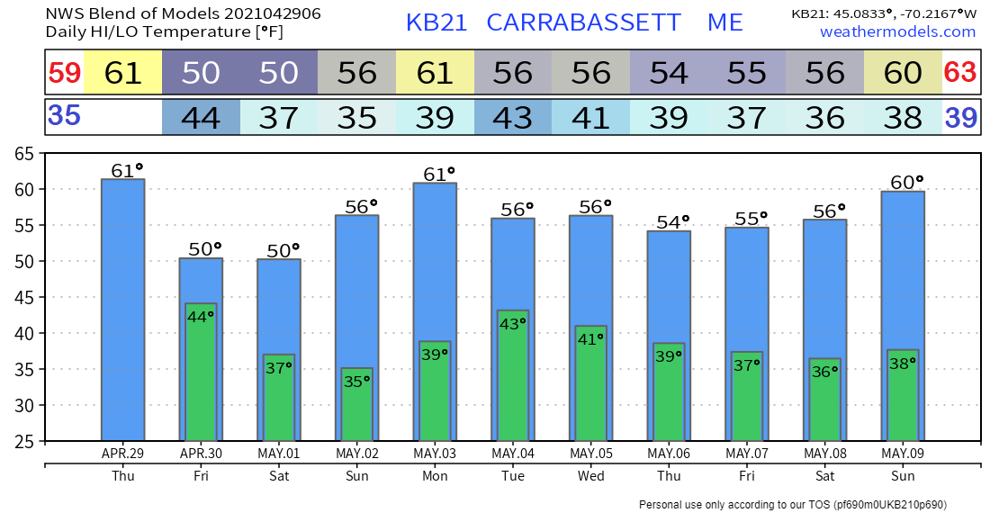 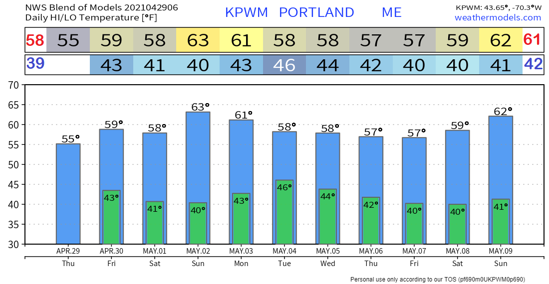 Be prepared to receive alerts and stay updated!
For more information in between posts, please follow Pine Tree Weather on Facebook and Twitter.
Thank you for supporting this community-based weather information source which operates by reader supported financial contributions. Stay updated, stay on alert, and stay safe! Thank you as always for your support! - Mike |

Mike Haggett
|