
Near-normal temperatures with a chance of showers on Thursday, thunderstorm potential on Saturday6/16/2021 Scattered showers for northern areas on Thursday, drier elsewhere with comfortable conditions through Friday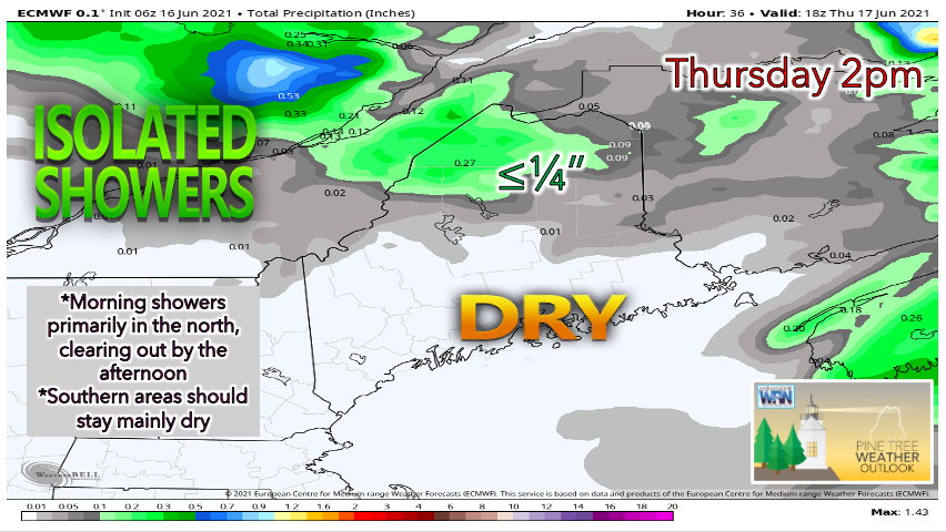 An upper-level trough is expected to track over eastern Canada, bringing the potential for isolated showers across northern areas on Thursday morning. The precipitation appears to only last through the morning hours and be fairly light. Southern areas of the state will likely enjoy some sunshine filtering through patchy clouds as high pressure begins to build. Skies appear to remain cloudy towards the north. Thanks to dew points in the 40s statewide, humidity should not be an issue on Thursday. High temperatures appear to reach the lower 70s in the south, while northern regions will likely see the mid 60s for a high due to lingering morning clouds. Overall, Thursday is looking like a very comfortable day for most once the showers pass through. 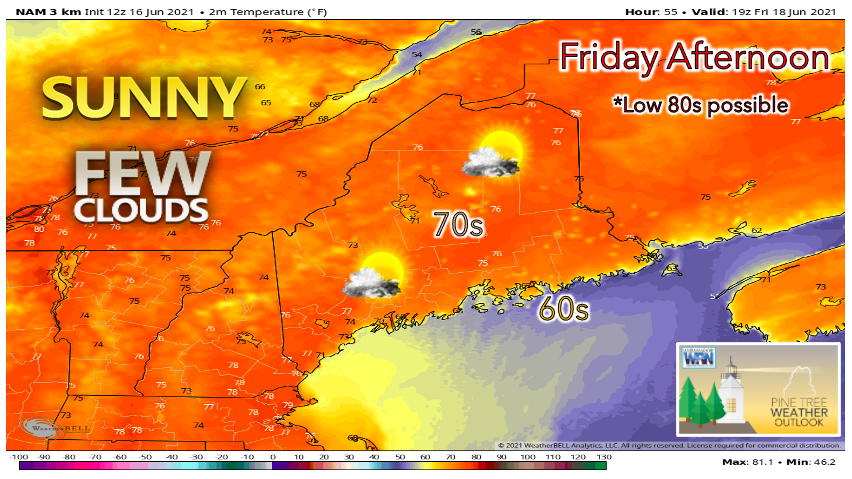 A warming trend is expected to take place on Friday as high pressure sweeps south of the state. High temperatures are expected to reach the upper 70s, with the low 80s also possible across much of the state. The only exceptions are the mountains and the coastline, which will likely stay a bit cooler. Fortunately, dew points will remain relatively low in the upper 40s and lower 50s, so we do not have to worry about mugginess. Northern areas that see cloudier conditions on Thursday will likely receive more sunshine on Friday. Potential for breezy conditions Friday afternoon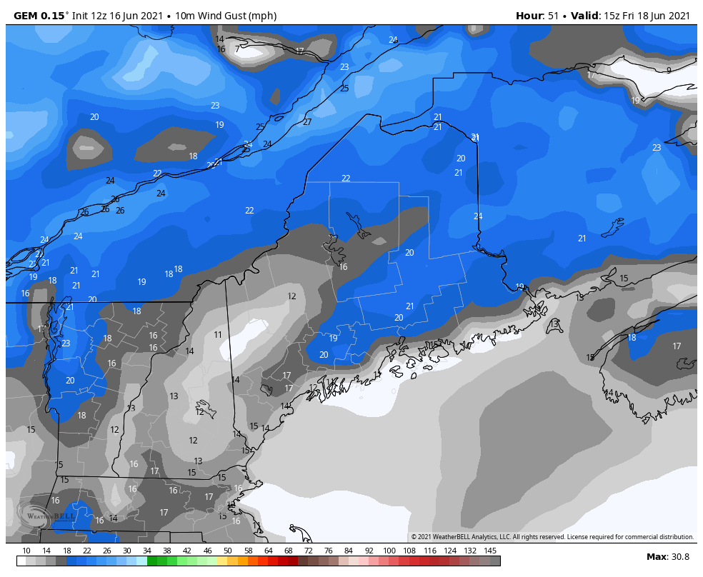 Wind gusts of up to 25 mph are possible on Friday afternoon as a projected low over eastern Canada interacts with the high pressure over Maine. Given the low humidity, wildfires are at a heightened risk in these conditions, and outdoor burning is strongly discouraged. Check back for updates from us and look out for a potential RED FLAG WARNING on Friday morning. Showers and thunderstorms possible for Father's Day Weekend, warmer temperatures in store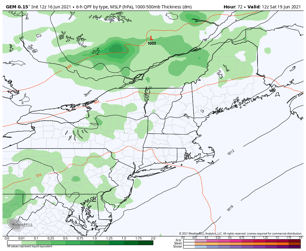 A weak low pressure system along with a cold front is expected to approach New England on Saturday, resulting in showers and thunderstorms across Maine during the afternoon. It's a bit early to talk about specific rainfall amounts, but current models do not suggest a wash-out. Diurnal heating will allow for convective activity during the afternoon and evening, so be sure to have a place to quickly take shelter if spending the day outdoors. Showers and thunderstorms should wind down by Saturday night. 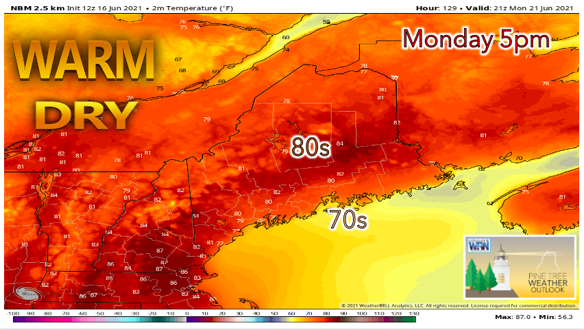 Showers are possible in northern areas on Sunday as the low-pressure system passes, while southern regions appear to stay dry on Father's Day. Sunday also marks the Summer Solstice, the longest day of the year in terms of daylight. Temperatures are currently projected to reach the high 70s in the north and the low 80s in the south. A ridge of high pressure will likely build beginning later Sunday into Monday, allowing highs to potentially reach the 80s statewide by early next week. The next chance for significant rainfall comes on Tuesday as models indicate an approaching cold front. Temperature outlook through TuesdaySeasonable temperatures likely for Thursday. A warming trend begins on Friday with many areas potentially reaching 80+ degrees on Monday. 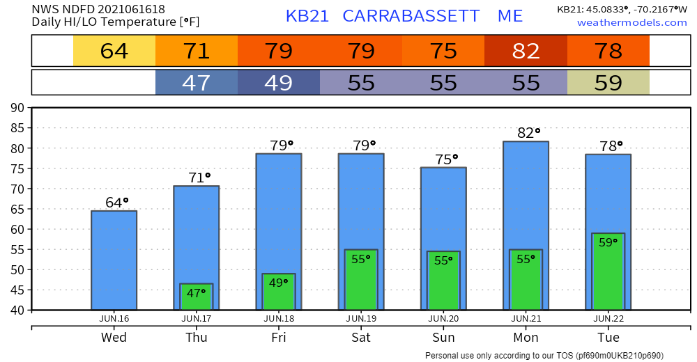 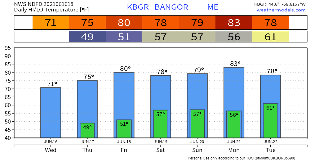  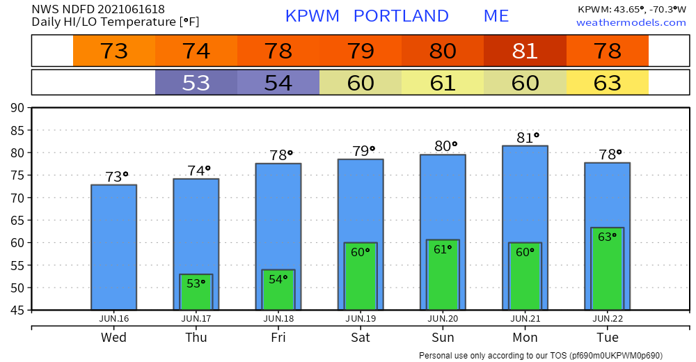 Small decisions: Wildfire There are aspects of wildfire preparation, like using fire-resistant landscaping around your home, that aren’t possible for everyone. But there are also small, potentially life-saving decisions, that anyone can make. weather.gov/safety/wildfire Be prepared to receive alerts and stay updated!
For more information in between posts, please follow Pine Tree Weather on Facebook and Twitter.
Thank you for supporting this community-based weather information source which operates by reader supported financial contributions. Stay updated, stay on alert, and stay safe! |

Mike Haggett
|


