
A lovely Father's Day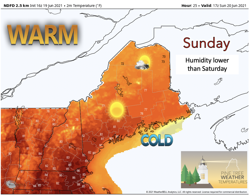 As Sunday begins the cold front from Saturday evening has finally passed and a weak high pressure system pushes in from the west by Sunday afternoon. Any showers will be scattered and limited to the very north as the cold front lingers there just a little longer. With the incoming high pressure temperatures are back on the rise and skies become much sunnier for the day in the south and sunny with a few clouds in the north. Temperature models similar to the one above are predicting that areas in the south will be slightly hotter than in the northern half of the state especially as you move closer to the coast. The highs for the day are likely to be in the upper 70's and pushing into the low 80's south. As you move up the coast temperatures begin to fall as nearby ocean temps decline. Don't be too fooled by the warm weather today as ocean temps still remain quite cold. Overall the day will be sunny and warm, the perfect day to celebrate Father's Day outside! 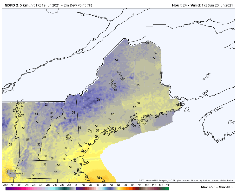 As the model shows in the above image, dew points for Sunday during the peak temperature hours (about 1 p.m.) are barely reaching into the 60's and hovering in the high 50's. Humidity wise, this means that the air will feel less humid and sticky than what was experienced the day before on Saturday. With higher temperatures and lower dew points across the state the air is likely to be much more comfortable for Father's Day, so don't be afraid take advantage of this! Long wave cold front to begin the week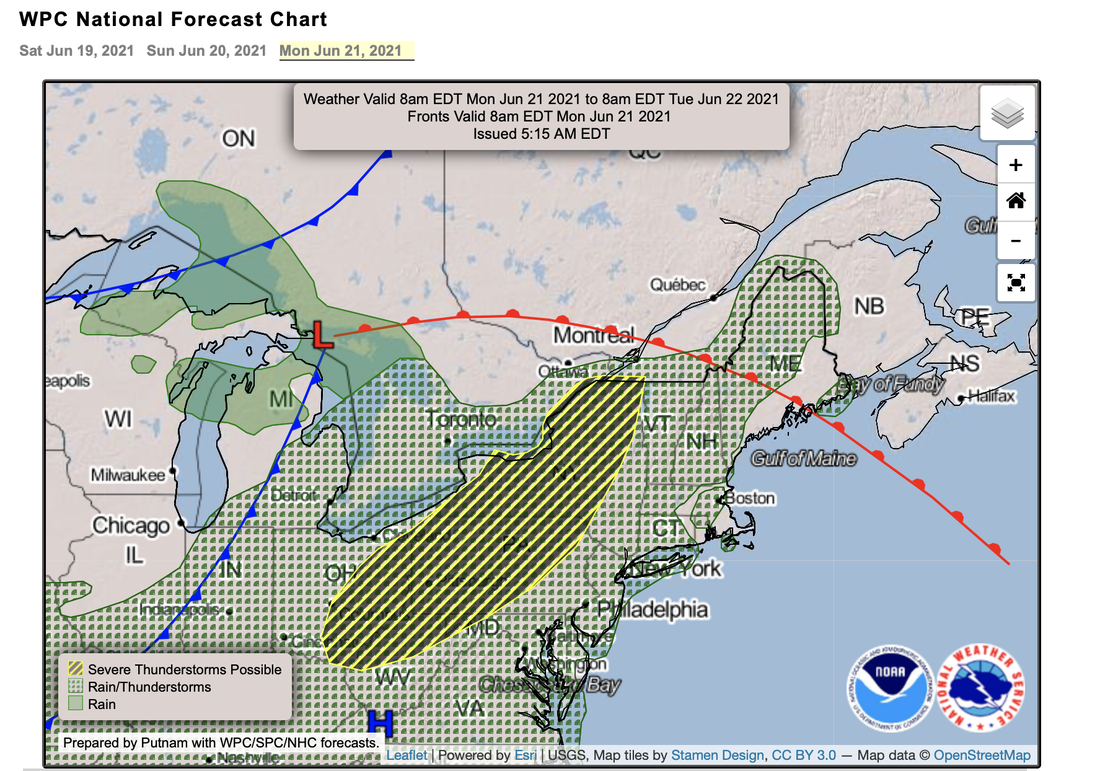 Monday is hot! Temperatures for Monday are currently expected to be high based on what we have seen this season so far. Highs for Monday are likely to reach 90 and slightly above for the interior southern regions and the upper 70s and 80's along the southern coast. As for the north, high temperatures are forecasted to be well into the 80's in the interior and cooler along the coast, as usual. Dew points are also on the rise and will potentially enter into the 60's. Heat indices may approach or in some cases exceed 95F for the south. Afternoon showers and storms are likely in the highland regions due to the warm and humid air conditions. As we move into Tuesday a deeply amplified trough with an associated cold front is expected to cross through New England. While the front pushes through the region Tuesday it brings with it potential for showers and possibly some thunderstorms. Temperatures for Tuesday will be lower than Monday due to the presence of clouds starting early in the day and continuing throughout. Conditions are likely to become drier and more seasonal after the rain stops Tuesday night into Wednesday. Claudette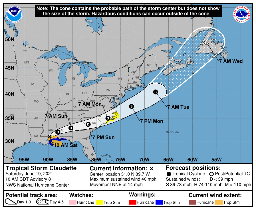 Above is the current NHC (National Hurricane Center) prediction path for Tropical cyclone Claudette. As you can see the storm path has Claudette off the coast of Maine by 7 am Tuesday. This tropical storm is likely to be close enough to interact with the long wave and associated cold front coming in from the west to cause a very wet day across the state for Tuesday. It seems as though the moist airmass from Claudette will be pushed south, but with high PWATs some heavy downpours are likely especially along the coast. Any remaining circulation and winds that come with the tropical system are expected to remain south of the region and should not cause any damage within the state. Calm for the end of the week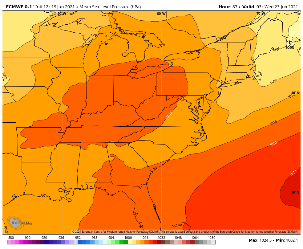 The cold front dominating the area on Tuesday is scheduled to pass Maine by Wednesday morning while a ridge of high pressure is likely to enter the northeastern region. As Wednesday progresses into Thursday the high pressure system will slowly move eastward and throughout this time weather will remain seasonable and quiet. The next front to approach the area should arrive from the west on Friday and bring with it the next chance for rain showers especially later on for areas to the north and west. Hurricane Watch vs Warning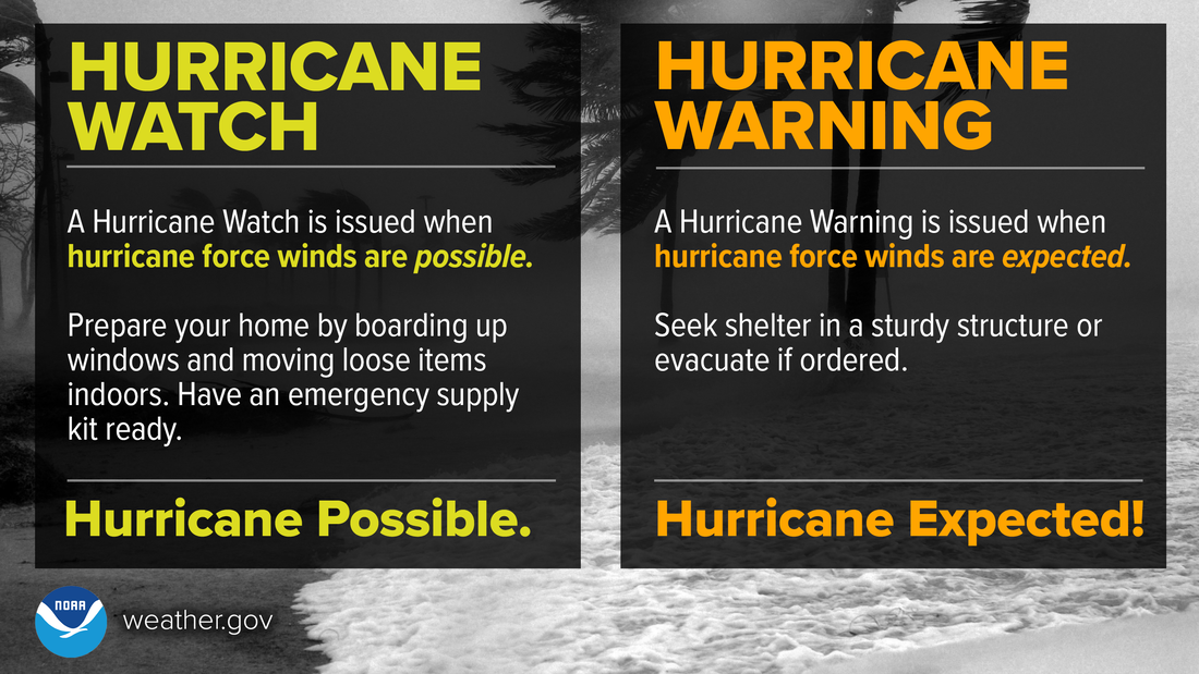 A Hurricane WATCH is when hurricane force winds are POSSIBLE. A Hurricane WARNING is when they are EXPECTED. Know the difference and stay Weather-Ready! weather.gov/safety/hurricane-ww Temperature OutlookThe temperatures for the rest of this month will be relatively warm throughout. Temperatures Sunday and Monday will be warmer with Monday being the warmest day through the end of June. Temperatures will take a dip on Tuesday into Wednesday due to a passing cold front. Temperatures are to be relatively steady starting Thursday and remaining this way as the month wraps up. 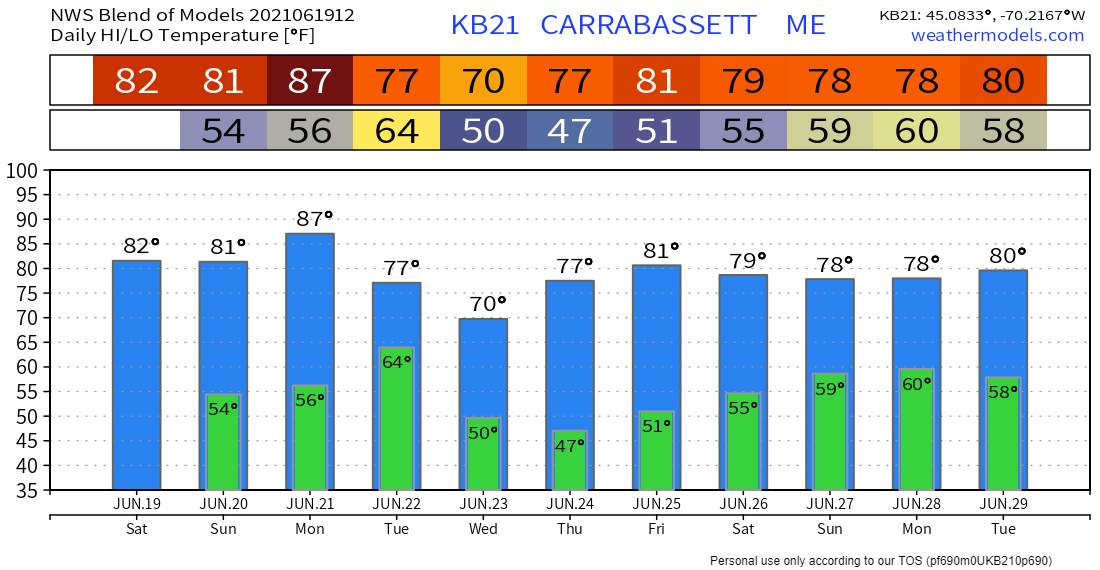 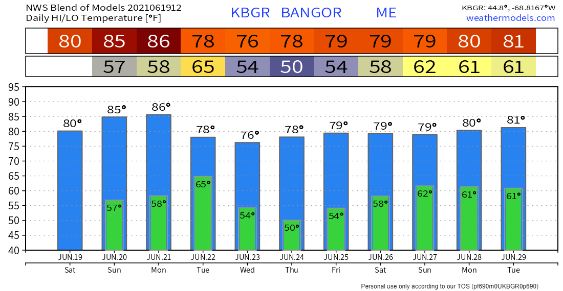 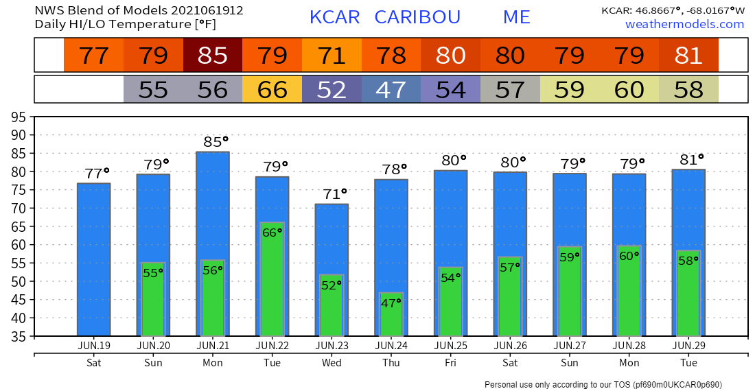 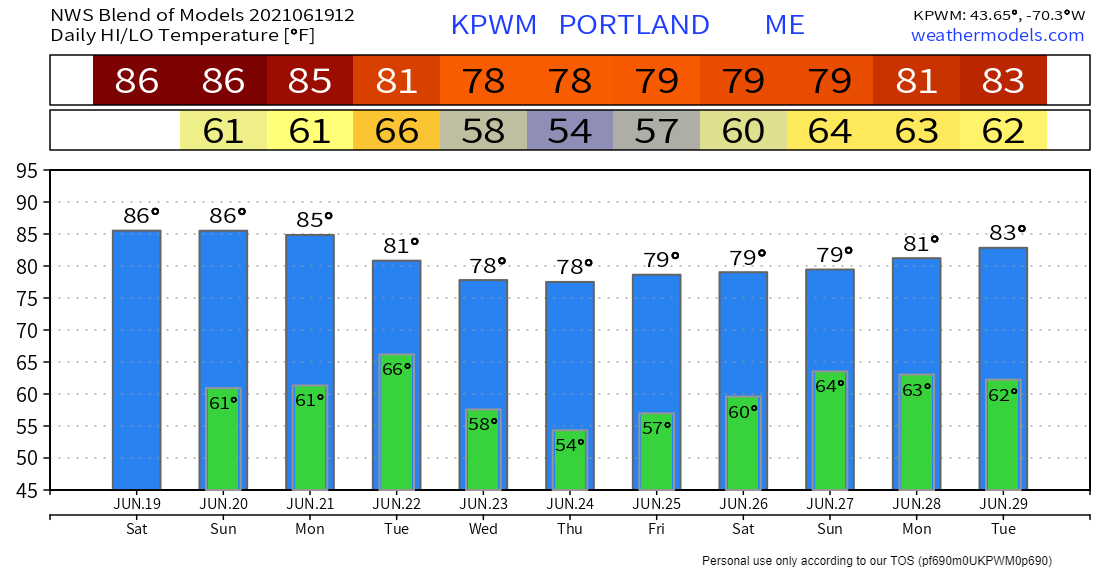 Be prepared to receive alerts and stay updated!BE PREPARED WITH A NOAA Weather Radio. For $20-$40, it could provide vital information to you when you need it. The weather bands are standard on most public safety scanners, and newer scanner models. Weather radios can be programmed for auto alert. Click here for more information.  ► ► For the latest official forecasts, bulletins, and advisories, please check in with the National Weather Service in Gray for western and southern areas, or Caribou for northern and eastern parts of Maine. 
|

Mike Haggett
|


