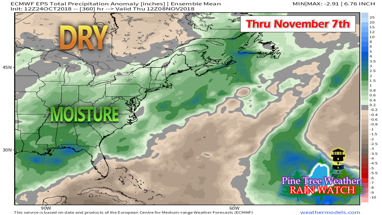
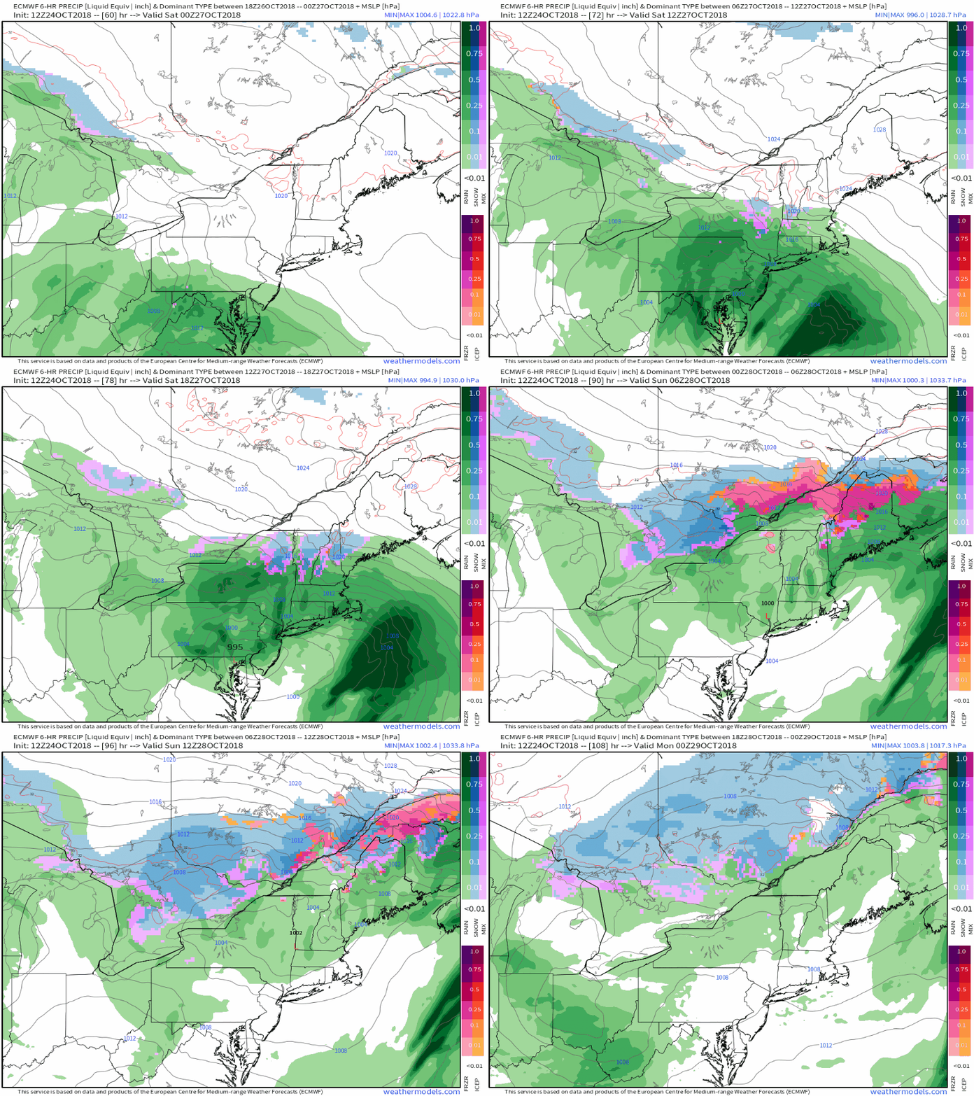
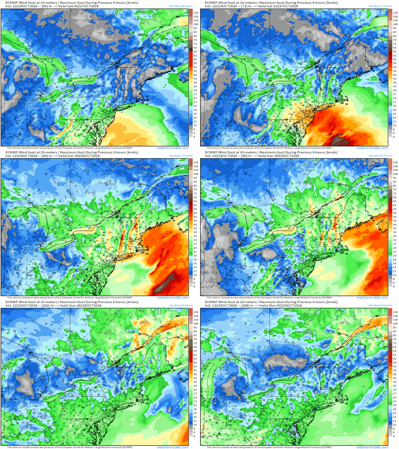
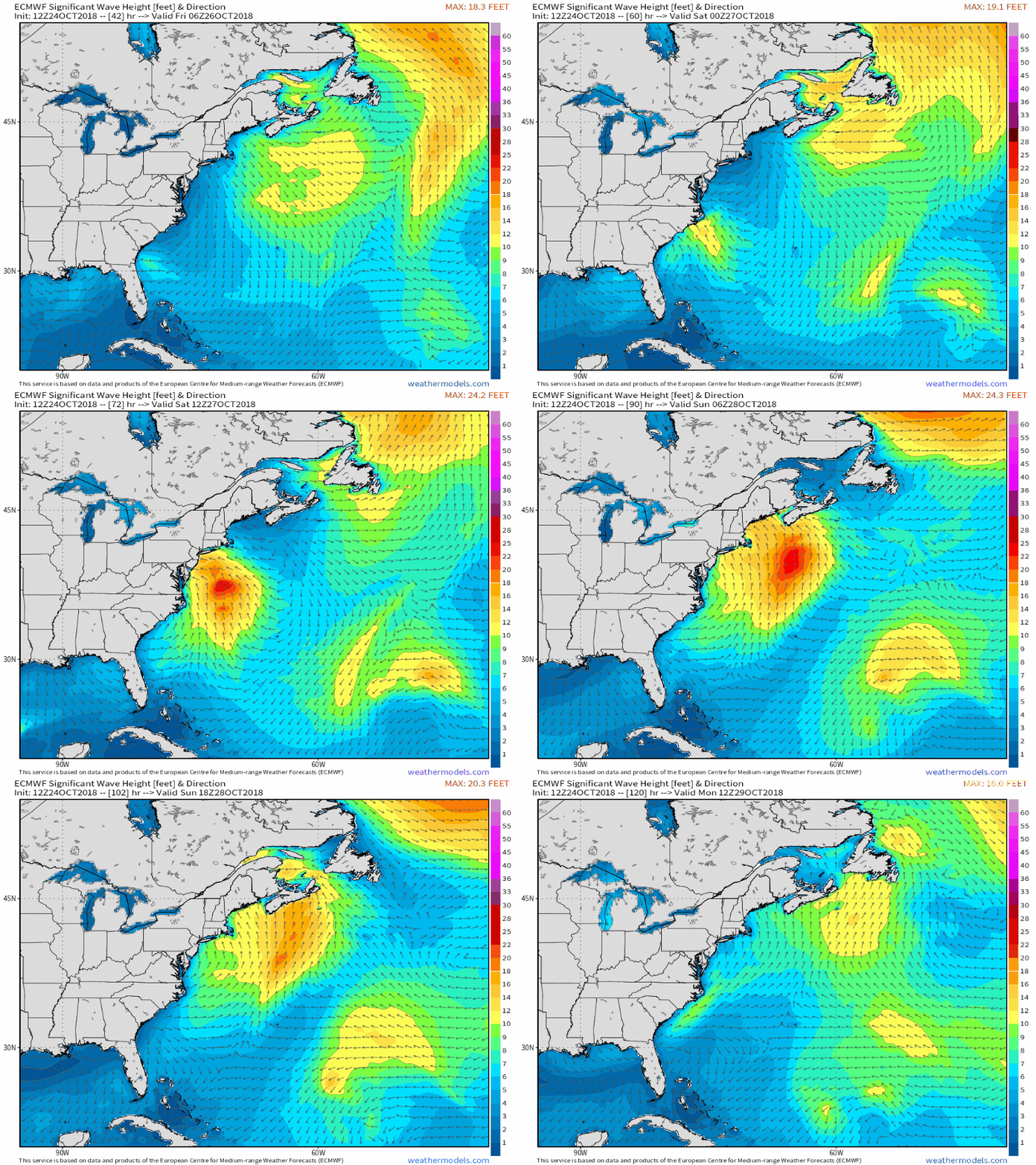
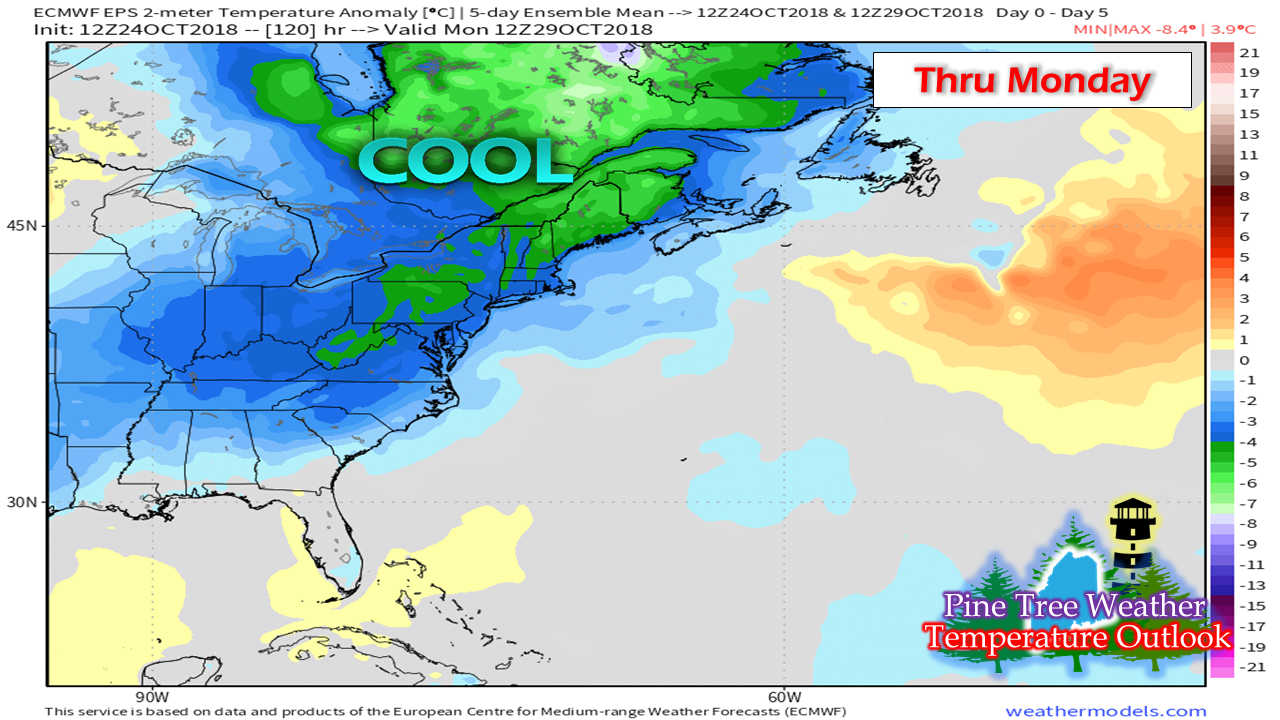
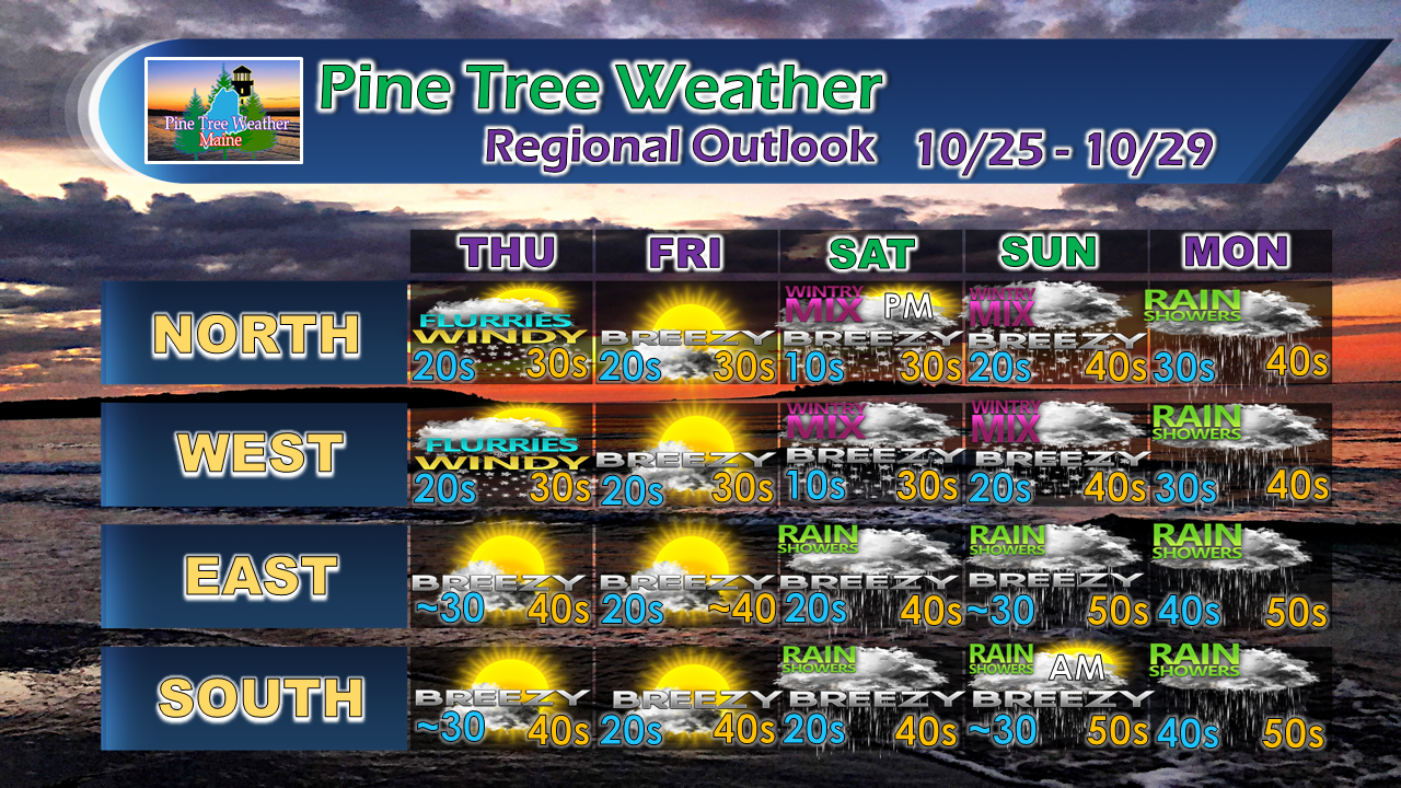
Damp, stormy times aheadGood news for those that have been dealing with groundwater supply concerns. Given the pattern shift to a more stormy one, the chances for precipitation have gone up. The ensemble mean average through early November is above average for most of the state, as well as the the entire east coast. Coastal regions that have been hit hard this summer will get their fair share of rain in the coming days. The trade off will be stormy conditions, but for the sake of those struggling to take care of livestock or even take a shower, this is a signal of hope that is much needed. Weekend NorEaster updateWhile there is still time to iron out details and timing on this storm, it's close enough to present ideas. The track of the storm appears the "inside runner" type, meaning the center of the system will pass to the west through New York and into Vermont. This would put Maine on the wet and windy side of the storm. This storm has tropical characteristics to it as it is the remnants of Hurricane Willa that impacted the Pacific coast of Mexico earlier in the week. With this type of track, add the fact cold air will be in place with the Canadian High moving in Thursday and Friday, interior parts of the state appear to start off with snow/mix before eventually going to rain Saturday night into early Sunday. The signal that is presented in this loop is the potential for cold air damming with the pinks and oranges that signify freezing rain and sleet. With Saturday likely starting off in the teens for the mountains and north, I caution the idea this loop suggests that it turns to all rain. Time will tell if cold air will make a fool out of what the computer says. My bet is on the cold at this point. This will be something to stay updated on in areas away from the coast. It will get breezy along the coastWith a NorEaster comes a wind threat, and folks along the shorelines should take note of it. Saturday will be the windy day of the two. Gusts could range in 30-40+ mph range Saturday afternoon into the evening. For those that follow this site in southern New England, expect gusts 50+ mph during the day, subsiding Saturday night. Astronomical High TidesWith storm comes waves which will be a concern with the high tides over the weekend. The high tides of the main concern are in the 1 PM hour on Saturday and just after 2 PM on Sunday. Coastal areas susceptible to splash over and minor flooding should take note and stay in touch with the National Weather Service for coastal statements. The chill continuesTemperatures have been on the cool side for a while and appear to stay that way through the end of the month. The late fall type weather between the temperatures and snow have come early this year. There are signals out there that the east may see a bit of a warm up towards the first full week of November, but that may be short lived. Outlook through MondayA few flurries for the north is possible Thursday morning as a weak wave sweeps through from the northwest. High pressure moves in for Friday and quickly exits. Clouds increase Friday night into Saturday. Precipitation moves northeastward during the day and continues into Sunday. After the weekend storm passes, a bit of a break Sunday night into early Monday before rain arrives heading into Tuesday.
More updates to come. For the latest official forecasts, bulletins and advisories, please check in with the National Weather Service in Gray for western and southern areas, or Caribou for northern and eastern parts of Maine. For more information from me, please follow the Pine Tree Weather Facebook page and my Twitter feed. Thanks as always for your support! Please consider making a donation to keep Pine Tree Weather going through the year ahead. Check out the donate page on how to contribute. Always stay weather aware! - Mike |
Mike Haggett
|

