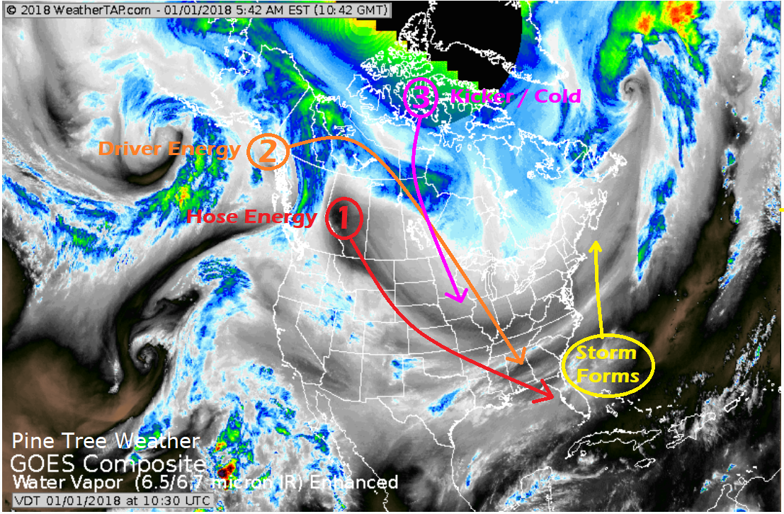
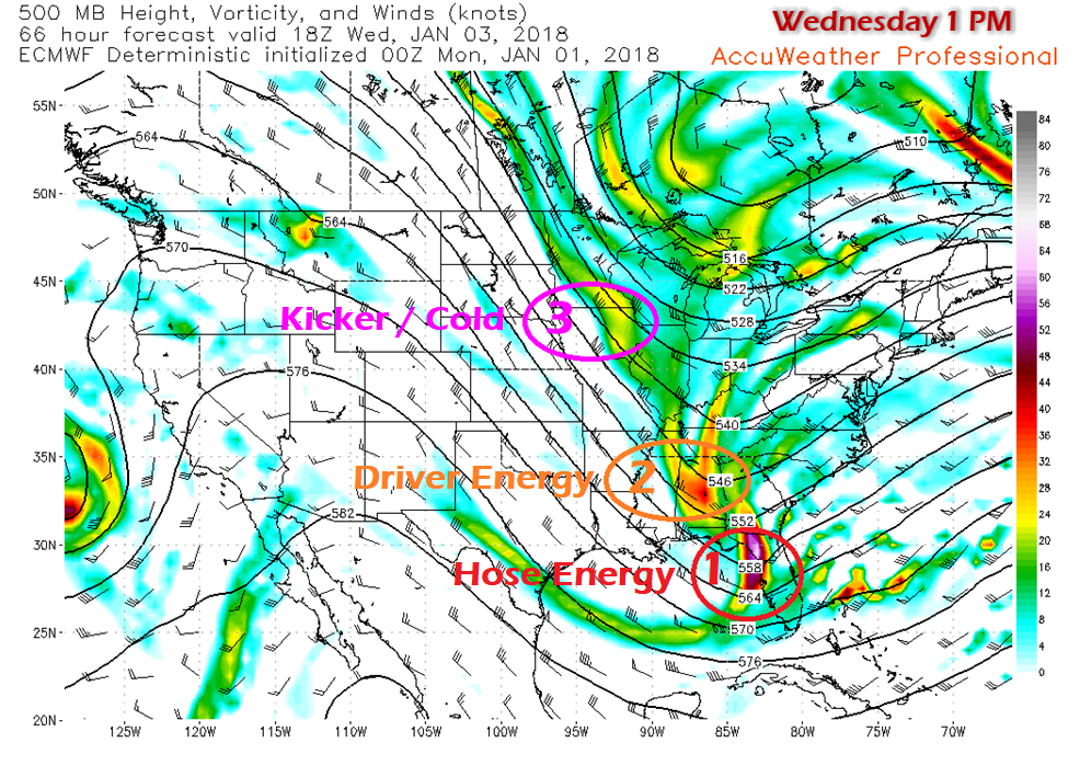
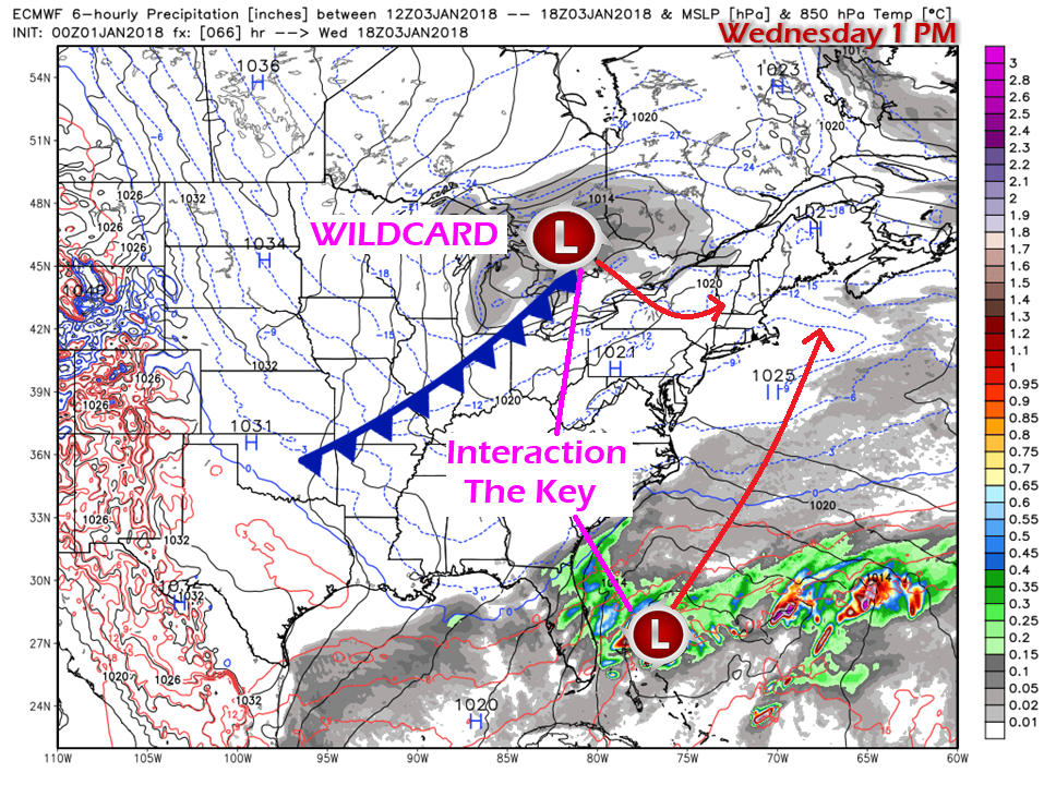
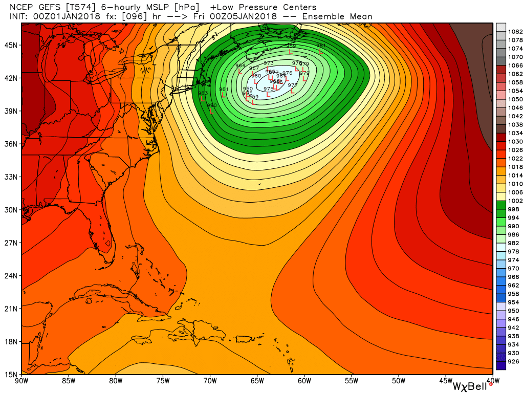
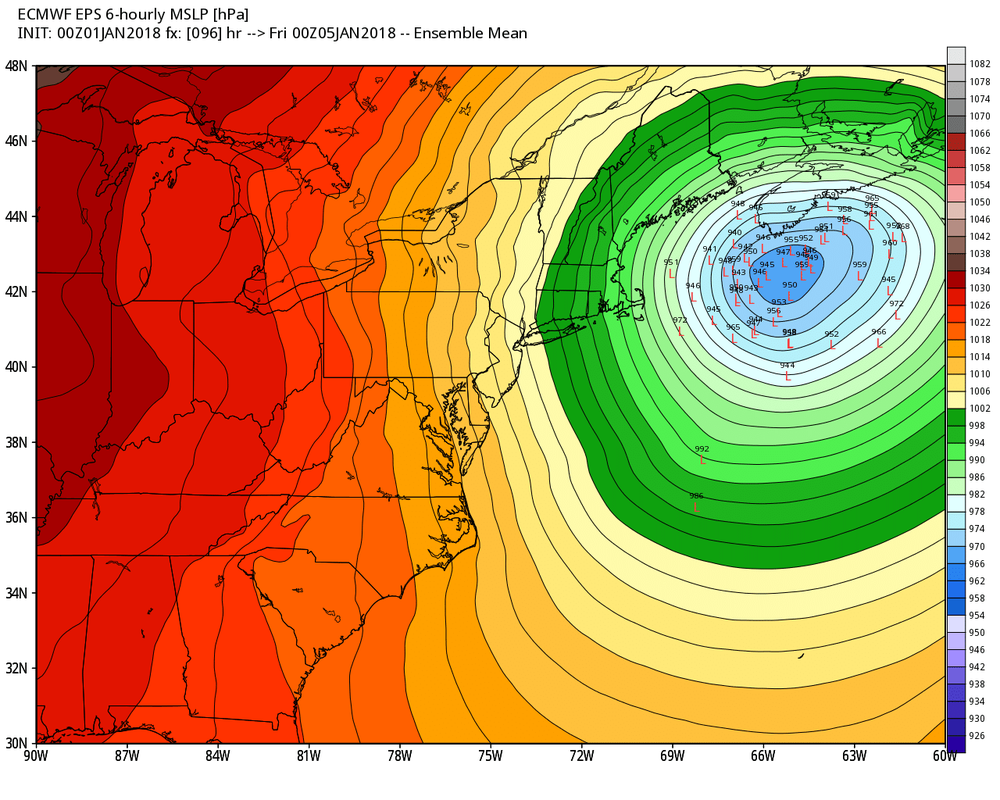
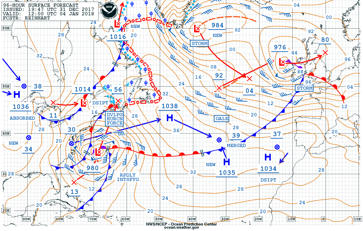
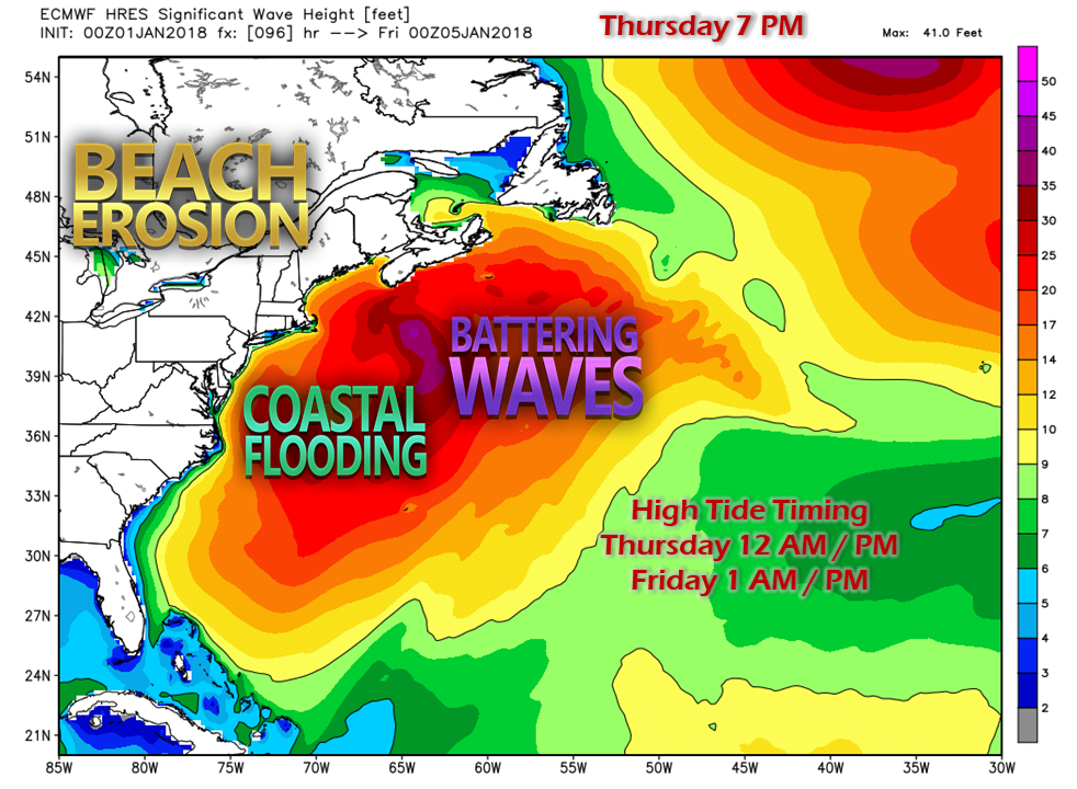
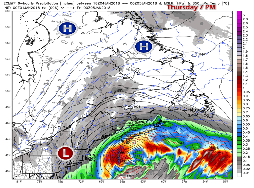
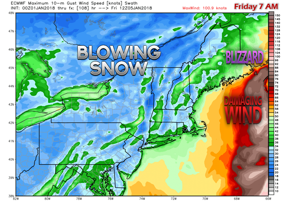
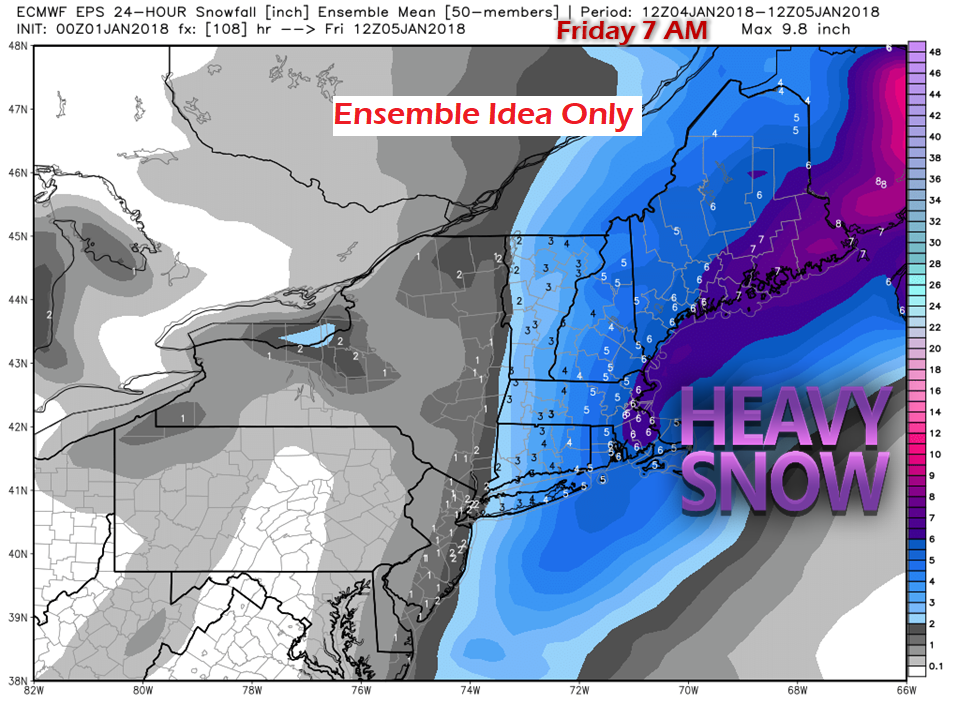
The players are on the tableA look at water vapor imagery from early Monday shows most of the elements for what could be a formidable NorEaster to impact the region Thursday into Friday. There are several moving parts that all have to fall into place correctly for "the big one" to happen. The strong ridge to the west is sending energy over the top of it and in conjunction with the deep cold in place, the combination of the two is driving it south. A steeper energy drop to the south fuels the stormWith the "hose energy" tapping into the Gulf of Mexico, that is where the moisture comes into the picture. The "driver energy" is what helps the hose energy reach its destination. The "kicker" brings the reinforcing cold behind the driver to tilt the trough "negative" which sends the storm up the coast. Under typical NorEaster set ups, the three major components of the hose, driver, and kicker are likely enough for a storm to develop. Add in the other key elements of a strong ridge to the west and east, with a blocking high to the north. What makes this forecast more of a challenge is the weak low that forms from the kicker energy over the Great Lakes. As the NorEaster moves up the coast, the interaction between the two is the wildcard in how close the storm tracks to the shoreline. The weak areas of high pressure between the two is another critical element to factor into this. If that narrow ridge in between the two systems can create a buffer, the NorEaster moves further east. If the narrow ridge collapses, that sets up possibility of the Great Lakes low drawing the system closer to New England. Ensembles still scatteredThe GEFS (GFS) model ensemble ideas in the 06z (1 AM) Monday model run have multiple ideas. The lows to the west are picking up on the potential interaction with the Great Lakes low. The ones to the east of the mean center do not believe the Great Lakes low will be much of an influence. The model mean indicated by the color shading has the storm well east of the traditional 40°N / 70°W benchmark point. The European (ECMWF) model ensembles from 00z Monday (7 PM Sunday) how a heavy westward bias in individual ideas, and a more westerly mean than its American counterpart. The European model has been consistent with its idea of the making landfall on the southern nose of Nova Scotia in the past four operational runs. The sum total of ingredients in all of these ensemble ideas is there is wiggle room for storm track and storm intensity. Expect that to continue into Tuesday. -Potential- ImpactsThe Ocean Prediction Center's update Sunday evening is more or less on board with the European model idea for a Nova Scotia landfall. Hurricane force wind speeds are in their forecast given the rapid intensification of the storm. Given the close proximity of Maine to Nova Scotia, impacts here are likely to be felt, and could be rather strong. Focusing closer on the shorelines, storm warnings are likely for much of the New England coast, with hurricane wind speeds for Georges Bank / Browns Bank possible. Tides will be astronomically high during the period from the full moon, running 2-3 feet above normal for the southwest coast, and 3-4 above for DownEast areas. Mariners and those with shoreline property are advised to stay close to the National Weather Service for forecast information and bulletins. A closer look of the NorEaster with the weak area of low pressure from the Great Lakes shows the widespread precipitation shield and the strength of the storm. Due to the nature of models going nuts on intensity, I will caution you by saying the idea of a 941mb low at Category 3 hurricane pressure may be a bit of a stretch. A sub 970mb storm is certainly on the table for debate and discussion, and that will be plenty powerful enough. Wind will be a factor for the entire region. With many areas still iced up from the pre-Christmas storm, a storm of this projected intensity is likely to cause power outages, near blizzard to blizzard conditions, and areas of blowing snow reducing visibility for most of the region. Any deviation to the west will bring higher wind with it. This is the European ensemble idea for snow potential through sunrise Friday. With the deep cold in place, these numbers do not reflect the "fluff factor", which is likely to come into play. This could be a high ratio snow event in the 15-20:1 range pending on location, which could double these numbers in areas. Closing thoughtsI will say again there are many moving parts to this, and the fine details need to be worked out. There is bust potential this far out, without question. That said, I do believe that there will be a storm that will provide snow, wind, travel, and shoreline implications. Given the potential impacts that this storm could deliver, I thought it best to get the word out now. I think there is a certain amount of model hype which may modify as the pieces fall into place. DownEast Maine is likely in the cross-hairs with the greatest impact for now. Any deviation to the west brings the MidCoast and southwest coast into play. Expect a two day event, with Thursday and Friday being the days affected. After that, it's back to the deep freeze, not that is really will have left the area anyway.
The 5-Day Outlook page has been updated... click on the menu bar above to get you there. - Mike |
Mike Haggett
|

