|
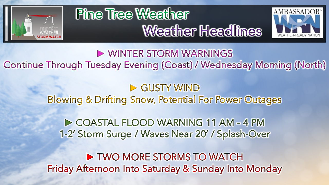
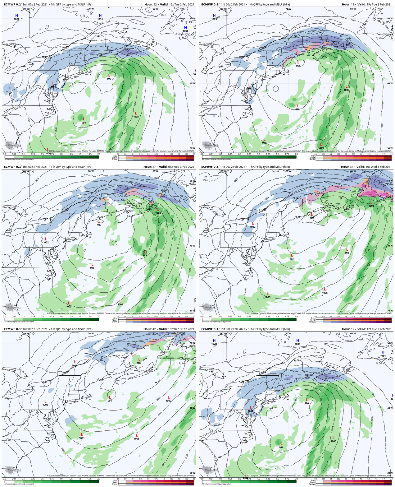
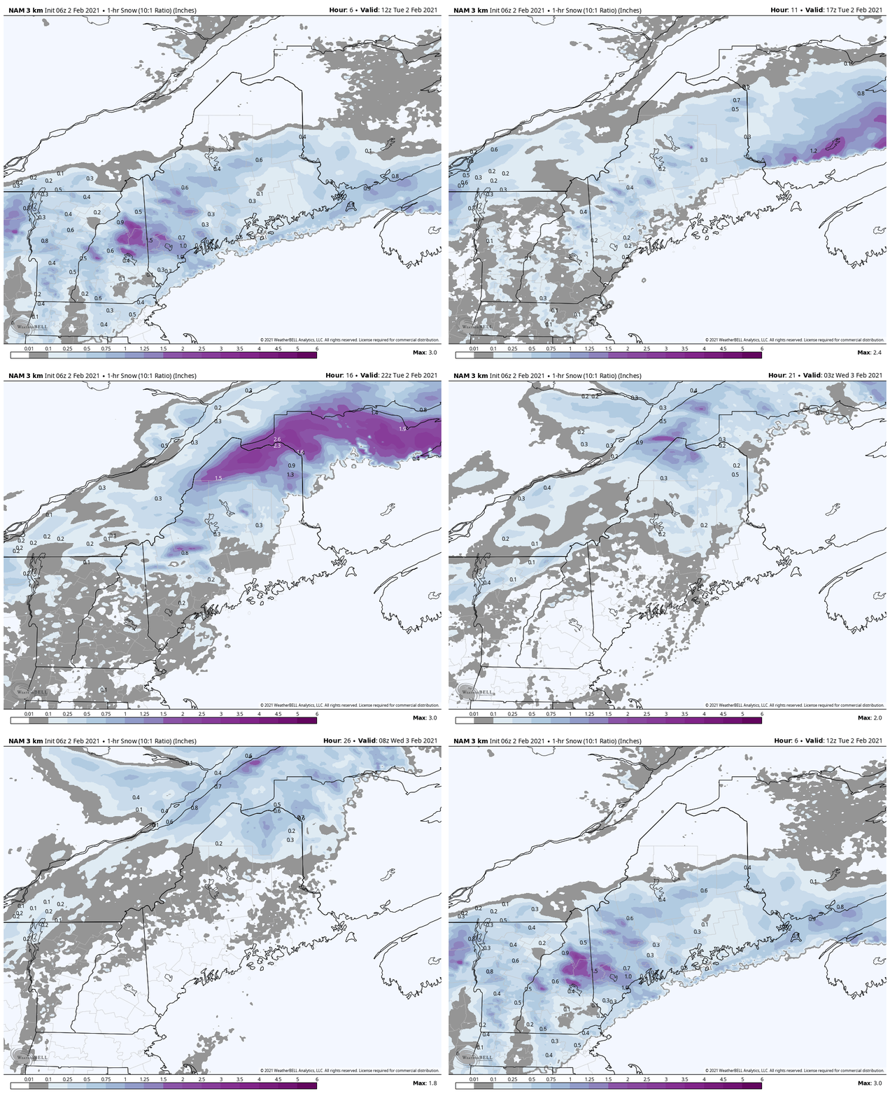
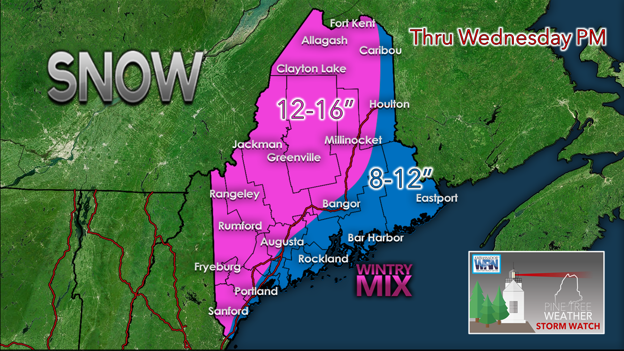
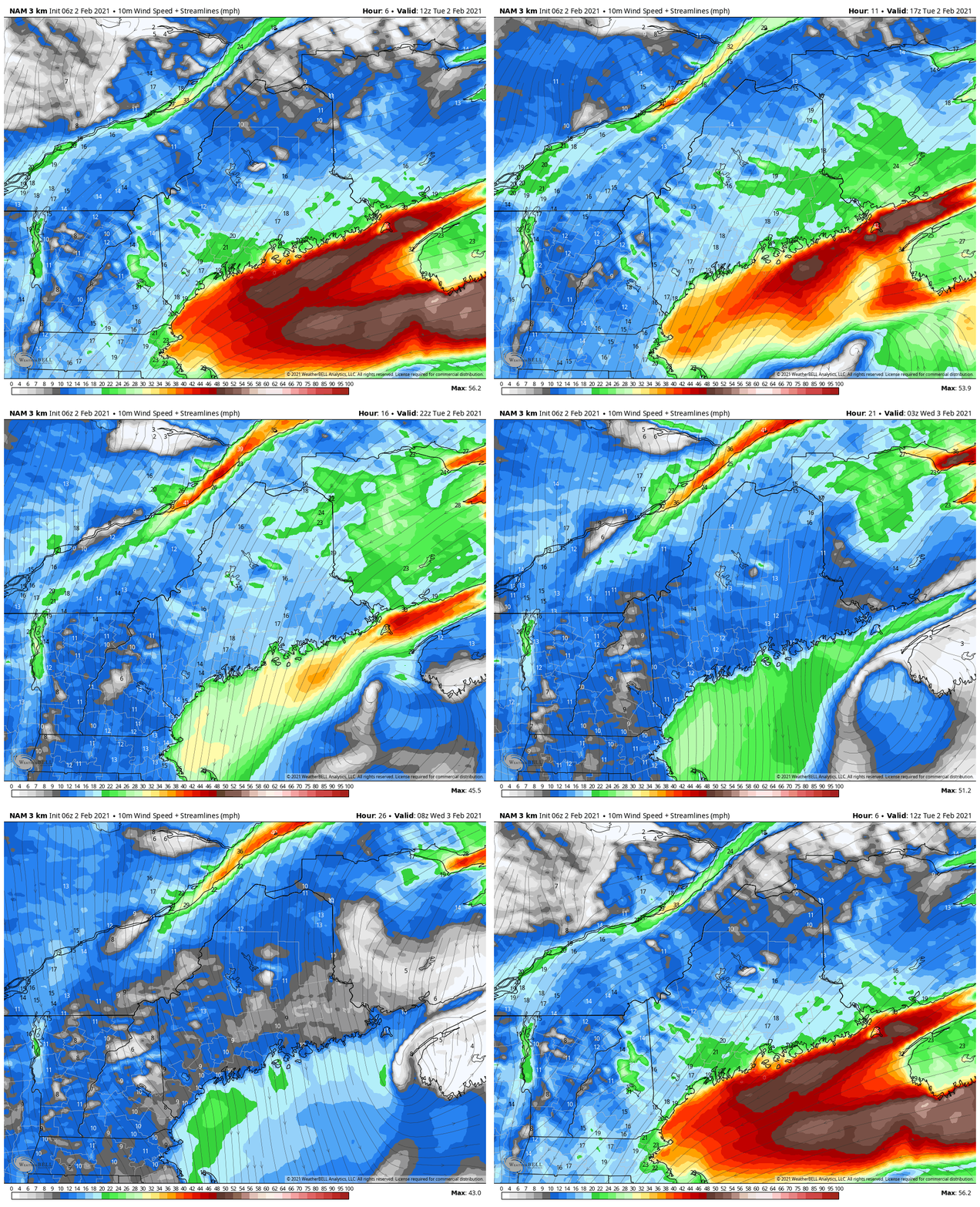
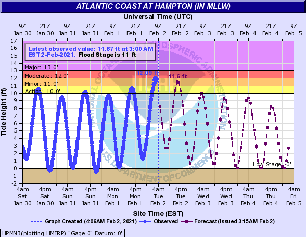
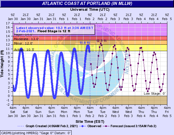
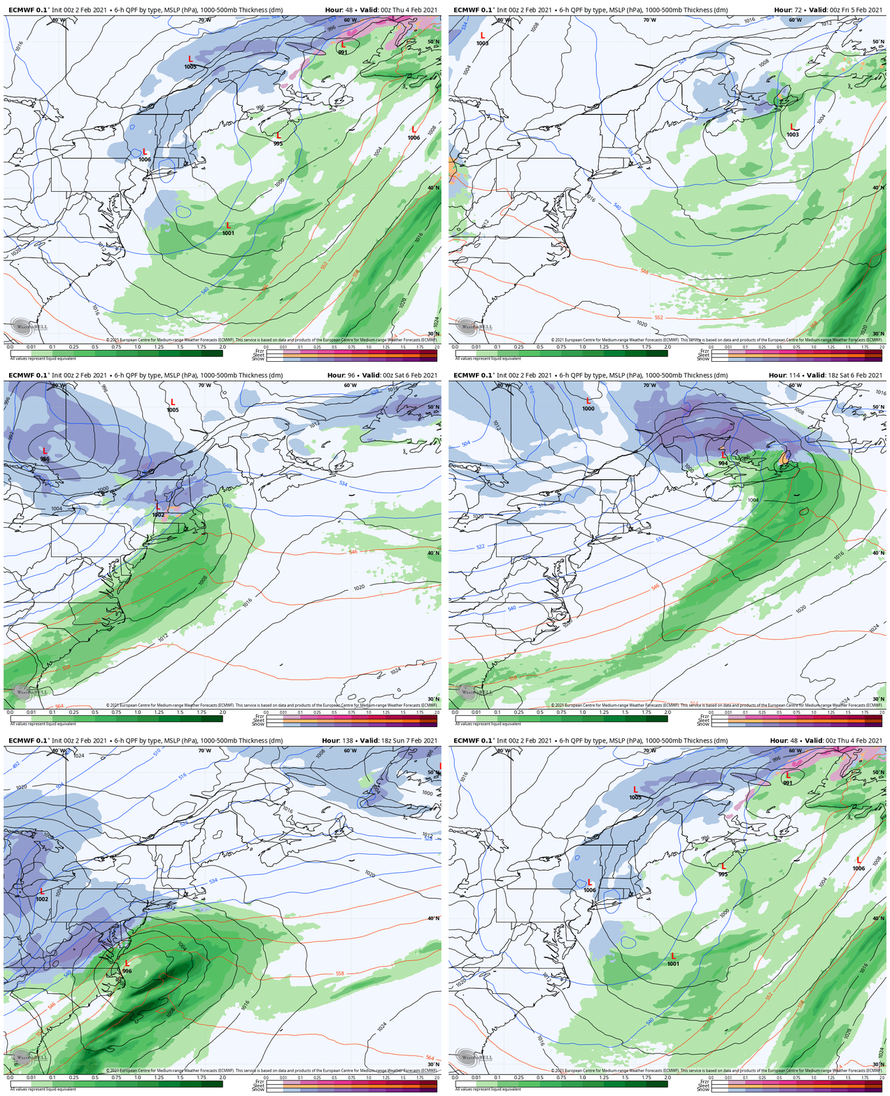
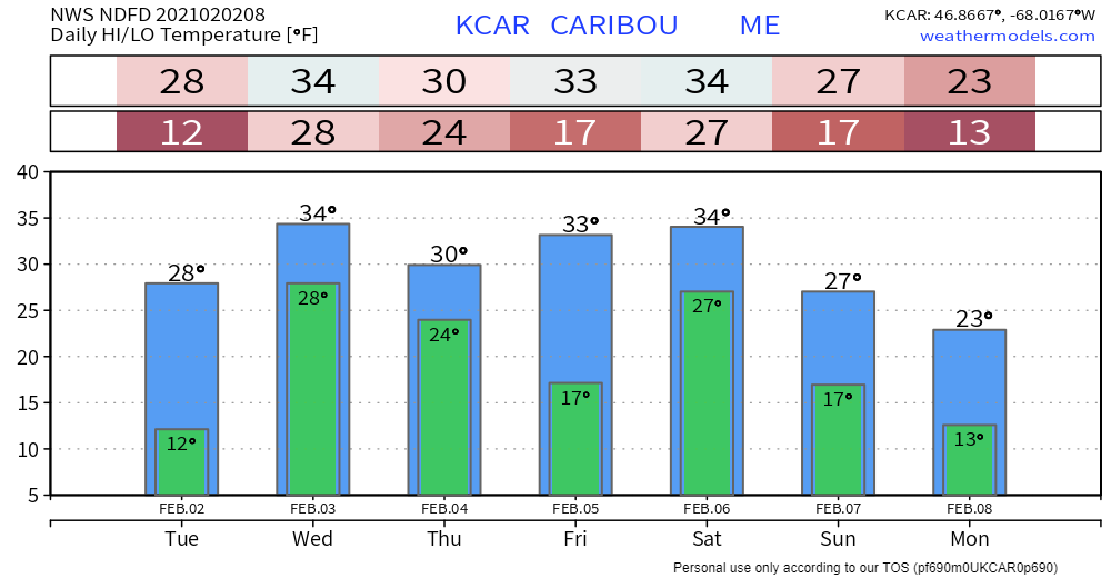
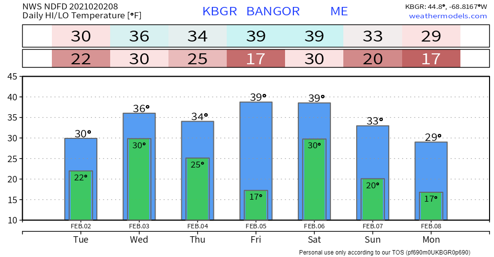
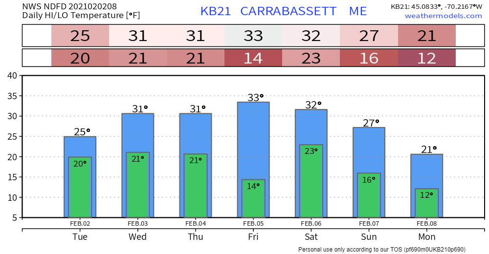
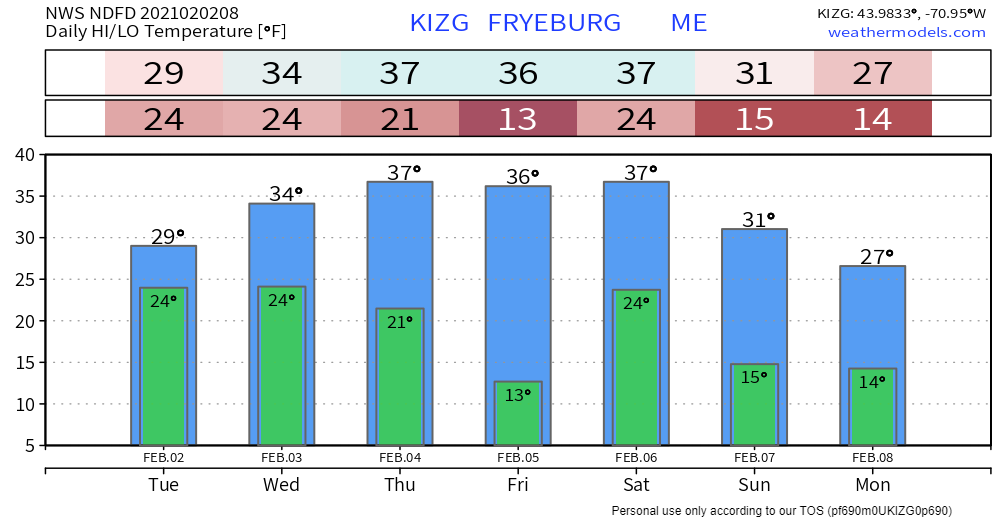
A decent storm going on across the region. Tuesday will be very interesting as the secondary low forms. It will be rough day for travel, and our shorelines appear to take a beating. The pattern is becoming more active. Buckle up... February is off to a busy start. Low forming over the Gulf of Maine to watch TuesdayThe parent low off the coast of southern New England transfers energy to a new low over the Gulf of Maine Tuesday morning. At first, the formation and track of the new low appeared closer to the southwest coast. It appears at this point that it will be more towards Penobscot Bay. This appears to end the heavy snow over southern areas, and moves it northward. Southern areas may see snow showers, pockets of freezing drizzle and sleet from time to time through the day, but a large majority of what was expected to fall already has to this point. DownEast areas have seen their heavier snow, and that appears to switch to light mixed precipitation there. Snow continues in the western mountains and northern areas through Wednesday morning. With the new low forming and gaining with intensity, northern Maine gets into the banding game. It could be a wild afternoon into the early evening with snowfall rates 1-3" per hour and gusty wind blowing it around. By the time all is said and done Wednesday evening, a foot of snow appears to be the average amount statewide. The ski hills could see 18-24" as their grand total through Thursday morning. Wind to blow snow around all day and nightNortheasterly winds to start off shift to the north / northwest as the new low over the Gulf of Maine moves northeast, Snow will blow around as wind gusts 30-40+ mph, which will cause whiteout conditions and drifting. The progress of the storm to the northeast appears rather slow, so this appears to keep the breeze going through Thursday, slowly diminishing over time. Coastal flooding concernsThe southwest coast is under a coastal flood warning. Flooding has already been observed in Hampton. There appears to be another round of it Tuesday afternoon. Storm surge remains in the 1-2' level. Seas could reach 16-21' in exposed areas. Portland will be flirting with potential minor flooding not only with Tuesday's 2 PM high water mark, but also Wednesday morning with the high tide near 4 AM. Two more storms in the pipelineBe forewarned that sunshine will be a limited commodity over the next several days. Southern areas have the better chance Thursday afternoon, but for northern areas, any clearing appears to happen at night, and briefly at that. The system Friday into Saturday once appeared to be a soaker but has progressively trended colder. For now, that appears to be a mainly snow event, with coastal mix and/or rain possible, The region sees a pause in activity Saturday afternoon through Sunday morning. The European model here is depicting potential for a strong storm Sunday night into Monday. There is good ensemble support for this within its members. Other models are considerably weaker with the idea. With a more active pattern, this solution is totally in the realm of possibility. Stay tuned. Temperature outlook through MondayTemperatures appear to be generally above normal through the period. Looking beyond Monday, it appears that we could be heading for the cellar as a big blast of arctic air is likely to move in behind the storm early next week. Winter... fashionably late again this year. Easy does it while moving snow!Be prepared to receive alerts and stay updated!
For more information in between posts, please follow Pine Tree Weather on Facebook and Twitter.
Thank you for supporting this community based weather information source operates by financial contributions. Stay updated, stay on alert, and stay safe! Thank you as always for your support! - Mike |
Mike Haggett
|

