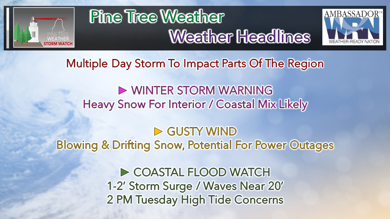
 All in all, a decent storm here. I am not into all the hype of "major storm" unless it truly is one, where we have to get out the yardstick. For areas to the south, it will be pretty significant. Anytime there is a good bet of a foot or more of snow in New York City / Philadelphia region, it's a huge problem there. For us here, it's winter, it's a storm, and we get through it like we always do. For those like me who have to travel to work over the next couple of days, use caution, and plan for a slow go of it. It would be wise to keep the electronics charged just in case power goes out. Interior snow, coastal mix likely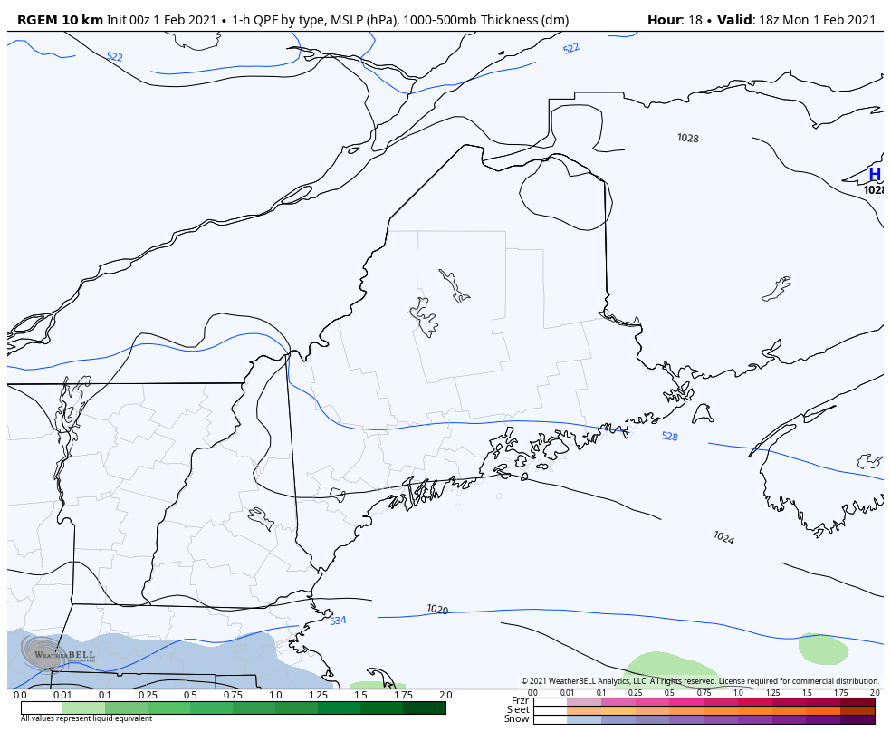 RGEM mean sea level pressure and precipitation type idea from 1 PM Monday to midnight Wednesday I am going to be right upfront here and say there is still some uncertainty on the secondary low that forms in the Gulf of Maine, and how intense it gets. Some guidance has it more towards DownEast areas, this one here from the RGEM has it more to the west. I have mentioned the threat for sleet here over the past couple of days, and that idea remains on the table. Where the warm nose comes in aloft and where it does not, will dictate the outcome of precipitation type. Important to note here that the storm appears to start off all snow everywhere. For the coastal plain expect any change to sleet to happen after daylight Tuesday morning. MidCoast and DownEast areas may not only see sleet, but there is a chance for freezing drizzle, light freezing rain, and perhaps light rain to end Tuesday night. 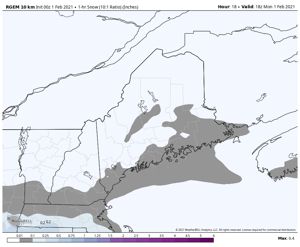 RGEM idea of snowfall rates per hour from 1 PM Monday to midnight Wednesday For Monday afternoon for coastal areas, there is the chance for some ocean effect snow showers before the main event moves in Monday evening and spreads north and east overnight. I am still in the camp of heavy banding of snow to develop. At this point, the heaviest banding appears over interior areas where snow could dump 1-2" or more per hour at times Tuesday afternoon. This a great news for ski country! For southern areas, the steadier banding comes overnight Monday into early Tuesday morning, By the time of the morning commute, the heavier snow bands appear to be inland. While the snow bands move inland, the tricky part for the coastal plain after that is the timing of the sleet working in, and eventually potential for light icing for MidCoast and DownEast areas. When does this end? At this point, precipitation amounts in various intensities and types continue into Wednesday. An upper low stall over the region and will be slow to depart, keeping the threat for precipitation at time through Thursday morning.  Given the threat for mixed precipitation and potential for a more westerly track of the surface low, this has changes my thoughts on snow amounts. DownEast areas see lesser amounts. The mountains should get the higher end totals. For those that can wait to move snow, that may work to your advantage. With the prospects of sleet and icing, the later you wait, the easier it will be to manage. If you have to move it, keep the ice melt handy as you will need it. More good news for ski country... expect bonus inches to continue Wednesday night into Thursday morning, and potential for a couple inches of snow over the weekend. Blowing snow the concern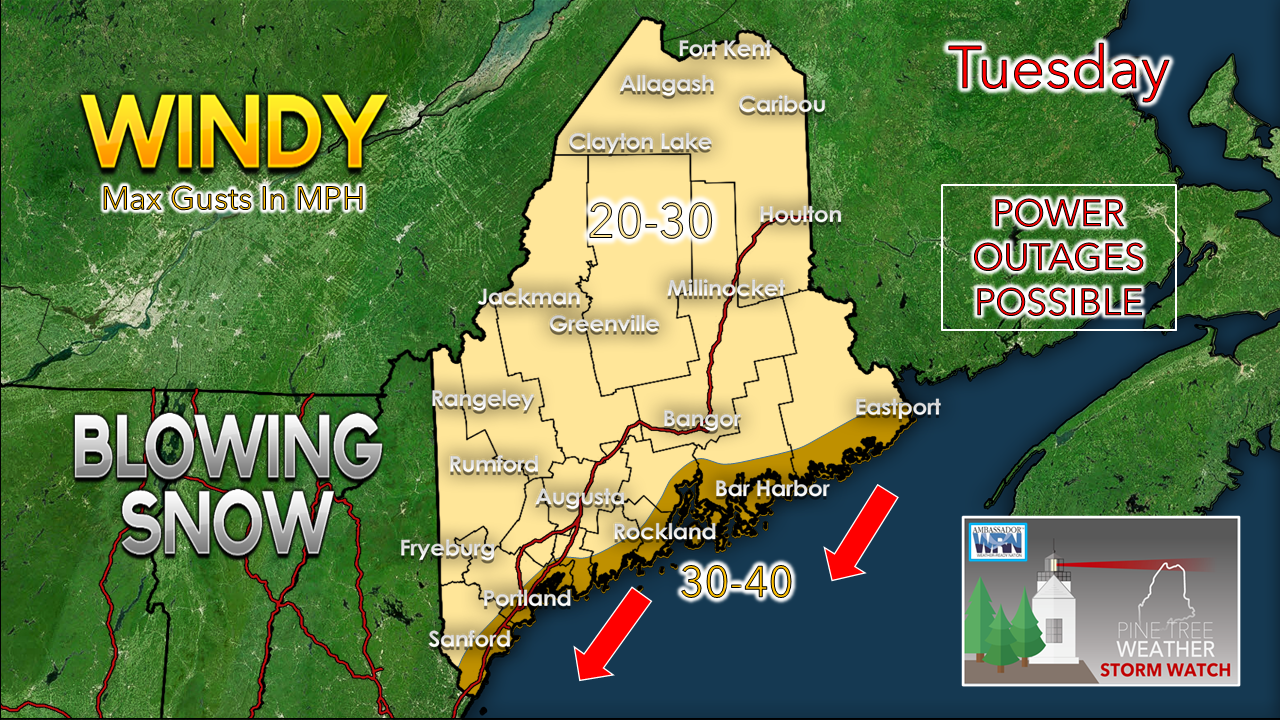 As I mentioned yesterday, the snow is likely to drift as the wind picks up. With the heavy snow bands come whiteout conditions. The storm appears to fall short of blizzard criteria. That said, it will make travel difficult over interior areas especially could make it difficult for road crews to keep up at times. Power outages are possible where the snow is wet and sticks for MidCoast areas eastward. As the storm weakens Tuesday night, the wind begins to slowly settle down, but expect it to be on the breezy side through later in the week, Coastal flood concerns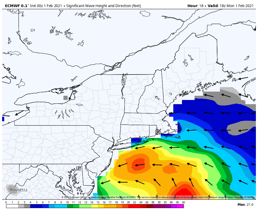 Folks with shoreline interests should be aware that flooding is possible between 11 AM and 5 PM Tuesday. A coastal flood watch has been issued for York and Cumberland Counties. Expect 1-2' of storm surge, splash-over from battering wave, and some beach erosion. Stay tuned to the National Weather Service for bulletins. For more information, check out the Pine Tree Weather marine page.  mPING reports would be appreciated through the storm! Check out mPING (Meteorological Phenomena Identification Near the Ground) project. Weird name, cool app! You can report the type of precipitation you see where you are. No need to measure! Use the free mobile app to send reports anonymously. Reports are automatically recorded into a database, which improves weather computer models. The information is even used by road maintenance operations and the aviation industry to diagnose areas of icing. mping.nssl.noaa.gov  Be prepared to receive alerts and stay updated!
For more information in between posts, please follow Pine Tree Weather on Facebook and Twitter. Thank you for supporting this community based weather information source operates by financial contributions. Stay updated, stay on alert, and stay safe! Thank you as always for your support! - Mike |

Mike Haggett
|