
Buckle up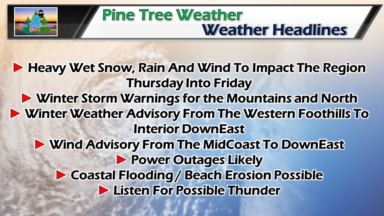 Every once in awhile we get a late winter corker, and that is the way it is shaping up. Hopefully you have all the supplies you need, a generator (if you have one) is ready to go, and you can settle it and watch it come. This will be a great day to utilize mPING if you have it on your tablet or smartphone. This is a complex storm, which could bring some surprises. Track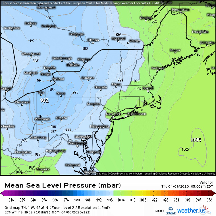 The projected track of the storm has not changed much. It's a coastal hugger. The one change is that it's slowed down as a result of the blocking high in the east. Since the storm will be slow to get out of here, this means more precipitation and a slightly longer period of wind. The storm is on track to rapidly intensify. The cold air from the north will help feed into its development. With the moisture hose attached to it, it will bring a copious amount of precipitation. Timing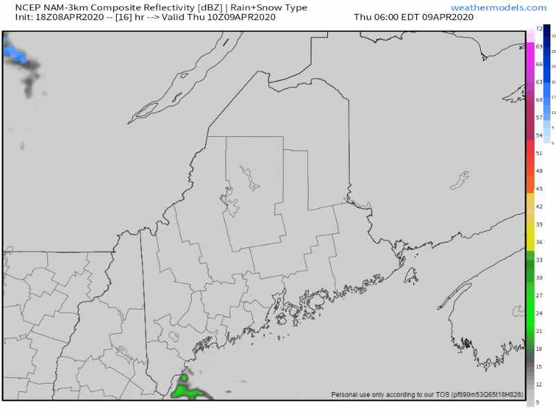 This loop from 6 AM to 6 PM Thursday shows the projected precipitation shield overspreading the entire state by around mid-afternoon. As the secondary low gets better organized, precipitation amounts will increase. 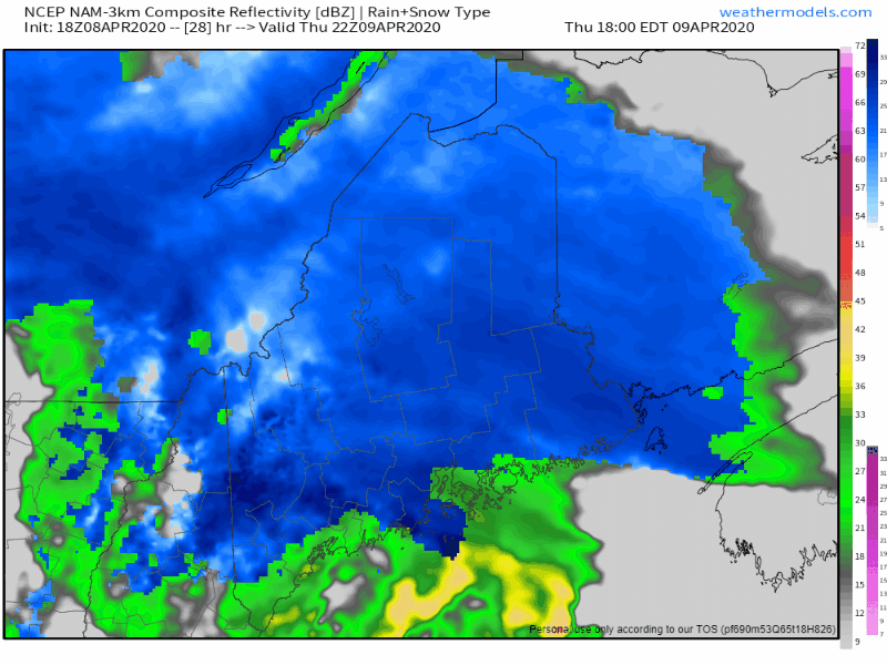 From 6 PM Thursday to 6 AM Friday, the storm rides along the coastal front and intensifies. Here we see snow bands that could dump 1-2+" of snow in areas, gusty winds which could cause whiteout conditions, and potential for thunder snow or thunder rain. As I said yesterday, this is a warm core storm that will transition into a cold core. This is the time frame where this happens. Where the surprises could happen, this is the period where it is most likely to occur. Southern areas see the bulk of precipitation end roughly before dawn, and it will likely end as snow, with and inch or less accumulation Portland south. 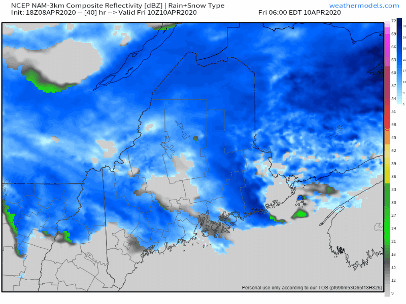 The loop from 6 AM Friday to midnight Saturday shows the storm moving slowly eastward. Western, eastern and northern areas will be dealing with snow showers, potential snow squalls, along with gusty wind and potential for blowing snow, especially up north in The County. Southern areas may get a rain shower. The snow machine finally shuts down by late evening. Precipitation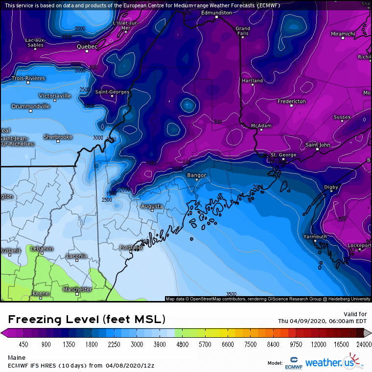 Areas of rain or snow/rain mix over western and southern areas see the cold work in by late afternoon / early evening, and as the atmospheric temperatures crash toward the surface, this is where rain ends and snow accumulations start to pile up quickly. 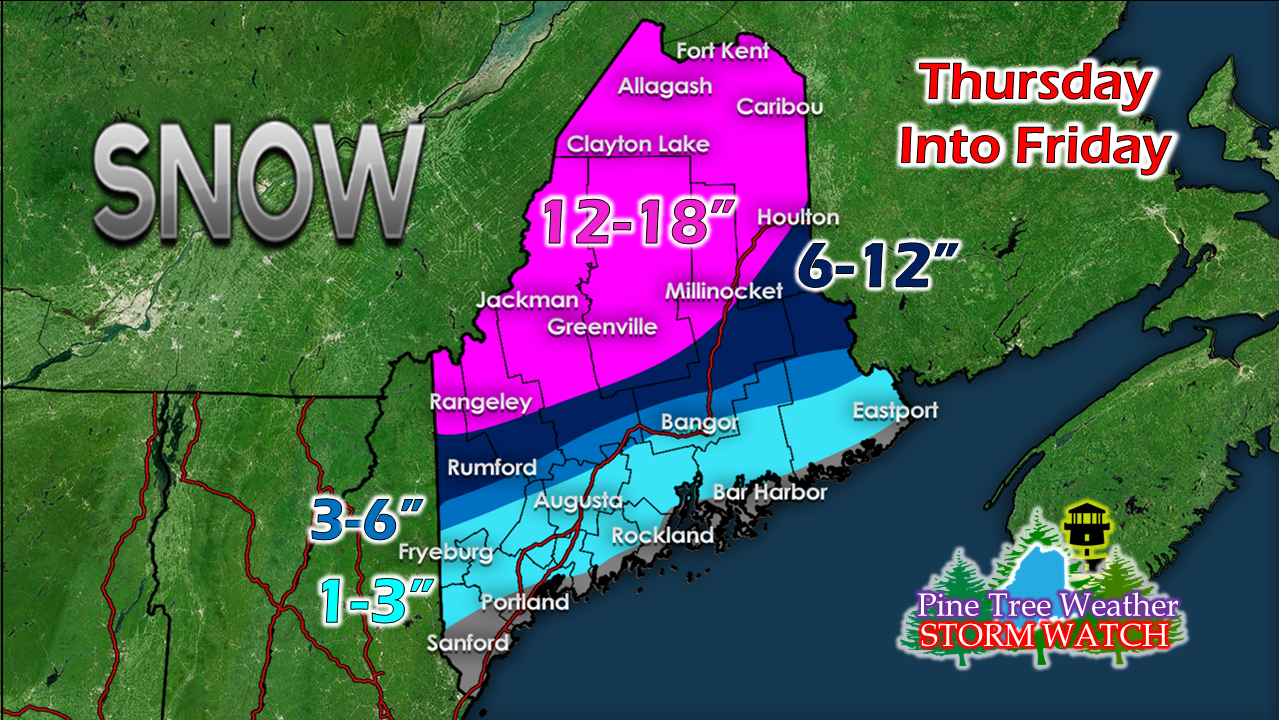 Adjustment made to the snowfall idea with the slowdown of the storms progression in mind. Higher elevations are likely to get double digits out of this. Given the core of the storm being warm at the onset, this cuts down on snow accumulations over much of the coastal plain. The closer to the storm center, the wetter and heavier the snow will be. Further to the north, it will be a lighter as the cold air will help to keep it fluffier. Just a friendly reminder... this is April. This snow won't stay long. It looks like a statewide rain event on Monday will help clean this up. Do the bare minimum. By Tuesday, most, if not all that falls from this event, will be gone. Wind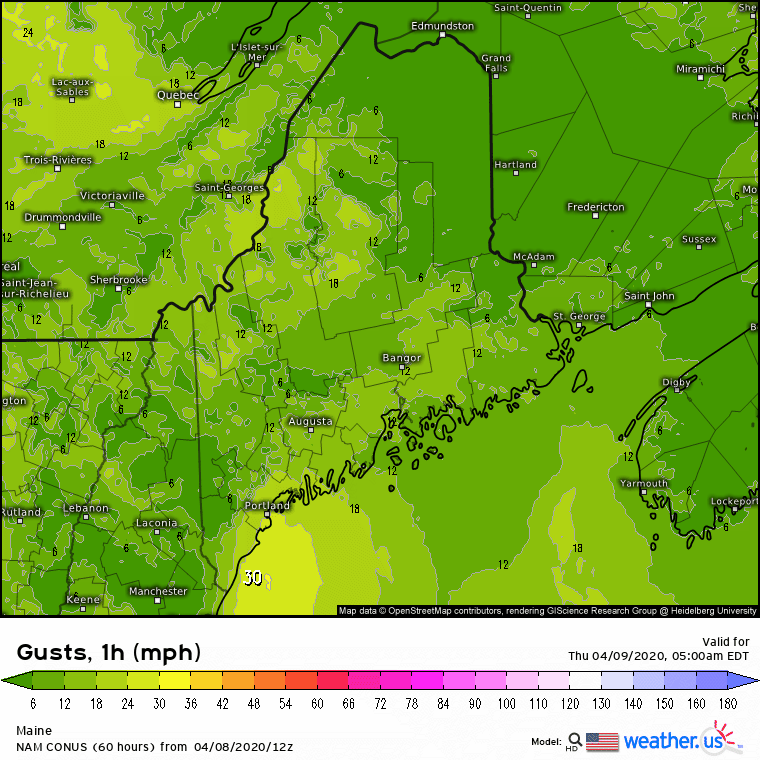 Strong gusty wind Thursday afternoon into mid-morning Friday in the 20-30 mph sustained range and gusts to 50 are possible. With the storm nearby in New Brunswick, breezy conditions continue through Friday. The wind slowly subsides on Saturday as the storm moves eastward. By Saturday night, the wind appears settled over much of the region. The shorelines will take a beating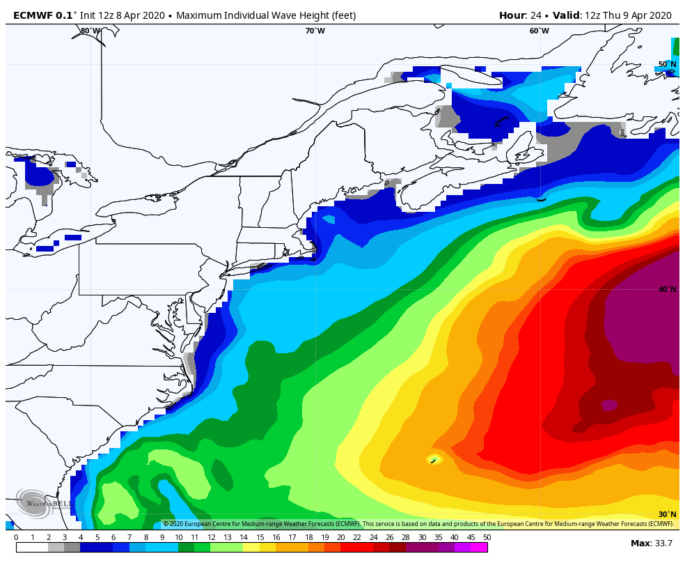 Either a coastal flood watch or advisory covers the entire shoreline of the state Thursday evening into Friday morning. Seas are expected in the 9-13' range, add astronomical influence and 1-2 feet of storm surge for the high water mark around midnight to 1 AM Friday, and that is a recipe for splash-over, inundation and beach erosion. Low lying areas are likely to be affected, and the main concern continues to be for Way DownEast to get the brunt of this. Stay InformedPlease be aware of changes in the forecast, and stay updated.
► ► For the latest official forecasts, bulletins and advisories, please check in with the National Weather Service in Gray for western and southern areas, or Caribou for northern and eastern parts of Maine. Thanks as always for your support! - Mike |

Mike Haggett
|


