
Nasty weekend ahead This is one of those storms that has forecasters looking at every piece of data they can get their hands on. Cold air damming is a challenge. Models do a very poor job of handling it. Add a NorEaster with tropical characteristics, it is even more fun to try to figure out. It's a good way for meteorologists and forecasters like me to get the dust off and prepare for the winter season ahead. This storm will have impacts from the Crown to the coast. A wind advisory has been posted for the entire coast for Saturday afternoon through early Sunday morning. Advisories as of Friday Evening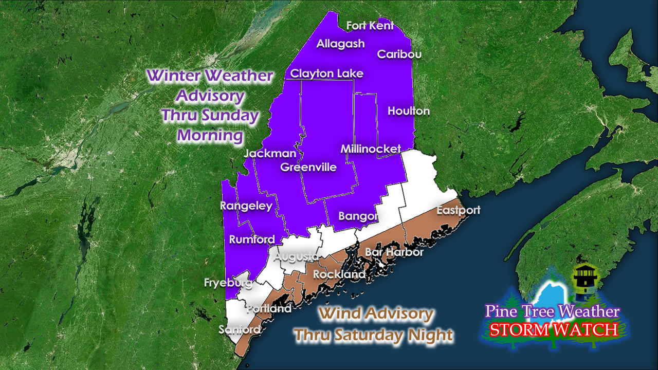 A winter weather advisory has been posted for much of the interior. Given the chance for ice to mix in with snow is the main contributing factor the National Weather Service decision on this. Cold air is likely to hang in there during the time of most of the precipitation falling over the interior. It will make for slick roads and sidewalks. Use caution and take your time if you head out over the weekend. Timing of precipitation Precipitation works into southern areas early Saturday and work northeastward during the day. Northern areas may see some sun to start off as the precipitation is not expected to arrive there until after dark. Coastal areas may see a touch of snow at the onset, but it is expected to change over to rain as the wind off the water picks up. Precipitation could be heavy at times, and an embedded thunderstorm is totally possible. The rain / snow / mix will taper off to showers / drizzle and fog as the day progresses on Sunday. The far north sees the showers end Sunday night. Snow and ice could cause travel issues inland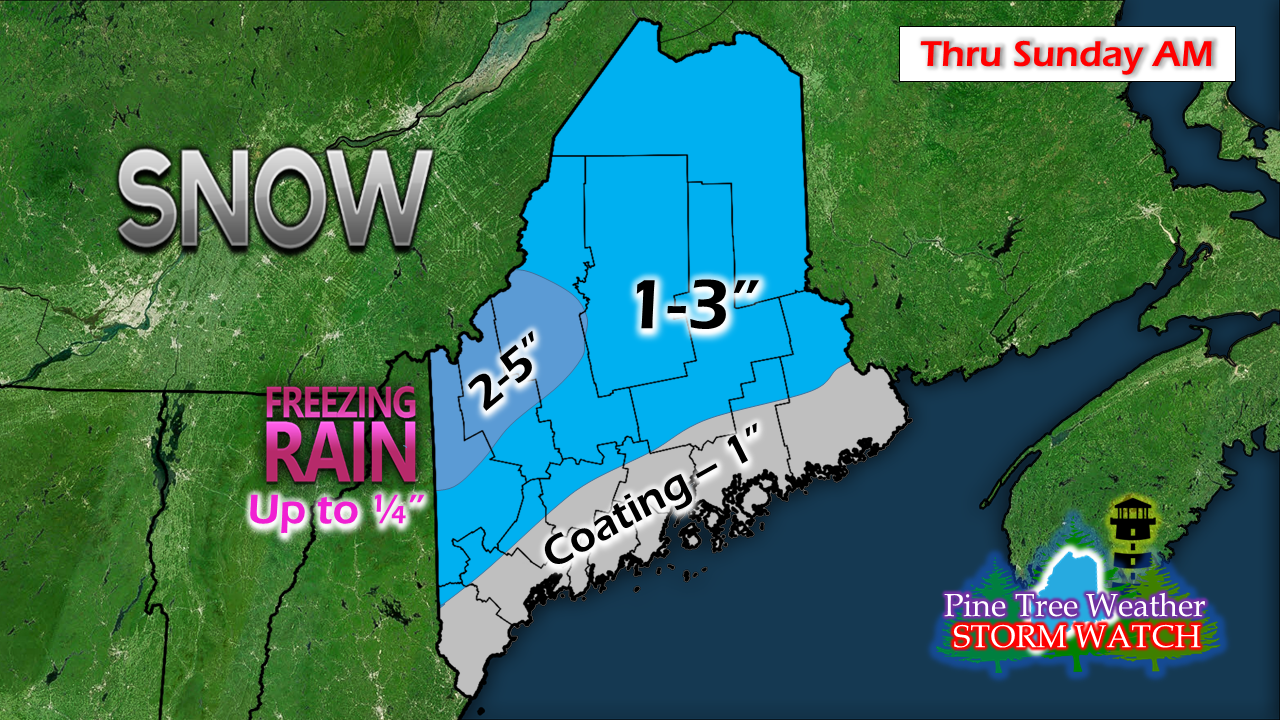 The greater threat for icing is over the western mountains and foothills up toward the Allagash. The peaks on the ski slopes could see a half of foot or more of snow before the change over to rain. Like with the last storm, this snow will be heavy and wet. Add ice to it, and it is a mess. Spotty areas of sleet are possible if the atmosphere sets up right. Coast to get the wind, surf and surge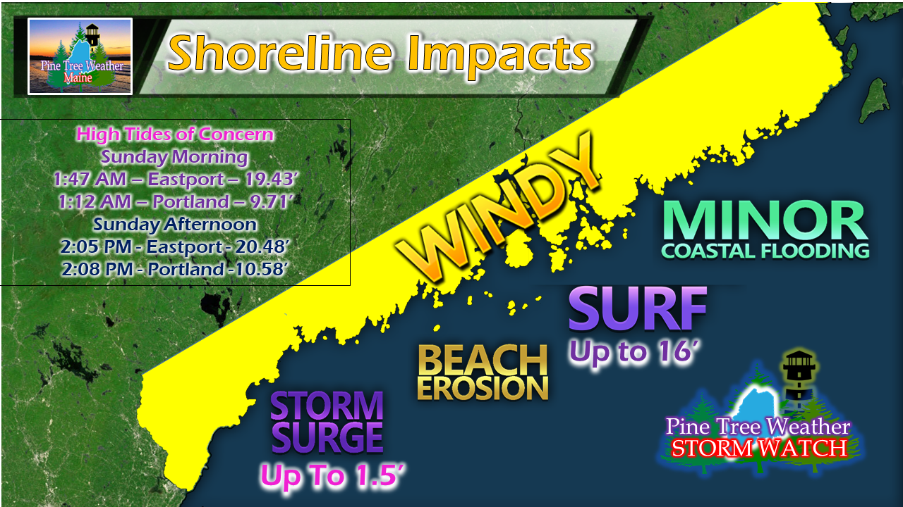 These concerns have been consistent over the past couple of days and there is no changes in ideas. Minor coastal flooding is possible at high tide in the wee hours of Sunday, along with splash over. Storm warnings are posted for much of the coastline with Gale Warnings set up for the bays. It will be rough Saturday night into Sunday. And the wind likely to be gusty through the evening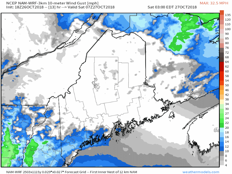 The main concern for wind at the coast starts early afternoon through the wee hours of Sunday before the strongest gusts subside. Wind will settle down over western and southern areas Sunday morning and eastern and northern areas Sunday evening. A decent amount of rain for the region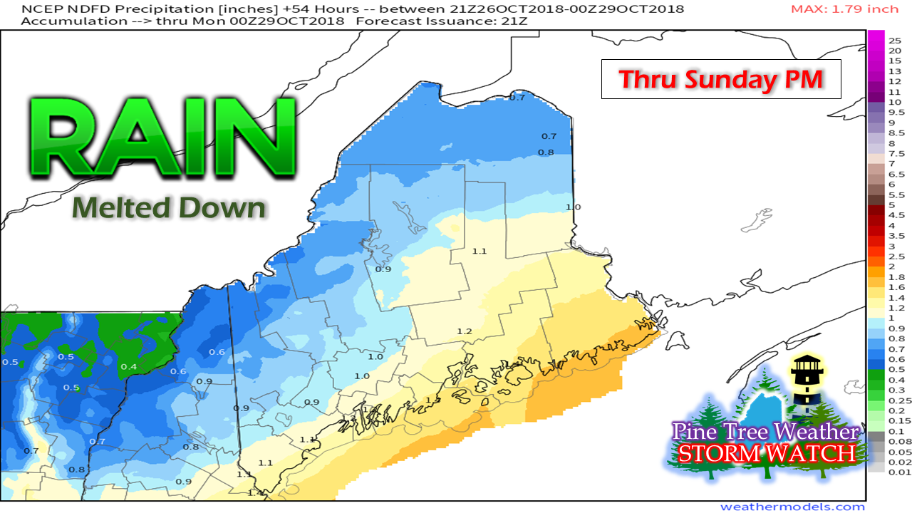 A bit of an afterthought in all of this is rain, which appears to be a fair amount. A half inch to an inch of liquid equivalent is likely the general outcome for this one. DownEast areas could see a bit more, with an inch and a half possible. Heavier downpours are possible with thunderstorms, which may lead to localized higher amounts, and possibly some urban street flooding. Outlook through Wednesday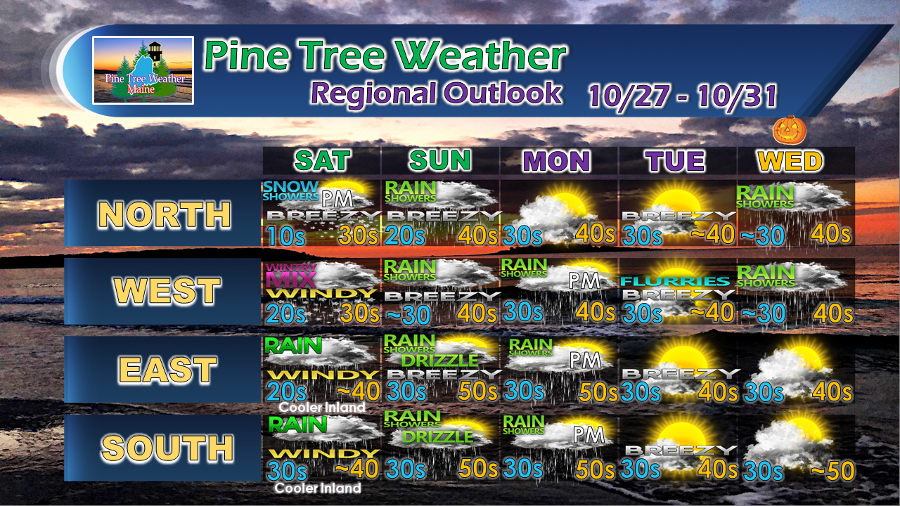 After the storm passes Sunday, another weak system follows that could bring some scattered showers for Monday. A cold front slides through early Tuesday which could bring some flurries for the higher elevations Tuesday morning. A system crossing central Quebec may bring some showers to the north country for Halloween.
More updates to come. For the latest official forecasts, bulletins and advisories, please check in with the National Weather Service in Gray for western and southern areas, or Caribou for northern and eastern parts of Maine. For more information from me, please follow the Pine Tree Weather Facebook page and my Twitter feed. Thanks as always for your support! Please consider making a donation to keep Pine Tree Weather going through the year ahead. Check out the donate page on how to contribute. Always stay weather aware! - Mike |

Mike Haggett
|


