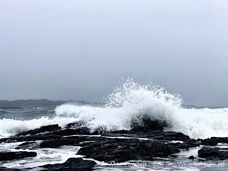
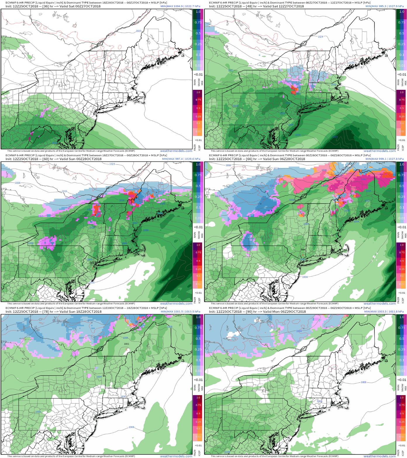
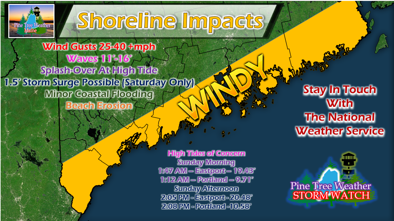
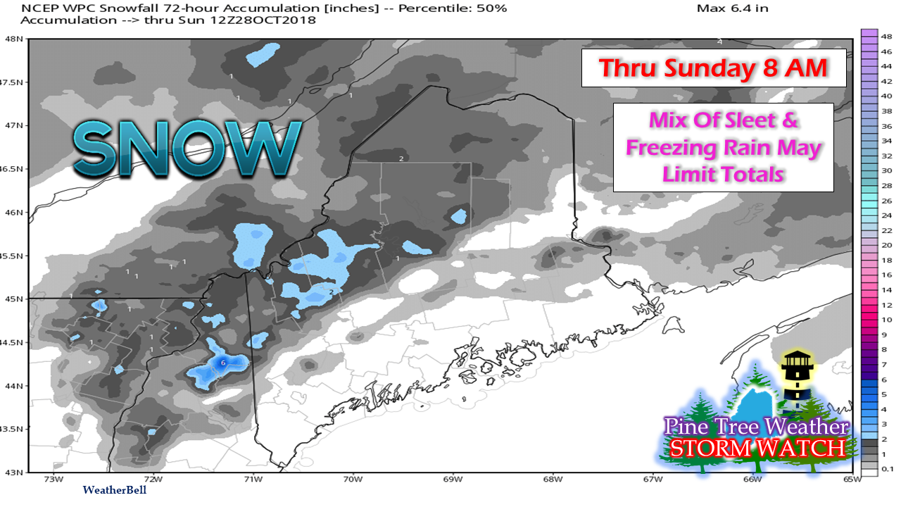
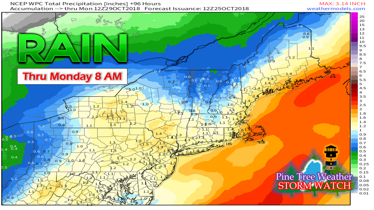
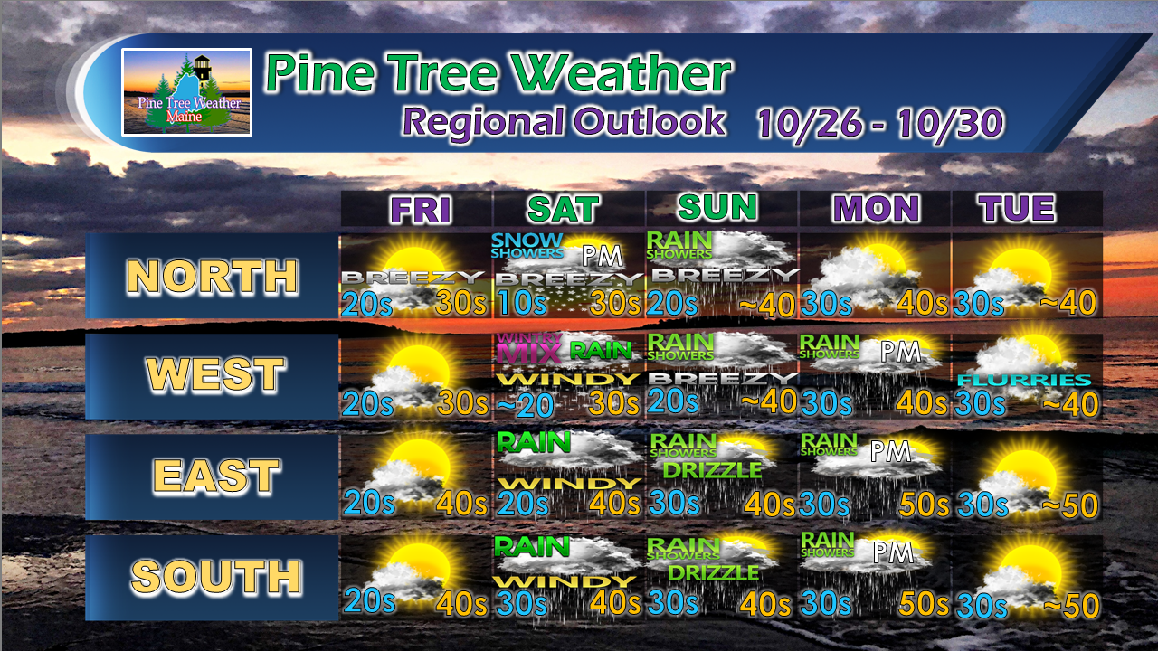
The weekend is a stormy oneOver the years we've seen some strong storms to impact the region. If this storm occurred closer to the winter solstice, I could be rattling off a laundry list of watches and advisories. This storm will have it's hazards, travel concerns, and the coastal impacts, but we've certainly dealt with far worse. Timeline and track remains on courseNo real changes to the timing and track I posted last night. Storm will be tracking to the west which will spare the region from getting buried in snow. Coastal areas get rain, interior sees light snow changing to sleet and/or freezing rain then to all rain. Only possible exception may be around the Allagash if the cold holds on there, but that area may see a bit of rain before that is over. Timing of the storm starts Saturday morning for the south and moves northeast through the day reaching the rooftop Saturday night. Precipitation tapers from steady to showers Sunday. Southern and eastern areas may see a peek of sun late, however drizzle and fog may have keep the beams away. Coastal areas to get multiple impactsWind along the coast is always the headliner with these events. Gusts in the 25-40 mph range will work up the shorelines Saturday afternoon into the night, settling down towards Sunday morning. A bit of storm surge on the way with this one and the impacts of that comes with the timing of it, which may come as the tide is departing Saturday afternoon. That is something that will need to be watched. Minor coastal flooding and splash over is likely with the Sunday high tides. Beaches could see some mild erosion from the waves that could be upwards of 15 feet or more Saturday, and continuous wave activity that will continue through Sunday. Shoreline folks should stay in touch with the National Weather Service for coastal flood statements and advisories A bit sloppy for the north countryFor interior areas, Saturday afternoon could be a bit slick as precipitation starts off as snow. Higher elevations will see the most with perhaps a couple of inches. Snow changes to sleet and freezing rain towards Saturday evening and eventually all rain Saturday night into early Sunday. A good soaker for mostA fair bet at this point is for roughly an inch of rainfall to come from this event. Given the tropical characteristics associated with it as the remnants of Hurricane Willa in the Eastern Pacific, there could be additional rainfall pending on timing and intensity. For now, an inch of liquid for most areas is a good place to start. 5-Day Outlook through TuesdayMore updates to come.
For the latest official forecasts, bulletins and advisories, please check in with the National Weather Service in Gray for western and southern areas, or Caribou for northern and eastern parts of Maine. For more information from me, please follow the Pine Tree Weather Facebook page and my Twitter feed. Thanks as always for your support! Please consider making a donation to keep Pine Tree Weather going through the year ahead. Check out the donate page on how to contribute. Always stay weather aware! - Mike |
Mike Haggett
|

