|
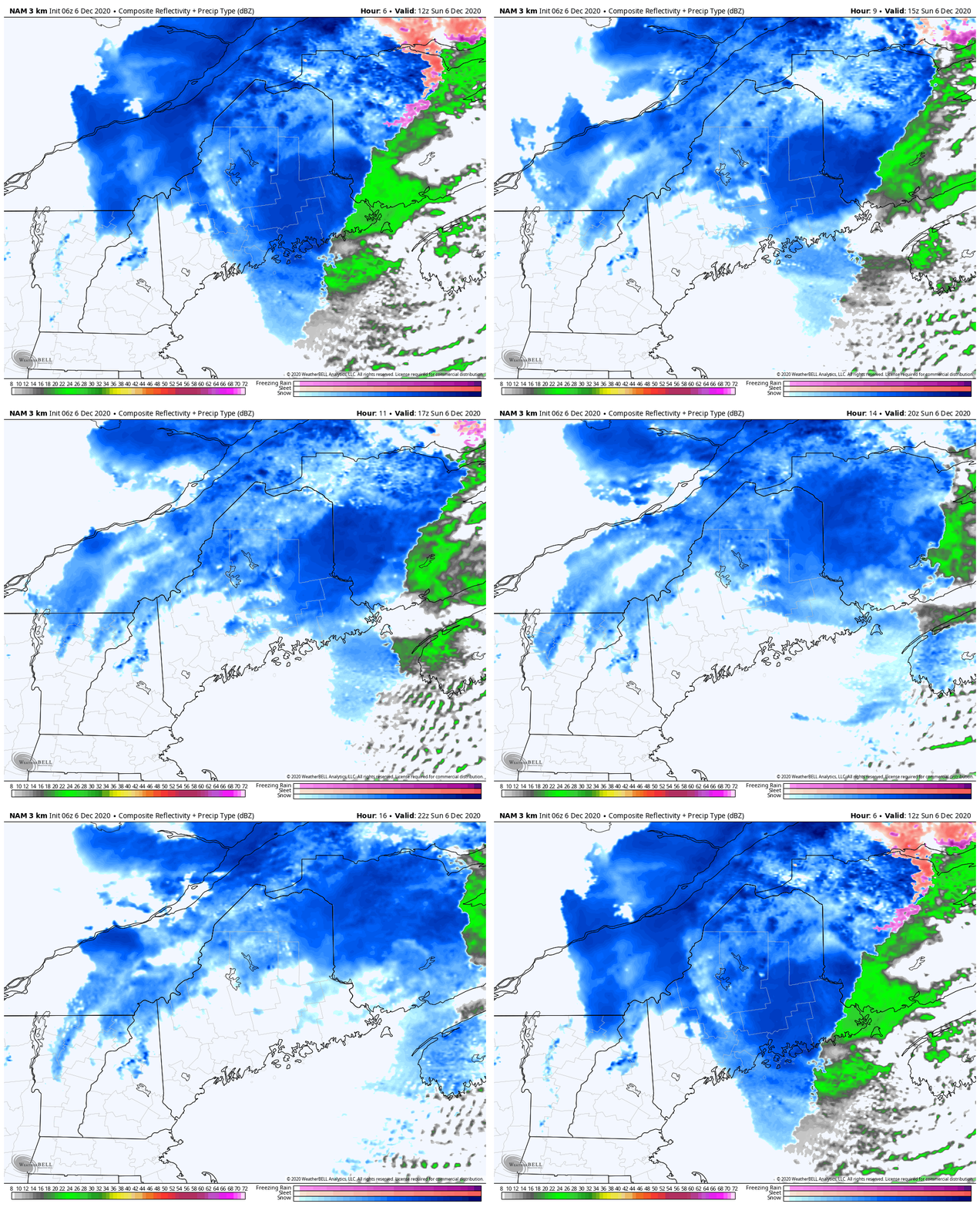
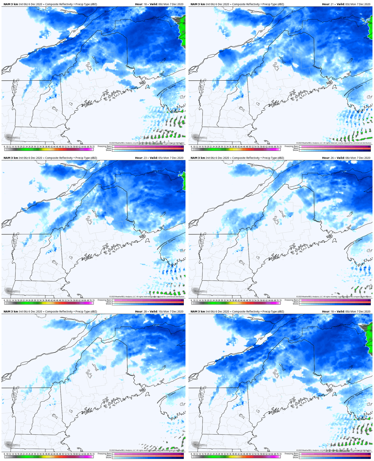
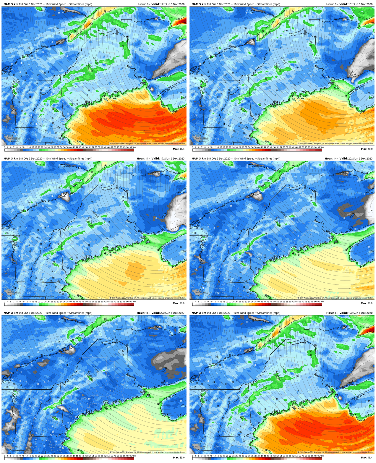
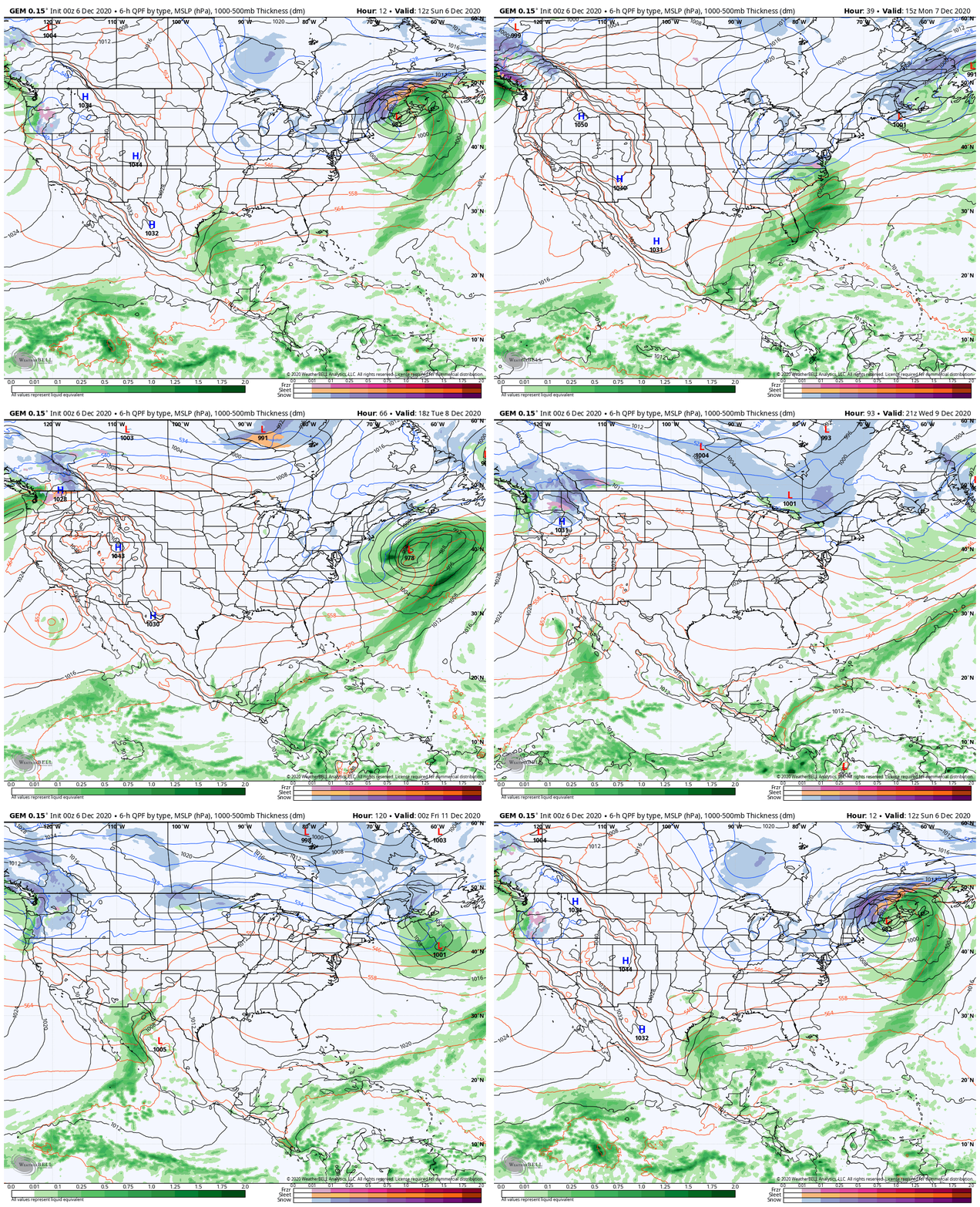
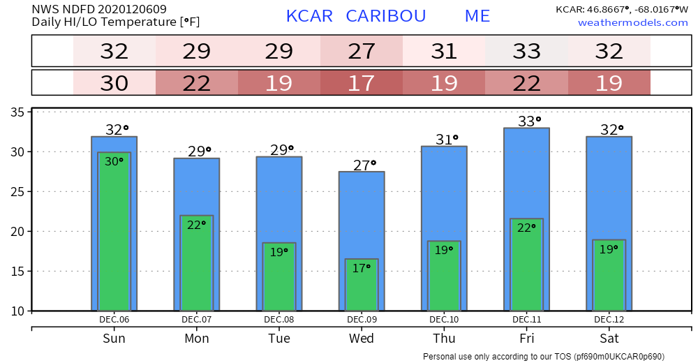
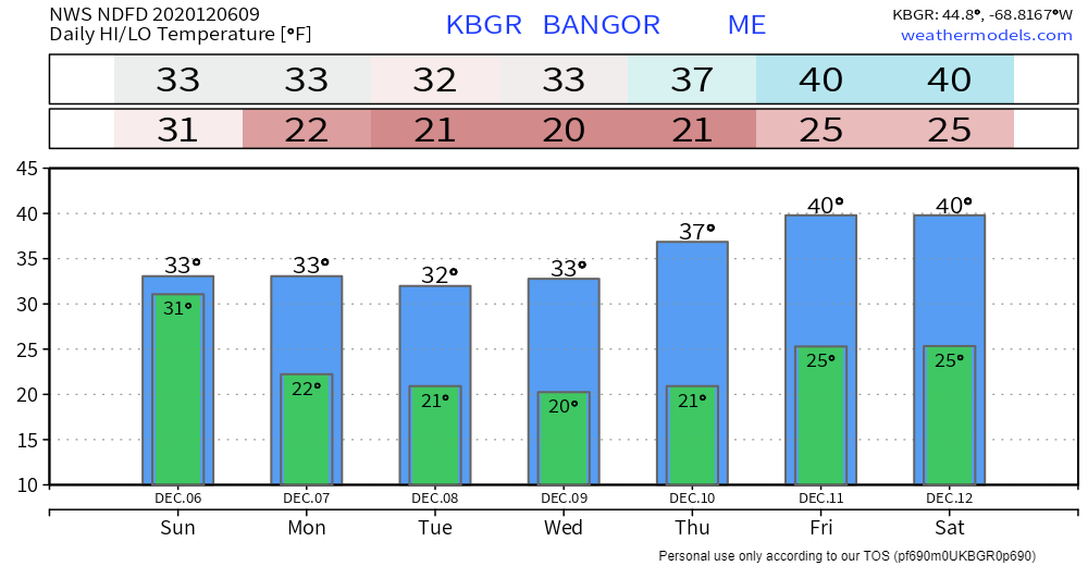
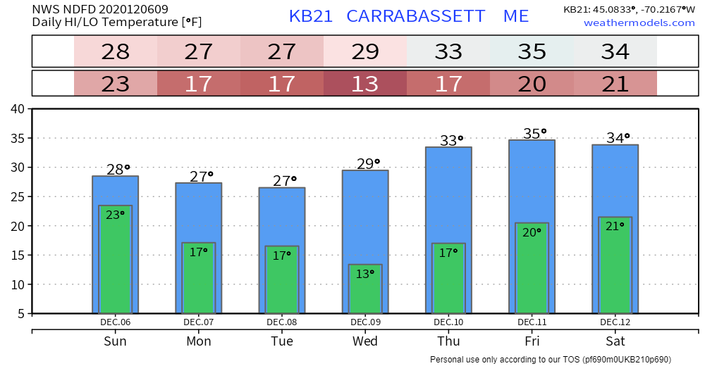
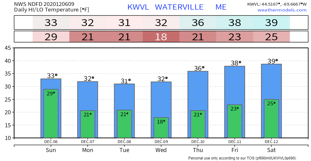
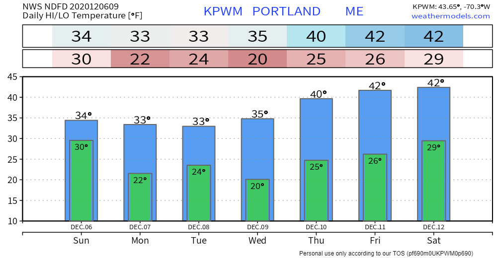
As of the time this post was made public Sunday morning, over 200,000 Mainers are in the dark. For some of you, this is the second time in a week. If you are reading this on a mobile device, understand that restoration efforts may take a few days pending on the situation that surrounds the outage in your area. The storm is weakening, but a gusty wind is going to continue through Monday which will slow the recovery process. We are heading into a quieter pattern, which will be good to get folks back online. It's good for me as this is the week of my final for school. I also need to get caught up on sleep and attend to family matters. I will keep watch as I always do, and will update when warranted. Also, a special thank you to those who have donated this week. Your words of praise and encouragement mean a lot to me. I am very happy to see that, and that you appreciate the service I provide here. The deficit has been cut, but I am still running behind for what I need for the year. Any assistance in that regard is helpful. Storm slowly blows out of the region SundaySouthern areas are done with the precipitation aspect of the storm. The Capitol District and MidCoast areas see snow end by noon. Most of eastern areas see the last of the steady flakes end by this evening, but may see some snow showers after that. For northern areas, it will be tonight before steady snow tapers to snow showers. For western areas, upslope snow showers may bring a couple of bonus inches to the ski hills through the day. It will be a mainly cloudy day for most. Southwestern areas may see the sun, with clouds working through at times through the day. Sunday night the storm moves northeast, ending any residual snow showers over eastern areas. Steady snow ends up in The County, but snow showers continue. Snow showers lower in frequency for the western mountains, but will continue into the night. All snow shower activity in the north and mountains ends by around midday Monday. The wind will remain gusty over the region. This may cause a slowdown in power restoration. It may also cause snow to blow around where there is powder. Pending on how much snow is stuck to the trees and power lines, it may cause a few new outages. Northwest winds gusting 30-40 mph are expected through Sunday, slowly subsiding Sunday night into Monday. It may be Monday night before the breeze settles as high pressure moves in. Outlook for the weekOur current storm moves off to the northeast Sunday into Monday. The trough working in aloft keeps a developing storm over the Carolinas well to our south Monday into Tuesday. The trough begins to erode on Wednesday and an approaching warm front brings the chance for snow showers to the region Thursday. A ridge builds in from the south bringing warmer temperatures to start the weekend. Temperature outlook through SaturdayThe normal high and low temperatures for Caribou are 30° and 16°. For Portland, 41° and 25°. The trend at this point is for below normal temperatures through midweek, before climbing to close to normal by the weekend. Stay safe while using a generatorCarbon monoxide, also known as CO, is called the “Invisible Killer” because it's a colorless, odorless, poisonous gas. More than 150 people in the Unites States die every year from accidental non-fire related CO poisoning associated with consumer products, including generators. Other products include faulty, improperly-used or incorrectly-vented fuel-burning appliances such as furnaces, stoves, water heaters and fireplaces. Source: Consumer Product Safety Commission Be prepared to receive alerts and stay updated!
For more information, please follow Pine Tree Weather on Facebook and Twitter.
** FUNDING NEEDED FOR 2021 ** Thank you for supporting this community based weather information source that is funded by your financial contributions. Stay updated, stay on alert, and stay safe! - Mike |
Mike Haggett
|

