
A turn for the worse For the past couple of days I've mentioned how severe weather over the southeast could throw a wrench into the forecast. It has. This is going to be a crippling storm for northern areas with big snow and gusty winds. DownEast areas need to pay attention to ice accretion, as that may lead to power outages as the wind picks up there Friday afternoon. For western and southern areas, it's sleety snow for the mountains, ice to snow for the foothills, and ice to rain to snow showers for the coast. If you can take the day off, you should. This is a great day to stay off the roads, no matter where you are. Timing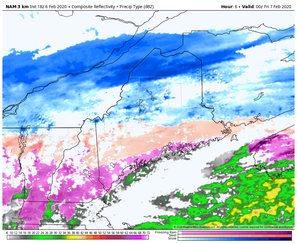 Precipitation will generally be light overnight, whichever type of precipitation you get in your area. That changes Friday morning as the storm moves closer, brings moisture and intensifies. Northern areas, I am concerned with impassable roads to due to near blizzard or blizzard conditions. Heavy sleet over the western mountains into northern Washington County along with snow will be like driving on marbles. Ice accretion of up to a third of an inch is possible for the coastal plain within a scant mile or two from the shorelines. Time will tell if the coastal front will work in to bring straight rain to the shorelines. Everyone gets snow as a parting gift as the storm pulls away Friday afternoon into the wee hours of Saturday morning. For areas that get snow without ice, expect it to blow around and cause drifting, and whiteout conditions Saturday. 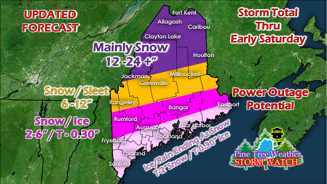 From Thursday evening at 5 PM onward, this is what to expect. Northern areas, heavy banding of snow, 1-3"+ snowfall rates, near blizzard conditions. Rangeley, Greenville, Millinocket could see upwards of an inch or more of sleet, which steals away snow there. Rumford-Waterville-Bangor-Calais, it's ice then snow. The coastal plain is mainly ice with some snow as the storm departs.
Roads will be dangerous in areas, impassible in areas, and everyone can expect slick conditions statewide. We've seen a surprise already with coastal effect snow showers over the Portland region which added some bonus snow there on Thursday. I suspect there could be more surprises. Thunder is possible. Freezing rain could go further north into the mountains. Sleet may make it further south. There could be more or less icing and sleet. There is still some uncertainty on how the sleet and freezing rain play out, but this is the best idea as of Thursday evening. Don't get caught off guard. ► ► For the latest official forecasts, bulletins and advisories, please check in with the National Weather Service in Gray for western and southern areas, or Caribou for northern and eastern parts of Maine. ► ► Due to a revised budget there is a $125 shortfall for the year ahead! You can help keep Pine Tree Weather going with a donation of ANY amount now through VENMO @PineTreeWeather, a monthly donation on Patreon or messaging me on Facebook or Twitter to send a check in the mail. Thank you for your support! For more information from me, please check the Pine Tree Weather Facebook page as well as my Twitter feed. Always stay weather aware! - Mike |

Mike Haggett
|


