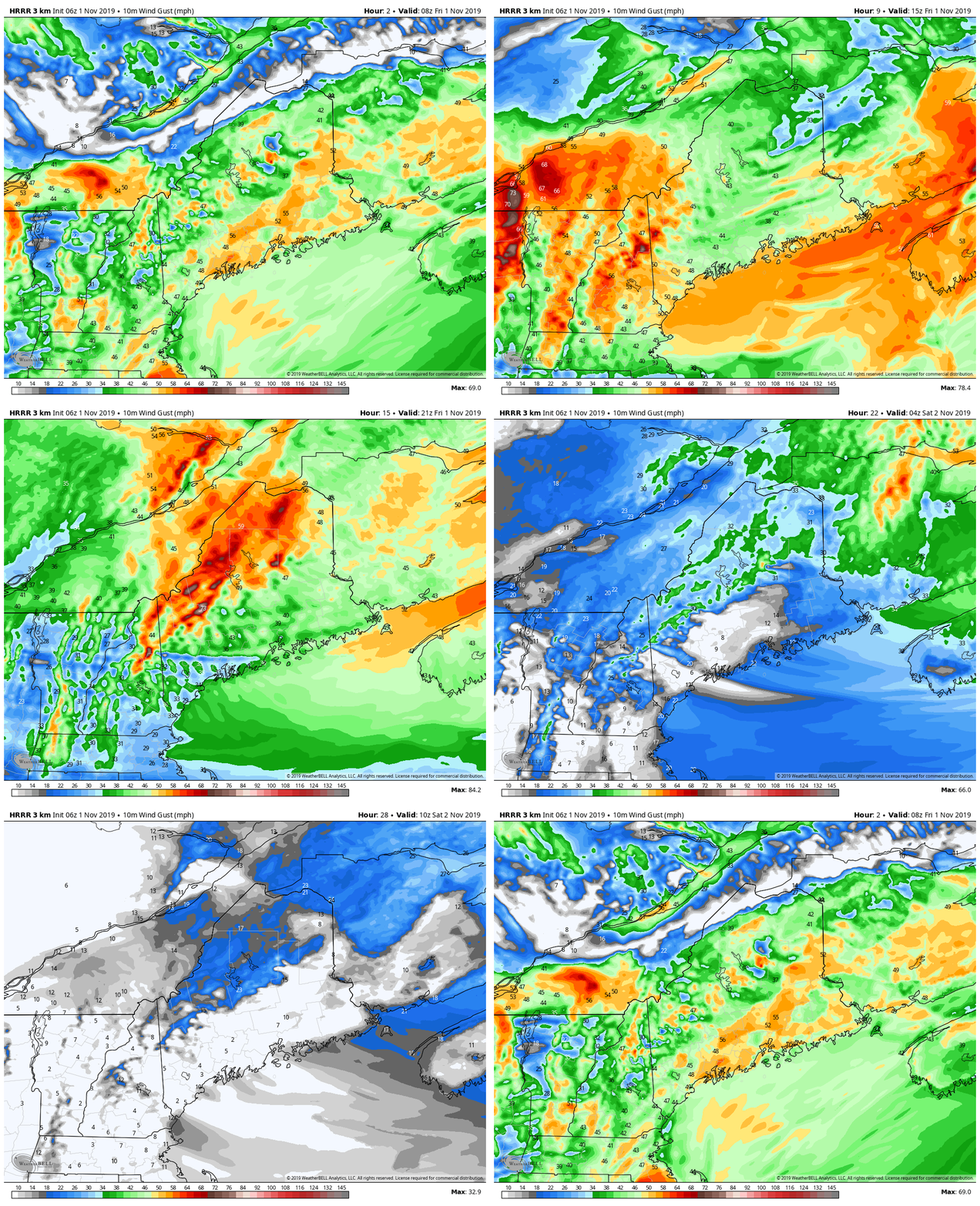
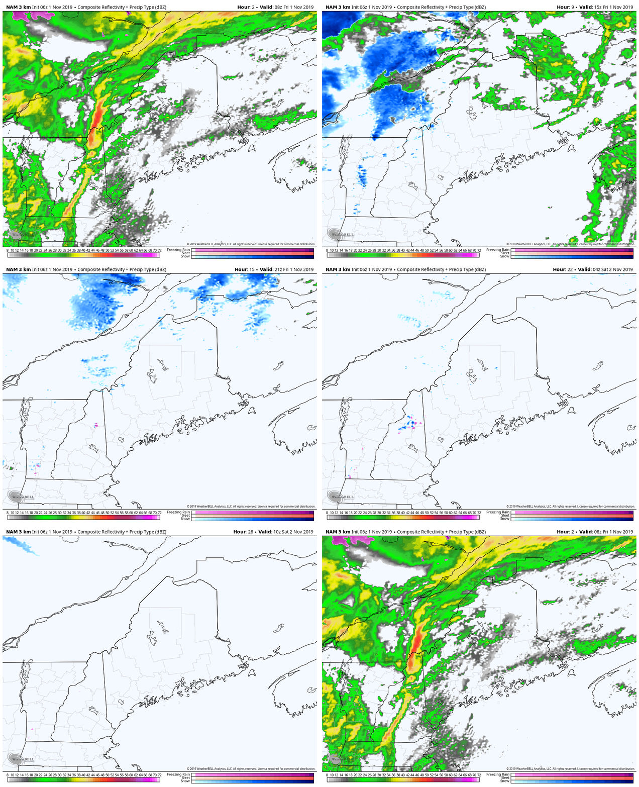
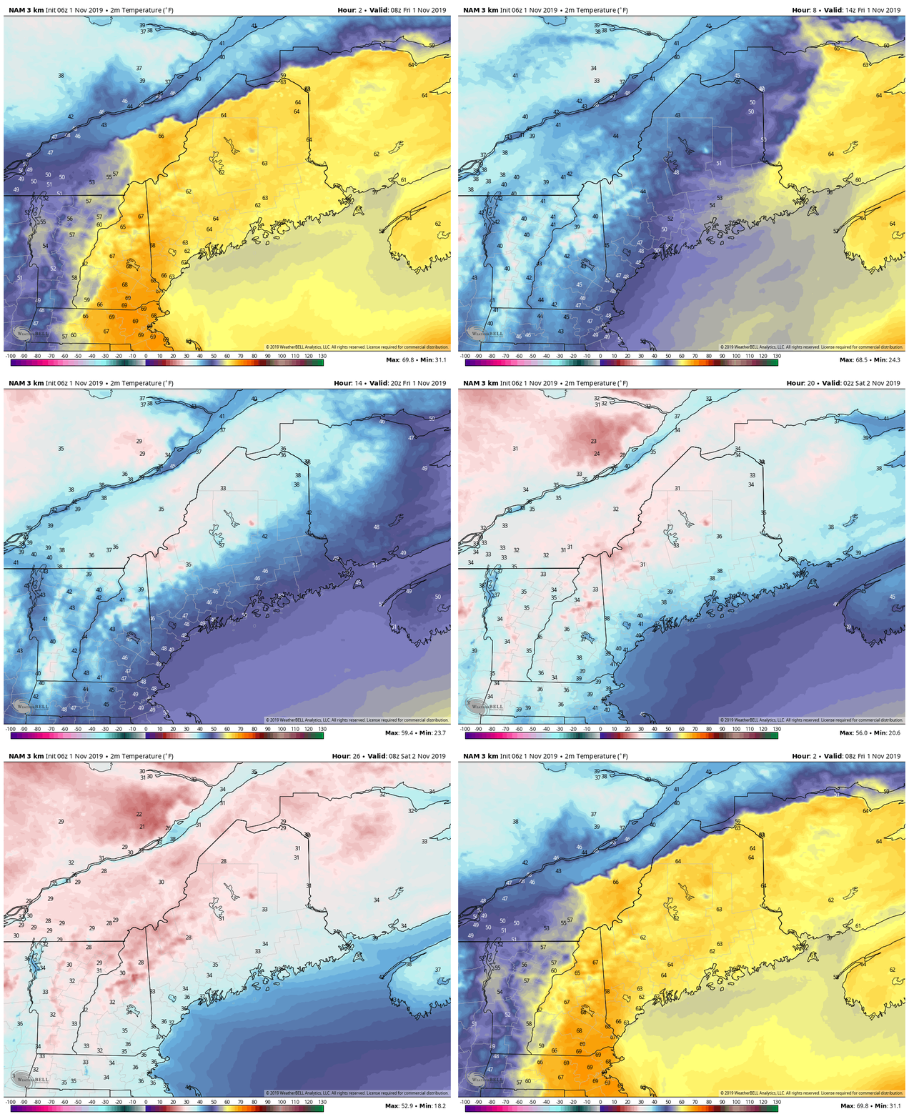
Wind to crank all day, settle down overnightTwo waves of wind to deal with. First, the south wind ahead of the approaching frontal boundary to affect the coastal plain early to mid-morning on Friday. Second, the west/northwest shift behind the front later in the morning and continuing through the afternoon. For those already without power, this may delay restoration. For those that have power, there remains the chance that it could be lost until after the wind begins to drop later today. By Saturday, high pressure takes over and the wind will be light. Rain ends by middayAs the front races through the region, rain tapers quickly on the backside. Some snow showers are possible in the mountains and north, but little accumulation is expected. Temperatures drop all dayDaily highs have already been established. It's all downhill for the rest of the day. With the gusty west/northwest wind, it will usher in much cooler air. The region could see as much as a 15-20° drop in temperature within two hours. By Friday evening, temperatures will be 30s and 40s, and will continue to tumble into the 20s and 30s by Saturday morning.
Continuous updates today on my Twitter feed @WesternMEwx. I will be taking a short break over the weekend for bereavement and other family matters. Thank you for your understanding. ► ► For the latest official forecasts, bulletins and advisories, please check in with the National Weather Service in Gray for western and southern areas, or Caribou for northern and eastern parts of Maine. ► ► DONATION DRIVE UPDATE - $840 shortfall for the year ahead! You can help keep Pine Tree Weather going with a donation of any amount now through VENMO @PineTreeWeather, a monthly donation on Patreon or messaging me on Facebook or Twitter to send a check in the mail. Thank you for your support! For more information from me, please check the Pine Tree Weather Facebook page as well as my Twitter feed. Always stay weather aware! - Mike |
Mike Haggett
|


