Rain mainly for western and southern areas for Friday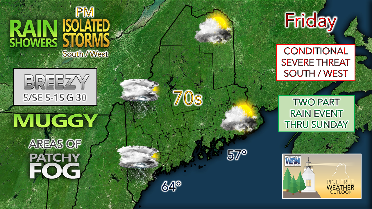 The cold front inches its way towards Maine for Friday. The boundary is forecast to stall over the region by Saturday morning and does not appear to move until Sunday. For western, northern and southern areas, Sunday appears to be the wetter day of the weekend. Eastern areas are in for a weekend washout. 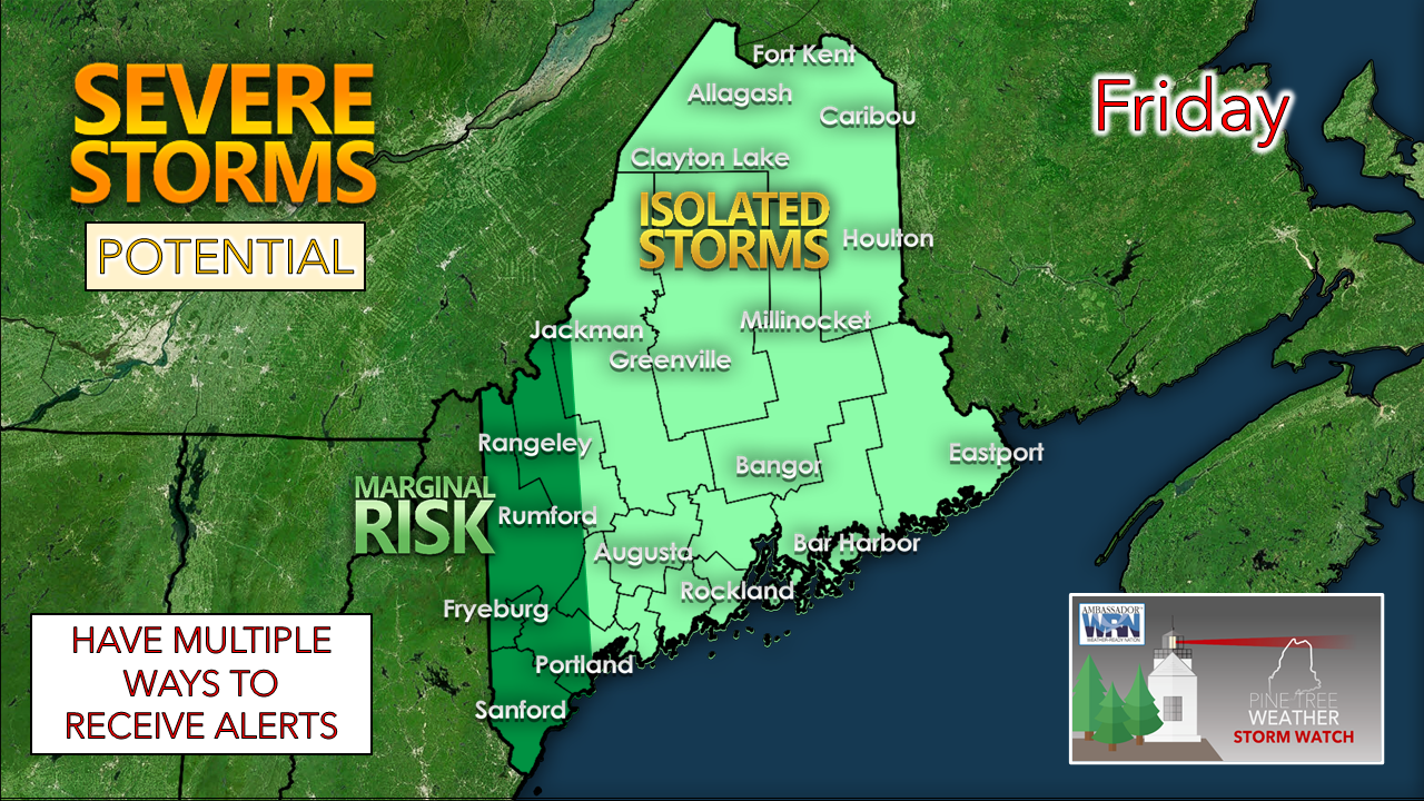 No changes to Storm Prediction Center's thinking for the severe level threat through their 1:30 AM Friday update. The threat remains conditional for western and southern areas depending on cloud clover. If the sun manages to get out this afternoon, look out. 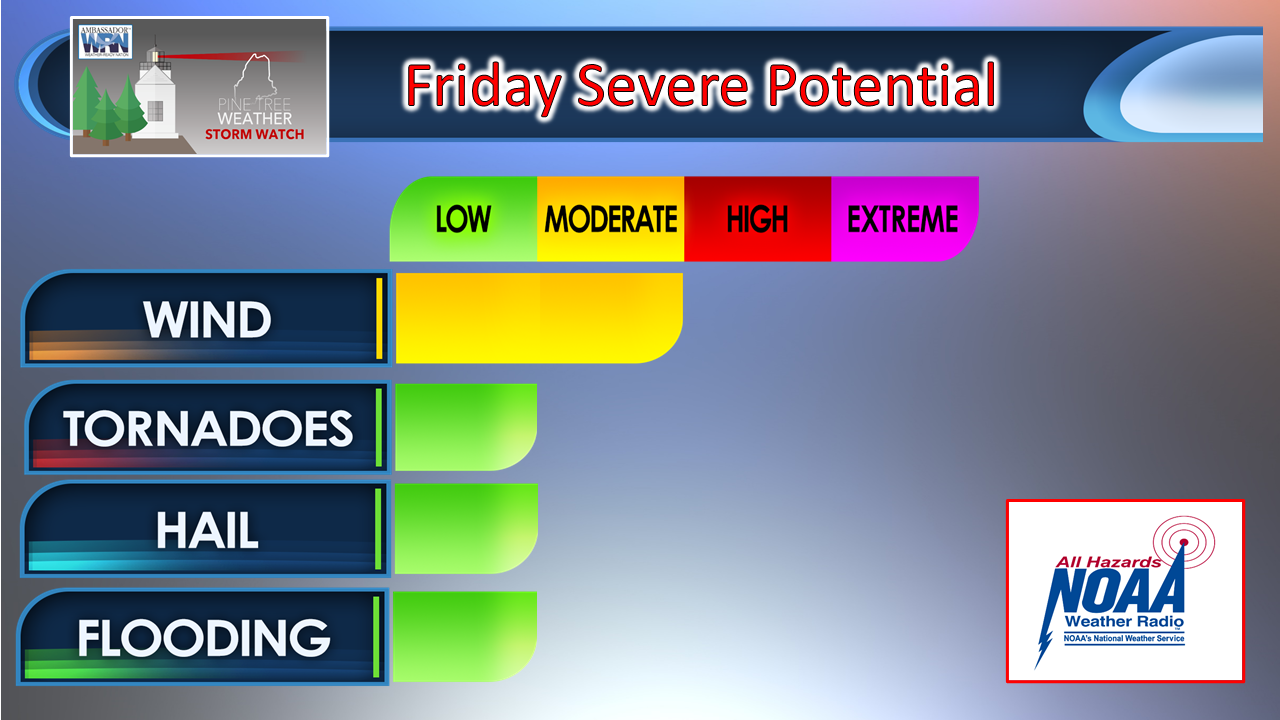 The potential severe threats remain the same. Isolated storms that could produce damaging wind and a brief tornado, along with heavy rain which could produce localized flash flooding. The main threat for storms is favored for New Hampshire as that is the region that could see the most sun and generate enough heat to initiate convection. For western and southern areas of Maine, it will be wait and see. Timing of the first wave of rain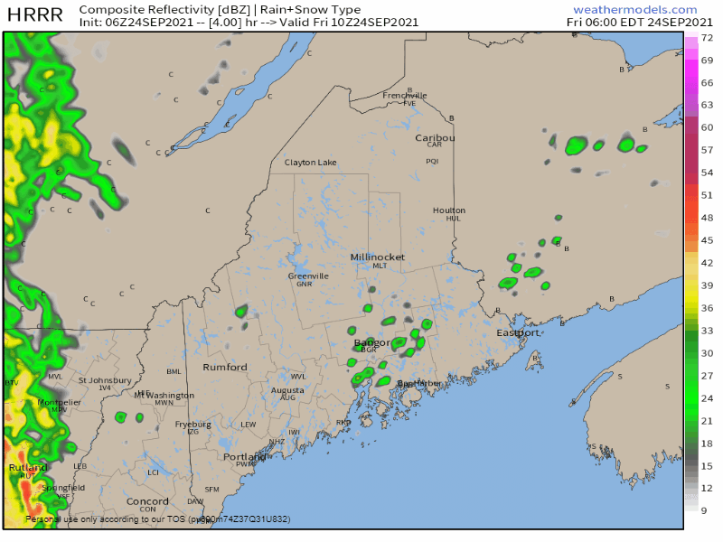 6 AM - 6 PM Friday: For the morning hours, scattered rain showers are possible with the approach of the front. What happens here sets the table for potential storms in the afternoon. The less shower activity for western and southern areas increases the potential for the sun to emerge and fire storms. The more active the showers are, the more cloud cover, and less chance for any severe weather to occur. The storm threat, if generated, diminishes late in the afternoon towards sunset. 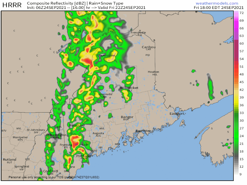 6 PM Friday - 6 AM Saturday: The frontal boundary slowly moves to the east overnight, then stalls out over eastern areas. Showers taper off for western and southern areas and become scattered over eastern areas. 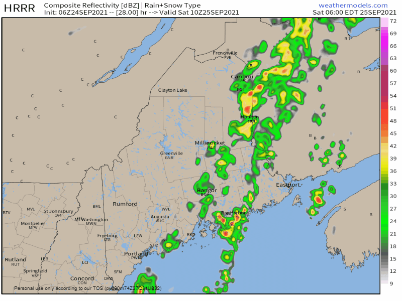 Saturday 6 AM to 6 PM: Western / mountain areas may see sun to start off on Saturday. The scattered shower activity continues over eastern areas through the day. Rain likely for all areas heading into Sunday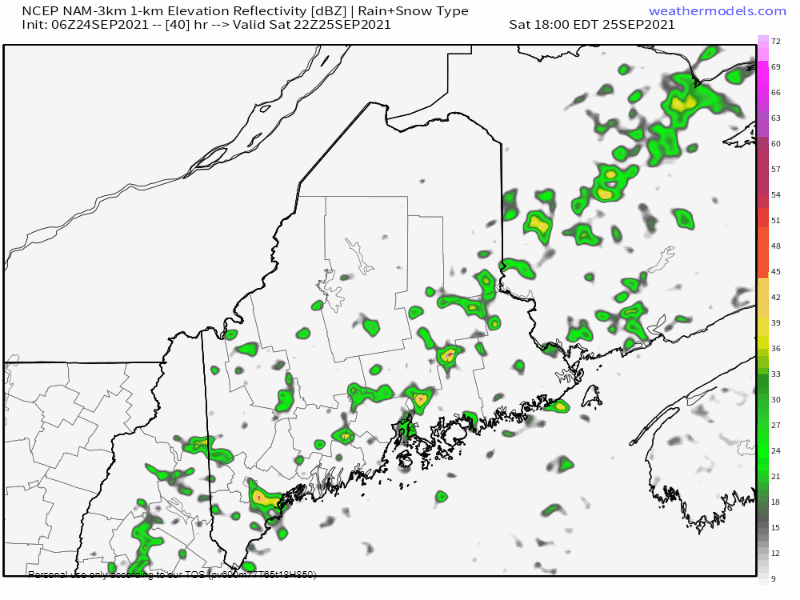 Saturday 6 PM - Sunday 6 AM: An area of low pressure appears likely to form along the stalled front. A shortwave trough dips in and pulls the front back to the west. Eastern areas may see a bit of a break as the precipitation shield shifts west in the process. 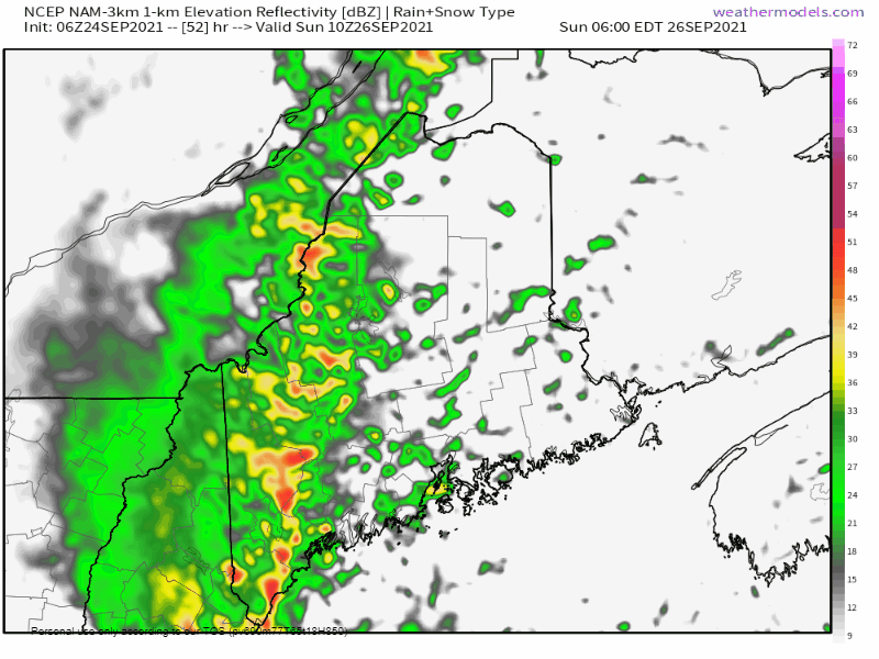 Sunday 6 AM - 2 PM: As the area of low pressure moves north along the front, showers increase over the region through the day. Rain begins to taper off from southwest to northeast in the afternoon, ending over northern areas Sunday night. A good soaker for the region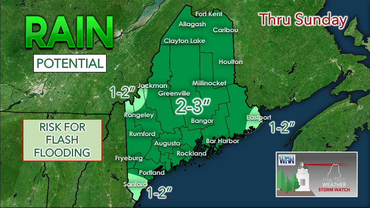 While the risk for flash flooding is low, it is a possibility given the amount of tropical moisture in the region and would accompany in any downpours. The areas of severe drought in the western mountains get a decent shot of rain that is desperately needed.  Hiking or Camping? Are you planning to camp or hike near a stream or river? Remember that it doesn’t have to rain directly over you for there to be flooding. If you notice even a slight rise in water level, seek higher ground immediately! weather.gov/safety/flood-during Outlook through WednesdayAs we start the work week, the focus on low pressure crossing Quebec may generate shower activity for the north and mountains Monday into Tuesday, but the confidence in that idea is low for now. Temperature appear to run near season average on the highs by the first of the week, with lows running well above normal through the period. 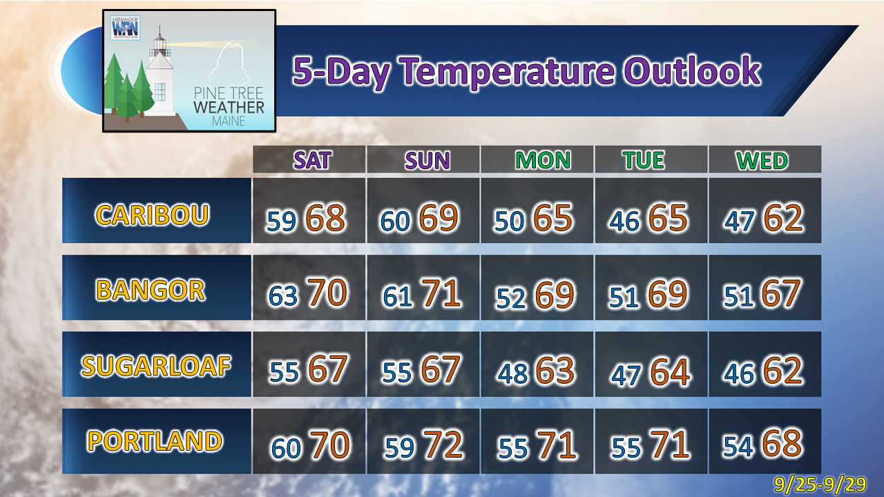 Be prepared to receive alerts and stay updated!
For more information in between posts, please follow Pine Tree Weather on Facebook and Twitter.
Thank you for supporting this community-based weather information source which operates by reader supported financial contributions. Stay updated, stay on alert, and stay safe! - Mike |

Mike Haggett
|