
Improvement late week While cool and gloomy, the rain is much needed. I know many folks are still struggling with water supplies, whether for personal or agricultural. While not a soaking stretch, what comes will help. Now that we are into October, this is typically the start to a more stormy period as cold air to the north works south. I don't have to remind you of the big storms the region had to deal with in Octobers past. Plan on at least one happening before we flip the calendar to November... and prepare for it. Pattern holds through the week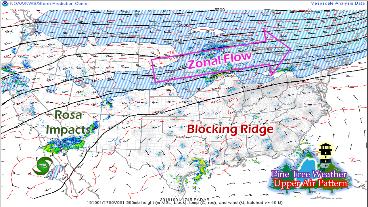 This upper air pattern pictured here from midday Monday has been rather steady over the past few days. While it will wobble north and south a bit, it won't change a whole lot through the end of the week. The region is the meat in the sandwich between the warm to the south and the cold to the north. 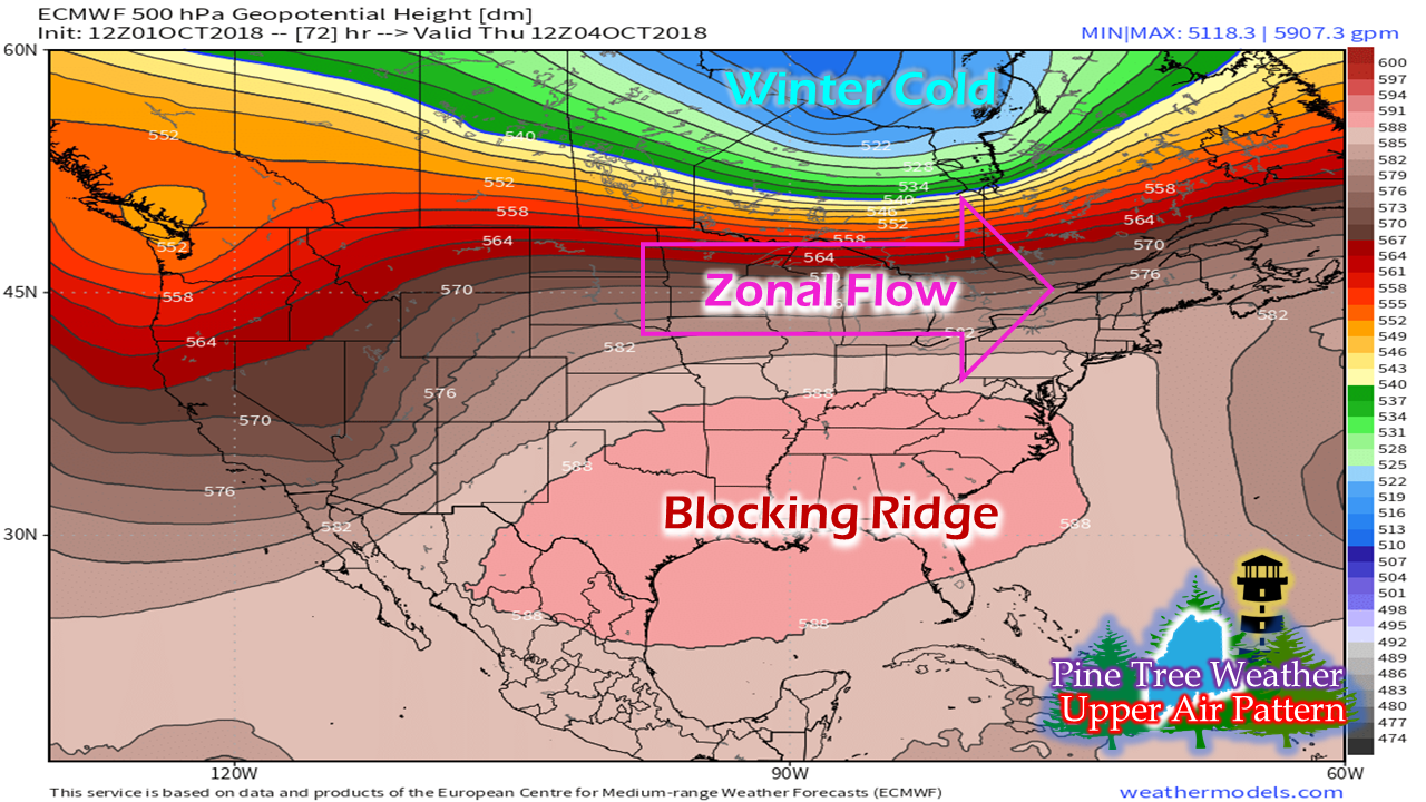 Fast forward to Thursday and it won't change a whole lot. The winter cold in the north will try to nose south, but the blocking ridge to the south keeps it in check. What is occurring is disturbances along the flow will continue to slowly erode the ridge over the coming week. The results are periods of unsettled weather, with a chance for storms of significance along the coast. Riding the boundary through the week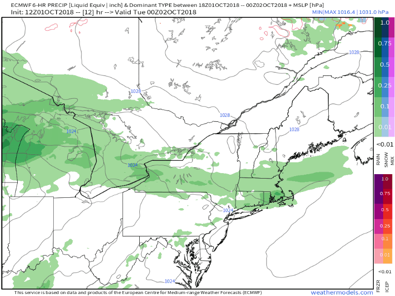 These west to east zonal patterns don't normally give the region much rainfall, but the boundary appears to be south enough for western and coastal areas to see some beneficial rainfall Tuesday into early Wednesday. Low pressure forming along the boundary near the Great Lakes could bring some enhanced shower activity Tuesday night into the wee hours of Wednesday. The region will have a bit of break Wednesday afternoon before a cold front arrives Thursday, but rain from that appears minimal as the boundary dissipates as it approaches the region. High pressure returns on Friday. The weekend appears at this point to start off dry, with northern and mountain areas potentially seeing showers on Sunday. 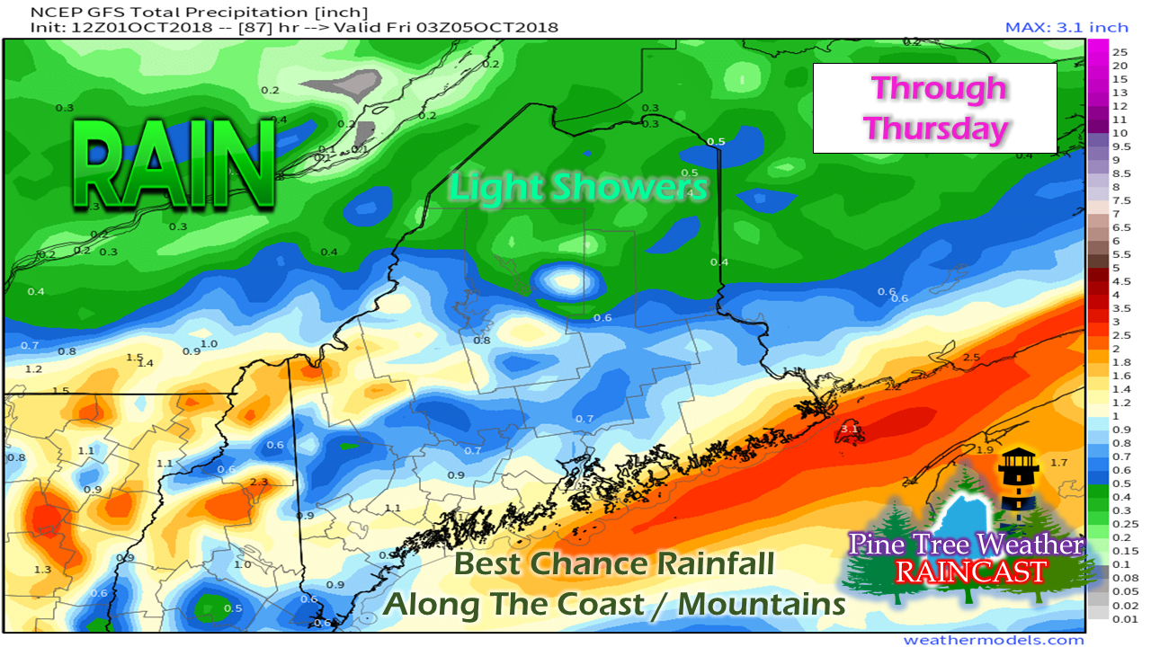 Conservative estimates on rain amounts indicate a half inch to one inch total from 8 AM Monday through late Thursday for much of the southern two-thirds of the state. Coastal areas and the mountains could over perform from this idea pending on track and intensity of the low Tuesday night into early Wednesday. Regional Outlook Through Saturday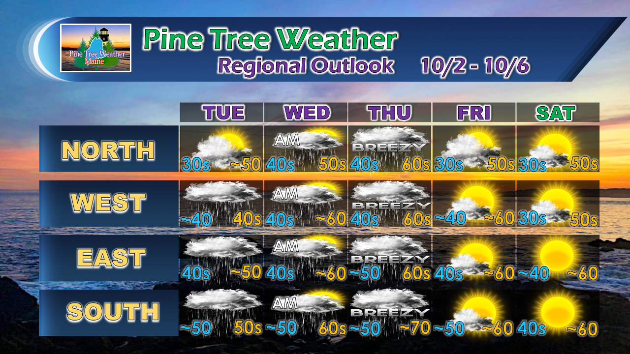 Our high temperatures appear cooler than normal for much of the period with the exception of Thursday. Overnight temperatures run above normal for southern areas through the period, with the rest of the state running at or below normal through Saturday. Stay Updated! For the latest official forecasts, bulletins and advisories, please check in with the National Weather Service in Gray for western and southern areas, or Caribou for northern and eastern parts of Maine.
For more information from me, please follow the Pine Tree Weather Facebook page and my Twitter feed. Thanks as always for your support! Please consider making a donation to keep Pine Tree Weather going. Check out the donate page on how to contribute. Always stay weather aware! - Mike |

Mike Haggett
|


