
One more round of showers to pass through Saturday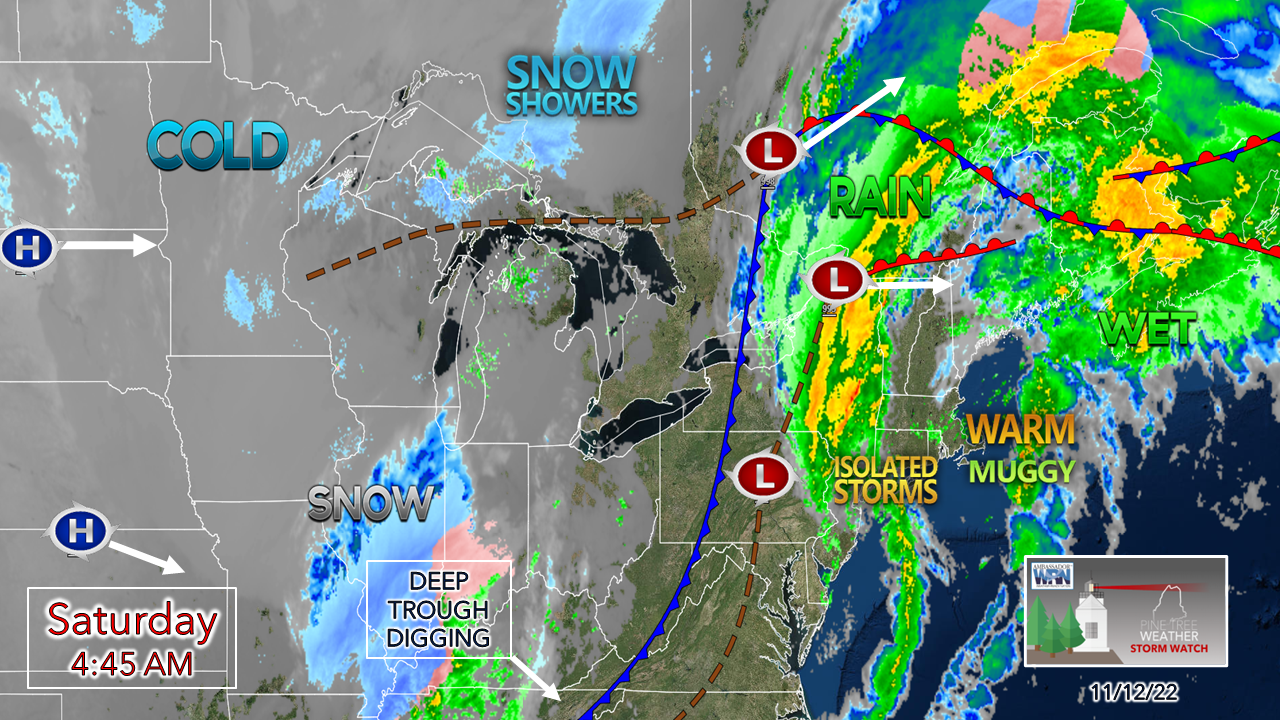 Many areas did very well with rainfall totals overnight with 1-2"+ observations reported along the coastal plain on up into the foothills, and another round to pass through. 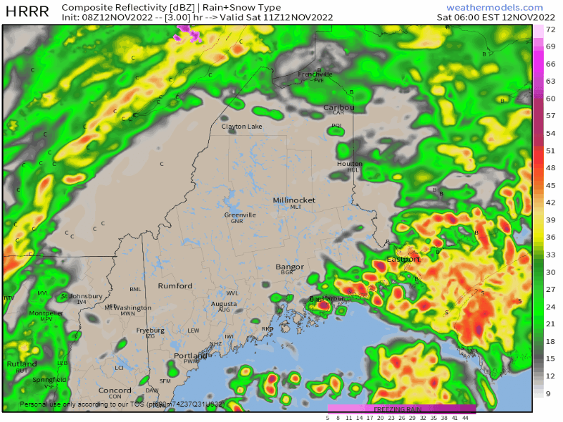 Saturday 6 AM to 4 PM - Many areas wake up being in the dry slot between what was left of Nicole and an approaching cold front from the west. A line of showers with a possible thunderstorm pass through the area rather briskly. Steady precipitation ends over the south and west by midday, north and east by mid-afternoon. 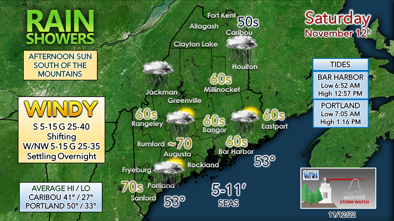 Records on the high and low end are likely to be re-written in several areas as the region deals with one last day of exceptionally warm temperatures for mid-November. Many areas will see sun this afternoon south of the mountains and north. A stiff breeze ushers in cooler air and falling dew points beginning Saturday afternoon and through the overnight. The breeze settles for a brief time by daylight Sunday morning. Another round of showers for Sunday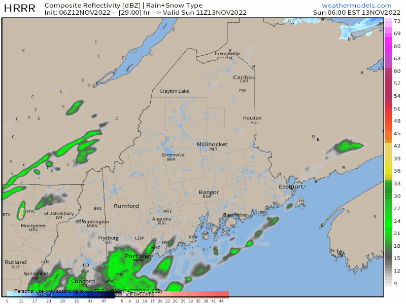 Sunday 6 AM to Monday 1 AM - An upper low situated over James Bay pinwheels a reinforcing cold front through the region Sunday into Sunday night. Expect a much cooler and damp day. The mountains have the best chance to see some snow showers as the colder air filters in behind the front, with little to no accumulation expected. Midweek snow chance for the mountains ebbs and flows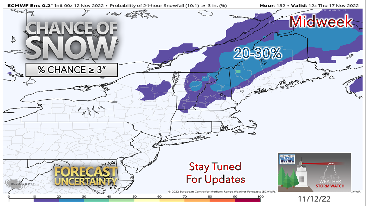 As I mentioned in Friday's update, the one thing working in favor of potential snow in the mountains is the cold air that will be around. I tread with caution here as there is always high bust potential for early season and late season snow events. At the very least, the ski hills will be able to make snow given the below freezing night temperatures, and hopefully pick up a bit of natural snow from what comes Wednesday. Coastal areas may see their first flakes of the season as well, but I don't expect any accumulation to be concerned with there at this point. Stay tuned! The future of Pine Tree Weather depends on you! Temperature outlook through Thursday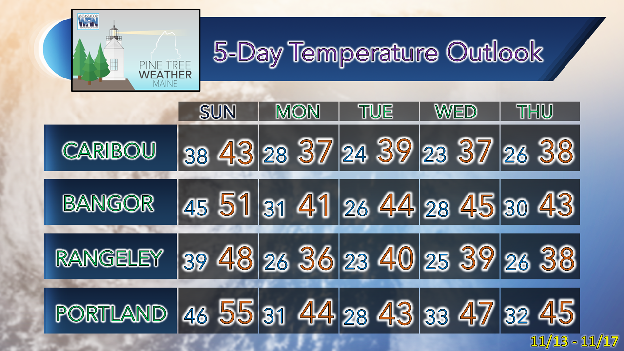 Thank you as always for your support! Stay updated, stay on alert, and stay safe! - Mike NOTE: The forecast information depicted on this platform is for general information purposes only for the public and is not designed or intended for commercial use. For those seeking pinpoint weather information for business operations, you should use a private sector source. For information about where to find commercial forecasters to assist your business, please message me and I will be happy to help you |

Mike Haggett
|


