
Conditional threat for severe storms As I mentioned here on Sunday, I will reiterate by mentioning again this is condition threat for severe storms. It's not a cut and dry set up here. While the cold front is sharp, clouds and inversion capping may steal the thunder, literally. 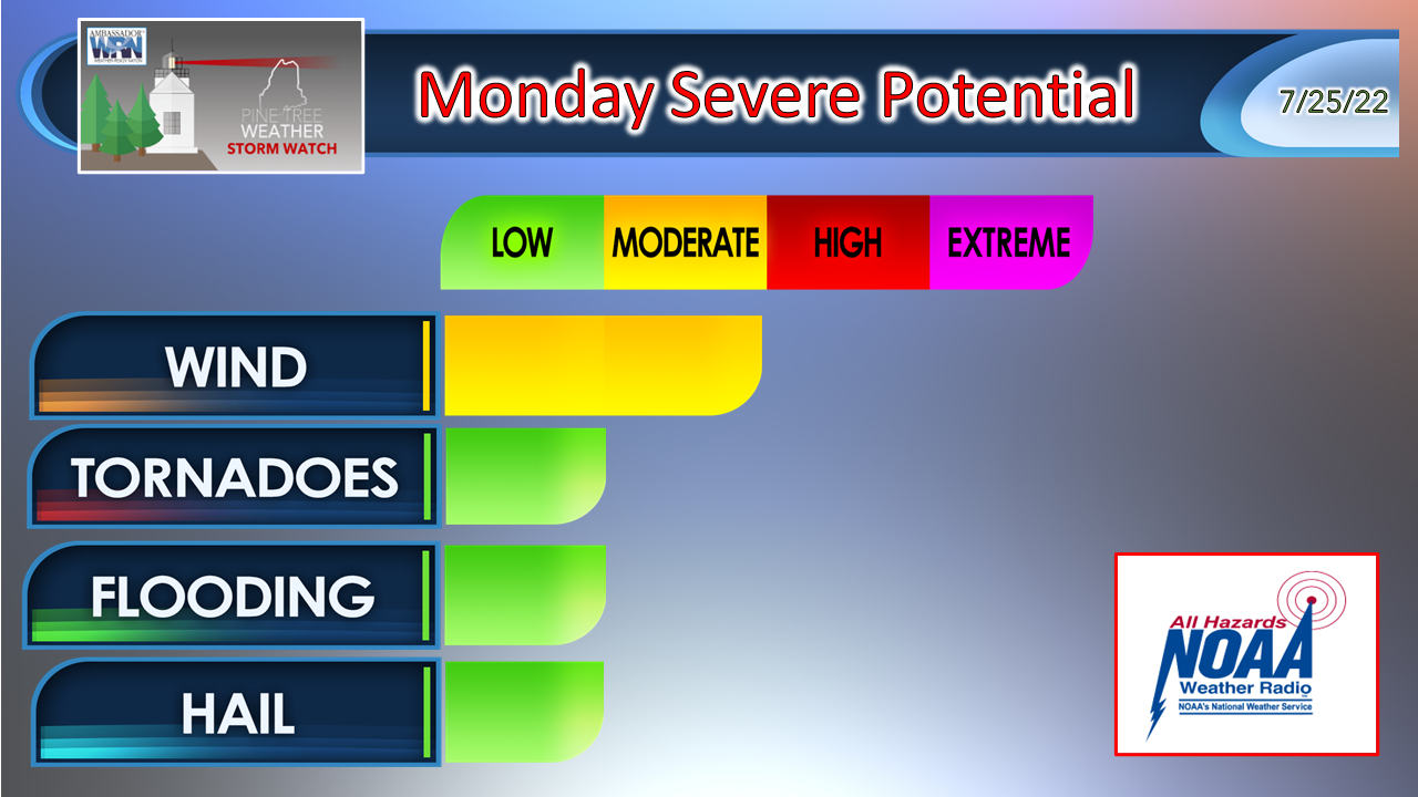 In order are the potential impact threats. You will notice that wind and tornadoes are the top two on the list. The potential between the two goes hand-in-hand given the shear and the potential for low level spin. While damaging wind is the most likely threat from any severe warned storm, as northern Maine experienced Sunday evening, that escalated quickly. Flash flooding from torrential rain associated with the potential training of storms is also a possibility. While hail is at the bottom of the list, it could turn into a threat pending how the day evolves. If the sun comes out Monday afternoon, a scene like this one from the same tornadic called storm in northern Maine Sunday evening is a distinct possibility where hail upwards of 2" fell in Eagle Lake. The bottom line here is when a tropical airmass such as the one over the region gets pushed by a sharp frontal boundary, it won't go down without a stiff fight... unless the clouds takes the steam out of it. 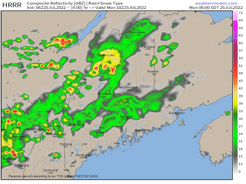 Monday 6 AM to 9 PM - Any storms that form over the region Monday mid to late morning could be strong if not severe. It is the outcome of that first wave and what cloud debris remains from it that sets the table for the second wave that passes through later in the afternoon. If the sun comes out, look out. Storms could form quickly and get out of hand. This is where the primary threat for damaging wind, tornadic activity and hail exists. If the clouds hold serve, heavy rain showers are possible with some rumbles The threat ends between 7-9 PM as the front clears DownEast areas. 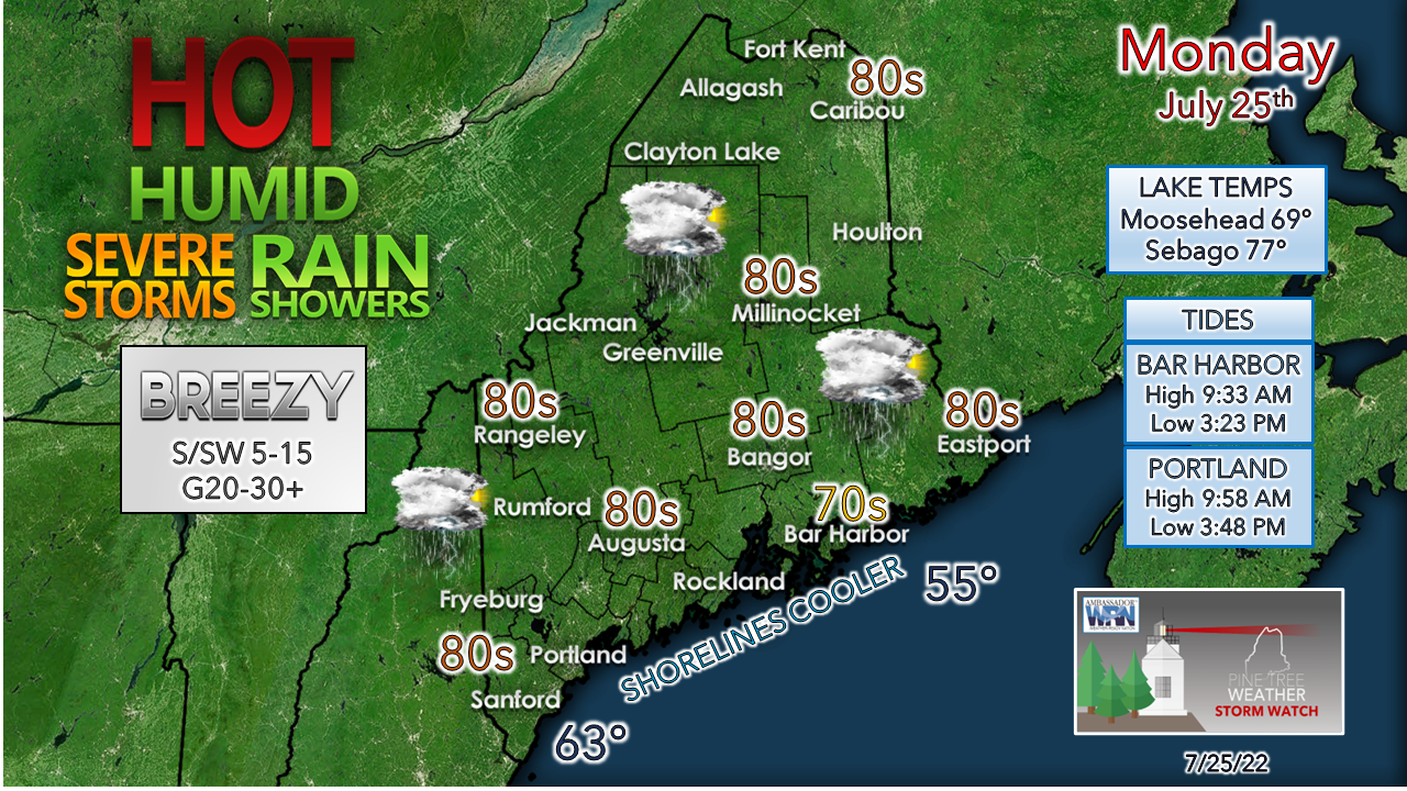 The day won't be as warm, at least figuratively, as Sunday was. It may not feel that much different given the humidity around. Areas that get rain in the morning will get steamy if the sun gets out. That steam provides more high-octane atmospheric gas to the storm threat in the afternoon. Expect the breeze to get stiffer as the frontal boundary approaches. 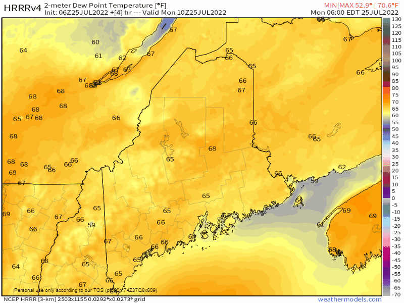 Monday 6 AM to Tuesday 6 AM - How do you spell relief from this ghastly humidity? C-O-L-D-F-R-O-N-T. Interior areas should be able to open up the windows before bed as a northwest breeze ushers in lower dew points. Coastal areas get relief overnight. Hopefully everyone gets a good night's rest for the first time in days. Live updates continuing all day from 8 AM to 5 PM Outlook through SaturdayTuesday and Wednesday will feel like heaven after the past few days. An upper low over St. James Bay brings the threat of showers back into the forecast to round out the work week. Next weekend appears dry with manageable humidity levels. 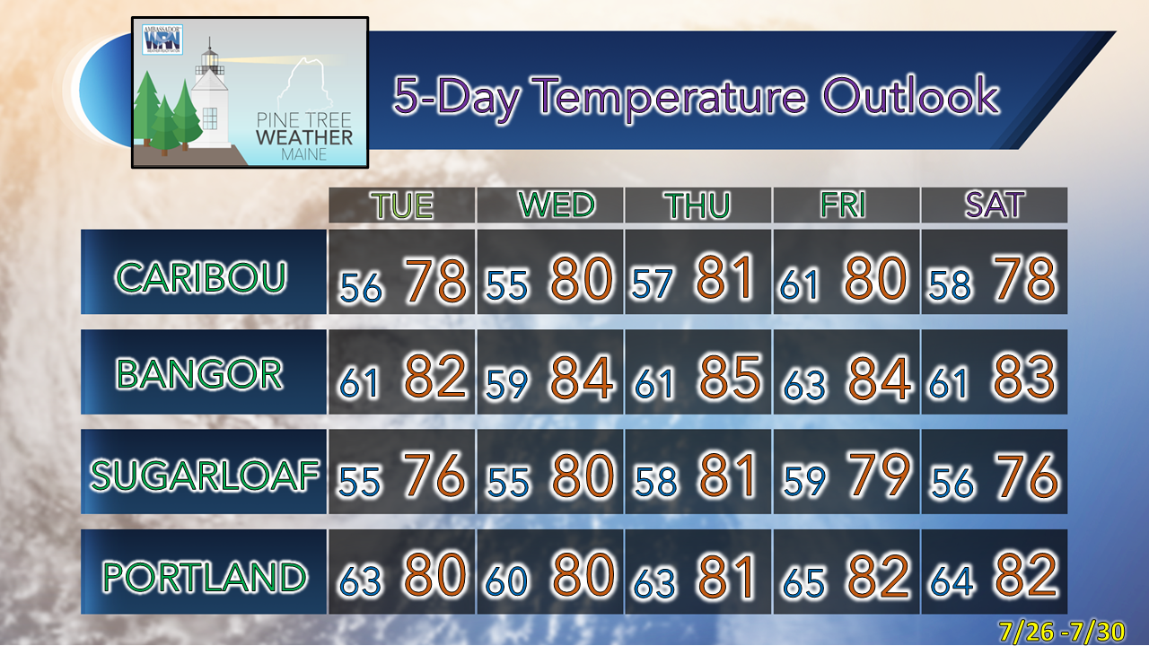 Thank you for supporting this community-based weather information source which operates by financial contributions from people like you. Stay updated, stay on alert, and stay safe! NEXT UPDATE: WEDNESDAY - Mike NOTE: The forecast information depicted on this platform is for general information purposes only for the public and is not designed or intended for commercial use. For those seeking pinpoint weather information for business operations, you should use a private sector source. For information about where to find commercial forecasters to assist your business, please message me and I will be happy to help you. |

Mike Haggett
|


