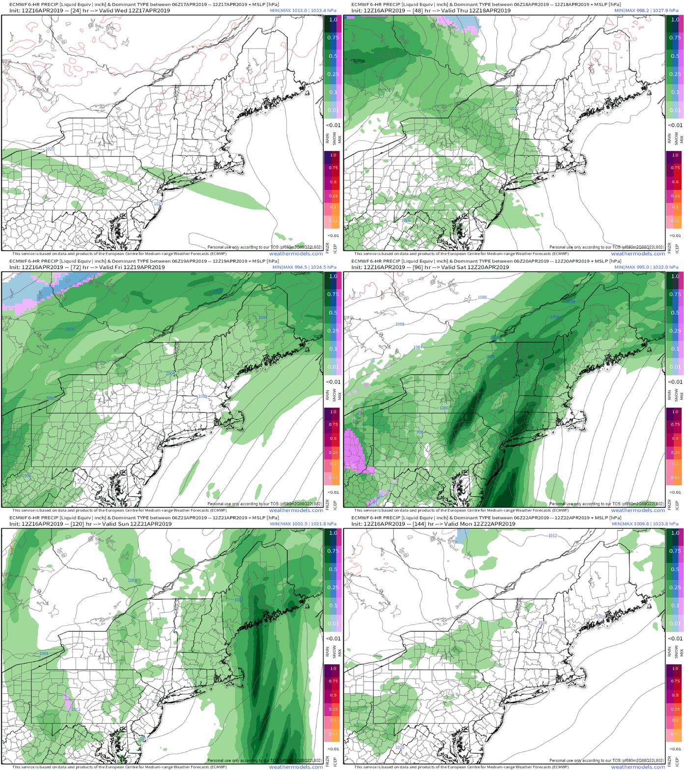
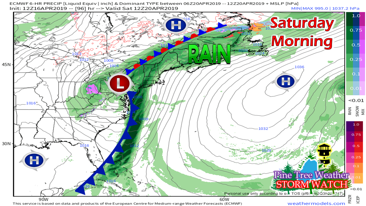
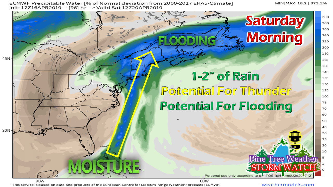
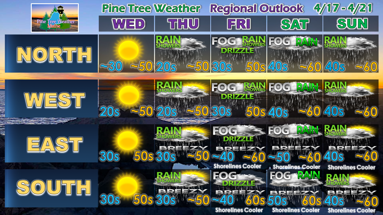
Status updateThanks again to those who have sent messages of support for my family as we dealt with another loss of a family member. It's always great for me to get back into forecasting, not only for the challenge of it, but for your words of appreciation and encouragement. This is a wonderful community that continues to be built here, and it makes it easy for me to take the time to do this as a result. April showers bring...Naturally, the first thought to that phrase would be "May flowers", and yes, those are coming. We'll have to deal with mud and flooding before we get to that, however. After a beautiful day on Wednesday, the rest of the week looks dreary. There is a chance for shower activity Thursday, Friday and Sunday. Steady rain could be had by all areas on Saturday, and that is where the flood concerns return as we head into next week. This is the spring thaw. It's here. Saturday the main focusAfter a winter dominated by clipper systems and Colorado lows, we're headed into the long wave frontal boundary pattern. Yet another sign that spring has arrived, even to the far north. Anytime we have these long wave fronts, there is moisture that feeds up from south along the boundary. That tropical hose has a tendency to bring a decent amount of rain, and this one is no different. Along with it comes mild temperatures, a chance for thunderstorms, and downpours. Guidance indicates that the region could see 1-2" of rain from this event, as it stands for now. Between temperatures around 60°, fog, and the water falling from the sky, there is potential for flooding due to run off from snow melt. It may have been a blessing that the storm Sunday night into Monday helped get the process going. A few rivers reached flood stage with that event. The melting will slow down through Thursday, thanks to some chilly nights, and then will gradually increase as we head into the weekend. For those who live in areas where the ground is still frozen, you'll want to check your sump pumps to make sure those are functioning properly, and make sure your basement is prepared in case of flooding. For those traveling around tributaries, remember that if you come across a flooded roadway, TURN AROUND, DON'T DROWN. Outlook through Easter► ► For the latest official forecasts, bulletins and advisories, please check in with the National Weather Service in Gray for western and southern areas, or Caribou for northern and eastern parts of Maine.
► ► Your financial donations are much appreciated to keep this site funded and for further development. I sincerely appreciate your support not only financially, but also in sharing my efforts with others. Always stay weather aware! - Mike |
Mike Haggett
|


