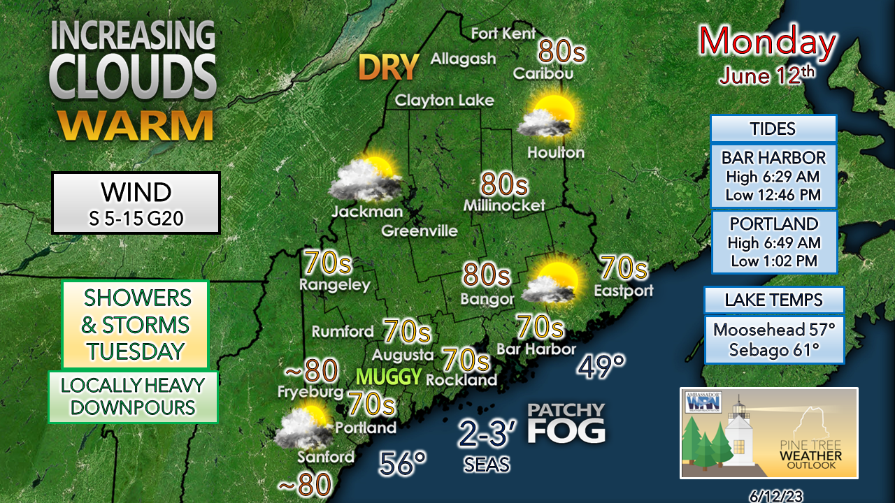
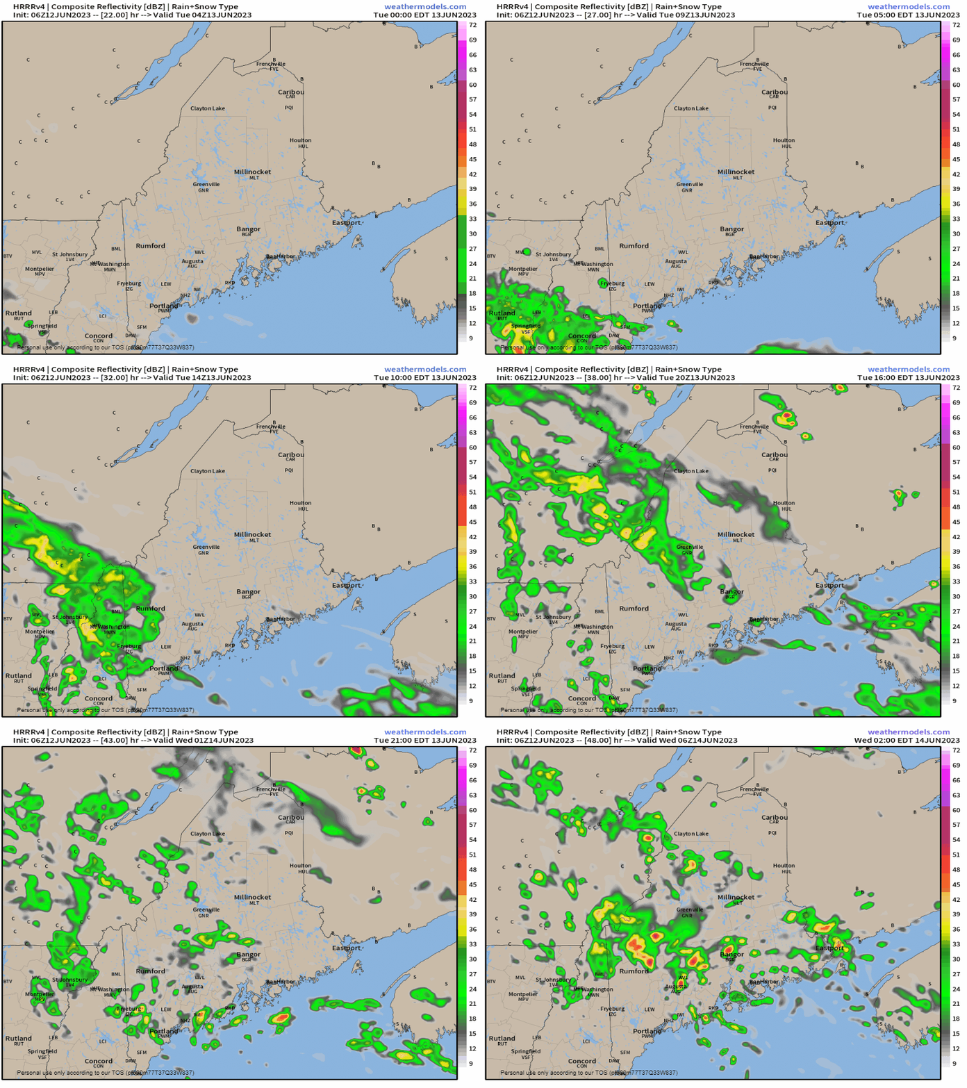
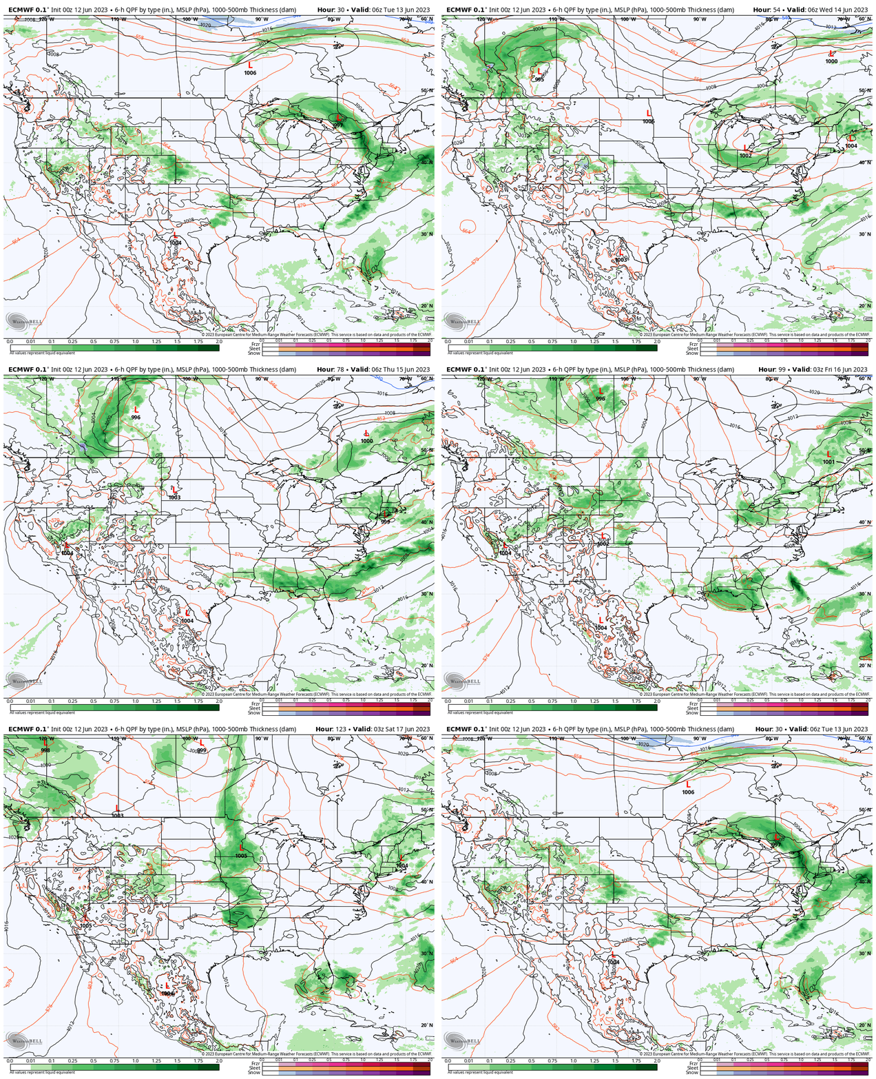
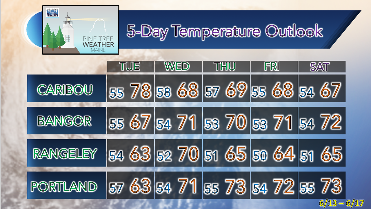
Clouds and humidity increase to start the weekHigh pressure has slid off to the east and southerly wind flow sets up for the day. This will keep the shorelines on the cool side and raise dew points into the 60s and bring a taste of the humidity over southwestern areas. Northern areas have a better chance of seeing warmer temperatures due to less cloud cover. Outflow from the approaching warm front may pop up an isolated sprinkle or light shower, but that is about it for rain chances for the day. With the dew points on the increase, there is fog potential along the coast. Warm front moves through TuesdayTuesday midnight to Wednesday 2 AM - Showers arrive over southwestern areas by daylight Tuesday morning. The front advances to the northeast during the day and spread scattered showers and storms through the state into the afternoon and will continue into Tuesday night into the wee hours of Wednesday. While the threat of severe storms is minimal, locally heavy downpours due to the increase of humidity are possible, and may cause poor drainage flooding, water on the roadways, and poor visibility. Outlook through SaturdayTuesday 2 AM to Saturday 8 PM - A parade of cut-off upper lows keeps the threat of showers and storms in the forecast throughout the period. Wednesday appears the driest for now, but with the upper-low overhead there is the risk of isolated showers and maybe a storm. Thursday sees shower and storm chances increasing once again as another upper low spins climbs on the back of the one already over the region. Those two lows combine and spin overhead through Saturday. Yet another upper-low takes shape over the Great Lakes on Saturday and may bring shower activity to the region for Father's Day on Sunday. Pine Tree Weather is funded from followers like you. I would appreciate your financial support. Click here for how you can contribute. You may not like the weather, but I hope you like what I do, and support my efforts. Thank you! Stay updated, stay on alert, and stay safe! - Mike NOTE: The forecast information depicted on this platform is for general information purposes only for the public and is not designed or intended for commercial use. For those seeking pinpoint weather information for business operations, you should use a private sector source. For information about where to find commercial forecasters to assist your business, please message me and I will be happy to help you. |
Mike Haggett
|

