A cloudy and muggy day on tap for Tuesday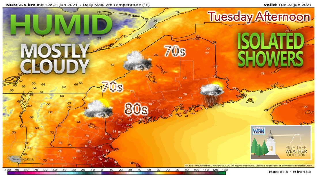 Cloudy skies are likely during the day Tuesday with the chances of some isolated showers. Skies likely clear out through the rest of the work week, with the next chance of clouds and showers not being until next weekend. The cold front that approached the region Monday bringing storms to the mountains will continue to slowly push its way through the state during the day on Tuesday. Thanks to this, clouds will likely linger throughout much of the daytime on Tuesday. Southwesterly winds during the morning hours Tuesday will help to keep the muggy air in place during the day, as dew points across the state likely climb into the upper 60s and lower 70s before the front passes through the state. Once the front has passed during the late afternoon and evening, dewpoints likely drop into the 40s heading through the overnight hours. As the front passes, the eastern part of the state likely has the best chance of seeing showers heading into the evening hours Tuesday. Tropical Storm Claudette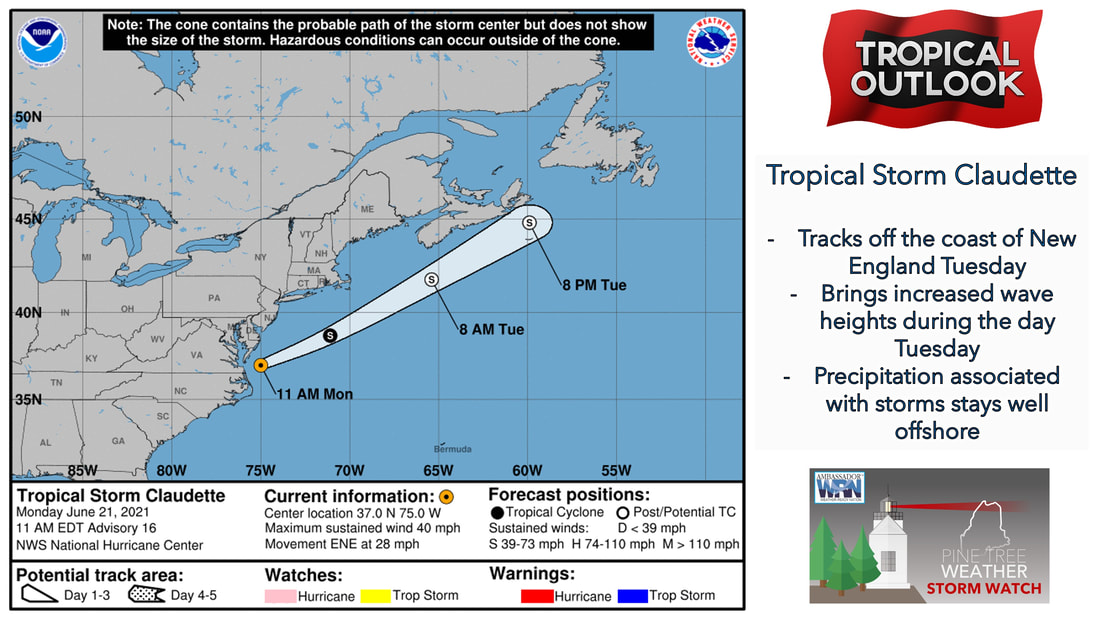 As Tropical Storm Claudette continues to make its way to the north and east during the day Tuesday, the cold front that likely works through the area will help to keep any precipitation from Claudette away from our area and keep the storm out to sea. While the majority of the state needs a good soaking rain from a tropical system, it doesn't look like Claudette will be that relief. The bigger concern for us from Claudette will likely be the conditions on the water that are seen because of the system offshore. Swells and rip currents appear to be the biggest risk at the moment, so make sure to check with local lifeguards and NOAA forecasts when heading out to the beach over the next few days. A break from the heat and humidity Wednesday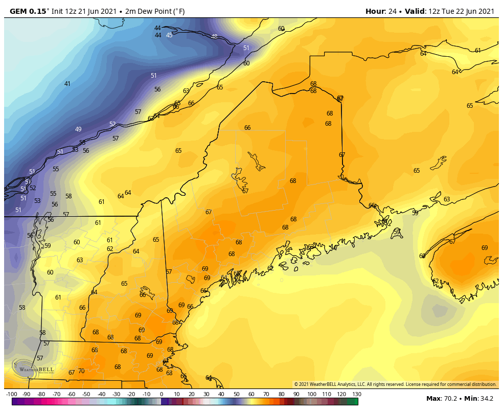 Northwesterly winds Tuesday night into Wednesday will likely bring in cooler and drier air into the region for the rest of the week. By Wednesday morning, dew points likely will be in the 40s for most places across the state. They likely remain in the 40s throughout the day Wednesday, before we see the possibility of them creeping up into the 50s during the afternoon Thursday. 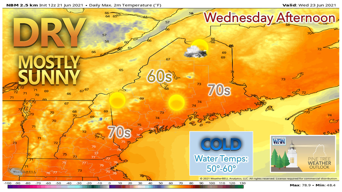 With the cold front well off the coast by Wednesday morning, most of the state likely remains mostly sunny throughout the day Wednesday. The drier air combined with the sunshine lets temperatures climb back into the upper 60s through the mountains and far north, to lower to mid 70s elsewhere. Northwesterly winds could be breezy at times during the day on Wednesday, helping to make it feel more like a late spring day outside. High pressure in charge through Friday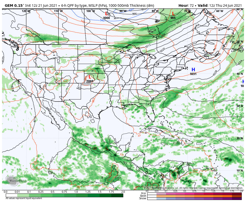 Throughout the rest of the week high pressure sets up to our south and west, keeping us dry and quiet through the end of the week. As the high pressure slides off to our south and east, winds become more southwesterly heading into Thursday and Friday. While this will help to bring in warmer air for those days, the humidity doesn't return with the warm air. Temperatures are expected to climb into the mid 70s heading into Thursday, with some places reaching the lower 80s for high temperatures by the time we get into Friday. 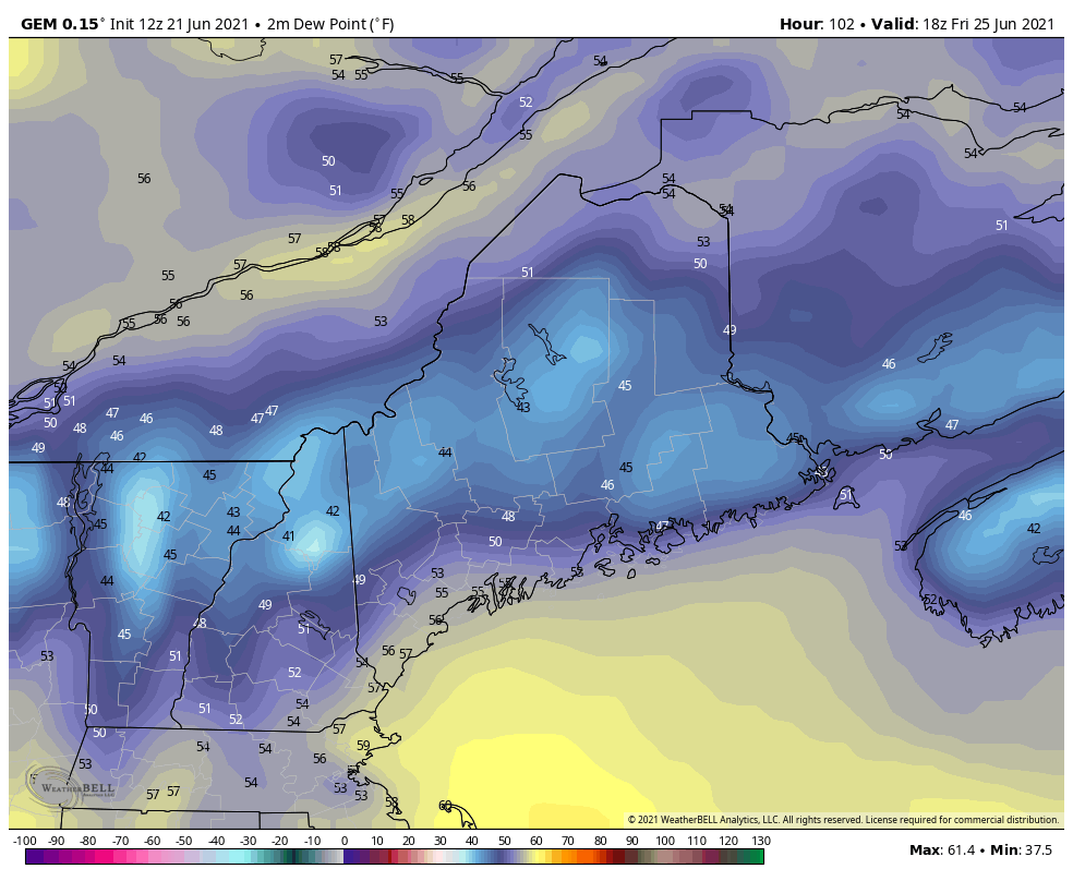 Once Saturday arrives, the high-pressure system is offshore enough to help pump in more humid and muggy air into our region for the weekend. This will cause dewpoints to rise into the mid to upper 60s during the day on Saturday, with some locations by Sunday seeing dew points close to 70. With the warmer and more humid air comes another risk of showers moving into our area. At this point it looks like the main event will hold off until Sunday with the passage of a cold front. We'll have a better idea on the timing of this front as we get closer to the weekend. Temperature outlook through next ThursdayIf you're not a fan of heat and humidity, you'll want to get outside and enjoy the second half of the week with temperatures below average in some spots for the day Wednesday, before climbing to be slightly above average by Thursday and Friday. Once we get into the weekend and into early next week, both low and high temperatures are expected to be above average, with that lasting through the better half of the work week. 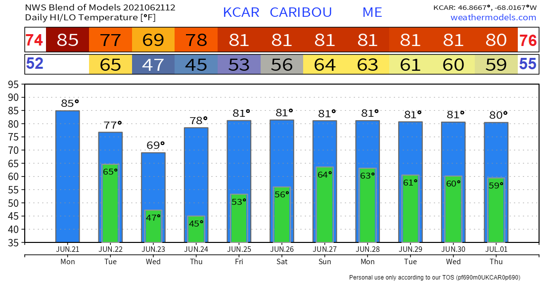 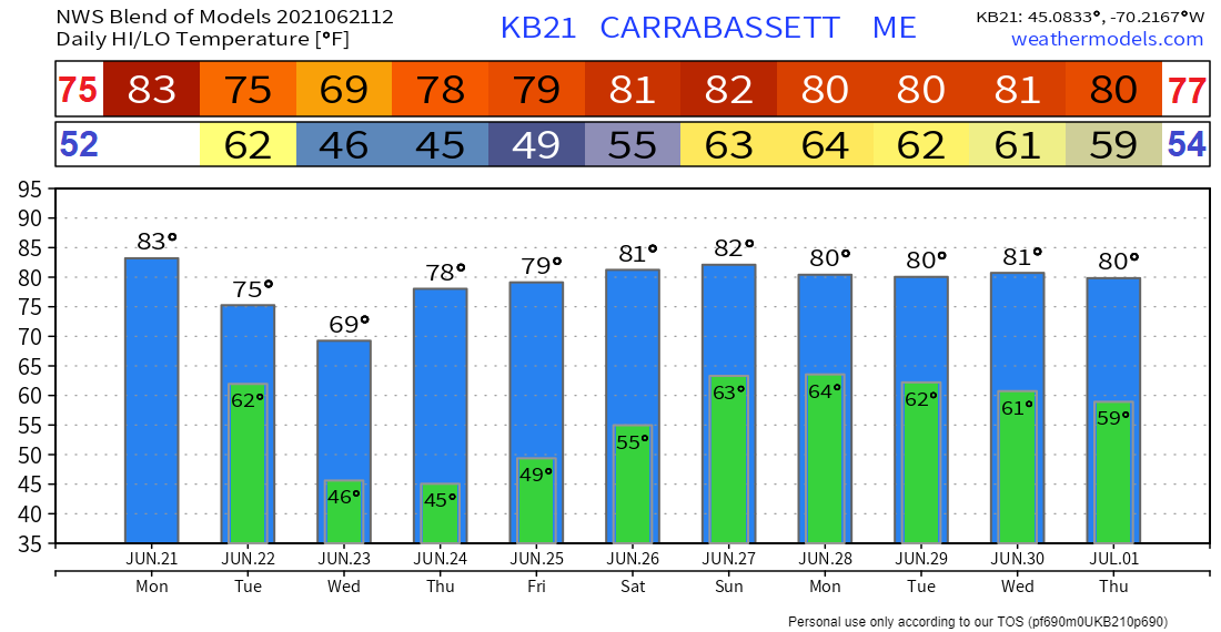 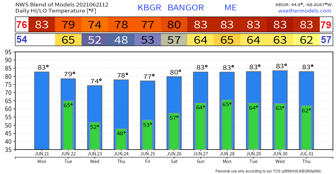 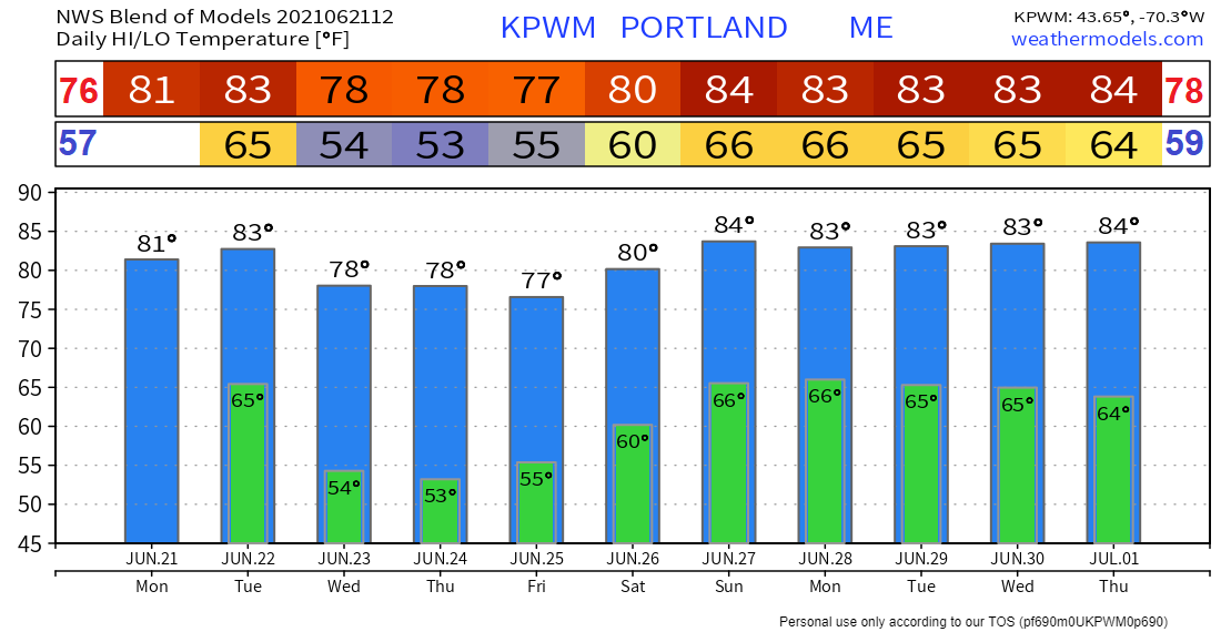 Heat Index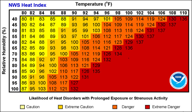 Did you know the air temperature can actually feel hotter than what the thermometer reads? The Heat Index is a measure of how hot it really feels when relative humidity is factored in. To find out how hot it feels, you can use the pictured chart or the Heat Index calculator found at: weather.gov/safety/heat-index Be prepared to receive alerts and stay updated!
For more information in between posts, please follow Pine Tree Weather on Facebook and Twitter.
Thank you for supporting this community-based weather information source which operates by reader supported financial contributions. Stay updated, stay on alert, and stay safe! |

Mike Haggett
|