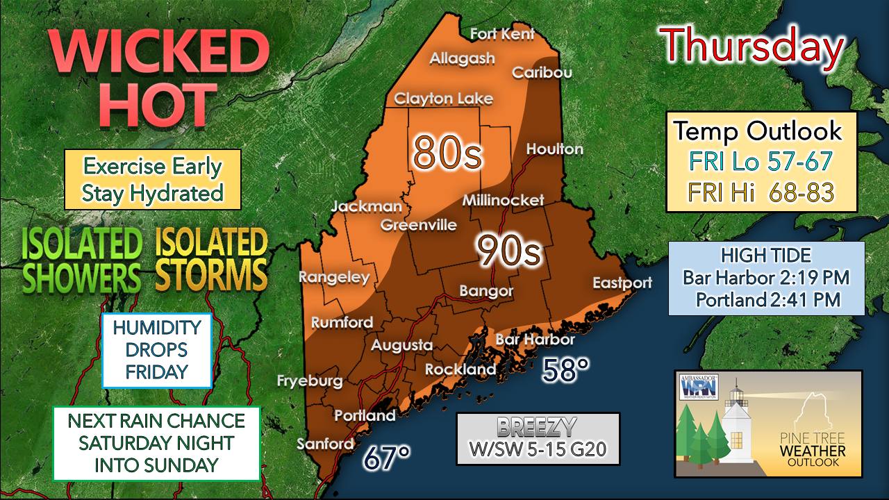
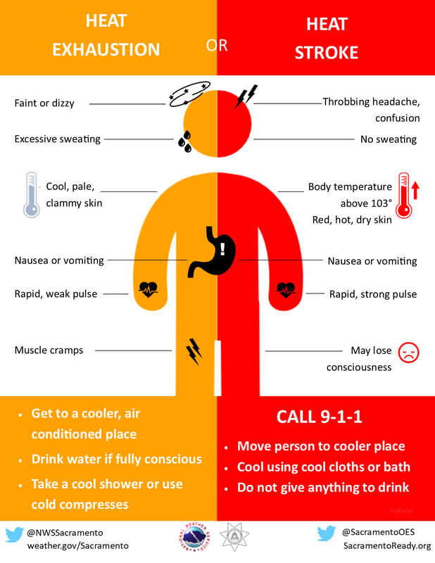
Do your best to stay coolHeat advisories are posted throughout much of the state as ambient temperatures climb well into the 90s and may come close to 100° over interior southwest areas today. Dew points continue to run juicy in the upper 60s to low 70s. Do everything you can to stay cool, hydrated, and protect yourself from the heat. If you are working outside, take frequent breaks in shade or air conditioning. Exercise early if you can. If you are headed to the ocean for relief, please note the high tides and plan your perch appropriately as space will run out by the high heat point of the day. A W/SW breeze favors cooler temperatures for MidCoast and DownEast shorelines. An outflow ahead of a pre-frontal trough drops down from Quebec Thursday morning which may bring some showers and storms to The County. As the pre-frontal trough comes in at a NNW / SSE trajectory in the afternoon, this could touch off isolated showers and thunderstorms. While there is abundant convective energy, wind shear is very poor, so any widespread activity not expected. Any severe storms that do develop could bring damaging wind and torrential downpours. The best chance for activity is in the mountains and north, with the risk diminishing closer to the coastline. Most shower / storm potential ends by early evening. The main cold front passes through Thursday night, and as it does dew points begin to drop. The shift of wind to the northwest ushers in cooler, drier air. The mountains and north feel the relief by Friday morning, Bangor / western foothills by mid to late morning, Portland area by early afternoon, and coastal York County by mid to late afternoon. Friday night will be a wonderful evening to open the windows and rest well with dew points in the upper 40s to low 50s. A look at the weekend shows a mix of sun & clouds around for Saturday, with high pressure keeping the heat to the southwest. There has been some difficulty with guidance being consistent with how far to the southwest the ridge will be. At this point, the day appears mainly dry, but I will pencil in a chance for a late afternoon shower for extreme western and southern areas. We'll experience temperature whiplash as the highs for the day range in the upper 60s to low 70s. By Saturday night, high pressure moves to the east, and the ridge begins to creep northeastward. A weak area of low pressure brings some showers to western and southern areas Saturday night into Sunday. Northern areas appear to be the warmest in the 70s with some sun, southern and western areas coolest with the chance for showers and in the 60s. Heat SymptomsDuring hot and humid weather, your body's ability to cool itself is challenged. When your body heats too rapidly to cool itself properly, or when too much fluid or salt is lost through dehydration or sweating, you may experience a heat-related illness. Learn the symptoms of excessive heat exposure and the appropriate responses. weather.gov/safety/heat-illness Be prepared to receive alerts and stay updated!
For more information in between posts, please follow Pine Tree Weather on Facebook and Twitter.
Thank you for supporting this community-based weather information source which operates by reader supported financial contributions. Stay updated, stay on alert, and stay safe! - Mike |
Mike Haggett
|


