Tonight will be another refreshingly cool and crisp night with most experiencing lows in the low 40s to low 50s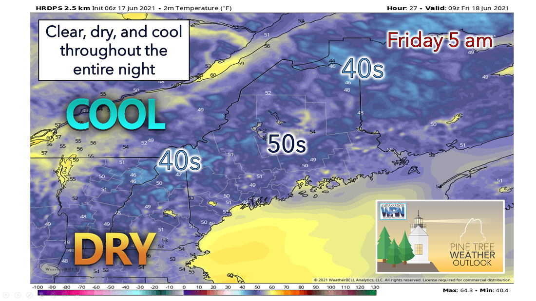 High pressure begins to build in during the day today and into the overnight hours for our Friday. With a dry airmass present over the region, dewpoints will be in the 30s and 40s. This will allow for low temperatures to easily drop into the low 40s - 50s across much of the region and possibly reaching the high 30s in some outlying areas. Conditions will remain dry enough to prevent overnight fog from forming, so a clear calm cool night will be the main story. Warmer air moves into the region as southerly flow increases during the day A warming trend is expected to take place on Friday as high pressure moves in from the south. High temperatures are expected to climb and reach the upper 70s and low 80s for most of the area. The exception will be the mountains and coastal regions. These areas will likely start the morning cooler and onshore flow will develop later during the day, thus limiting highs. Dewpoints will also begin to increase but only into the lower 50s, so we do not have to worry about any mugginess. Increasing clouds late Friday afternoon as a front starts to approach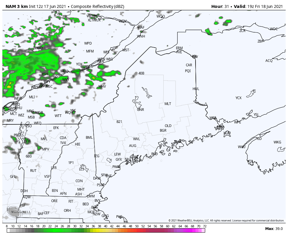 By late Friday afternoon, we will see an increase in clouds as a front begins to approach from the west. There is a possibility for a shower or two up north with the upper-level low tracking along the Ontario/Quebec border. Any showers will hold off until late Friday night or Saturday morning. Saturday will be warm and more humid with the chance for showers and thunderstorms as a cold front approaches. Some storms on Saturday may become strong to severe so keep that in mind if you are making any weekend plans! Diurnal heating will allow for convective activity during the afternoon and evening. The storm prediction center as of today is suggesting some of these storms may produce damaging wind gusts and hail, stay tuned for more updates tomorrow and over the weekend! 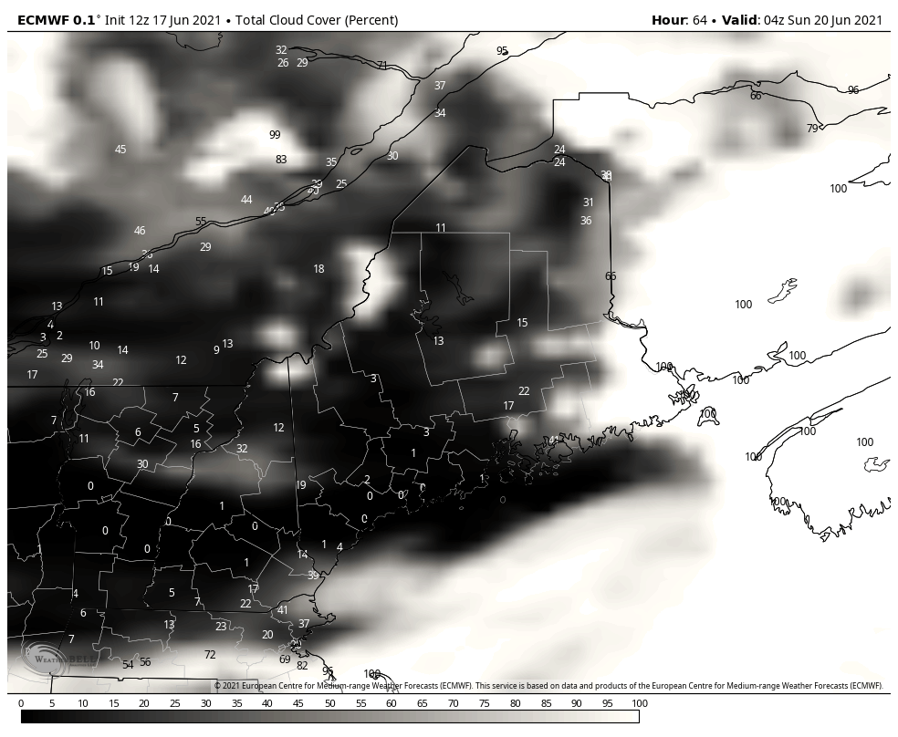 Any storms and showers should clear out in time for Father’s Day on Sunday with mostly sunny skies. Father's Day will still be warm with high in the 70s to the north and low to mid-80s across the south and interior regions. Isolated showers are possible in northern areas on Sunday in the morning hours, but most appear to stay dry. Sunday also marks the Summer Solstice, the longest day of the year in terms of daylight. A ridge of high pressure will likely build in beginning later Sunday into Monday. This will allow for highs to potentially reach the high 80s and lower 90s by Monday and into early next week. Drought monitor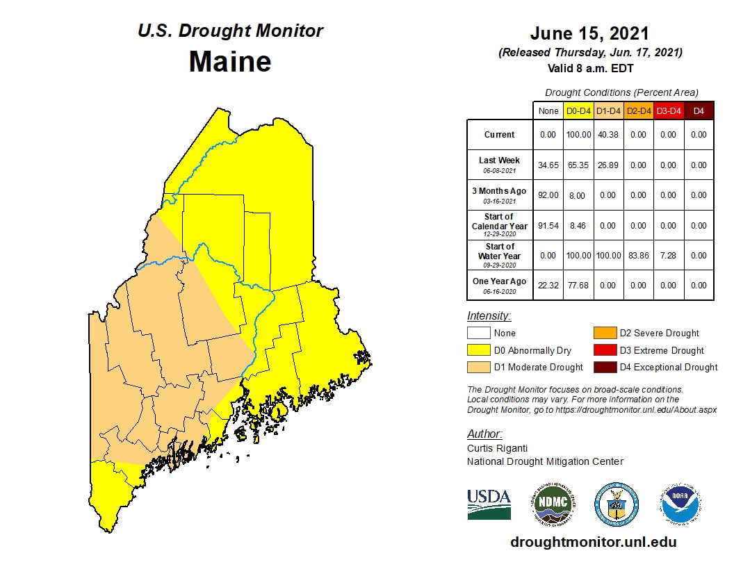 Conditions remained the same or worsened for most of northern New England. For Maine, widespread degradation to moderate drought and abnormal dryness occurred. Now 40% of Maine is in a moderate drought with the rest of the entire state abnormally dry. Check back next Thursday for an updated drought monitor! 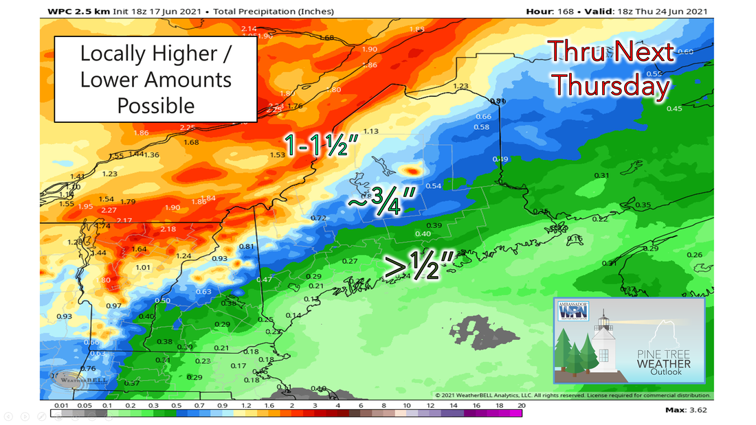 The image above shows precipitation amounts through next week. Much of the state is only expecting to get ½ to ¾ inches of rain (locally higher/lower amounts possible). The rain chances will mostly come from thunderstorms on Saturday as well as another storm system approaching next Wednesday and Thursday. Any rain we get will still be near or below average for this time of year which is not good news for our drought situation. Rain at this point is beneficial but it does not appear we will receive enough in the short term to damper the drought effects we currently face. Temperature outlook through the end of JuneThe plots below show the trend of the high and low temperatures for Carrabassett, Bangor, Caribou, and Portland over the next week and a half. Seasonable temperatures remain for Thursday, but a warming trend begins on Friday. Many areas will reach 80+ degrees to start the next work week and remain above average. 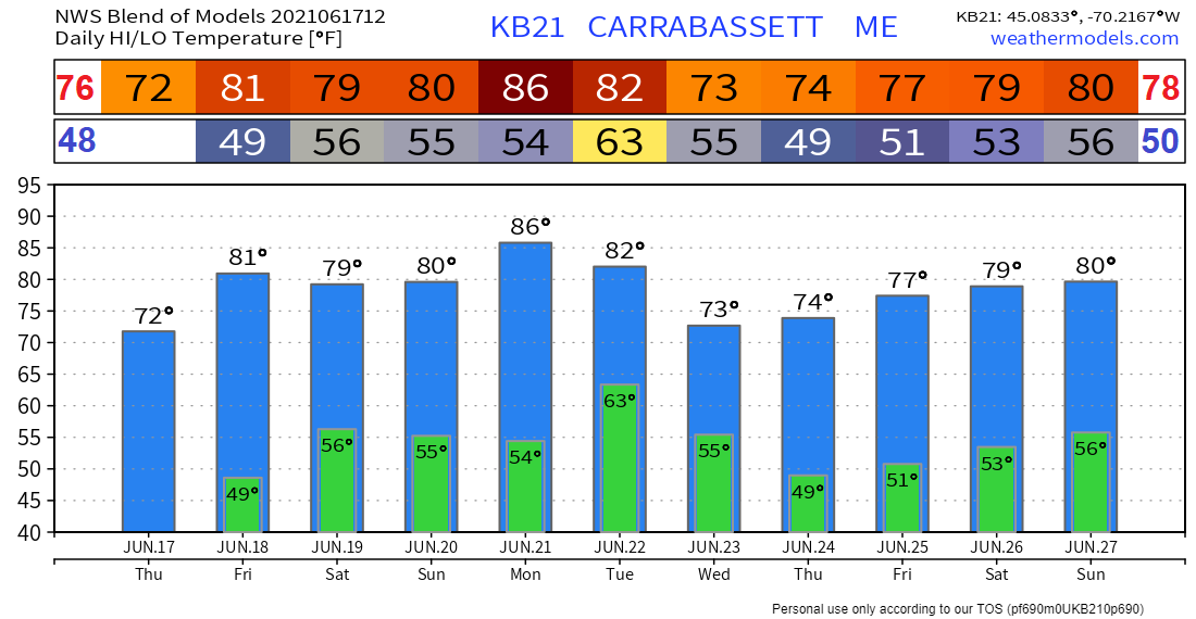 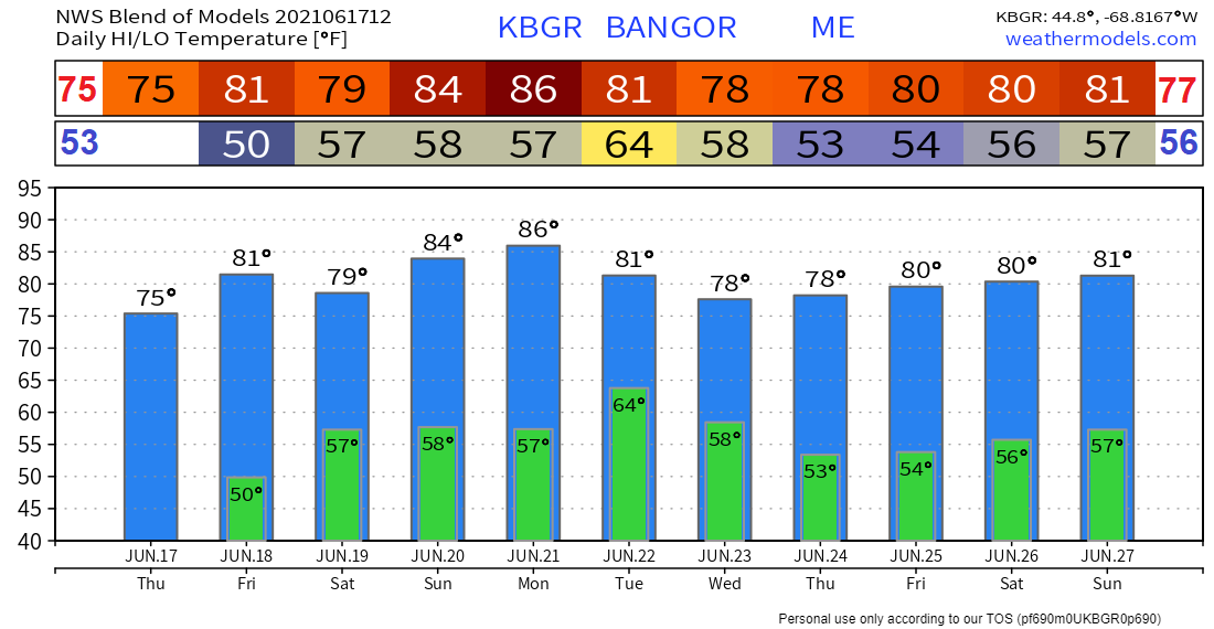 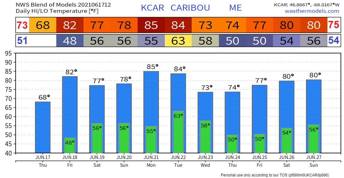 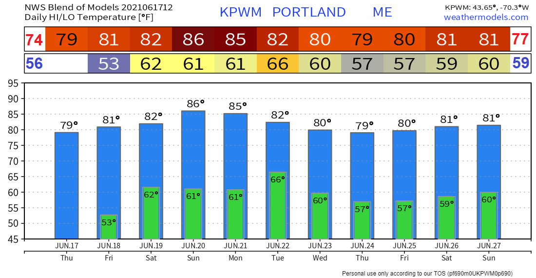 Wildfire safety Wildfires are common disasters that can spread quickly, particularly during dry conditions. Preparing plans in advance can help workers get to safety before a wildfire impacts an area and can also help protect personal property. Having an evacuation plan in place before a wildfire occurs can help avoid confusion and prevent injuries. Here are some safety tips to help keep you safe during the summer weather.gov/safety/wildfire Be prepared to receive alerts and stay updated!
For more information in between posts, please follow Pine Tree Weather on Facebook and Twitter.
Thank you for supporting this community-based weather information source which operates by reader supported financial contributions. Stay updated, stay on alert, and stay safe! |

Mike Haggett
|