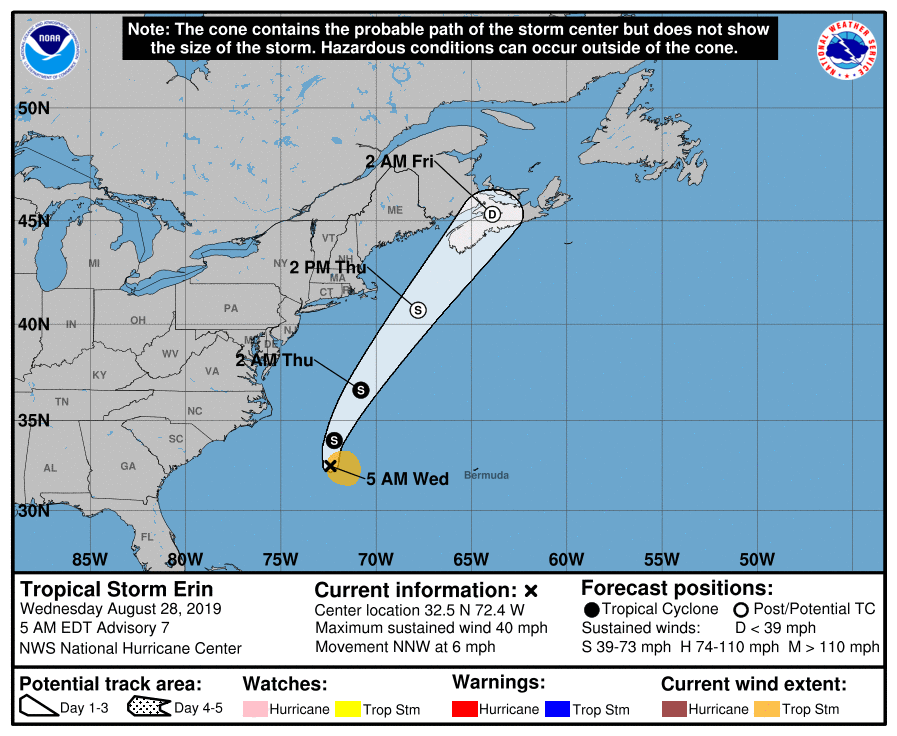
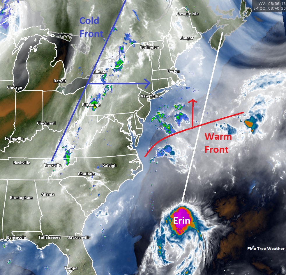
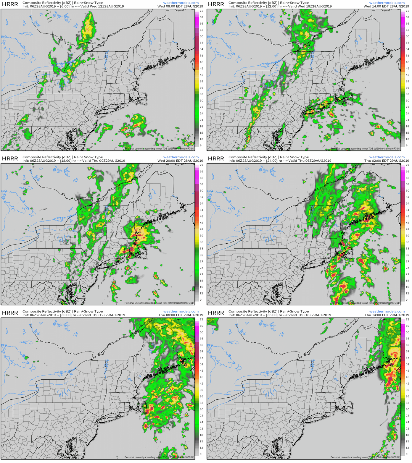
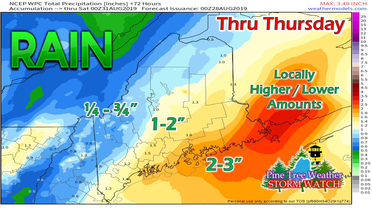
A good soaker on the way for much of the regionI want to make this clear, Maine is NOT going to take a direct hit from a tropical storm. Maine will get moisture effects from Erin, for sure. The gusty winds and storm surge will stay well to the east. The approaching cold front will make sure of that. The main concern with what is coming, is rainfall. The coastal plain into the foothills of the state is under a flash flood watch. It will be a soggy night into Thursday for southern and eastern zones. As of the 5 AM advisory, Erin is a low end tropical storm. It may strengthen a bit today, but then weaken as it transitions into an extra-tropical cyclone. The wind field is rather narrow with this storm. It may bring a bit of a breeze to DownEast areas as it passes by into Nova Scotia Thursday night, but there is no concern. The waves from Erin may make things a bit rough on the coast, and could bring some decent surf for a time Thursday into Friday. Warm front moves north as cold front moves eastOutflow moisture ahead of Erin is what the main concern is for Maine. A warm front heads northward which brings tropical moisture and high humidity. It appears that the warm front will stall around the Portland area this evening before being pushed out to sea by the cold front. With all the moisture around, it's a safe bet that much of the coastal plain will be in for a sticky night. Erin will run along the frontal boundary into Nova Scotia Thursday afternoon into Friday night and dissipate as its moisture heads for Newfoundland. Timing hasn't changed much from the update on Facebook I posted Tuesday afternoon. A few spotty showers are possible for southwestern areas Wednesday afternoon. The main slug of moisture arrives in the evening and overspreads the region Wednesday night. Rain ends in western and southern areas early Thursday morning, northern and eastern areas Thursday afternoon. Folks travelling Wednesday night should be aware of ponding on roadways and hydroplane potential on the highways, along with reduced visibility from heavy to torrential rainfall and fog. There is the chance for thunderstorms with the tropical moisture meeting the cold front. Gusty wind is possible with thunderstorms and the heavier rain. Severe weather chances are very low, but cannot be ruled out entirely given the dynamics here.
Stay tuned for further updates on Twitter and Facebook. ► ► For the latest official forecasts, bulletins and advisories, please check in with the National Weather Service in Gray for western and southern areas, or Caribou for northern and eastern parts of Maine. Please consider supporting Pine Tree Weather ► ► Your financial donations are much appreciated to keep this site funded and for further development. FUNDRAISING FOR 2020 BEGINS SOON! I sincerely appreciate your support not only financially, but also in sharing my efforts with others. For more information from me, please check the Pine Tree Weather Facebook page as well as my Twitter feed. Always stay weather aware! - Mike |
Mike Haggett
|


