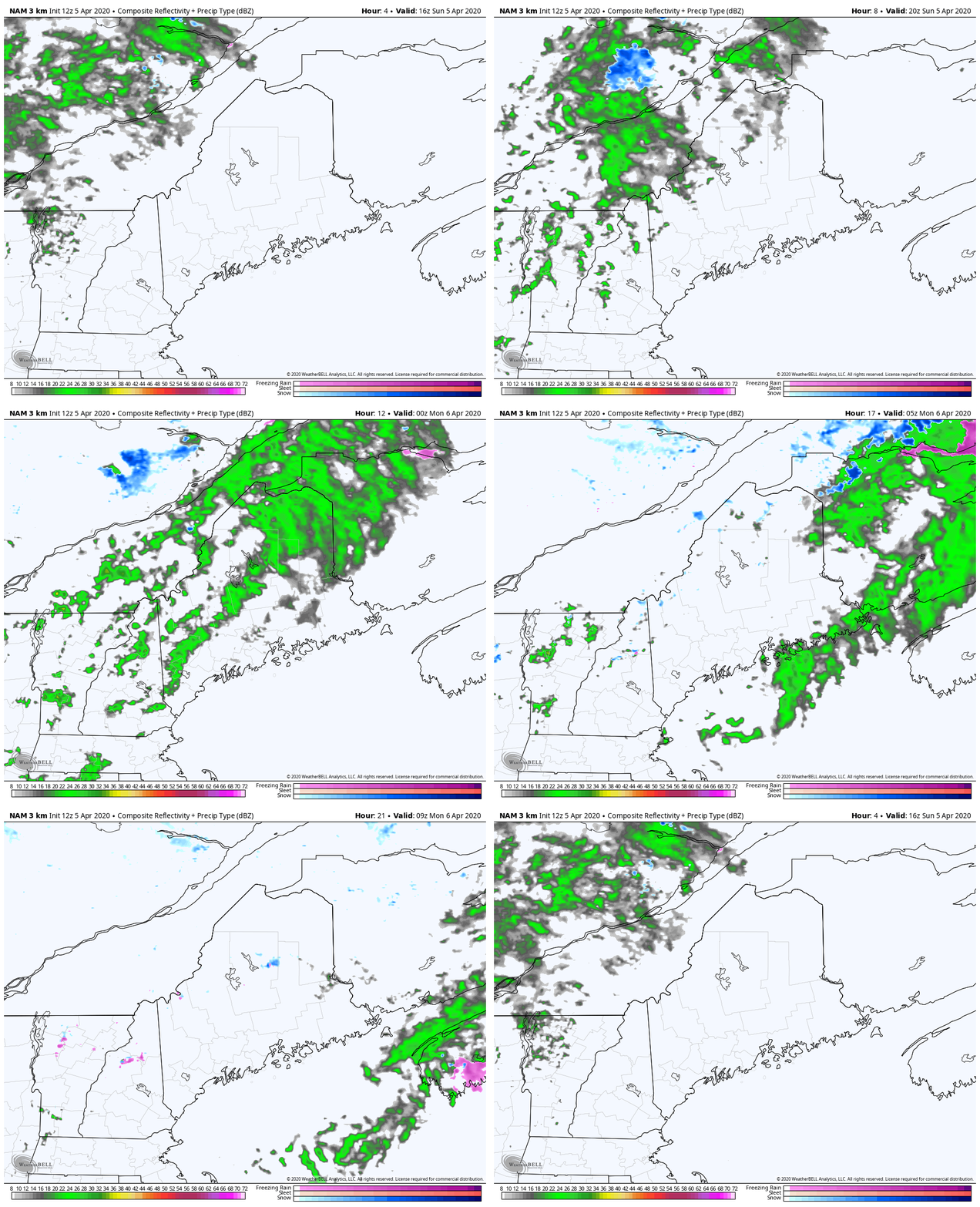
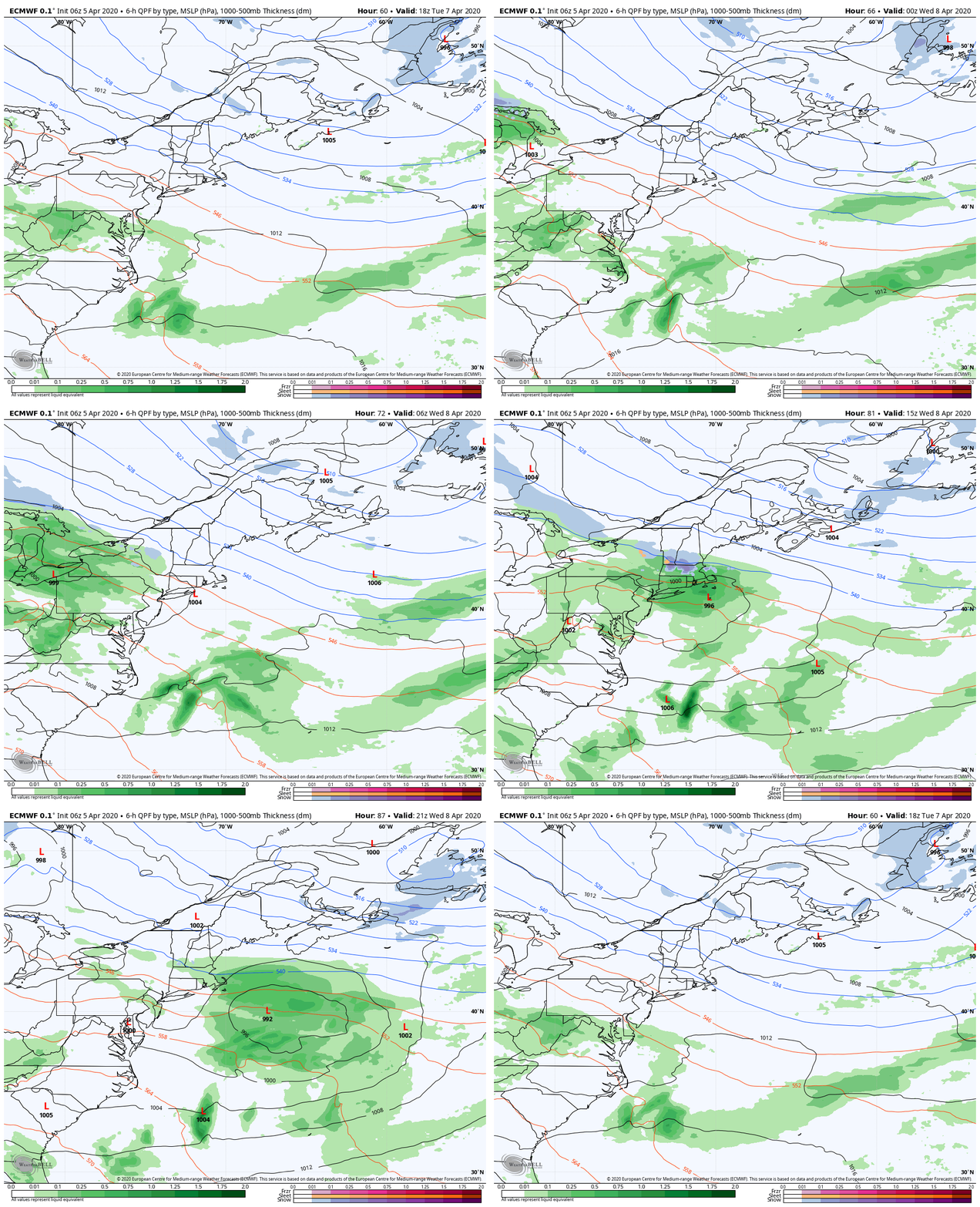
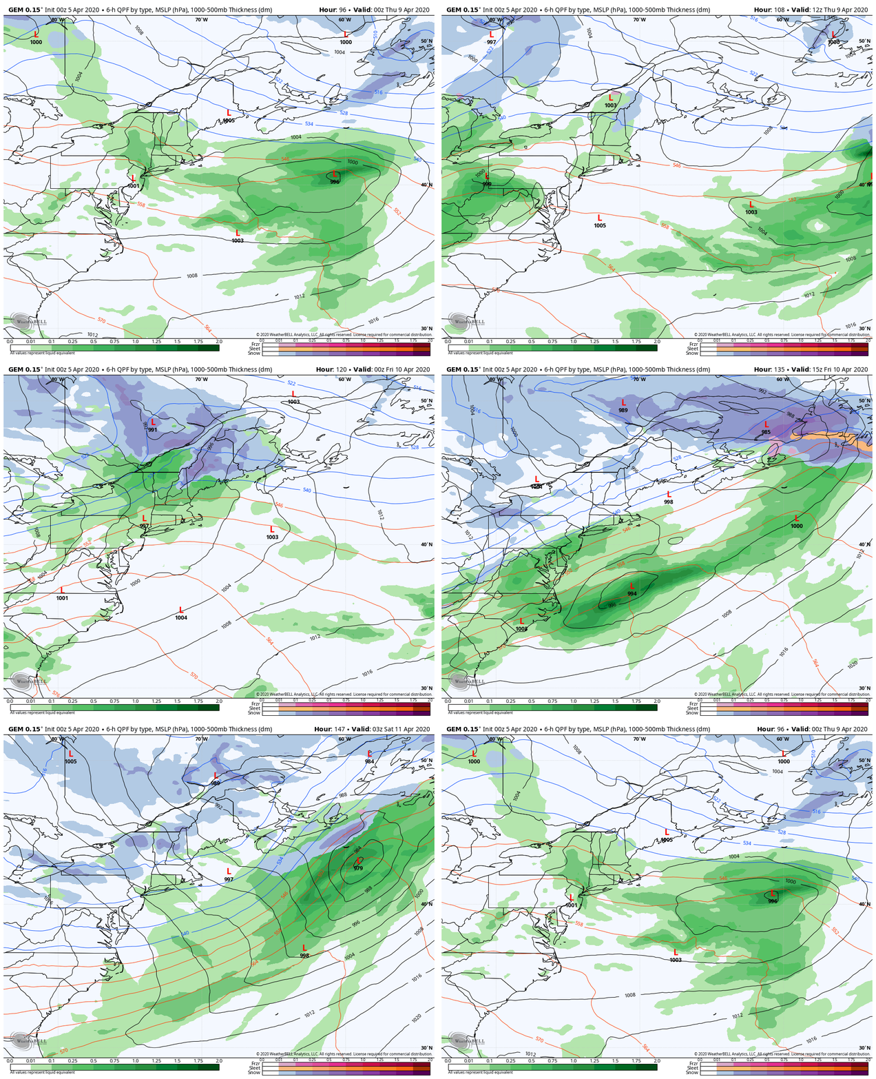
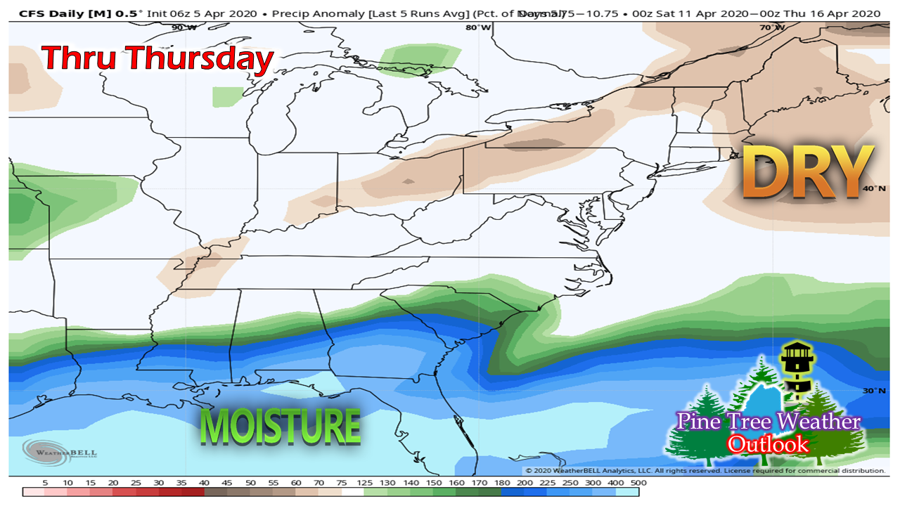
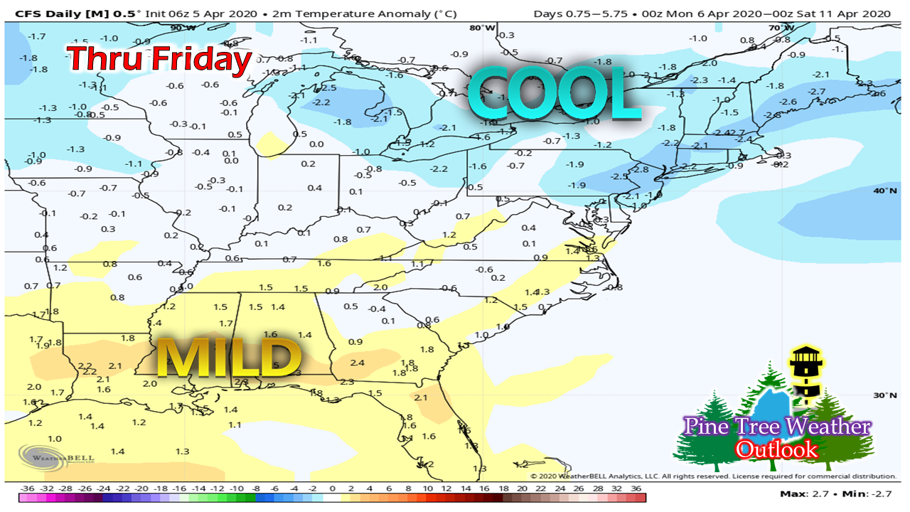
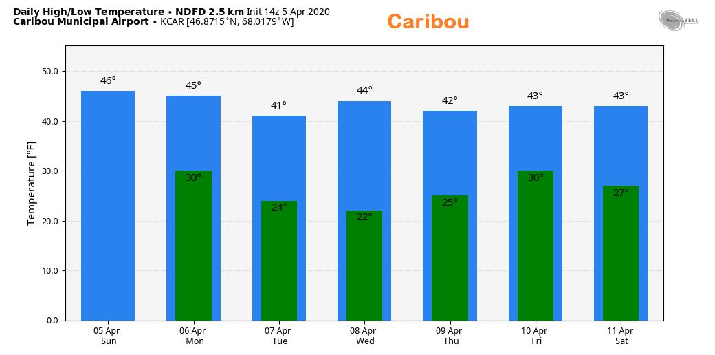
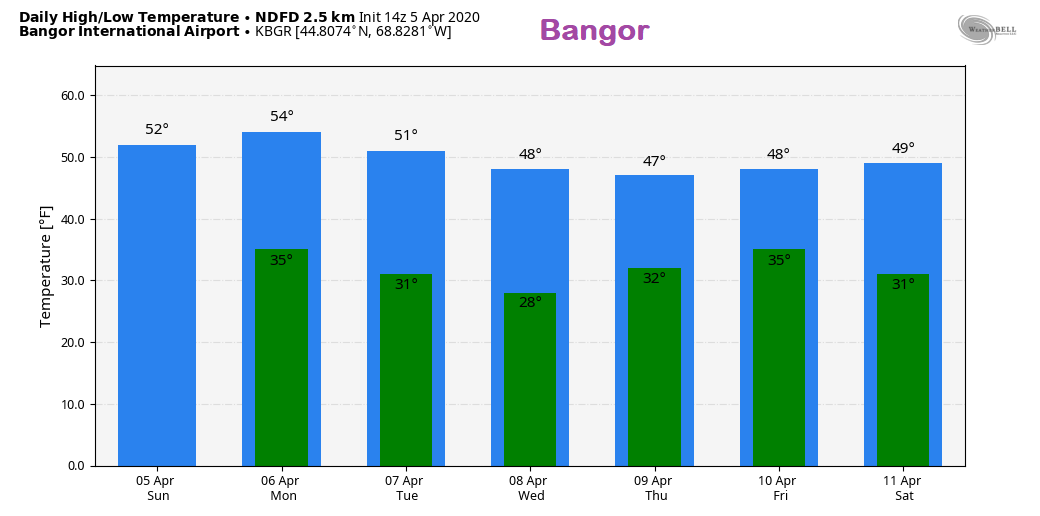
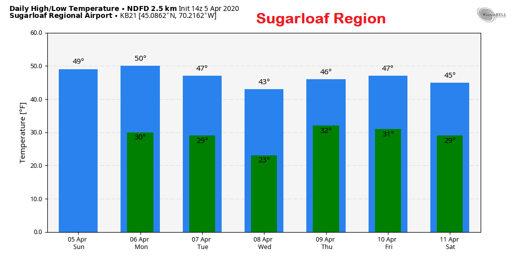
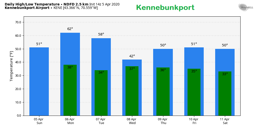
Showers pass through Sunday afternoon / eveningAny areas seeing sun will likely see it disappear Sunday afternoon as a cold front approaches. Scattered showers break out over northern and western areas by around mid-afternoon and reach the coast by 7 - 9 PM. As quickly as they come, they end. Northern and western areas see showers taper off by 10 PM - midnight Monday. For the coastal plain, showers end by around midnight - 2 AM Monday. Some areas see some light accumulations of rainfall, others may not get much, if any. A near miss midweekBehind the cold front Sunday, a trough settles in over the region for Monday and Tuesday. A storm forms along a ridge over the midwest and could bring a mix of rain and snow to southern New England on Wednesday. Showers may impact far southern areas of Maine, but most of the rest of the region sees clouds and breezy conditions Wednesday into Thursday. Winter may not be over yet for interior areas late weekThe ridge over the midwest appears to try to nudge northeast Thursday. While that happens, an area of low pressure and an associated cold front taps into cooler air over Labrador and potentially brings snow for interior areas and rain potential for the coast. It's a bit early to determine snowfall amounts and where the rain/snow line converges. This is a low confidence forecast for now. Stay tuned for updates on this as the week unfolds. Outlook: generally dry and cool thru midweekAfter the showers pass through the region Sunday night, the outlook is generally drier than normal through Thursday. The pattern again becomes more active and will change this outcome as we head towards the weekend. While southern areas have chance to reach 60° on Monday, generally, the trend is cooler than normal overall through Friday. For those curious, I have a page set up with 6-10 day outlooks from the Climate Prediction Center that automatically update twice daily. Temperature outlook for the weekFeel free to use the many pages available on this website for many types of forecasts on rainfall, snowfall, marine, longer range CPC outlooks, and maps.
Thank you as always for your support! Stay healthy and safe! ► ► For the latest official forecasts, bulletins and advisories, please check in with the National Weather Service in Gray for western and southern areas, or Caribou for northern and eastern parts of Maine. Always stay weather aware! - Mike |
Mike Haggett
|

