
Trend is a bit more north for now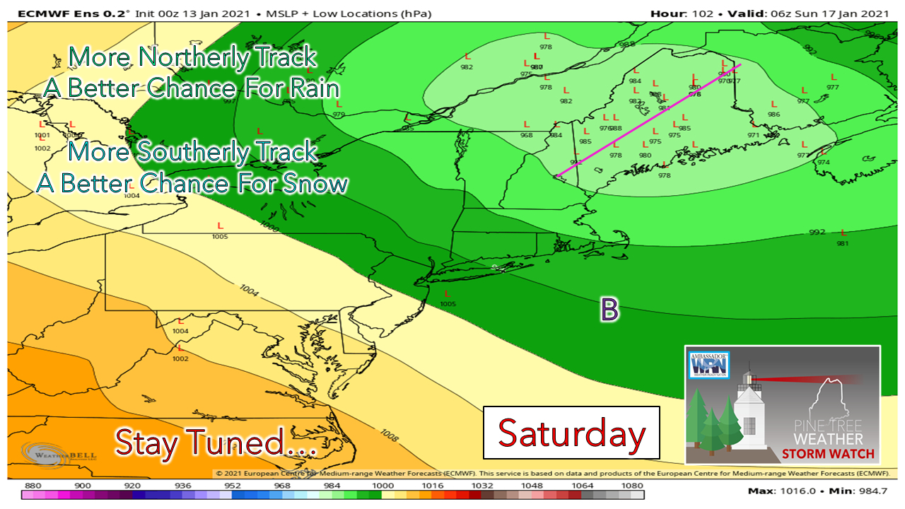 One of the things that happens from time to time with deterministic guidance is there is a bit of a "windshield wiper" effect and there is some of that going on here. As I continue my journey with my education and forecasting, ensemble ideas help show that effect and where the one trick pony deterministic output leaves plenty of room for error. You'll notice here where I drew a line through the portion of the state from roughly Fryeburg to Caribou. From what I have learned over the years, winter storms north of that track tend to favor rain for areas south and east of there, and a mixed bag potential to the north and west. The ensemble ideas are well north of the benchmark "B" (40° N / 70° W) so rain appears to be the main precipitation type for the coastal plain. The question at this point is what happens for the western mountains on up into The County. 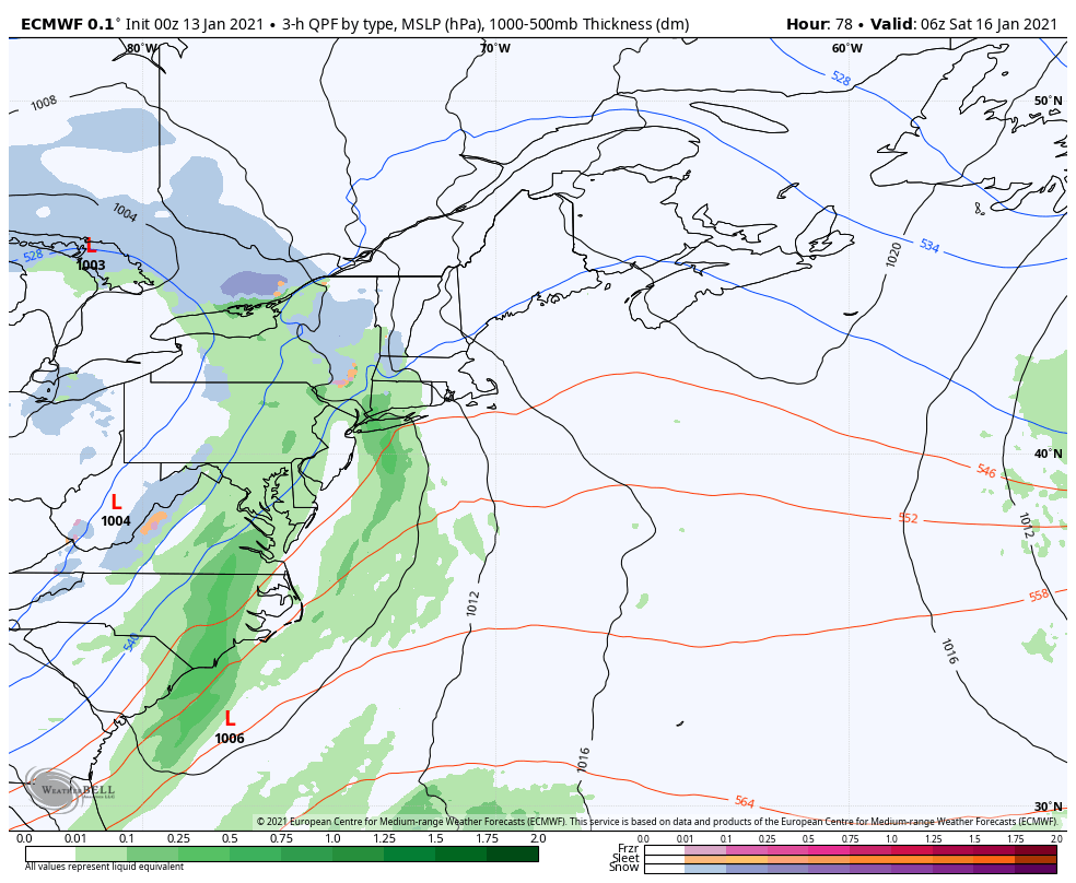 This deterministic idea from the European model with data from the 00z / 7 PM sounding Tuesday evening shows low pressure running up along the Maine / New Hampshire border up to the St. Lawrence River before moving northeast. In this scenario, this could bring all four precipitation food groups (snow, sleet, freezing rain, rain) to the mountains and north. A possible wrench that could be thrown into this is the secondary low that forms offshore. Where that happens and when is important, because that shuts off the warm air moving in from the south and brings the cold air in. At this point, that appears more of a concern for Atlantic Canada, and there is a very low chance of that for Maine, but worthy to make note of in case there is a sharp change in the forecast. 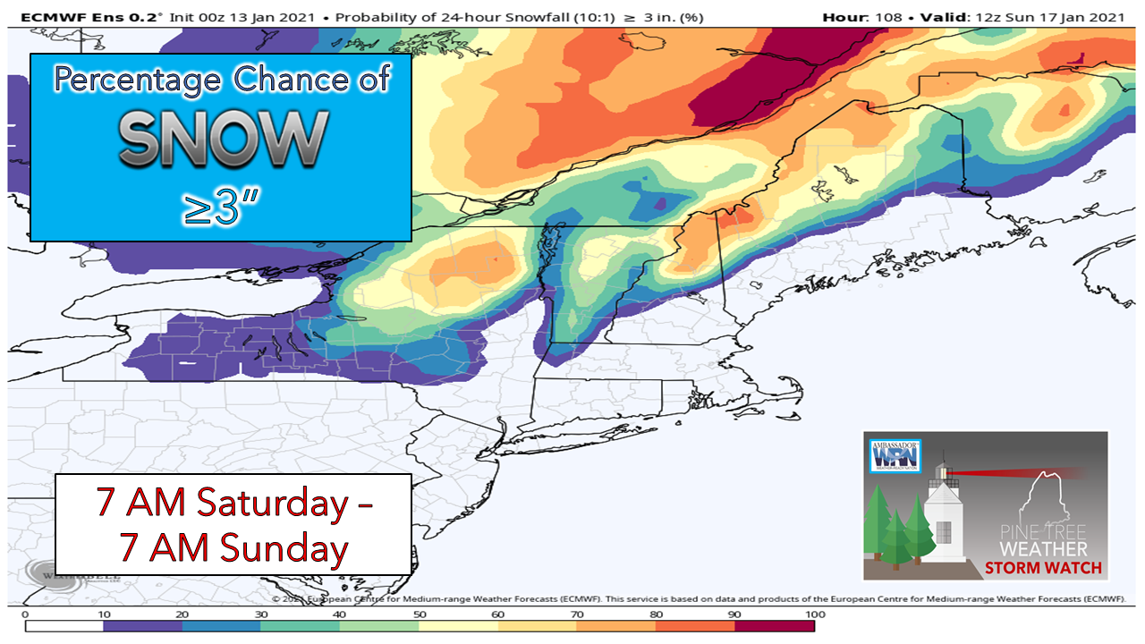 At this point, the mountains and the Allagash region have the best chance to see 3" or more of snow. This idea has been consistent for a couple of runs now. 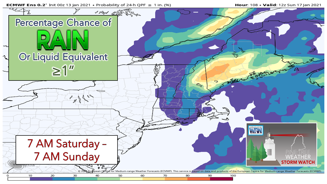 There is also a decent chance for roughly 1" of rain (or liquid equivalent) for a good portion of the region as well. Chances are good that the snow that falls will be wet and sticky over the interior areas given the moisture involved and potential track. That would cut down on accumulations. Then there is the chance for sleet and freezing rain to come into the picture for the mountains and north as well. There could be some cold air damming issues further north. Flooding does not appear to be a big concern here given the Christmas washout doing much of the clean up well ahead of this. Rivers in The County should be monitored as there is ice build up there, and a current ice jam on the Aroostook River in Fort Fairfield which may get agitated pending on how much rain works that far north. 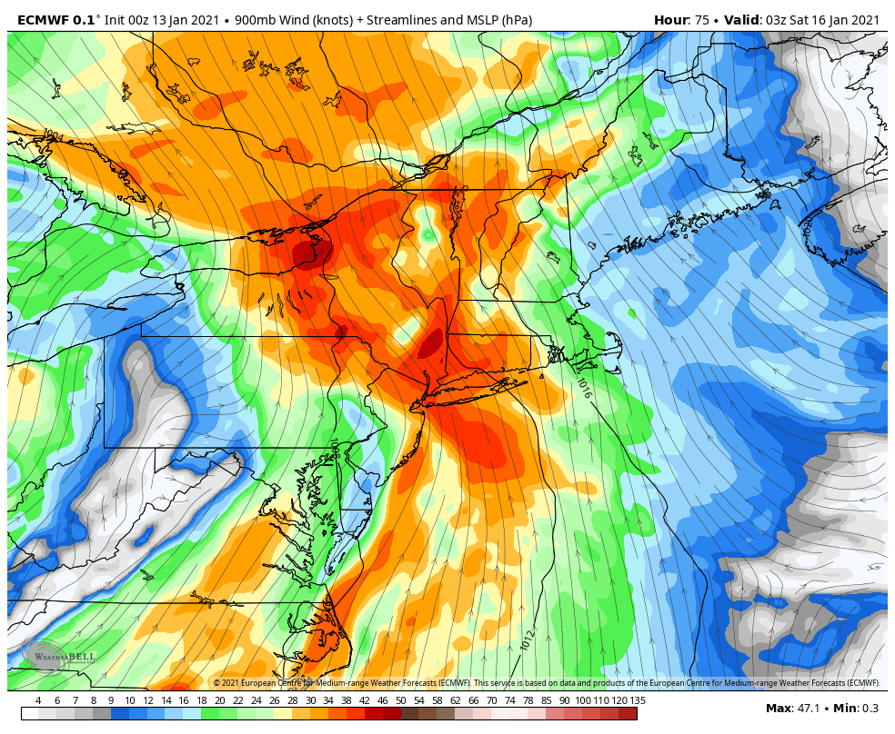 Looking at the low level jet stream here, compared to other events, it appears rather tame. Shoreline areas and higher elevations may see gusts in the 40-45 mph range. For now, I do not expect any widespread power outage issues south of Route 2 and east of Route 11 up north, but there may be some spotty ones. Where the wet snow falls and how much will dictate any power loss threats for the mountains on up into northwest Aroostook. There is still plenty of wiggle room for changes here, but this best idea as of Wednesday morning. Stay tuned for updates. Keep watch on my Twitter feed for added information through the day. Winter 2020-21: where we are, where we are going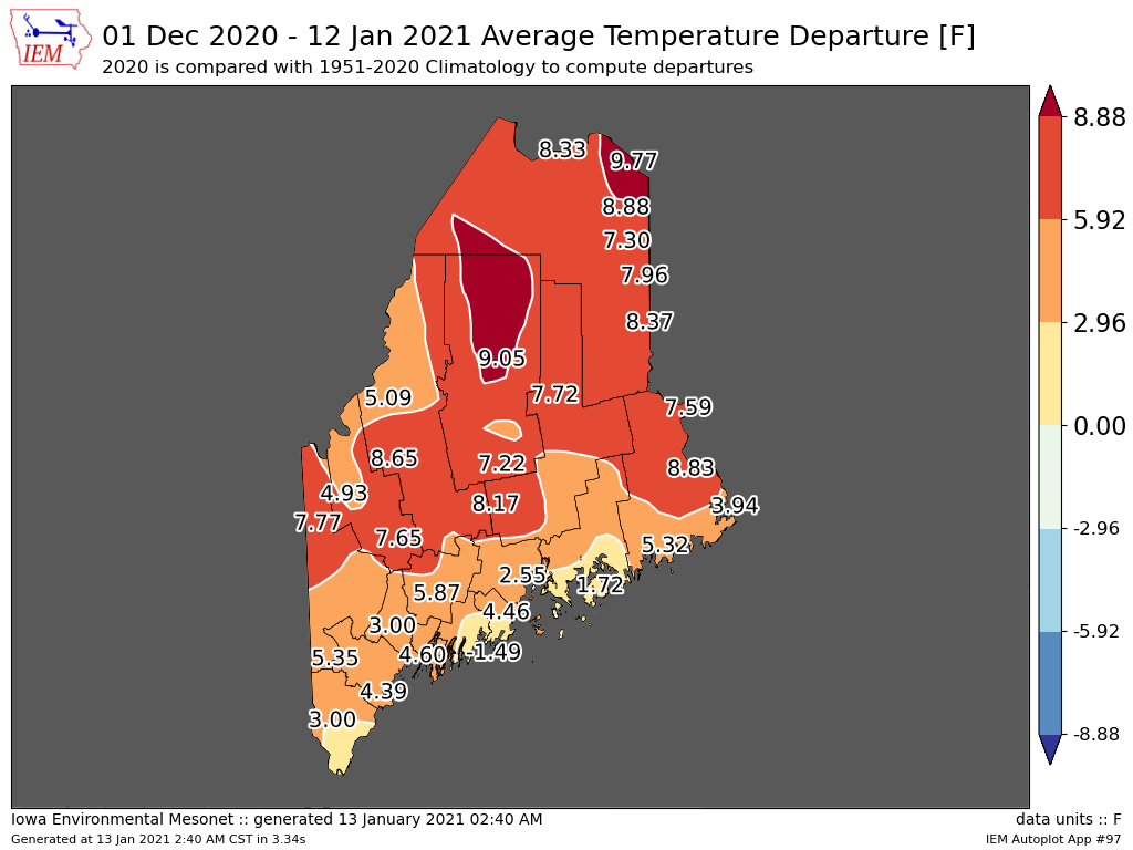 Meteorological winter begins December 1st and at this point, we're coming close the half way point. No surprise, temperatures are running well above normal over much of the interior. Where the abnormal warmth most noticed is at night where overnight lows are running 10-15° above average, which is rather significant. There is not a whole lot of ice on the lakes south of Katahdin and well below normal to the north. If there is one upside to this, that does cut the threat for ice jams in the spring, but we have plenty of winter still to go, and that could change. 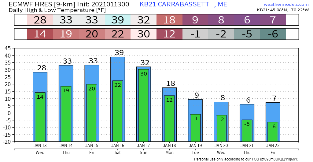 Change appears to be on the way. After the weekend storm, the cold comes in. Where I discuss a rain and mixed bag event for Saturday, the narrative shifts to freezer burn wind chill potential next week. 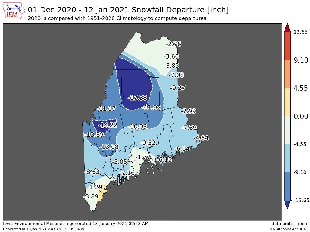 Again no surprise here that most of the region is well behind on snowfall. If not for the big storm before Christmas, these totals would look more bleak than they do for southern areas. The persistent blocking ridge over the region has kept temperatures up, and kept the snow away.  Outside of the storm on the way this weekend, the outlook for snow for ski country appears limited as we head into the latter part of the month. The upside appears that it will be plenty cold enough to make snow, but I would not expect help from Mother Nature anytime soon. I do think that is going to change as bits and pieces of the polar vortex over Siberia break off and filter southeast and juggle the pattern up. Patience is virtue for snowmobilers and Nordic skiers, as well as ice fisherfolks. Hang in there! Be prepared to receive alerts and stay updated!
For more information in between posts,
please follow Pine Tree Weather on Facebook and Twitter. Thank you for supporting this community based weather information source operates by financial contributions. Stay updated, stay on alert, and stay safe! - Mike |

Mike Haggett
|


