Pine Tree Weather
  • DISCUSSIONS
  • DONATE
  • MAPS
  • NWS BRIEFINGS
  • SATRAD
  • MARINE
  • SNOW / ICE OUTLOOK
  • RAIN OUTLOOK
  • CPC OUTLOOK
  • Kennebunk
  • OBSERVING WEATHER
  • Who We Are
  • My Photography
  • DISCUSSIONS
  • DONATE
  • MAPS
  • NWS BRIEFINGS
  • SATRAD
  • MARINE
  • SNOW / ICE OUTLOOK
  • RAIN OUTLOOK
  • CPC OUTLOOK
  • Kennebunk
  • OBSERVING WEATHER
  • Who We Are
  • My Photography

Outlook for the rest of the week

3/24/2020

Comments


Zonal pattern continues

Picture
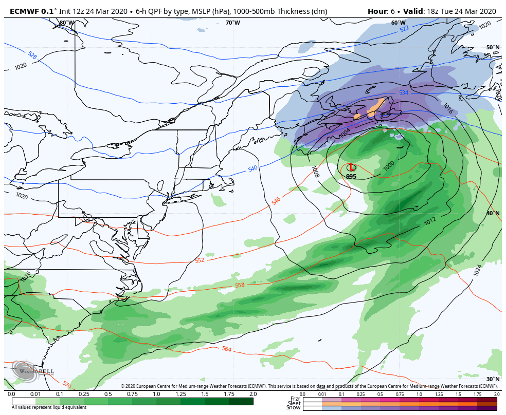
The ebb and flow of a zonal pattern continues for the state through the remainder of the week. As the storm that brought the region an early spring snow moves to the east, high pressure settles in for Wednesday. Looking to the southwest, a storm moves off the Mid-Atlantic region. High pressure over Maine keeps most of the moisture associated with that to south. Coastal areas may see some clouds, and far southern areas a light rain shower, but that is about it. The storm moves south of Nova Scotia on Thursday.
Picture
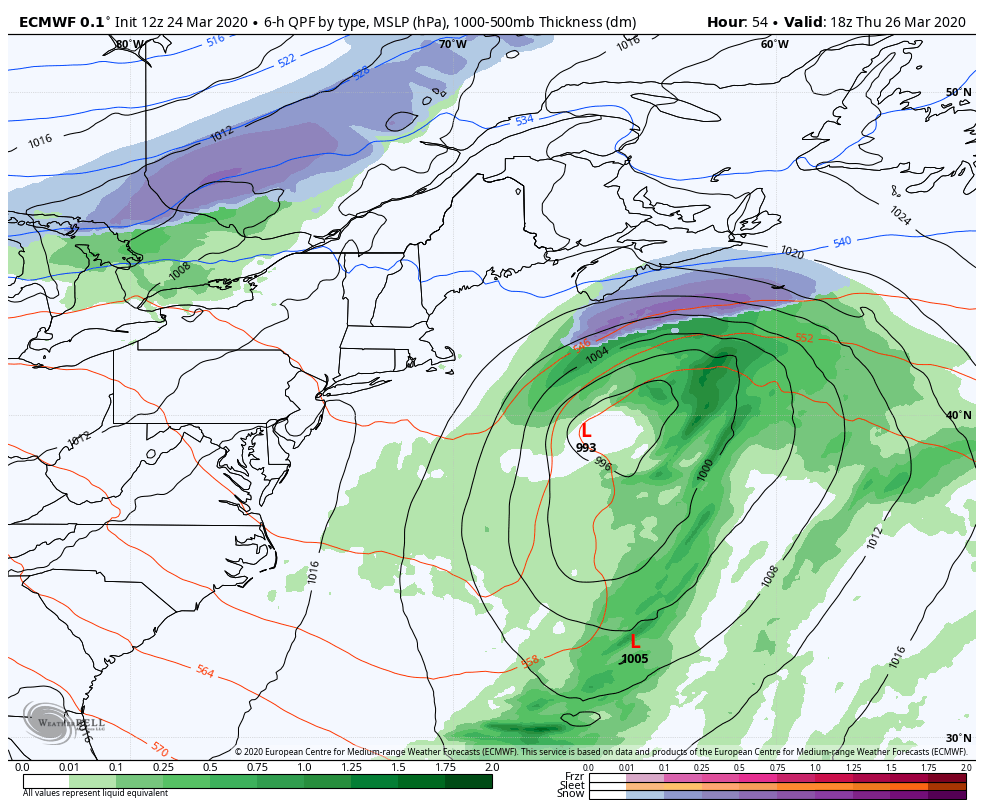
As that storm curls into the Gulf of St Lawrence, and inverted trough behind it may bring some light snow to western, eastern and northern areas Thursday night into Friday. Higher elevations and the Allagash region may pick up an inch of snow,  with lesser amounts elsewhere. The region will feel that storm into the weekend as a breezy west/northwest air flow persists.

At this point, our next chance for widespread precipitation appears possible Sunday into Monday. At this point, it could be a mixed bag of rain, snow and sleet. I will update more on this later in the week.  

Temperatures generally slightly above normal

Wednesday appears to be the cooler of the days as we head through the remainder of the week.
Picture
Picture
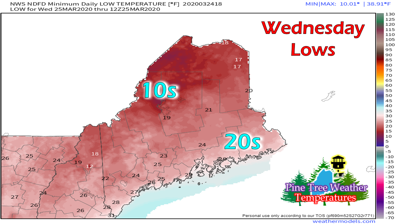
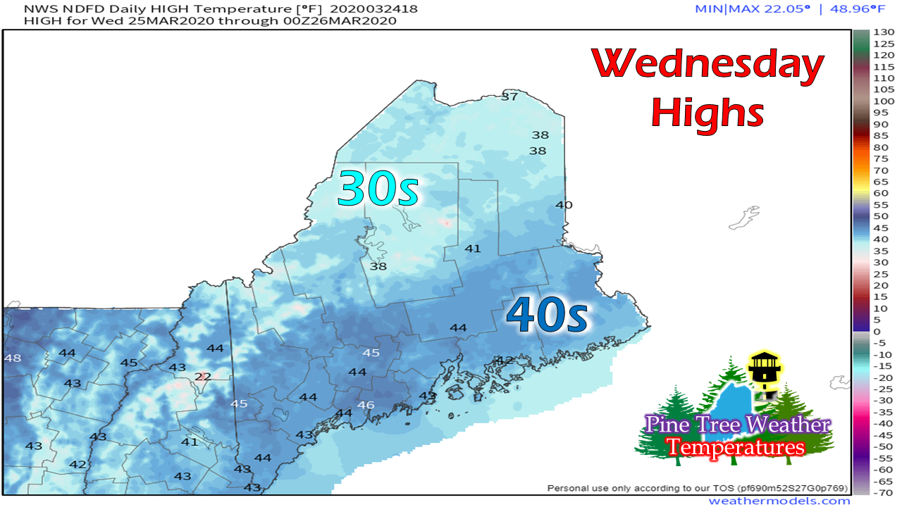
Thursday appears to be a bit warmer.
Picture
Picture
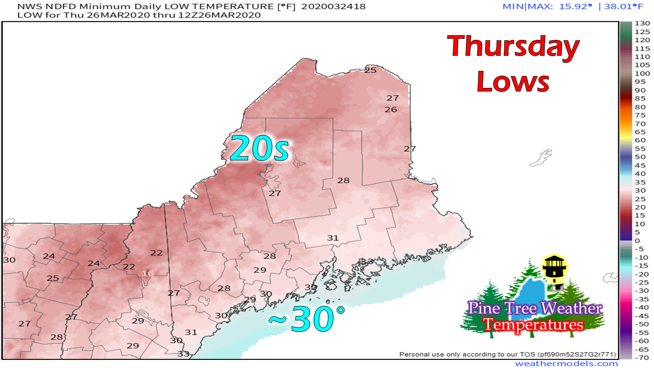
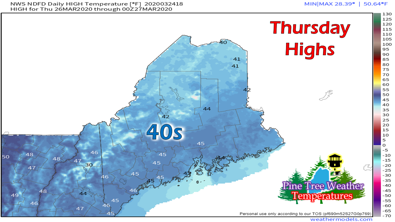
Try to get outside and get some fresh air as best as you can!

​Feel free to use the many pages available on this website for many types of forecasts on rainfall, snowfall, marine, longer range CPC outlooks and maps. 

Thank you as always for your support! 


​► ► For the latest official forecasts, bulletins and advisories, please check in with the National Weather Service in Gray for western and southern areas, or Caribou for northern and eastern parts of Maine.

Always stay weather aware!

​- Mike

Comments
    Picture

    Mike Haggett
    Kennebunk, ME

    Certified Weather
    Forecaster
    Penn State '21

    American Meteorological Society

    National Weather Association

    Weather-Ready Nation 
    Ambassador
    ​
    ​SKYWARN-CWOP

    Matthew 19:26


    Support
    Pine Tree Weather

    DONATE

    Picture

    Picture

    Picture

    Picture

    Picture

    Picture

    Picture

    Picture

    Picture

    Picture

    Archives

    January 2023
    December 2022
    November 2022
    October 2022
    September 2022
    August 2022
    July 2022
    June 2022
    May 2022
    April 2022
    March 2022
    February 2022
    January 2022
    December 2021
    November 2021
    October 2021
    September 2021
    August 2021
    July 2021
    June 2021
    May 2021
    April 2021
    March 2021
    February 2021
    January 2021
    December 2020
    November 2020
    October 2020
    September 2020
    August 2020
    July 2020
    June 2020
    May 2020
    April 2020
    March 2020
    February 2020
    January 2020
    December 2019
    November 2019
    October 2019
    September 2019
    August 2019
    July 2019
    June 2019
    May 2019
    April 2019
    March 2019
    February 2019
    January 2019
    December 2018
    November 2018
    October 2018
    September 2018
    August 2018
    July 2018
    June 2018
    May 2018
    April 2018
    March 2018
    February 2018
    January 2018
    December 2017
    November 2017
    October 2017

    RSS Feed

Proudly powered by Weebly