|
First off a BIG THANK YOU to everyone who chipped in a few bucks as Pine Tree Weather is now fully funded for the year ahead. Between the monthly pledges on Patreon, the checks mailed and the VENMO tips, I should be good for the year. I will continue to take donations anytime, so if you missed this round and want to help out later on when your financial position improves, feel free. Just click in the DONATE tab on the website here and that will direct you to your options. Thanks again to those who have my financial back and those who truly appreciate the effort that goes into this for the third year in a row. I am fired up to get through school by late April and take this to another level later in the year. Upper level waves pass through during the week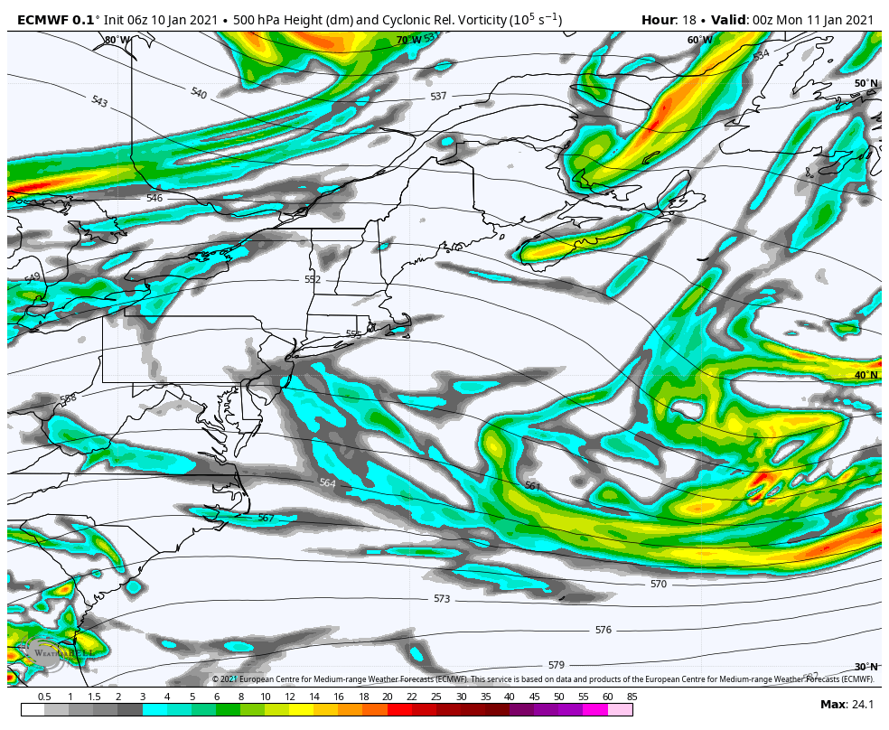 I am showing upper level energy here because that shows what the surface map ideas do not. Two things to note here. For one, the absence of the southern stream. If that was there, we'd be digging out daily. The second, the waves are brisk moving. Through most of the week (this runs until 7 PM Thursday) there will be varying amounts of clouds and sun, with a chance for snow showers for the higher elevations Monday night through Wednesday. These waves are moisture starved, so I don't expect anything more than an inch or two on the higher peaks for a grand total during this time frame. What the waves will do is keep a lid on temperatures from moving all that much. This trend continues until later on in the week. Regional temperature trend through SaturdayWhile it looks chilly, we're still running well above normal here. Typical high / low for Caribou is 20° / + 1°. For Augusta, 28° / 11°. Temps 5-15° above seasonal averages during the day, 10-20° above normal at night. For ski country, your saving grace for now are temps are below freezing at night to keep the guns going. 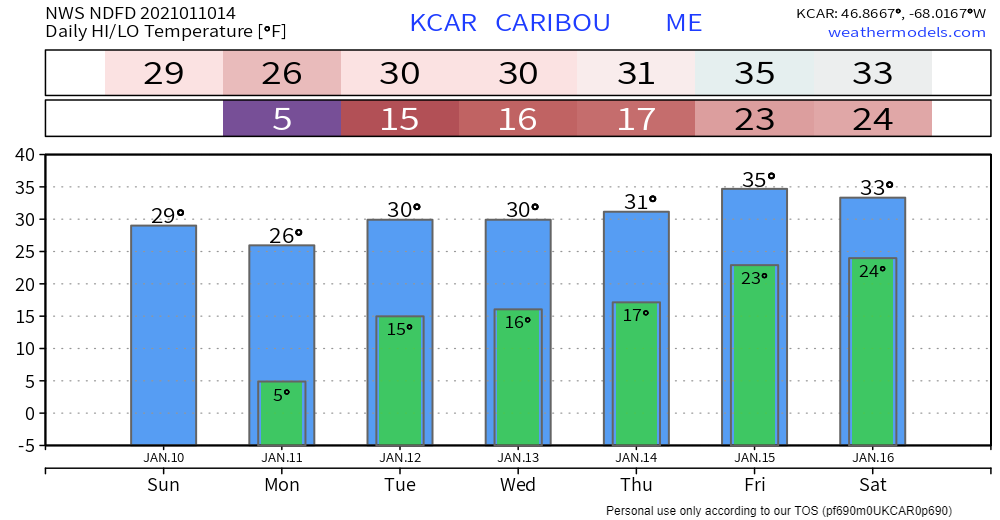 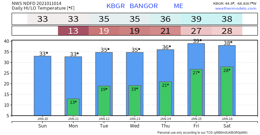 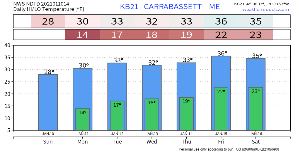 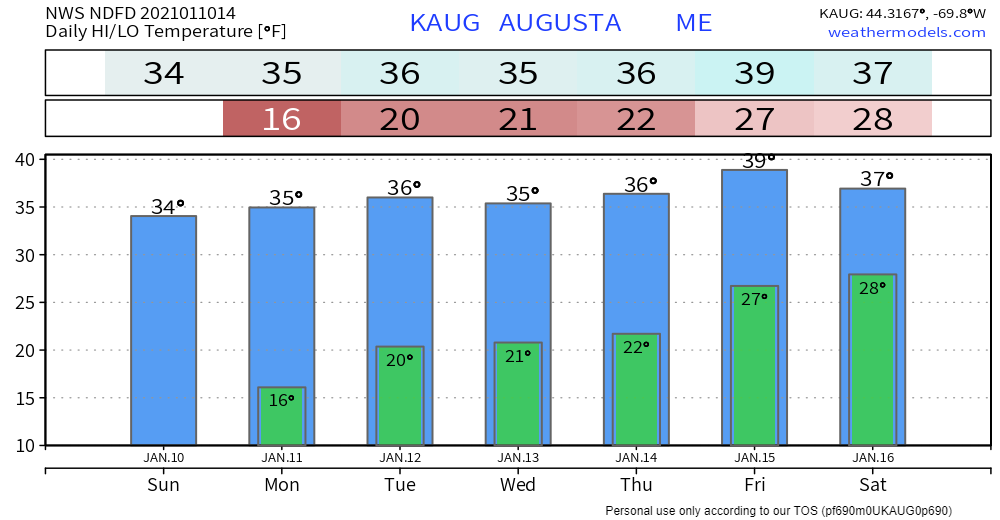 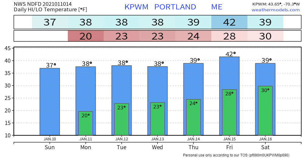 Potential for colder, snowier times ahead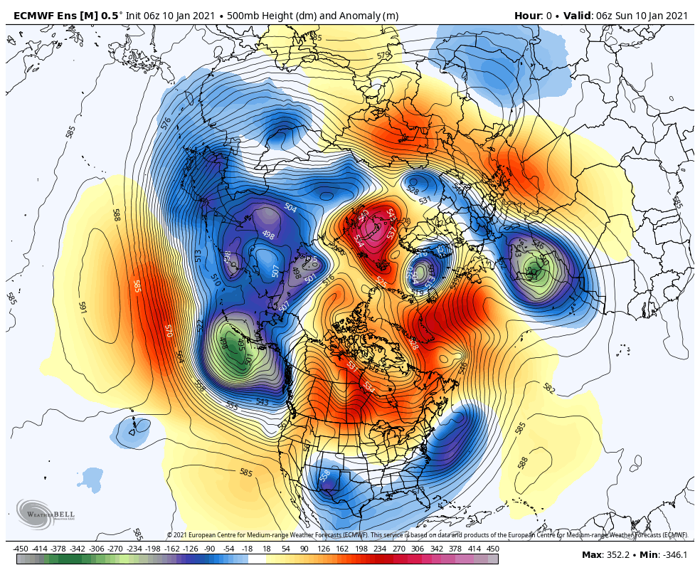 When you watch this loop from start to finish, watch the cold pockets over Siberia in the left center part of the screen. This is where the deep cold is right now over the northern hemisphere. Ridges to the southwest, southeast and north of that appear to chip away at that and dislodge chunks at a time. The other key focal point is the ridge that forms over the eastern Pacific that noses into western Canada. That is what could funnel those chunks of cold to the southeast part of the country, and that is where for our region, we need to pay attention. This loop, which runs through 1 AM Saturday, accurately shows the rather mundane pattern of the week ahead. Towards the end, the shift comes. Guidance ideas at this point indicate a potential for an inside runner as we head into next weekend, which puts Maine on the warm side of storm. I am not 100% sold on that idea just yet. As you can see at the end, the ridge builds over the eastern Pacific and more cold splits off and moves southeast. The combination of what happens late in the week along with that is a signal for a pattern shift. 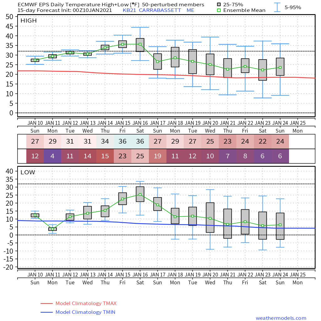 Looking ahead at European ensemble ideas for Carrabassett Valley, it doesn't take much effort to see where the trend is colder. While the mean (green line) still indicates above normal high / low temperatures (red / dark blue lines) it gets closer and the range indicates where it could go below normal. We still have yet to get to our seasonal average bottom for temperatures. There is plenty of winter left to go here. Meteorologically, we're halfway through winter by January 15th. Astronomically, it's February 3rd. For us who dwell along the 45th parallel, that is roughly our halfway point. Looking at snow probabilities... 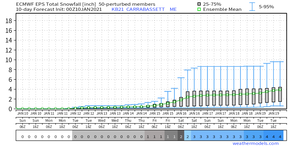 After a quiet stretch through the work week ahead, the chance for snow increases as we head into the weekend and beyond. While this idea is not set into stone, it fits the pattern shift. Going a bit deeper and stretching it out into February... 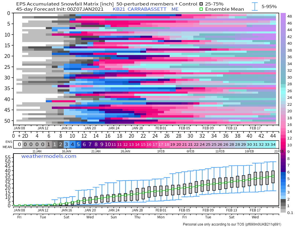 While this does not show individual storms, the ensemble trend definitely shows a snowier and thus stormier outlook. As we say in the forecasting world, "trend is your friend". While I refuse to take any long term idea on a hook, line and sinker, it is a loud enough whistle to pay attention to. Stay tuned.  Help fill the gaps!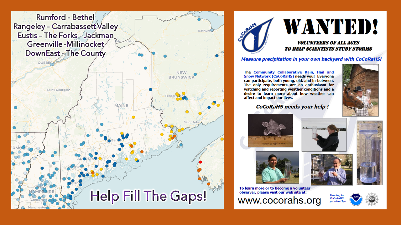 For folks in western, eastern, and northern areas, the Community Collaborative Rain, Hail and Snow Network could use your support! Verification of precipitation is very important to improve forecasts. All ages can participate. Reporting is easy, and it takes very little time to do. For more information, please check the CoCoRaHS Maine website. I would be more than happy to answer any questions you may have about the program! Be prepared to receive alerts and stay updated!
For more information in between posts,
please follow Pine Tree Weather on Facebook and Twitter. Thank you for supporting this community based weather information source operates by financial contributions. Stay updated, stay on alert, and stay safe! - Mike |

Mike Haggett
|