Monday: Muggy feel and warm temperatures; overnight showers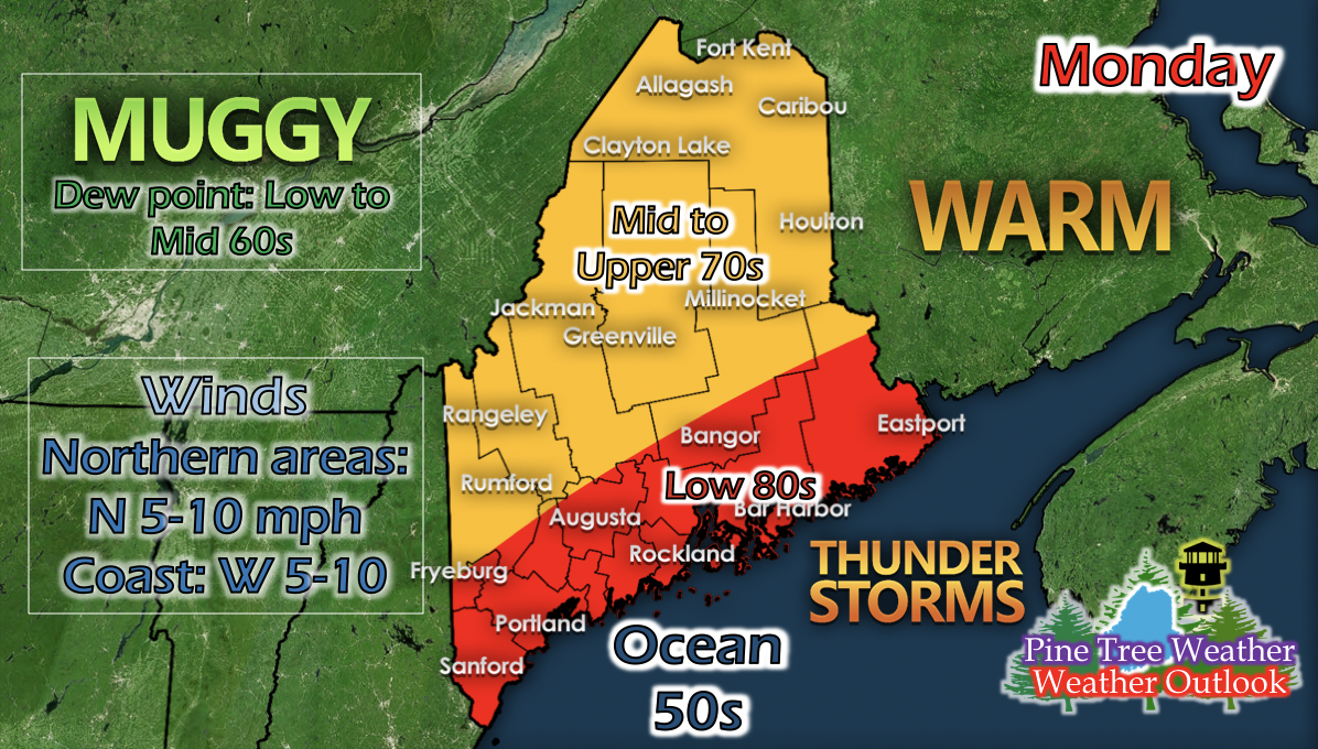 A low pressure system moves south of the state on Monday, and a secondary one northeast far above the state, and the coastal areas will be sandwiched in between two cold fronts. Starting late afternoon, scattered showers and some storms should linger just inland of the coastal regions and remain through the night, until the low pressure to the south moves easterly away from the state. Westerly winds from the south low pressure system will keep the coastal regions in the upper 70s to low 80s, and northerly winds from the cold front north of the state will keep the rest of Maine in the mid to upper 70s. Dew points range from low to mid 60s statewide, giving a slightly muggy feel to the air. 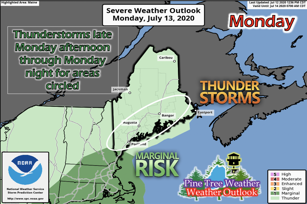 The Storm Prediction Center has issued Maine mostly under the "Thunder" category of their severe weather system, with the very far south tip of Maine in the "Marginal" category. The areas circled are the areas that will potentially be receiving scattered rain and thunderstorms. The low pressure system to the south will be moving away from the state Tuesday morning, where the second cold front from the northern low pressure system to swing down and maintain some of those scattered showers just inland of the coast. Tuesday: Slight cool-down, scattered showers just inland of coast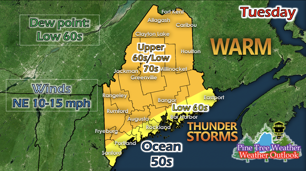 As the cold front from the north swings down into the state, daytime temperatures drop state wide. Northeasterly winds mostly keep the state in the 60s, but areas right up against the coast may be in the low 60s, and some places inland may get up and into the low 70s. As the cold front passes through, northeasterly winds kick up and range from 10 to 15 mph statewide. The scattered showers along the coast should begin to dissipate by the afternoon. Another warm temperature spike for Maine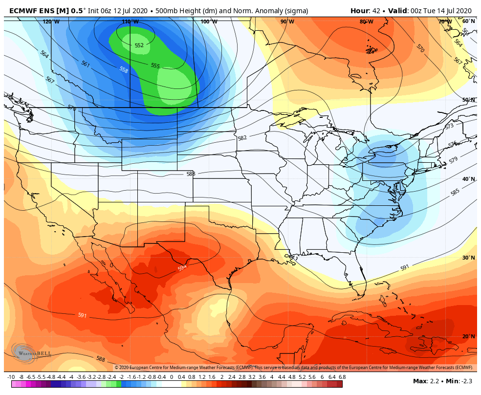 The GIF above runs from 8 PM Monday to 8 PM Friday. A shortwave trough in the mid-levels moves through Maine Tuesday and quickly leaves Wednesday. The rest of the week shows a mid-level ridge building over the New England area and maintaining strength throughout the week, suggesting warm and hot temperatures after Tuesday. Wednesday Temperatures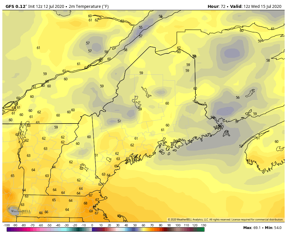 After a small cool-down and some coastal rain on Tuesday, Wednesday begins to slowly increase daytime temperatures with mid 70 degrees statewide. The mid-level pattern shown previously suggests that Thursday and Friday will have an increase in daytime temperatures as well. Help forecast verification, and stay informed!
For more information, please follow Pine Tree Weather on Facebook and Twitter.
Thank you for supporting this community based weather information source that is funded by your financial contributions. Stay updated, stay on alert, and stay safe! Have a good rest of your Sunday! - Kaitlyn |

Mike Haggett
|