
We've seen worse junk storms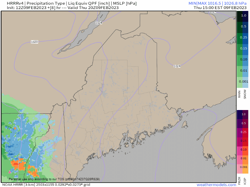 Thursday 3 PM to Friday 1 PM - Timing for the storm remains on track. It could be a slick ride home over the western foothills and mountains on over to the Moosehead region. The changeover to sleet and freezing rain occurs late evening as the warm front pushes into the area. By that point, snow begins to transition to a mix to rain over the east by around 2-4 AM. At that point, outside of scattered showers, it's over for the west and south. Northern Maine continues to deal with a snow / mix into the morning, then transitions back to snow as low pressure tracks to the east. A cold front brings rain showers and flips back to snow showers over the western mountains into the afternoon, ending Friday evening. 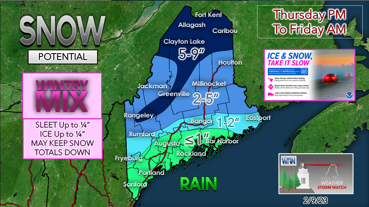 A slight adjustment here to the snowfall map. By morning, with the exception of the north, any snow is likely to be compressed due to the warmth, and could be slushy in spots. There could be some banding that will bust totals on the high end in spots pending on how active the warm front impacts the cold air aloft. 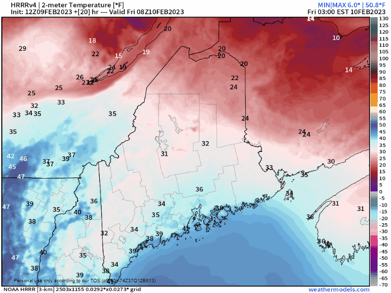 Friday 3 AM to Saturday Midnight - The rise in temperatures will help with clean up in most areas with exception of the north. The other side of that is whatever turns to liquid will freeze up in the afternoon heading into the evening as most areas drop below freezing heading into Saturday morning. With wind gusts 20-30 mph (30-40 mph mountains) that will help dry things out, along with areas of sun south of the mountains for southwestern areas. The jury is out if eastern areas see much sun. It's possible late afternoon around sunset. The north stays in the clouds all day. One to watch to start the week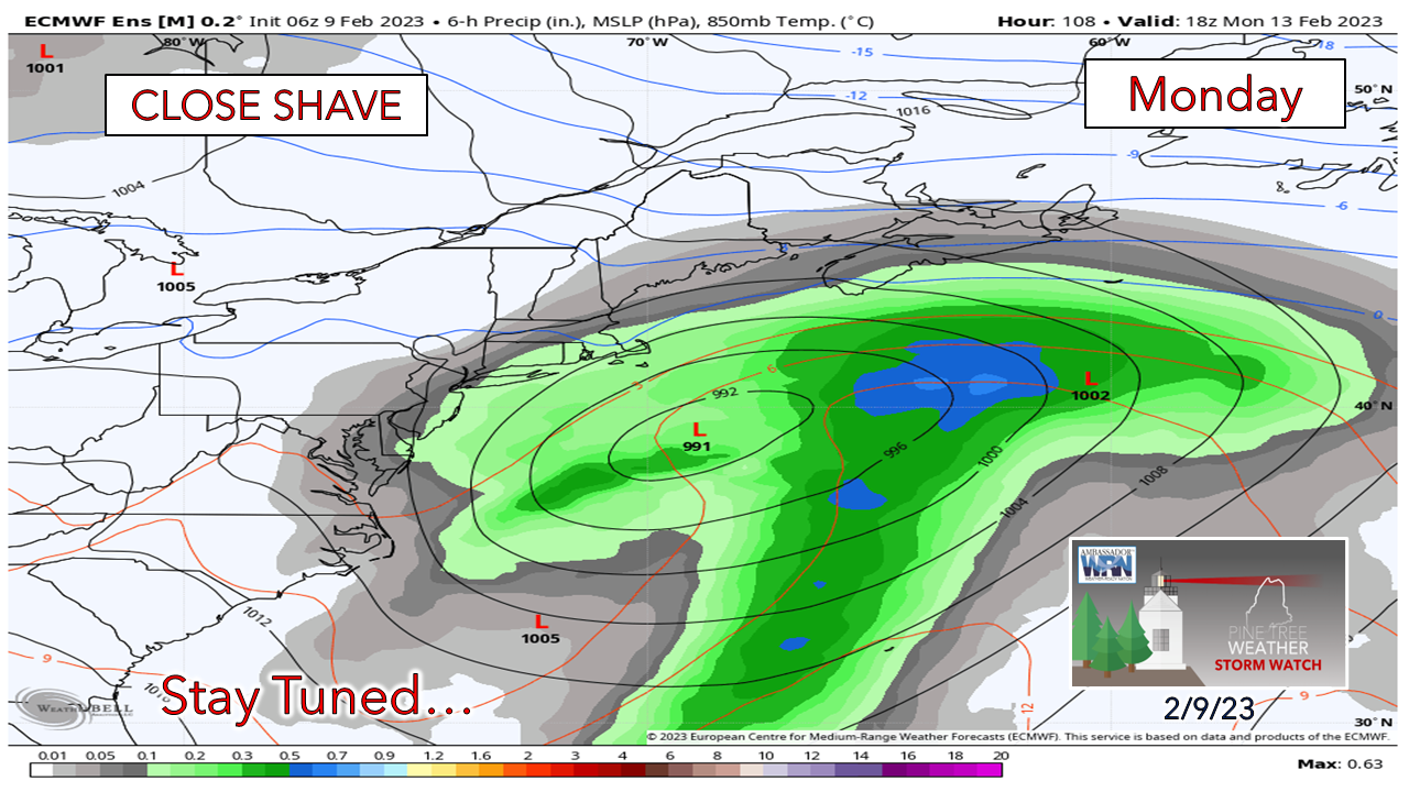 This one has been an on again/off again idea over the past several days. Operational ideas say no, but the ensembles have not given up yet. The consensus idea is for the storm to stay south of benchmark 40° N / 70° W which takes the mountains and north out of it. Coastal areas should stay tuned as this appears to be snow IF we get anything out of this. Thank you as always for your support! You may not like the weather, but I hope you like what I do! Please hit the like button on Twitter and Facebook, and share! Financial donations to fund what I do are always appreciated! Stay updated, stay on alert, and stay safe! - Mike NOTE: The forecast information depicted on this platform is for general information purposes only for the public and is not designed or intended for commercial use. For those seeking pinpoint weather information for business operations, you should use a private sector source. For information about where to find commercial forecasters to assist your business, please message me and I will be happy to help you. |

Mike Haggett
|


