A nice summer day in store for Saturday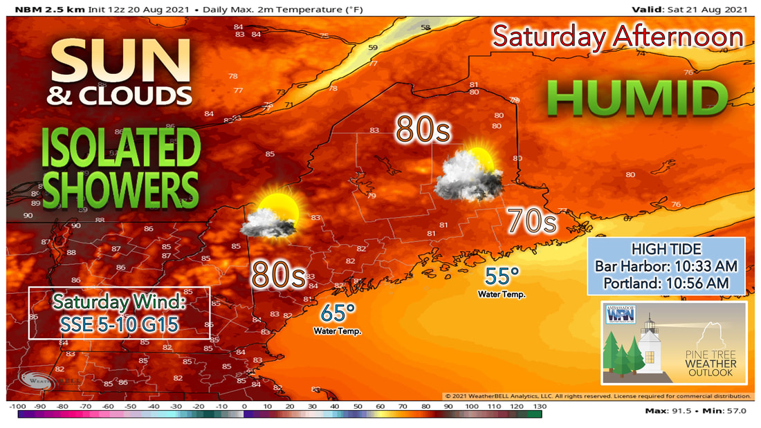 Heading into the weekend, Saturday looks to be the better of the two days with a mix of sunshine and clouds expected. Sunday looks to feature more clouds versus sunshine as Henri approaches from the south. This will continue to impact us through the beginning of the work week resulting in warmer temperatures along with the humidity continuing. A weak cold front will likely try to pass through the area Saturday. This weak cold front will bring with it some clouds and the risk for some isolated showers, especially in the mountains and eastern parts of the state. High temperatures where more sunshine is seen will likely climb into the lower to mid 80s, with some locations in western Maine feeling like their closer to 90 degrees 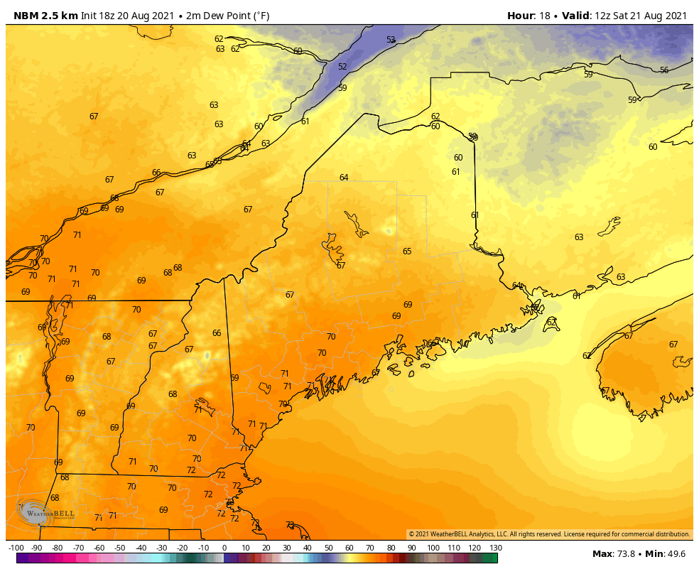 The dew points will likely be a major contributing factor to the stickiness over the weekend and even into next week. Dew points on Saturday appear to be the worst of all of the dew points over the next several days. Dew points likely climb into the lower 70s for a lot of places through southern and central Maine. The mountains and far northern parts of the state are spared from hitting a 70 degree dew point, but will still have to deal with the muggy weather with dew points still climbing into the upper 60s. Increasing clouds expected Sunday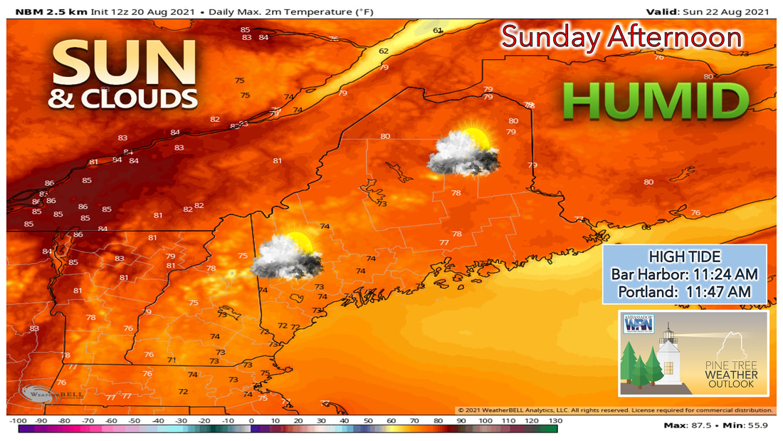 Clouds likely increase heading into and through the afternoon hours on Sunday. This is thanks to the approach of Tropical Storm Henri as it continues to makes its way closer to the coastline. Expect more sunshine the further north and east you head during the day on Sunday. A chance of an isolated shower can't be ruled out for the day as well considering the atmosphere will likely still be unstable enough for any communities that see more sunshine than clouds. High temperatures will likely climb into the mid 70s across southern and central parts of the state, with upper 70s and a few lower 80s the further north and east you head. 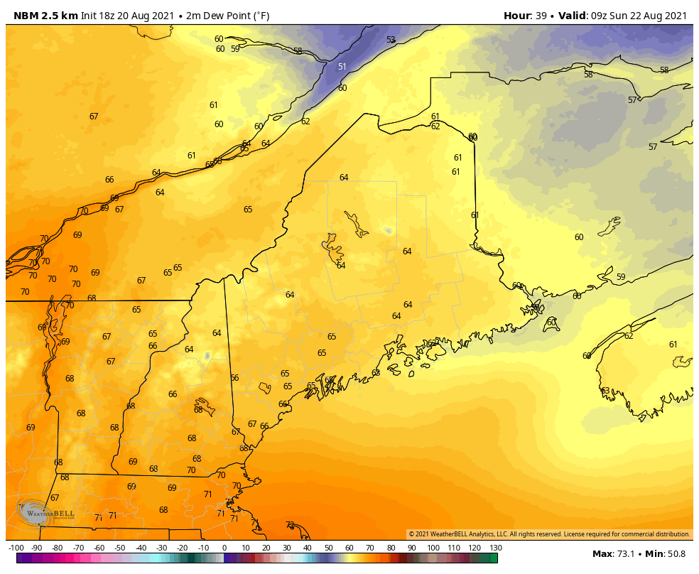 Dew points while they won't be as bad heading into the day Sunday, will still likely be in the mid to upper 60s throughout much of the day. This will help to keep that muggy feel to the air, and with temperatures only expected to climb into the lower 70s, it will help to make it feel even more humid than it actually is outside. Just make sure to take frequent breaks when outside over the next few days and stay hydrated. Tropical Storm Henri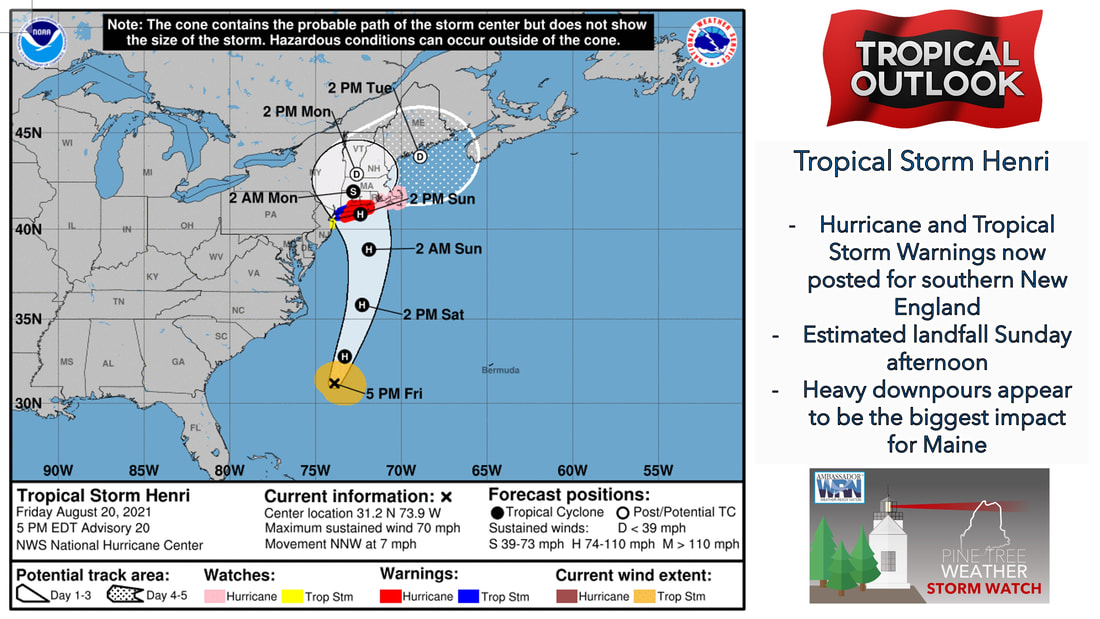 Tropical Storm Henri continues to make its way to the north and west as the track has continued to push the storm into southern New England. The 5PM National Hurricane Center update shows the track of uncertainty has narrowed in on the southern coast of New England. It is here that Hurricane and Tropical Storm warnings have been issued for the impending storm. As the system makes landfall during the afternoon and evening Sunday, it will likely begin to weaken, before making its way into the gulf of Maine Monday into Tuesday. 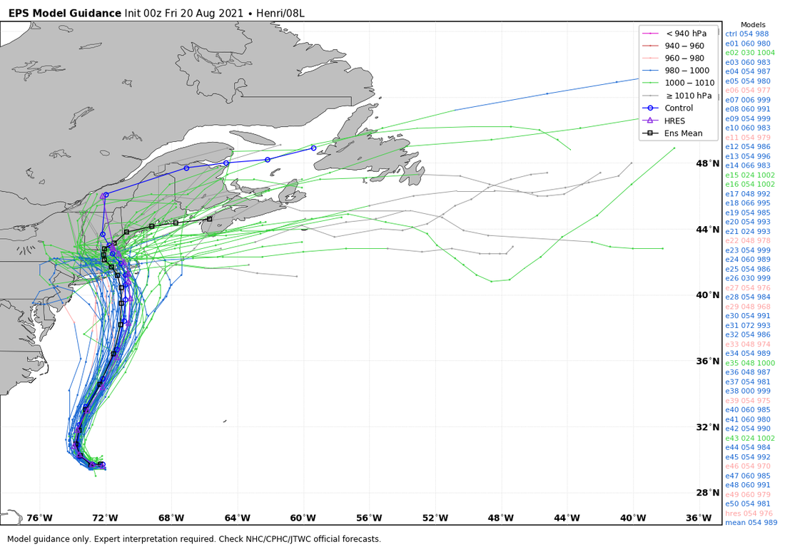 The computer model guidance over the past few days has become more in alignment with previous runs, and therefore has done a better job at determining the track of this storm. While we are still a few days out, and the track could make a last minute change, it looks pretty likely at this point that southern New England takes the brunt of this storm, and will likely see the most impact. While some gusty winds and heavy downpours can't be ruled out for us in Maine, the majority of this activity will likely occur to our south. The humid pattern continues next week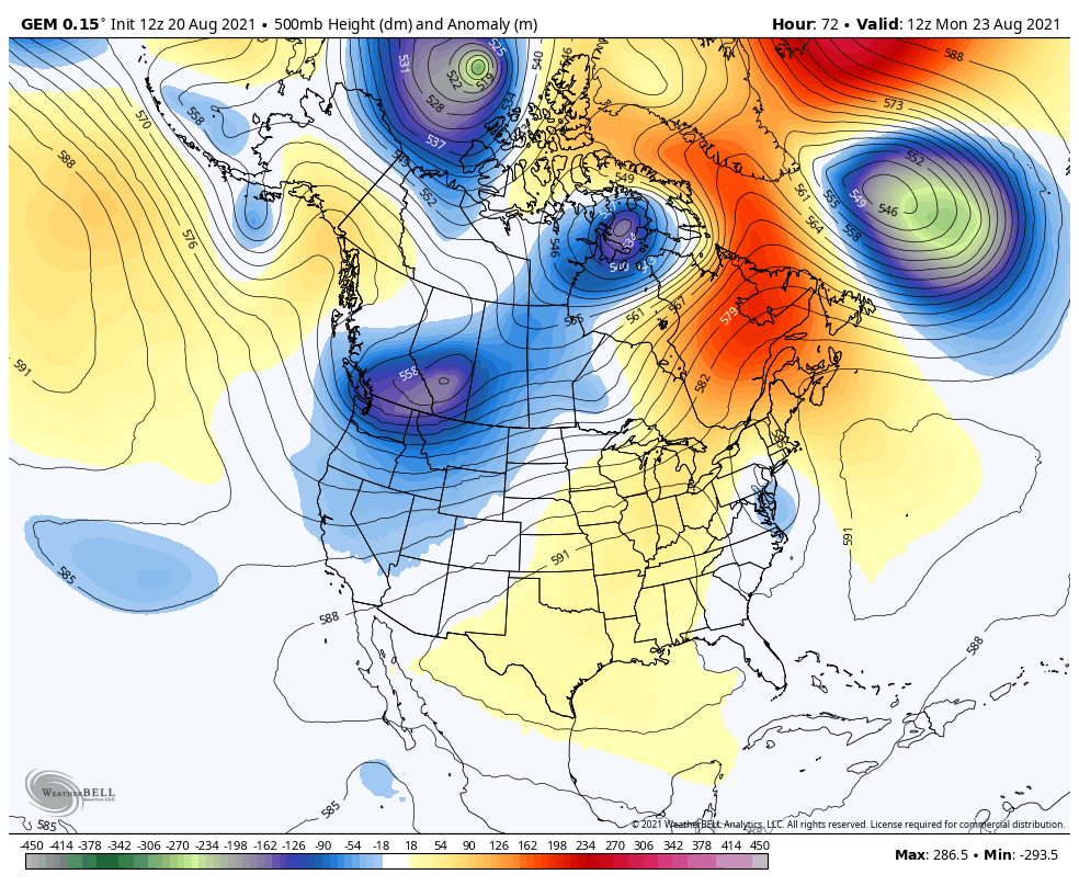 Heading into the upcoming week, an upper level ridge sets up over the eastern United States. This ridge helps to keep us in a quieter and warmer pattern heading into the middle of next week. Southwesterly winds are able to setup by the middle of next week allowing for warmer air to be pumped into our region from the south. This warmer air comes at the cost of humidity, as this warm air will bring the humidity with it, as dew points don't show any sign of falling out of the 60s through at least the middle of next week. 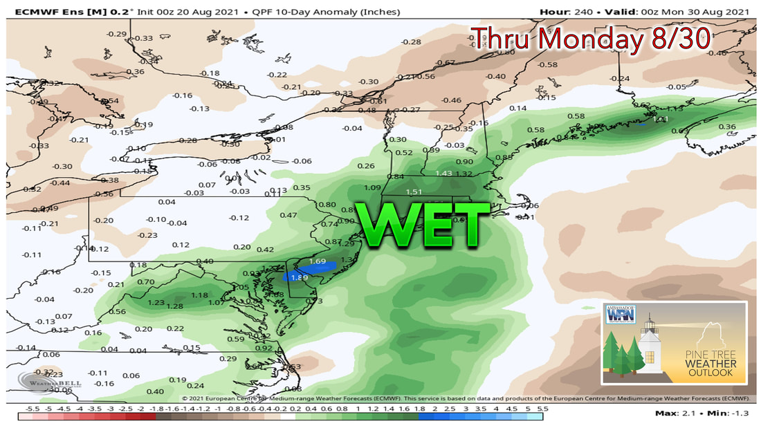 Although a good chunk of the state is no longer in a drought, the parts that are still seeing drought conditions are the ones who are less likely to see any precipitation over the next several days. With Henri looking to bring the majority of the precipitation to the area over the next several days, the setup of the rain bans associated with this storm will likely play a critical role as to whether or not the drought situation is helped. At this point the impact on the drought looks minimal as the majority of the precipitation looks to fall over southern parts of the state including the coastline, however that could all change if the track of the storm shifts.  Tropical Storms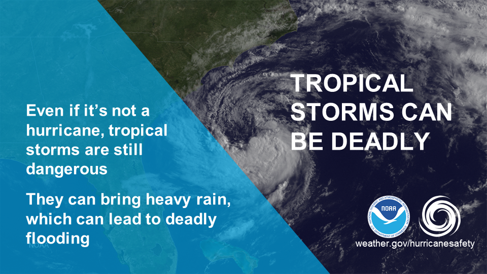 A tropical system does not have to be hurricane strength to be deadly. Tropical storms can produce strong winds, as well as heavy rainfall, which can lead to flooding. Don’t let your guard down when there’s a tropical storm watch. For more information about tropical storms and hurricanes, visit weather.gov/hurricanesafety Temperature outlook through next ThursdaySummer looks to hang on over the next week as high temperatures remain around if not a few degrees above the average for this time of the year. With these above average temperatures comes the humidity, which is reflected quite nicely in the warmer overnight lows. This upcoming week the overnight lows will likely be close to the dew point, which shows the muggier air that we'll continue to see heading into next week. 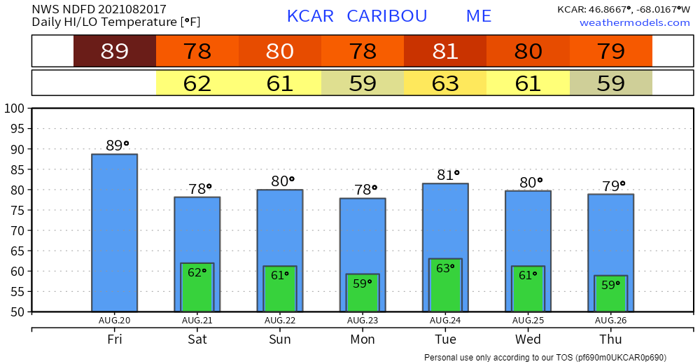 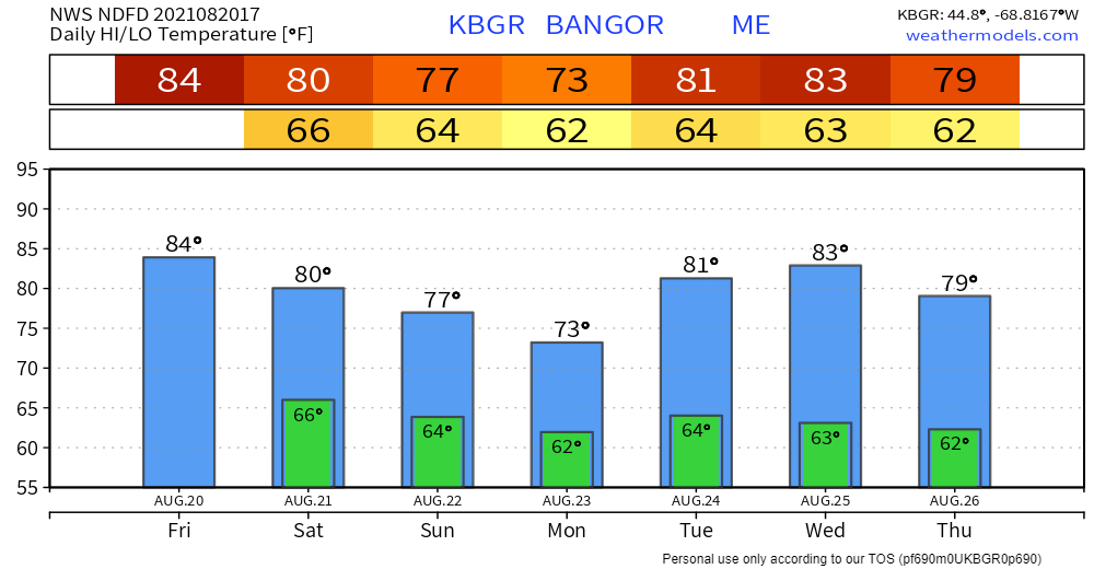 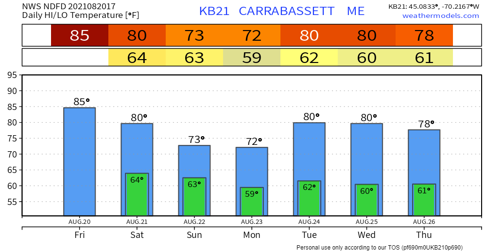 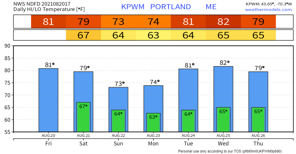 Be prepared to receive alerts and stay updated!
For more information in between posts, please follow Pine Tree Weather on Facebook and Twitter.
Thank you for supporting this community-based weather information source which operates by reader supported financial contributions. Stay updated, stay on alert, and stay safe! |

Mike Haggett
|