|
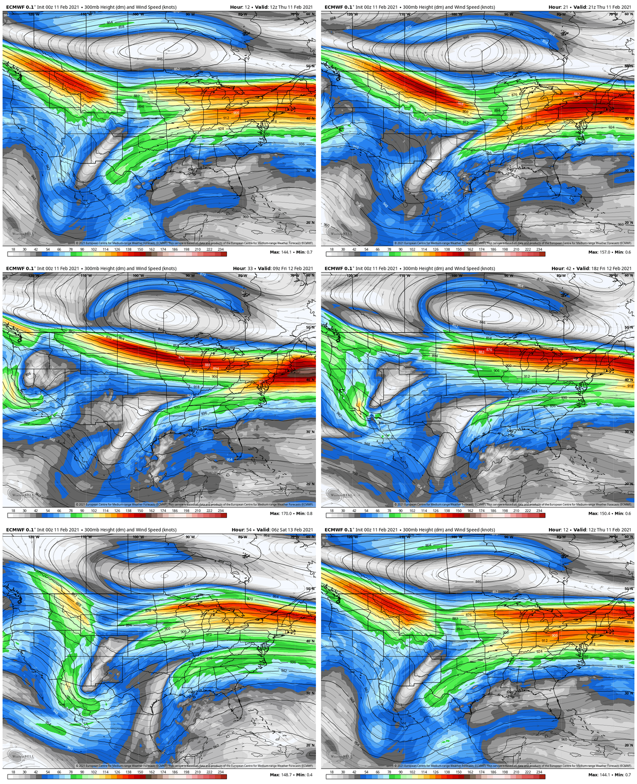
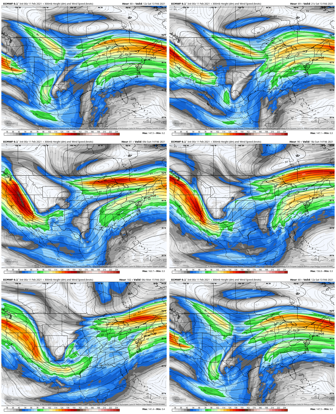
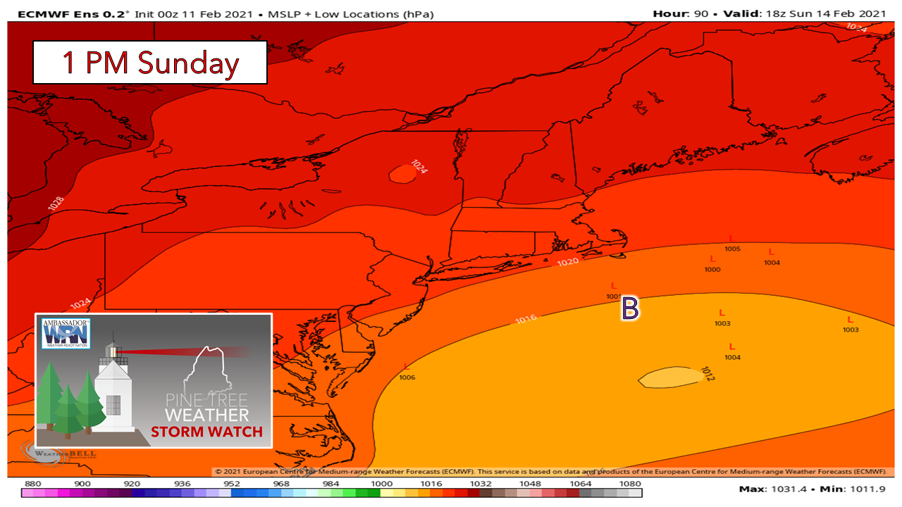
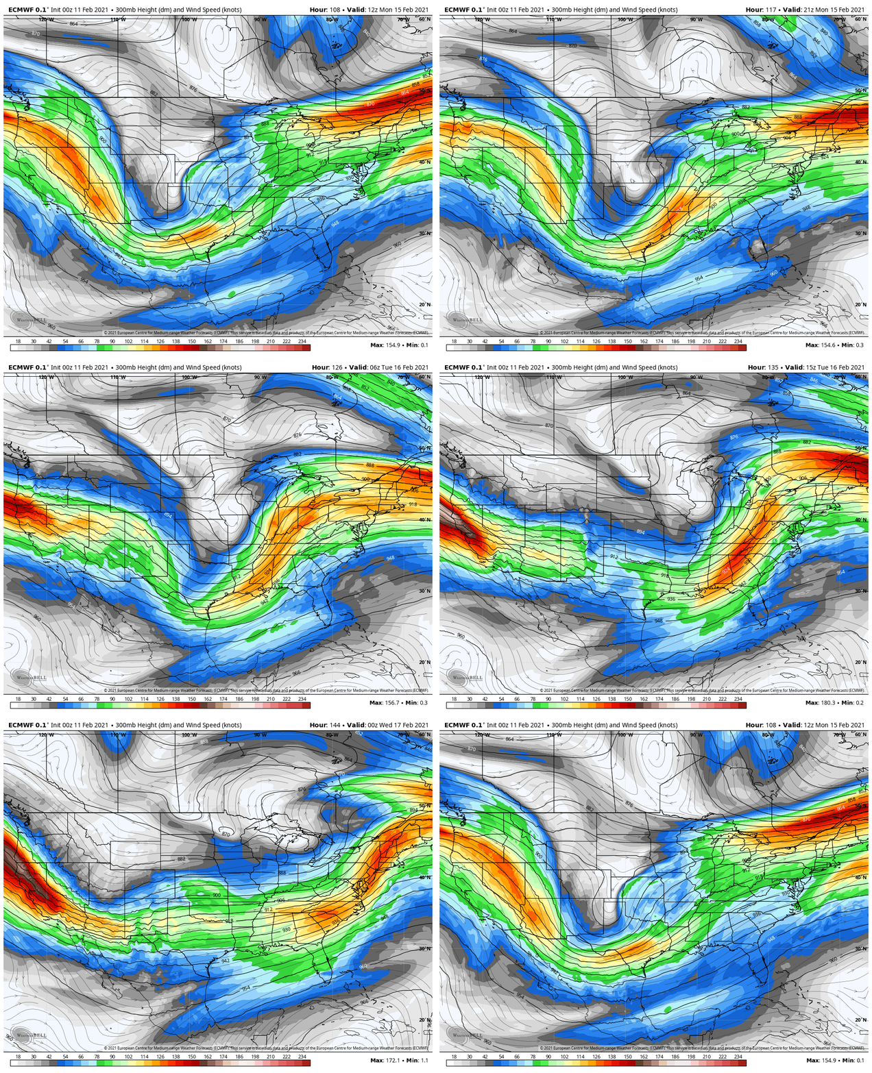
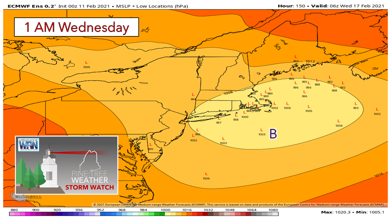
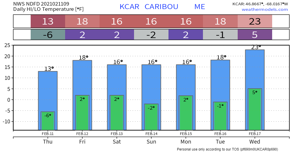
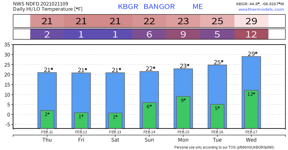
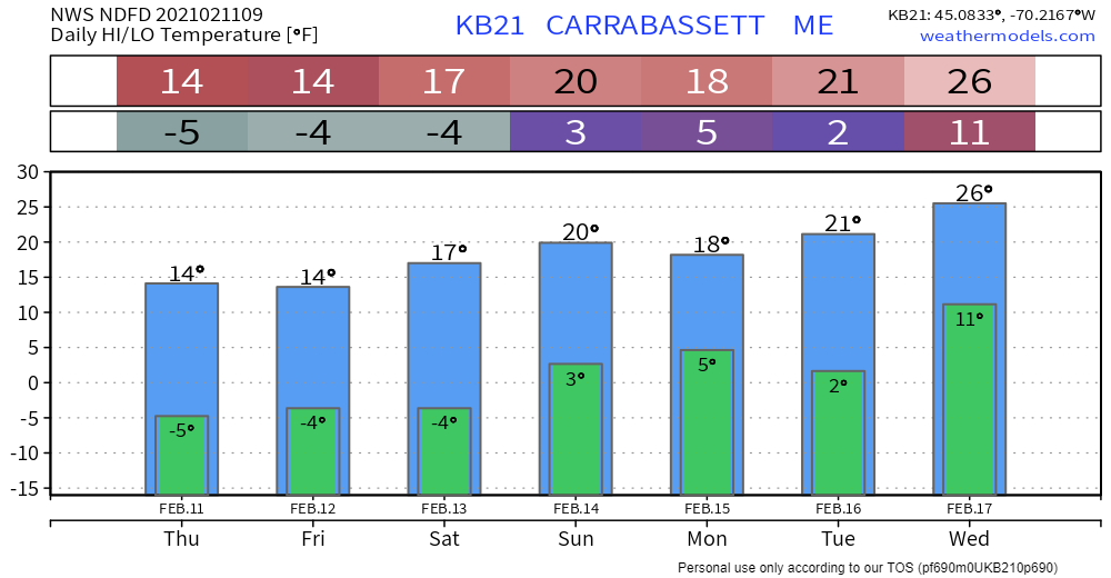
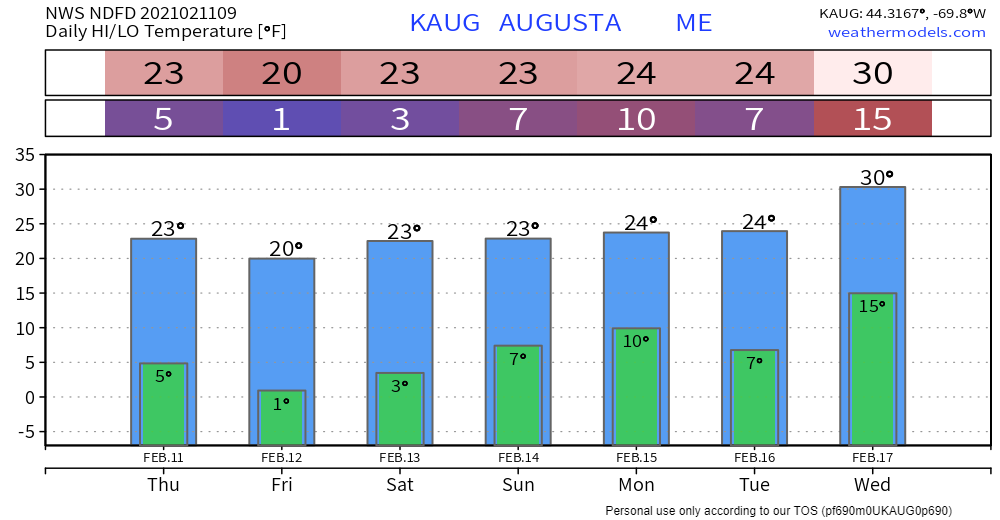
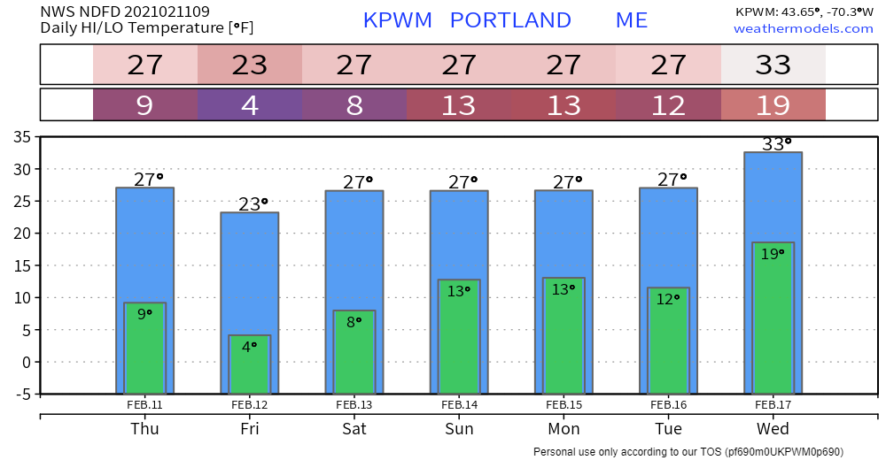
I've been able to get a bit of rest, continue to chip away at school, keep my office desk somewhat cleared off, and work some things behind the scenes for Pine Tree Weather as well. I look at the calendar as see that I have 10 weeks to go before I finish up through Penn State. I just want to say thanks for your trust and support over the years. I am in my tenth year of forecasting for my lifelong home area of over 50 years, and it has been an incredible journey. I will continue to post here when warranted, but I will take my breaks from the 2:30 AM alarm when the pattern permits. Thanks for your understanding and patience. Looking at the jet stream and ensembles thru midweekFrom Thursday morning through Saturday morning, there not a whole lot of change. The zonal pattern continues. The deep cold stays north. The polar and sub-tropical jet streams stay more or less separated. The sum total of this is storm activity stays south. Southern areas see the sun Thursday and Friday. Northern areas see more sun Thursday, a few more clouds for Friday. Beginning Saturday morning, the pattern begins to shift. A trough moves south over western Canada, a ridge moves north in the east. With the polar and subtropical jet streams appearing to stay separated, nothing major appears to come storm wise through the end of the weekend. The only thing that is on the radar is a chance for light snow on Sunday. With the separations of the cold and warm air streams, the outlook at the surface is flat and mundane. The two jets eventually phase, but that appears to occur well to the east of the region, with no impacts other than snow showers from an inverted trough set up as weak low pressure slides away. As we head into early next week, the trough over the west digs in deep. How about temperatures around 0° for Dallas, Texas, along with big snow deep in the heart of Dixie? That is real possibility and a worrisome concern there. For our area, we see the ridge build north, and potential for the phasing of the polar and subtropical jet streams, which means a storm chance. I would not take anything to the bank on this idea yet. Models have been poor in the mid-range for the past couple weeks. If this general idea holds, it would bring snow for the north and perhaps the western mountains, with potential icy / sleety mix for the coastal interior on up into the foothills in the Tuesday into Wednesday timeframe. The most important thing to understand at this point is the idea needs to hold together, which time will tell. We'll see what this looks like over the weekend before any ideas on impacts, precipitation types and amounts get thrown around. Stay tuned. Temperature outlook through WednesdayThe normal values for Caribou are 22° for a high and 3° for a low. For Portland, it is 34° and 15°. If you're keeping track of these occasional snippets of information, you will notice that we are beyond the bottom mean average low mark for the season, which occurs in late January south and early February north. What this also indicates by looking at the forecast temperatures is we'll be running generally below normal on both the low and high end until the middle part of next week, as it appears for now. Be prepared to receive alerts and stay updated!
For more information in between posts, please follow Pine Tree Weather on Facebook and Twitter.
Thank you for supporting this community based weather information source which operates by reader supported financial contributions. Stay updated, stay on alert, and stay safe! Thank you as always for your support! - Mike |
Mike Haggett
|

