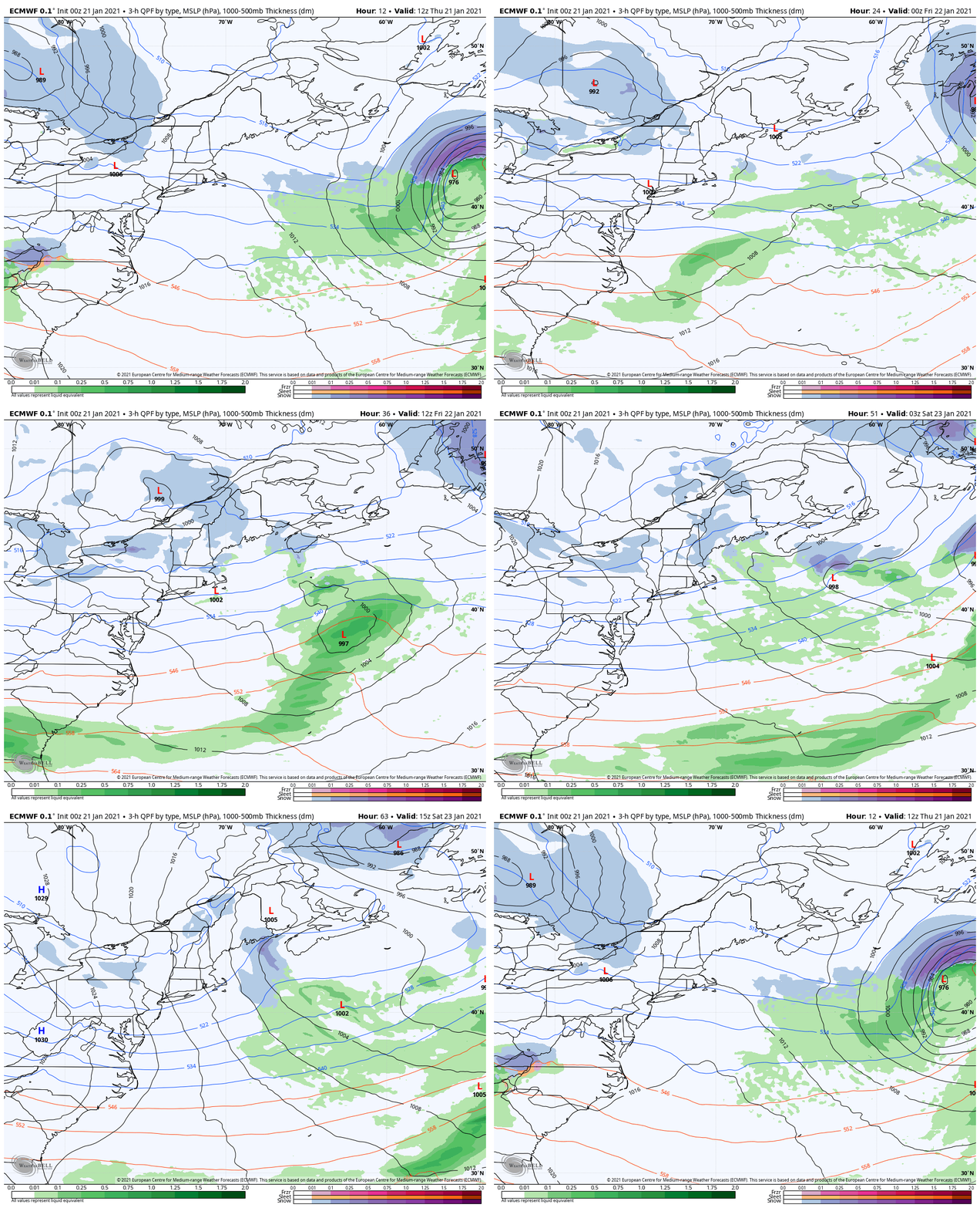
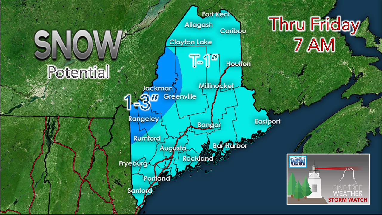
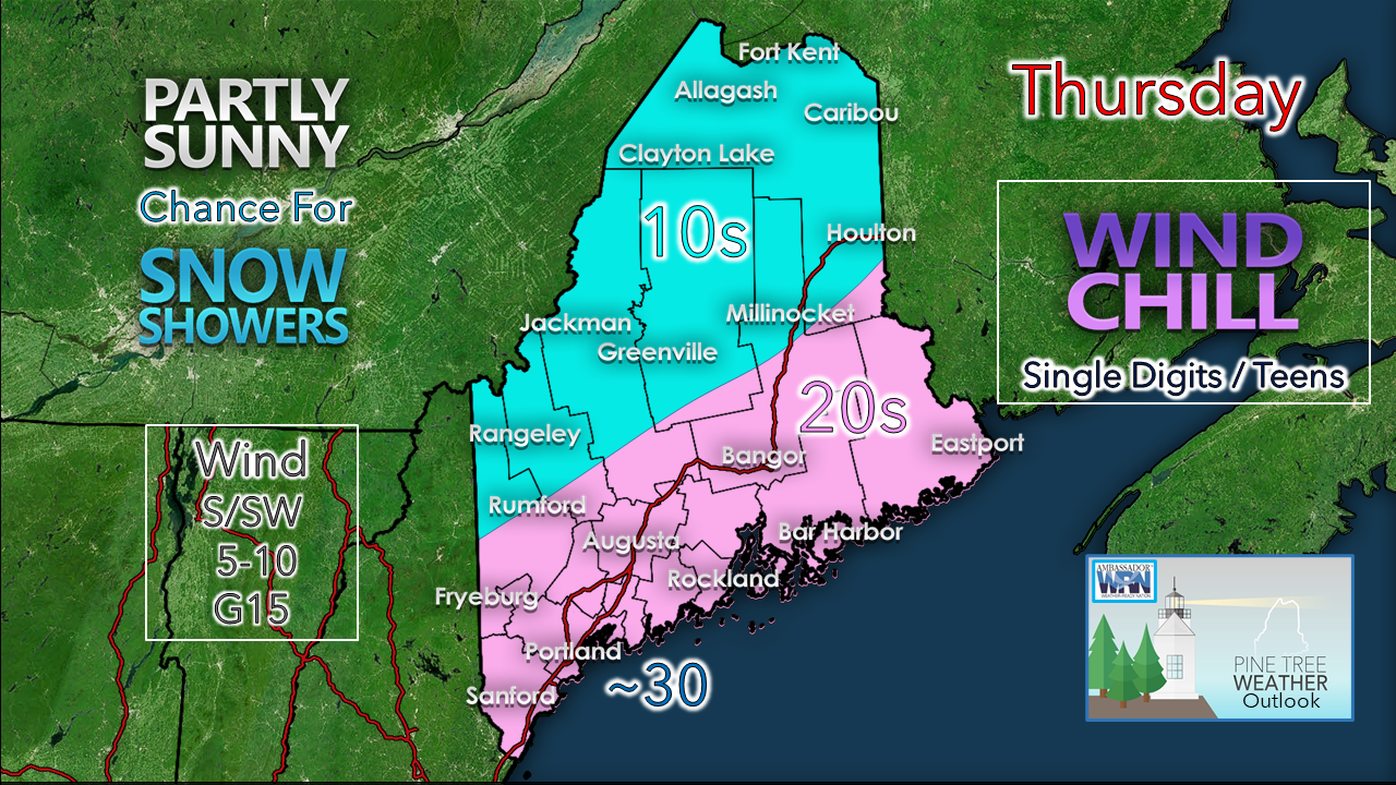
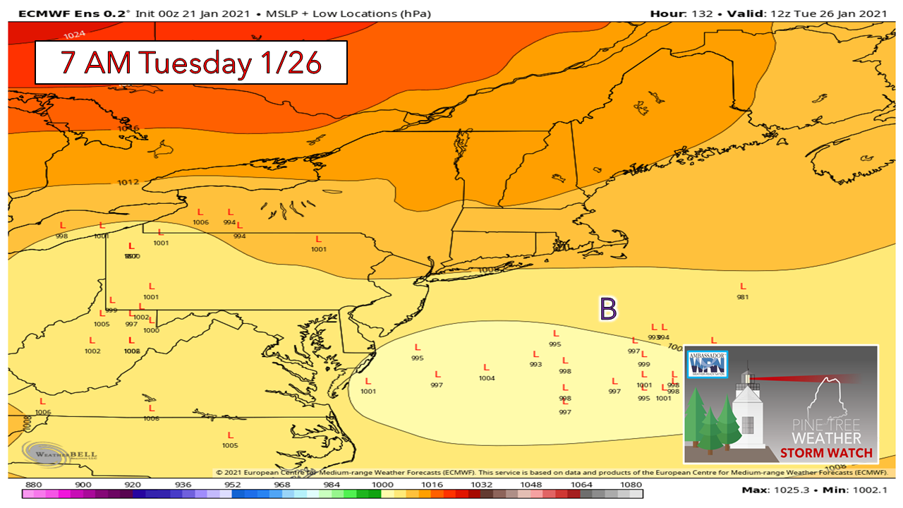
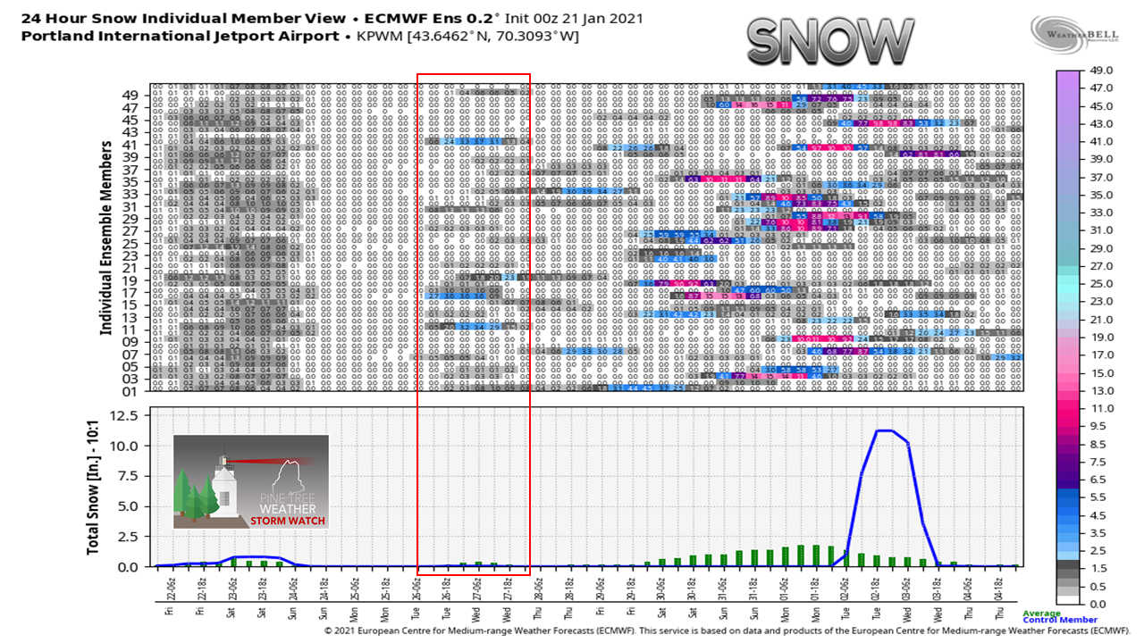
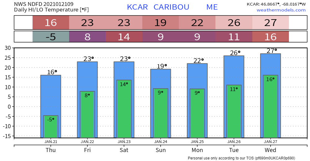
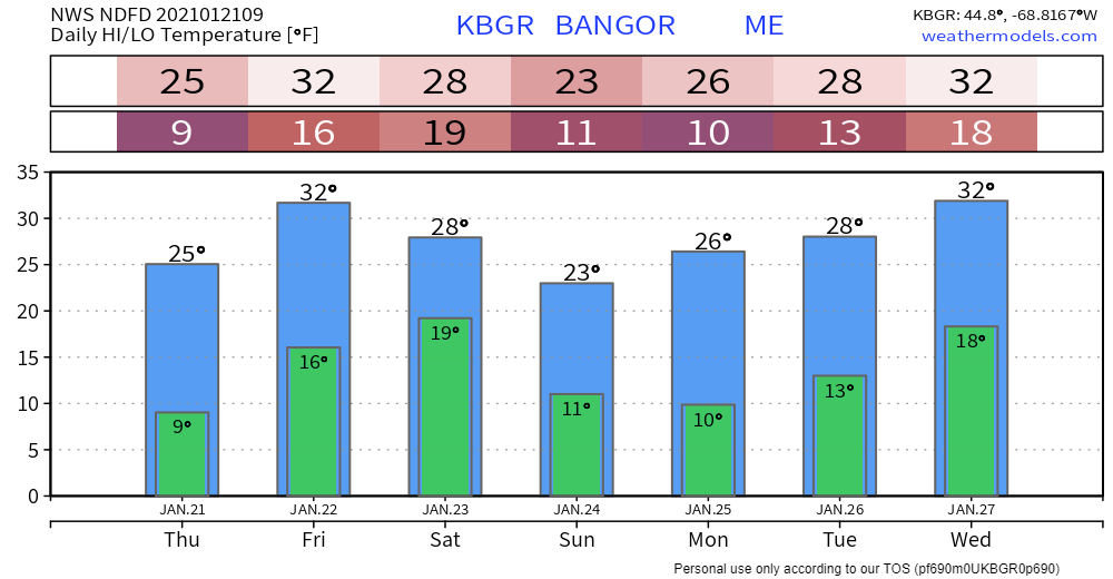
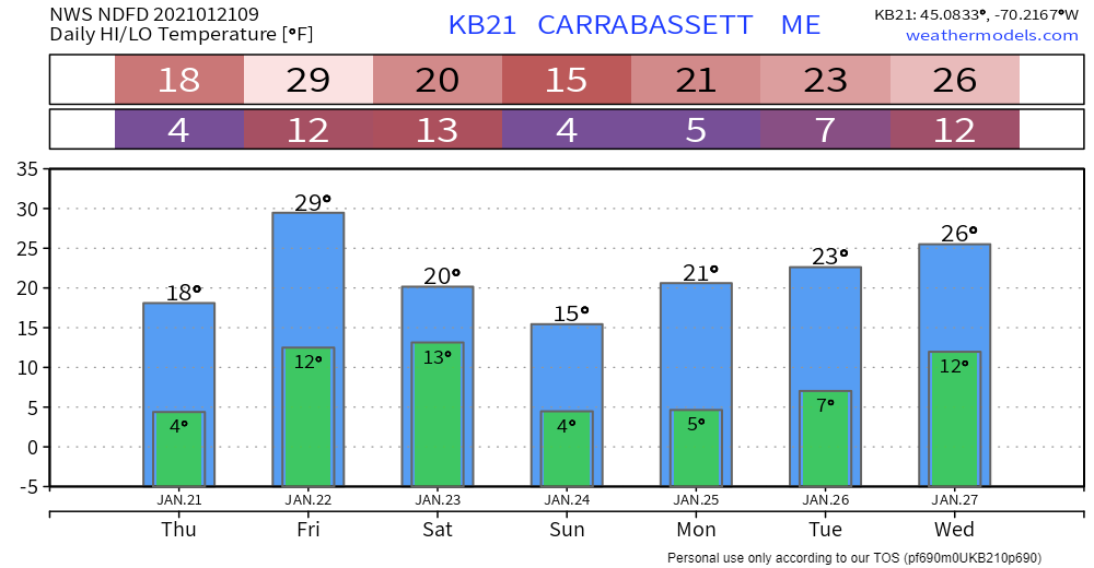
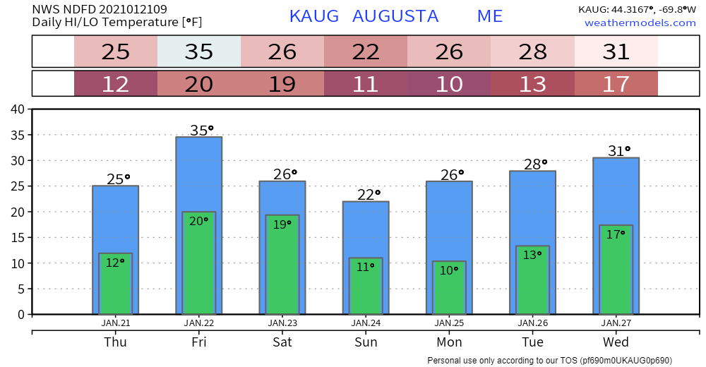
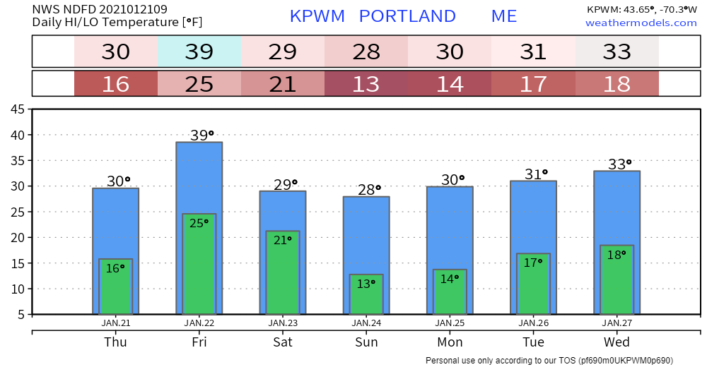
Lazy upper low and inverted trough to bring snowA big storm that formed to the south of the region slams into Newfoundland during the day Thursday. A weak area of low pressure slides into the state today and will hang around over the region through the first half of the weekend. Through 7 AM Friday, the mountains will be region that picks up the snow. There is a good chance all areas see some light snow fall, but dry air may prevent any accumulation of concern. Just a heads up for Friday from Portland to Eastport. There is a mix of ideas on where an inverted trough may set up. Where and IF it does could bring a potential plowable event. I will update on this Friday morning. High temperatures for the day appear to be slightly below normal. You may want to grab an extra layer on the way out the door to account for the wind chill. Face coverings will come in handy today. Storm potential next week continues to be southSome windshield wiper effect going on between north and south which potentially keeps the coast on the fringe of the storm idea for the first of next week. Most of the ensemble lows are south of the benchmark "B" 40° N / 70° W point with the overnight European ensemble run. Looking at Portland shows that area has a better chance for snow over the next couple of days than it does next week at this point. It's still too early to dismiss any potential impacts for the coast. If you see any deterministic charts floating which shows a potential blast of snow later next week, there are a grand total of two ensembles out of 51 feeding into that idea. It's comical at times to look at some of these long range ideas and how deterministic ideas handle it with very little support. We'll see what happens with that, if anything. Temperature outlook through WednesdayThe seasonal average for Caribou is 19° for a high and 0° for a low. For Portland, it's 31° for a high and 13° for a low. It's generally warm on either the high or low ends through the next 7 days. Be prepared to receive alerts and stay updated!
For more information in between posts,
please follow Pine Tree Weather on Facebook and Twitter. Thank you for supporting this community based weather information source operates by financial contributions. Stay updated, stay on alert, and stay safe! Thank you as always for your support! - Mike |
Mike Haggett
|

