Cool start on Tuesday, fair conditions for most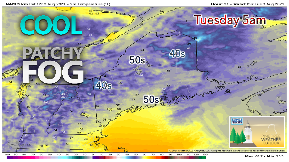 A cool and refreshing morning is in store on Tuesday with many waking up to temperatures in the high 40s to mid 50s. Some patchy fog is possible in the valleys and across northern areas, but it should begin to clear out shortly after sunrise. High pressure is expected to build over the northeast, allowing for a mostly dry day. A weak cold front is projected to track through northern Maine, but due to the lack of moisture available in the atmosphere, widespread precipitation is unlikely to occur. An isolated shower or two cannot be ruled out across far northern areas, but conditions should otherwise be partly to mostly sunny statewide. The front has the potential to stall out over the Atlantic, providing a boundary for shortwaves to develop on later this week. While Tuesday appears to be a very nice day, unsettled weather looks to be more likely beginning Wednesday through the end of the week. 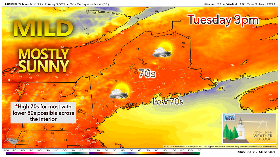 High temperatures on Tuesday will likely reach the mid to high 70s statewide. The low 80s are also possible, primary across the southwest interior stretching towards Bangor. A southwesterly sea breeze is expected to develop along the coast, keeping high temperatures a few degrees cooler at the beaches. Breezy conditions are possible in the northern half of the state as well as the coast, with gusts around 20 mph. Humidity levels appear very low thanks to the dry air mass in place, allowing for comfortable conditions. Tuesday is looking like the nicest day this week, as precipitation chances ramp up by Wednesday evening for certain areas. Chances of rain for the Downeast area through the end of the week, heat returns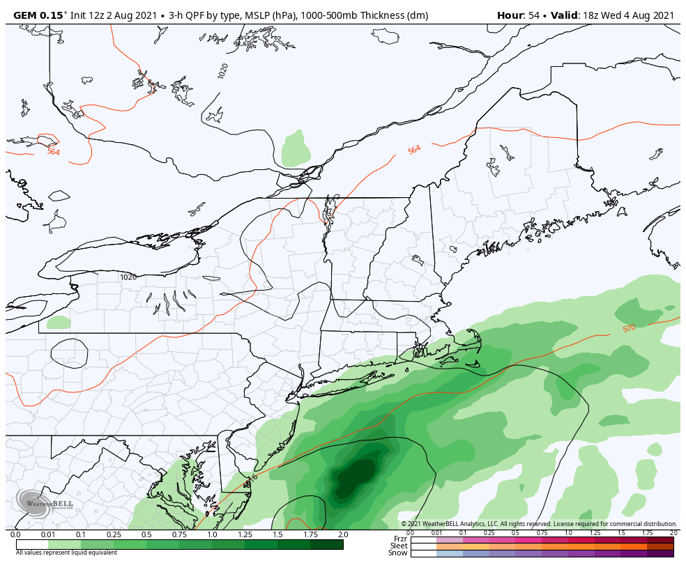 Beginning Wednesday through the end of the work week, an unsettled pattern is expected to begin. Showers will be possible each day with otherwise dry periods in between. The Downeast coast appears to be the most likely area to receive precipitation on Wednesday evening into Thursday as a low-pressure system approaches the Gulf of Maine. There is some uncertainty amongst models regarding how far inland the precipitation spreads. It is possible that only the edge of the system clips the coast, leaving most interior areas dry. As it currently stands, this system is unlikely to bring widespread, significant rainfall. However, forecast confidence will grow throughout Tuesday and Wednesday, so continue to check back for updates! 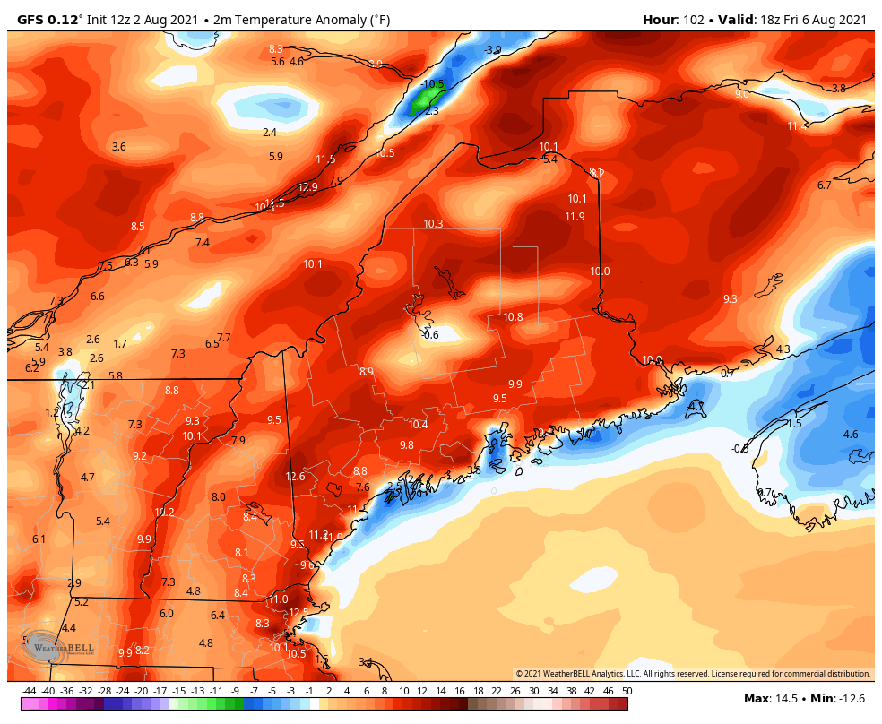 Temperatures are expected to begin trending above-average beginning Friday. While extreme heat does not appear to be a threat, there is a potential for 10°+ anomalies during this period. With dew points expected to rise, we will be monitoring the chance for thunderstorms as the week goes on. This weekend has the potential to be quite warm and sticky if the humidity is able to build. 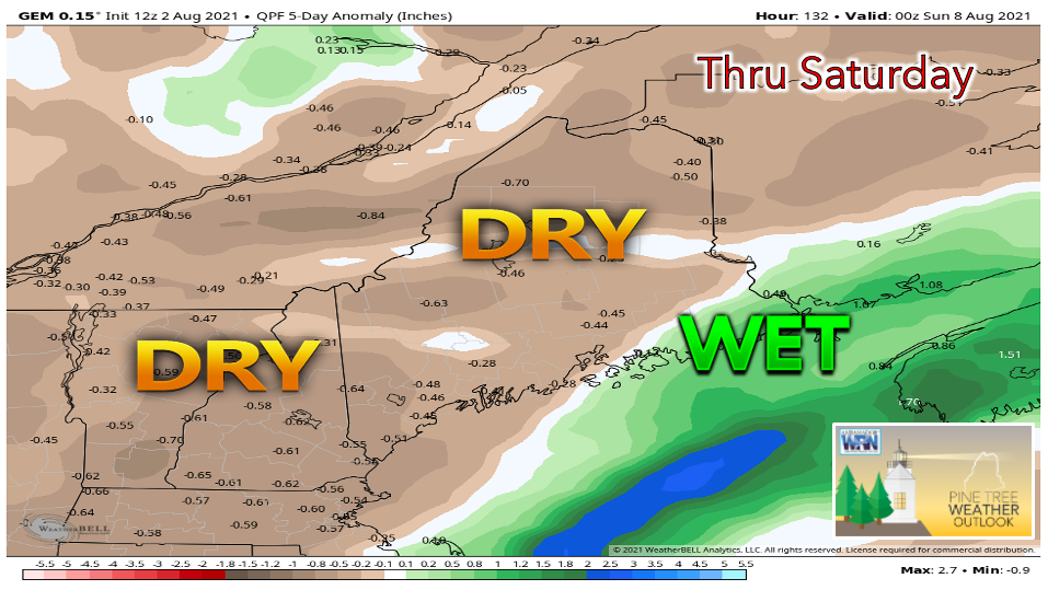 Drought and abnormally dry conditions continue to be an issue as the first week of August does not appear to offer much relief. Although chances of precipitation are possible throughout the next several days, most of it looks to be confined to the Downeast region, with the exception of an isolated pop-up thunderstorm or two in the mountains. While the coast has been trending in the right direction thanks to a very wet July, the interior remains deprived of rainfall. Check back on Thursday for a more in-depth look at the current drought situation in Maine. Wireless Emergency Alerts (WEA) Wireless Emergency Alerts (WEA) are emergency messages sent by authorized government alerting authorities through your mobile carrier. America’s wireless industry is helping to build a Weather-Ready Nation through this nationwide text emergency alert system. weather.gov/wrn/wea Temperature outlookTemperatures through the end of the work week appear fairly seasonable with a warming trend likely for the weekend. The warmer temperatures are expected to stick around for the second week of August, with the potential for certain areas to see the mid to upper 80s once again.  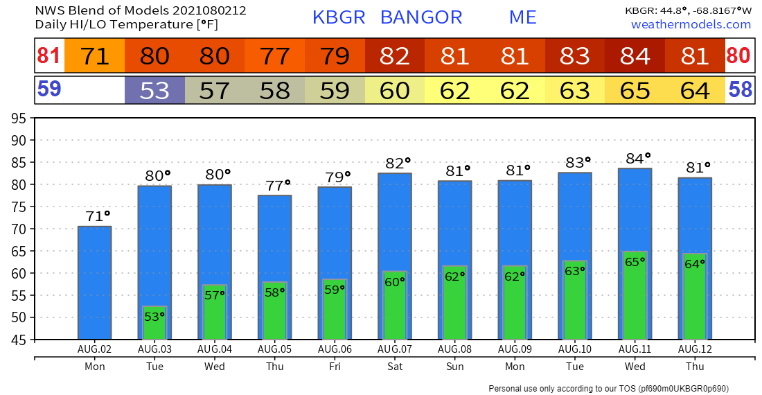 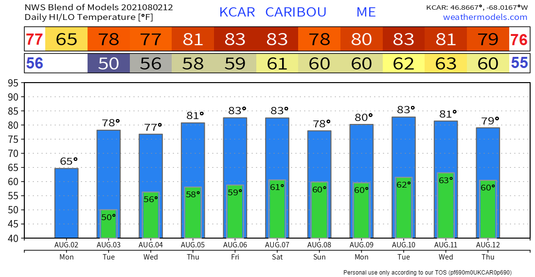 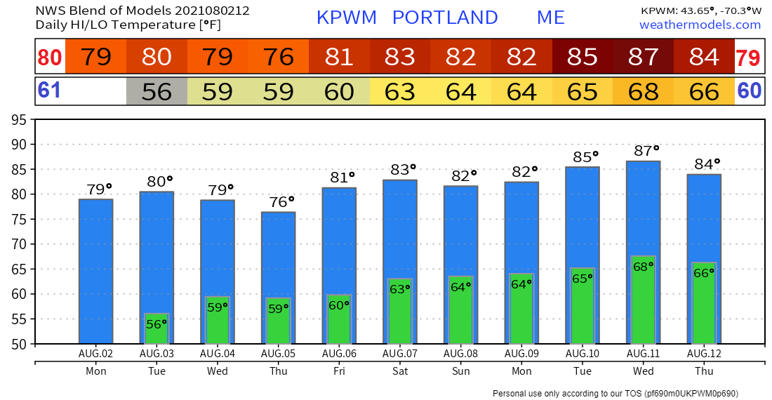 Be prepared to receive alerts and stay updated!
For more information in between posts, please follow Pine Tree Weather on Facebook and Twitter.
Thank you for supporting this community-based weather information source which operates by reader supported financial contributions. Stay updated, stay on alert, and stay safe! |

Mike Haggett
|