Possible thunderstorms for Sunday and Monday, and a look at the upcoming week's temperatures7/25/2020 Sunday: Hot temperatures and thunderstorms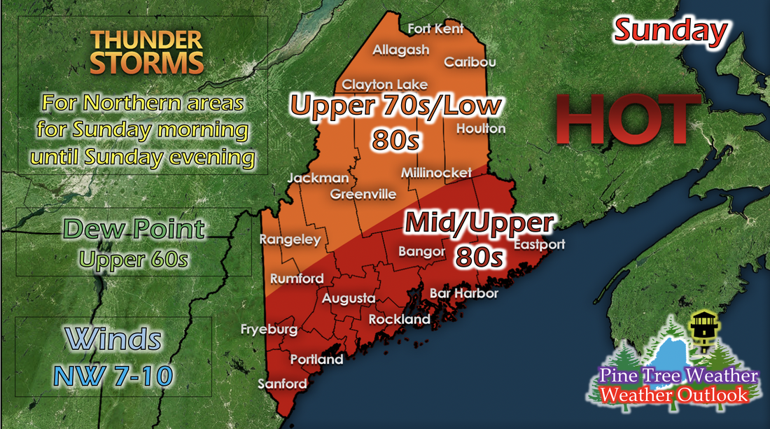 Temperatures remain hot again for Sunday, but what's different is the increasing likelihood of thunderstorms for northern and some central areas of Maine. A stationary front has stalled north of Maine and in Canada, and the cold front from the oncoming low pressure system in combination with increased wind shear values and higher dew points suggesting moisture in the air, gives northern and parts of central Maine a good possibility of thunderstorms. Short-range models show these storms appearing all day, with no set location for these isolated and scattered storms. Monday: Hot temperatures again, and afternoon storms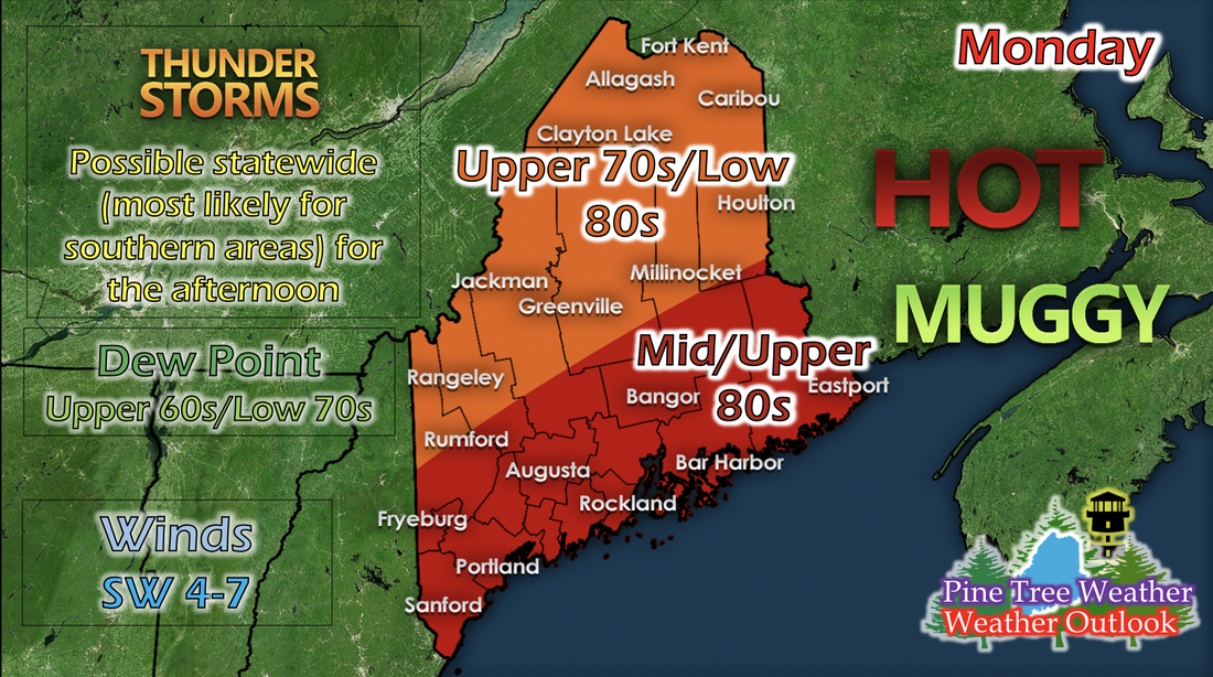 Dew points continue to increase, giving the air a soup-like feel when you go outside. Increasing dew points means increasing moisture in the air and more fuel for storms. Although it's not as much moisture as we would like to see for strong storms, temperatures are similar to what they were for Sunday, and there looks to be increased instability and higher CAPE (energy in the atmosphere) values in the atmosphere more concentrated in the southern portion of the state; this is where the greatest likelihood of afternoon thunderstorms on Monday. Max. temperatures for this week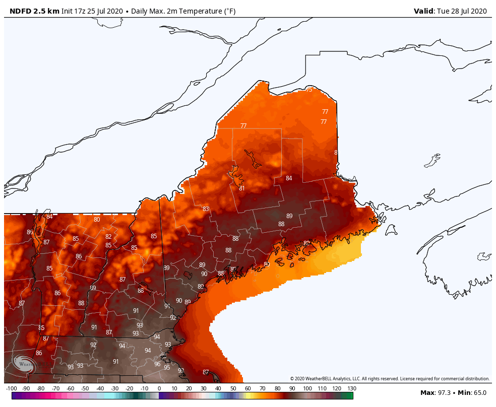 The GIF above is the maximum temperature outlook from a short-range model running from Tuesday to Friday of the upcoming week. This model in particular has a history of a very slight warm bias, so the southern portions may not see temperatures in the high 80s and 90s. As that cold front moves through, maximum temperatures are calculated to drop slightly by this model, and later in the week should have temperatures only reaching in the upper 70s and low 80s statewide. As this system does move closer, precipitation is likely as well for parts of the state. We don't have enough information from models to have a good idea where any storms or precipitation might develop, but we will update you as the information becomes available. Help forecast verification, and stay informed!
For more information, please follow Pine Tree Weather on Facebook and Twitter.
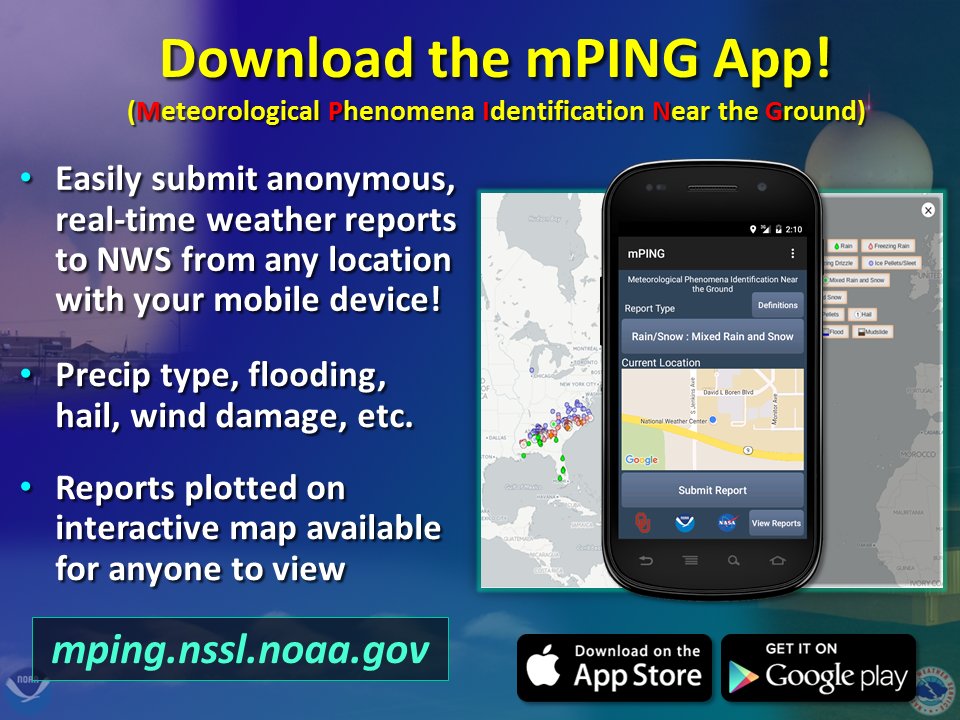
Thank you for supporting this community based weather information source that is funded by your financial contributions. Stay updated, stay on alert, and stay safe! Thank you so much for all of your continued support! This is my Venmo if you'd like to contribute: @Kaitlyn-Lardeo Have a great weekend! - Kaitlyn |

Mike Haggett
|