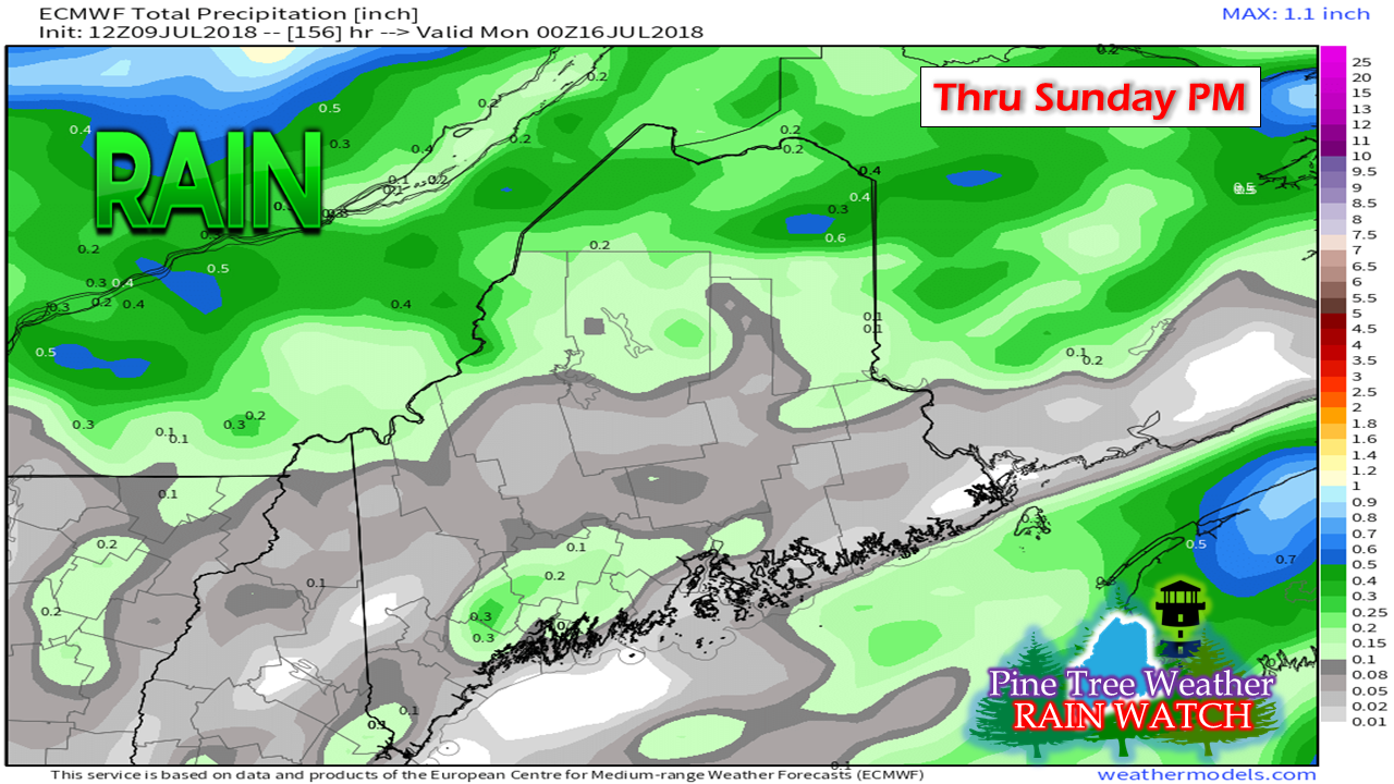
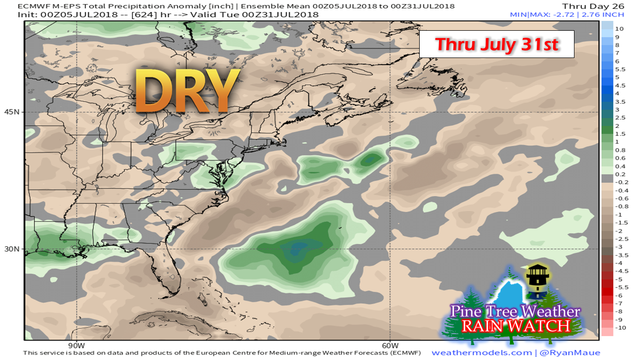
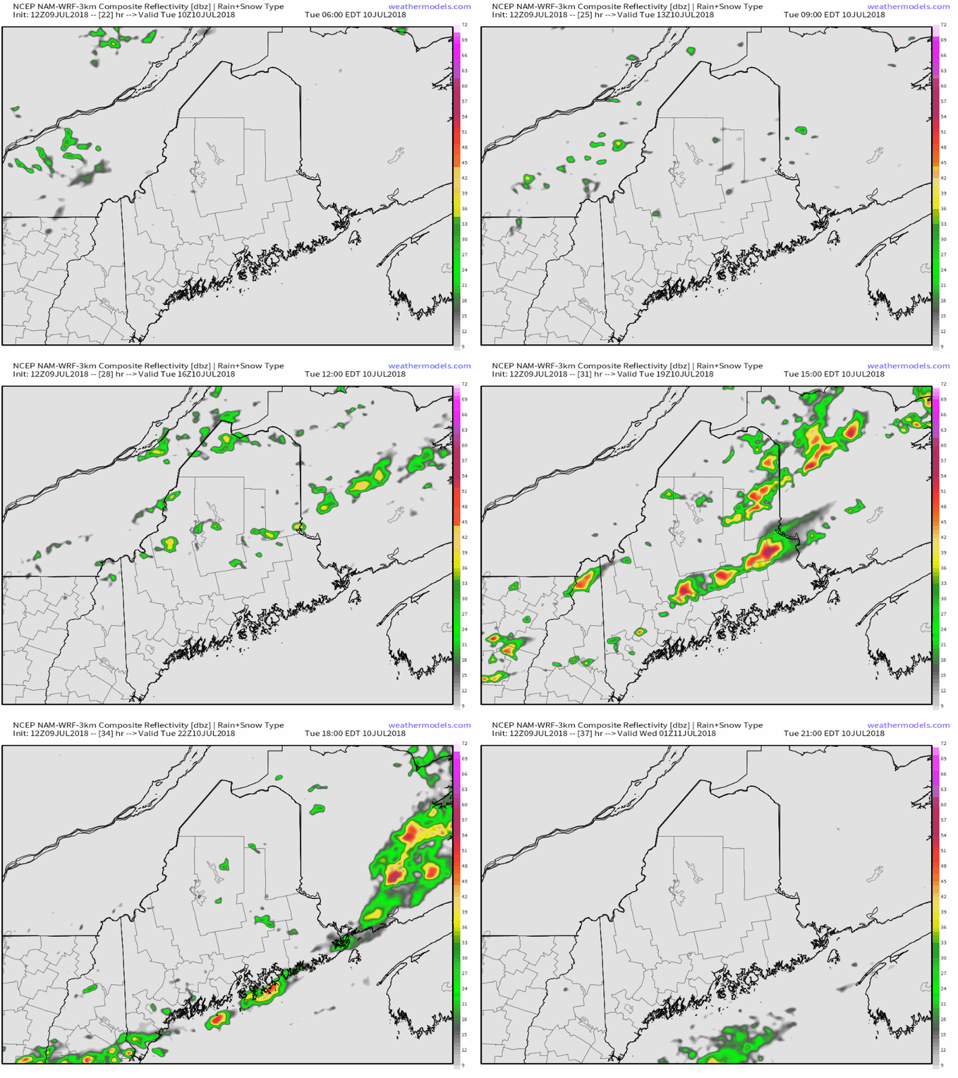
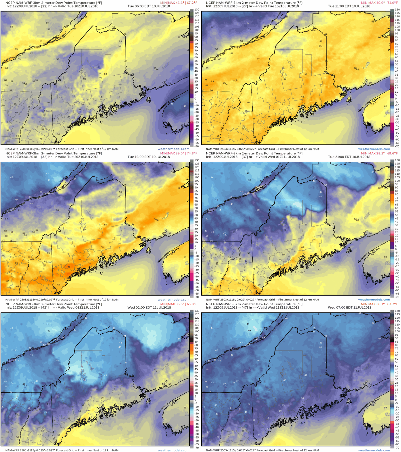
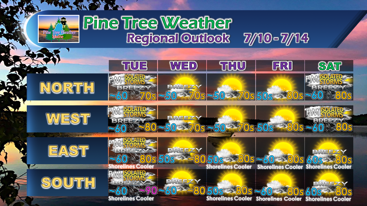
Rain outlook appears minimalOur already abnormally dry summer continues. This is typically the dry time of the season, so in some ways, this model idea isn't that big of a surprise. I hate beating on dead grass with the drought outlook, but the idea remains consistent for below normal amounts of rainfall in the foreseeable future. It's all I have talked about for months now. Keep up groundwater conservation efforts. Be blessed with any rain from pot luck showers and thunderstorms. There are some indications the trend may change in August. The forest fire threat continues. Stay in touch with the local fire department, park rangers, and the Maine Forest Service for the latest on burning status. Use utmost care with camp fires, grills, cigarette butts and fireworks. Next pot luck shower/storm chance: TuesdayA front drops through from Quebec on Tuesday which will the chance for showers and storms to the state. Most of the activity will be in the afternoon along the coastal plain. While the severe threat appears minimal, this is July, so the threat is on the discussion table. All areas should be on alert for a potential quick soaker, with lightning, gusty winds, and small hail possible through early Tuesday evening. Remember, when thunder roars, head indoors into a safe building. Humidity recedes by Wednesday morningThe recent uptick in humidity will be short lived as the front sweeps this round of the sticky air out to sea by Wednesday morning. Heat and humidity lovers will rejoice in the fact that another round of tropical air is on the way early next week, right on cue for the third week in July. I'll talk about that as this week unfolds. Tropical Storm Chris passes eastWhile Chris is no mainland threat to Maine, the storm could bring boating hazards from swells and surf, as well as rip current threats to the ocean coastline. The main threat appears Thursday and Friday from this point. If you are planning a trip to the beach later this week, it would be advised to pay close attention to the wave patterns. If there is a break in the surf, chances are there is a rip current in the middle of it. Watch out for the kids and those with low swimming skills. We have a new moon high tide Thursday night before midnight, which may bring some minor splash over to low lying coastal areas, with the swells and surf from Chris putting it over the top. Stay tuned for more on that as the week unfolds. For the latest on Chris, please check in with the National Hurricane Center. Regional outlook through SaturdayThe lack of rain means more sun. A cold front drops down on Saturday which may bring a shower / storm to the north country. A warm front approaches the region Sunday, which may bring a wider chance for pot luck showers and storms. That warm front brings the return of a tropical air mass to start next week.
As always, stay in touch with the National Weather Service in Caribou for eastern and northern Maine, or Gray for western and southern areas. Please check the Pine Tree Weather Facebook page and Twitter for more information from me. Thanks as always for your support! - Mike |
Mike Haggett
|

