
Maine spring starting to act like it This is not the news many of you want to see who don't have power restored yet, or have just come back online. Another rough storm is on the way. I've seen reports of people throwing away contents of freezers and refrigerators. A word to the wise: don't be in a hurry to fill them back up. Not only do we have rain to contend with, but wind will be an issue with this storm as well, and it may be windier than the previous one. Storm development and timing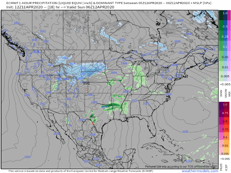 Sunday is going to be a scary day for the southeast as the forecast for severe weather is an ugly one. Low pressure forms over the Ohio River valley and heads northward into the Great Lakes and into Quebec. This system intensifies rapidly and brings a warm front up the east coast. Strong high pressure to the east helps to pump Gulf of Mexico moisture into the storm and brings our region heavy rain. As the frontal boundary works through and the storm advances north, strong gusty wind comes along with it. 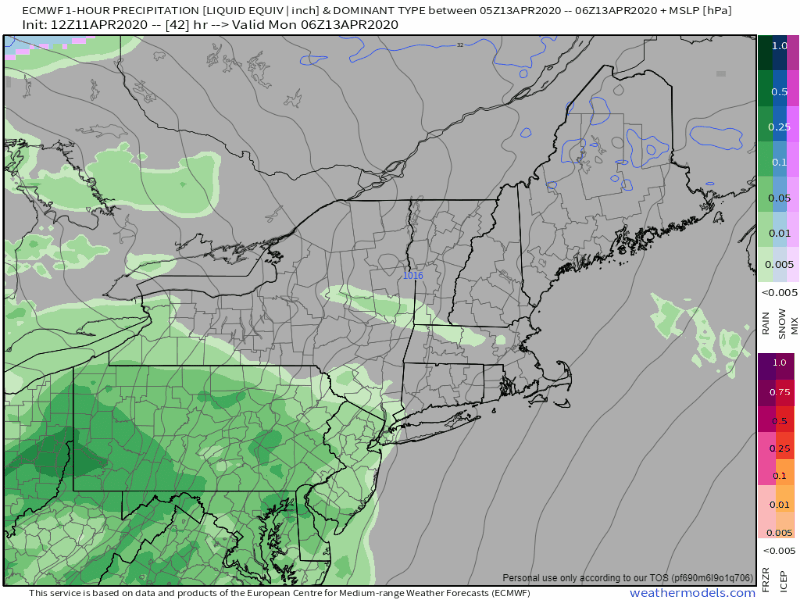 Monday will be a washout from start to finish. Rain overspreads the region Monday morning, and the faucet keeps running all day, ending Monday night. Rain could fall heavy at times, and with the Gulf moisture, bring thunderstorms. Heavy rain + melting snow = flood potential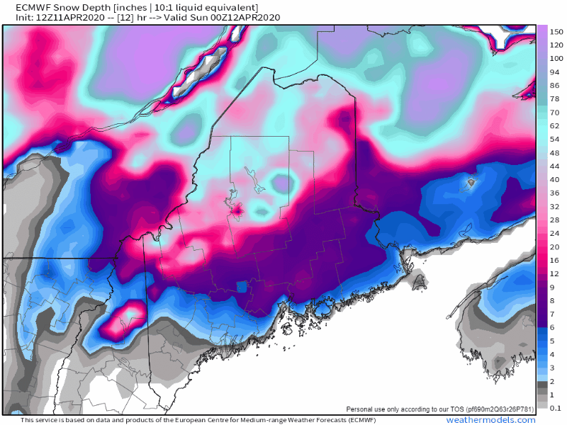 This simulated model loop shows a rough estimate of the current snowpack and how the rain, some fog, and warm temperatures will erode the current level back to where it roughly was before the recent dump. 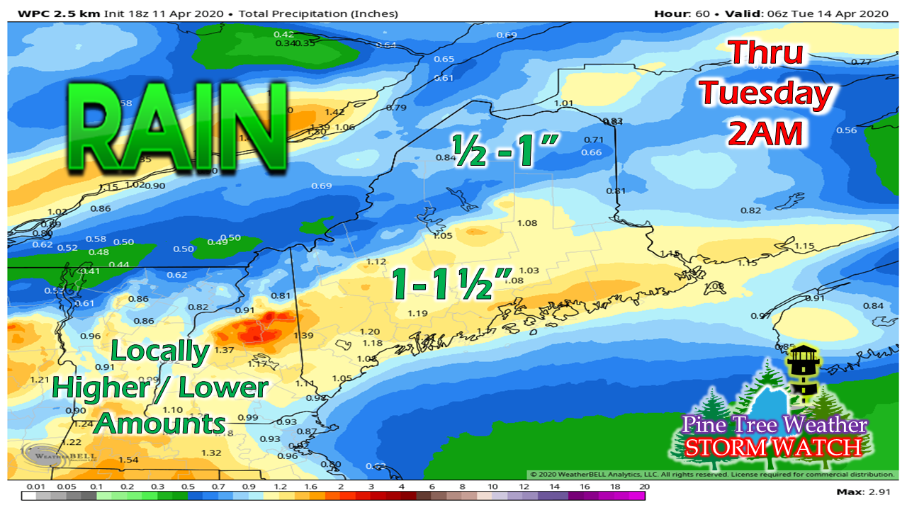 Rainfall estimates show some validity to the model idea, with potential for much of the region to receive a decent soaker. With snowmelt and runoff, there are flooding concerns. The rainfall idea from the Weather Prediction Center is roughly middle of the road. I've seen ideas for areas of 2"+, which makes me a bit concerned knowing how much water is in the current snowpack. 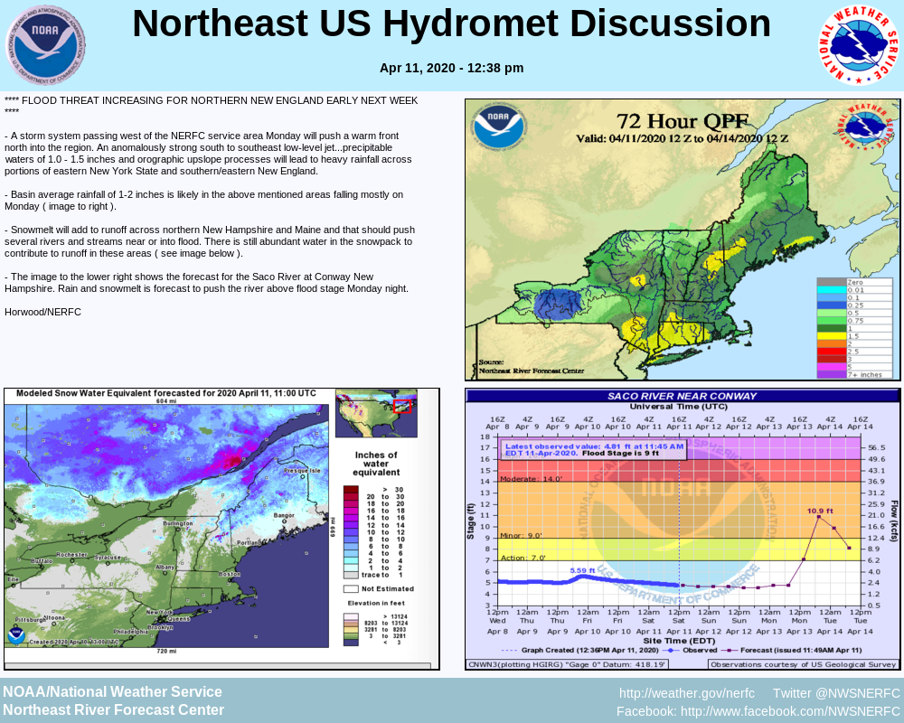 This is the Saturday briefing from the Northeast River Forecast Center already indicating the flood threat. This information is also available on this website on the briefings page, with additional information from both the Gray and Caribou weather offices. Regardless if you live in a flood prone area or not, this is all good information that gets updated regularly. You may find this page useful in conjunction with my discussions. Wind and shoreline concerns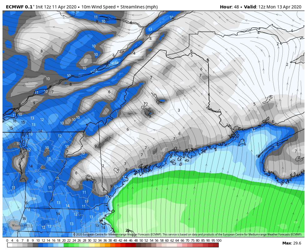 With the storm passing to the northwest of the region and intensifying as it heads into Canada, that puts our region into a vacuum. Strong southerly winds feeding moisture into the system will move through Maine Monday afternoon and evening. This stiff wind also comes in conjunction with high tide around 4 PM. Thankfully the astronomical tides are receding, but with seas of 9-15 feet, splash-over and minor flooding is possible. After the warm front passes through, the wind shifts to the west and remains gusty into Tuesday. Power outages are again a concern with this storm, with coastal areas especially vulnerable. Expect bulletins to be issued on that on Sunday. For those storm weary, it appears the region gets a break after this until maybe next weekend. Hang in there! Stay on alert! With the recent loss of power, internet and cell phone disruption, it would be wise to consider a small investment into an NOAA Weather Radio. For $20-$40, it could provide important information to you when you need it. The weather bands are standard on most public safety scanners, and newer scanner models and weather radios can be programmed for auto alert. Click here for more information.
► ► For the latest official forecasts, bulletins and advisories, please check in with the National Weather Service in Gray for western and southern areas, or Caribou for northern and eastern parts of Maine. Thanks as always for your support! - Mike |

Mike Haggett
|


