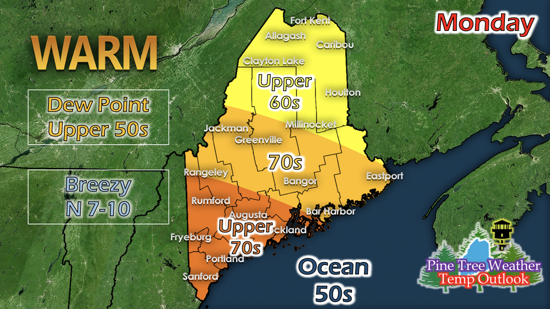
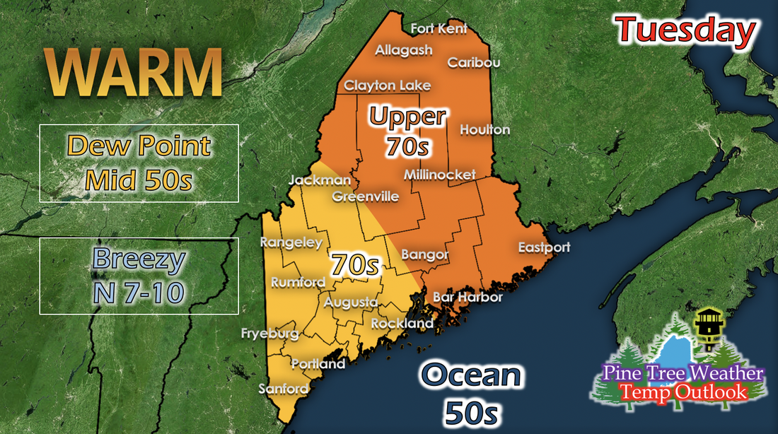
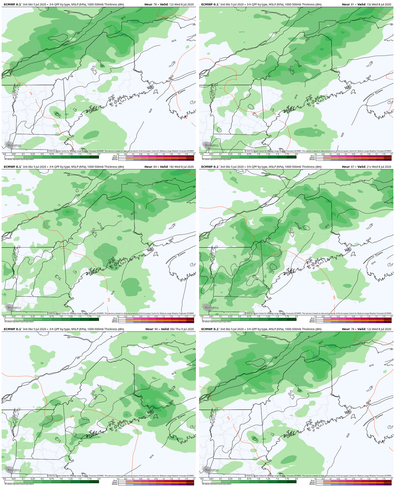
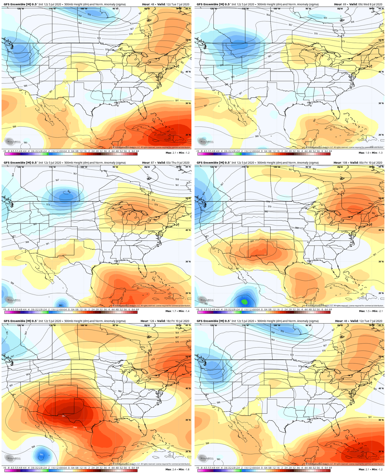
Monday: Warm temperatures and slightly humidThe recent passing of a cold front and low pressure system leaves some moisture in the air, resulting in a slightly humid feel for Monday as temperatures warm up. Portland and western areas will likely see high temperatures in the mid to upper 70s. Central, Mid Coast, and Down East with temperatures in the 70s, and Caribou and northern areas in the upper 60s. Winds will be northerly and slightly breezy; ranging from 7 to 10 mph. Tuesday: Temperature warm-upTemperatures begin to warm up as a weak high pressure builds in between the low pressure from a few days ago and another low pressure that will be making its way past Maine on Wednesday. Northerly winds bring drier air, so as temperatures warm up, dew points drop statewide. Some possible rain on WednesdayThe GIF above runs from 7 AM Wednesday to 7 PM Wednesday, and shows 3-hour precipitation. Since this is a medium-range forecast, precipitation is likely not this widespread. As mentioned before, another low pressure system will be making its way north of Maine on Wednesday. Both of the cold and warm fronts will be pushing through before becoming an occluded front past Maine. The lifting brought on by the fronts will likely give some precipitation, mainly isolated showers. Heat wave outlookThe GIF runs from 7 AM Tuesday to 7 AM Saturday. The New England region has been under a pretty zonal upper-level pattern for a few weeks, resulting in the drought the state has seen. Shortwaves would move through, bringing low pressure systems with some rain, but no significant events because of the lack of a big trough over the area. A small, building ridge looks to strengthen over the New England region on Thursday, after the next low pressure system moves through. As it builds and strengthens, temperatures are expected to increase across the region for a few days. If there are multiple days with high temperatures in the mid 80s to 90s, this could be the second heat wave for Maine in 2020. Help forecast verification, and stay informed!
For more information, please follow Pine Tree Weather on Facebook and Twitter.
Thank you for supporting this community based weather information source that is funded by your financial contributions. Stay updated, stay on alert, and stay safe! Have a good week! - Kaitlyn |
Mike Haggett
|

